Category:Locator maps of populated places in Hunterdon County, New Jersey
Jump to navigation
Jump to search
Media in category "Locator maps of populated places in Hunterdon County, New Jersey"
The following 37 files are in this category, out of 37 total.
-
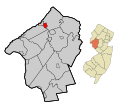
 Alexandria twp 019 nj.png 568 × 585; 48 KB
-
 Annandale cdp nj 019.png 660 × 580; 47 KB
-
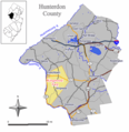
 Bethlehem twp 019 nj.png 568 × 585; 48 KB
-
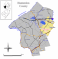
 Bloomsbury 019 nj.png 568 × 585; 47 KB
-
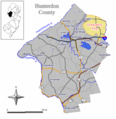
 Califon 019 nj.png 568 × 585; 46 KB
-
 Clinton 019 nj.png 568 × 585; 46 KB
-
 Clinton twp 019 nj.png 568 × 585; 48 KB
-
 Delaware twp 019 nj.png 568 × 585; 48 KB
-
 East amwell twp 019 nj.png 568 × 585; 48 KB
-
 Flemington 019 nj.png 568 × 585; 46 KB
-
 Franklin twp 019 nj.png 568 × 585; 48 KB
-
 Frenchtown 019 nj.png 568 × 585; 47 KB
-
 Glen gardner 019 nj.png 568 × 585; 46 KB
-
 Hampton 019 nj.png 568 × 585; 46 KB
-
 High bridge 019 nj.png 568 × 585; 46 KB
-
 Holland twp 019 nj.png 568 × 585; 48 KB
-

-

-
-

-

-

-

-

-

-
 Kingwood twp 019 nj.png 568 × 585; 48 KB
-
 Lambertville 019 nj.png 568 × 585; 46 KB
-
 Lebanon 019 nj.png 568 × 585; 46 KB
-
 Lebanon twp 019 nj.png 568 × 585; 48 KB
-
 Milford 019 nj.png 568 × 585; 46 KB
-
 Raritan twp 019 nj.png 568 × 585; 47 KB
-
 Readington twp 019 nj.png 568 × 585; 48 KB
-
 Stockton 019 nj.png 568 × 585; 46 KB
-
 Tewksbury twp 019 nj.png 568 × 585; 48 KB
-
 Union twp 019 nj.png 568 × 585; 47 KB
-
 West amwell twp 019 nj.png 568 × 585; 47 KB
-
 White house station cdp nj 019.png 660 × 580; 48 KB


