Category:Locator maps of places in Taiwan
Jump to navigation
Jump to search
中文(臺灣):臺灣各地方位置圖
Media in category "Locator maps of places in Taiwan"
The following 23 files are in this category, out of 23 total.
-
 Taiwan-Karte.png 1,184 × 966; 35 KB
-
 1945年32萬在臺日僑分布圖 Japanese citizens in Taiwan.png 458 × 660; 274 KB
-
 Candidates for Taiwan Second Science Park.png 325 × 350; 18 KB
-
 ElementarySchool in SouthDistrict of TainanCity.svg 300 × 399; 55 KB
-

-
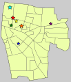
 High schools in South district of Tainan city.svg 300 × 399; 50 KB
-
 JuniorHighSchools in SouthDistrict of TainanCity.svg 300 × 399; 48 KB
-
 Map Dutch Formosa.jpg 1,255 × 1,781; 382 KB
-
 Map of Taiwan Horse Race Course.png 259 × 363; 9 KB
-
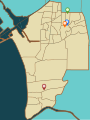
 Tainan en Taiwan b.png 348 × 498; 81 KB
-
 Tainan en Taiwan.png 348 × 498; 74 KB
-
 TaiPengKinMa map.png 326 × 350; 20 KB
-
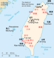
 Taiwan CIA map updated.jpg 713 × 756; 117 KB
-
 Taiwan map.gif 330 × 354; 8 KB
-
 Taiwan-CIA WFB Map (2004).png 330 × 354; 7 KB
-
 Taiwan-CIA WFB Map hu.png 864 × 931; 213 KB
-
 Taiwan-CIA WFB Map.png 324 × 349; 14 KB
-
 World Factbook (1990) Taiwan.jpg 570 × 551; 91 KB
-
 永康下里虎尾藔庄.svg 673 × 498; 24 KB
-
 竹篙厝庄聚落.svg 716 × 755; 48 KB
-
 臺南市東區國中學區.svg 2,557 × 2,947; 60 KB
-
 臺南市東區國小學區.svg 2,552 × 2,988; 84 KB
-
 臺南市東區高級中等學校位置圖.svg 2,552 × 2,980; 38 KB


.png)


_Taiwan.jpg)


_is_the_transit_point_to_hitch_from_when_going_from_West_Taiwan_to_East.png)