Category:Locator maps of municipalities of Luxembourg (Belgium)
Jump to navigation
Jump to search
Media in category "Locator maps of municipalities of Luxembourg (Belgium)"
The following 102 files are in this category, out of 102 total.
-
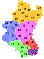
 Province of Luxembourg composite (9 in 1)-fr.png 220 × 424; 24 KB
-
 Province of Luxembourg ZIP.png 220 × 290; 15 KB
-
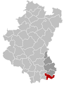
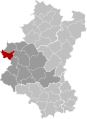
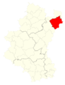
 Arlon Luxembourg Belgium Map.png 220 × 290; 7 KB
-
 Arlon Luxembourg Belgium Map.svg 537 × 736; 3.25 MB
-
 ArlonLocation.png 220 × 290; 7 KB
-
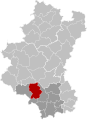
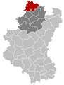
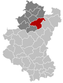
 Attert Luxembourg Belgium Map.png 220 × 290; 7 KB
-
 Attert Luxembourg Belgium Map.svg 537 × 736; 3.25 MB
-
 AttertLocation.png 220 × 290; 7 KB
-
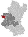
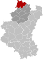
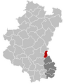
 Aubange Luxembourg Belgium Map.png 220 × 290; 7 KB
-
 Aubange Luxembourg Belgium Map.svg 537 × 736; 3.25 MB
-
 AubangeLocation.png 220 × 290; 7 KB
-
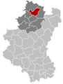
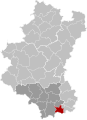
 Bastogne Luxembourg Belgium Map.png 220 × 290; 7 KB
-
 Bastogne Luxembourg Belgium Map.svg 537 × 736; 3.25 MB
-
 Bertogne Luxembourg Belgium Map.png 220 × 290; 7 KB
-
 Bertogne Luxembourg Belgium Map.svg 537 × 736; 3.25 MB
-
 Bertrix Luxembourg Belgium Map.png 220 × 290; 5 KB
-
 Bertrix Luxembourg Belgium Map.svg 537 × 736; 3.25 MB
-
 MnpBouillonLocation1.png 220 × 290; 7 KB
-
 Bouillon Luxembourg Belgium Map.png 220 × 290; 5 KB
-
 Bouillon Luxembourg Belgium Map.svg 537 × 736; 3.25 MB
-
 Chiny Luxembourg Belgium Map.png 220 × 290; 5 KB
-
 Chiny Luxembourg Belgium Map.svg 537 × 736; 3.25 MB
-
 MnpDaverdisseLocation1.png 220 × 290; 7 KB
-
 Daverdisse Luxembourg Belgium Map.png 220 × 290; 5 KB
-
 Daverdisse Luxembourg Belgium Map.svg 537 × 736; 3.25 MB
-
 Durbuy Luxembourg Belgium Map.png 220 × 290; 7 KB
-
 Durbuy Luxembourg Belgium Map.svg 537 × 736; 3.25 MB
-
 Erezée Luxembourg Belgium Map.png 220 × 290; 7 KB
-
 Etalle Luxembourg Belgium Map.png 220 × 290; 5 KB
-
 Fauvillers Luxembourg Belgium Map.png 220 × 290; 7 KB
-
 Fauvillers Luxembourg Belgium Map.svg 537 × 736; 3.25 MB
-
 Florenville Luxembourg Belgium Map.png 220 × 290; 5 KB
-
 Florenville Luxembourg Belgium Map.svg 537 × 736; 3.25 MB
-
 Gouvy carte.png 828 × 1,792; 109 KB
-
 Gouvy Luxembourg Belgium Map.png 220 × 290; 7 KB
-
 Gouvy Luxembourg Belgium Map.svg 537 × 736; 3.25 MB
-
 Gouvy.png 782 × 1,019; 87 KB
-
 Habay Luxembourg Belgium Map.png 220 × 290; 5 KB
-
 Habay Luxembourg Belgium Map.svg 537 × 736; 3.25 MB
-
 Herbeumont Luxembourg Belgium Map.png 220 × 290; 5 KB
-
 Herbeumont Luxembourg Belgium Map.svg 537 × 736; 3.25 MB
-
 Hotton Luxembourg Belgium Map.png 220 × 290; 7 KB
-
 Hotton Luxembourg Belgium Map.svg 537 × 736; 3.25 MB
-
 Houffalize Luxembourg Belgium Map.png 220 × 290; 7 KB
-
 Houffalize Luxembourg Belgium Map.svg 537 × 736; 3.25 MB
-
 La Roche-en-Ardenne Luxembourg Belgium Map.png 220 × 290; 7 KB
-
 La Roche-en-Ardenne Luxembourg Belgium Map.svg 537 × 736; 3.25 MB
-
 Libin Luxembourg Belgium Map.png 220 × 290; 5 KB
-
 Libin Luxembourg Belgium Map.svg 537 × 736; 3.25 MB
-
 Libramont-Chevigny Luxembourg Belgium Map.png 220 × 290; 5 KB
-
 Libramont-Chevigny Luxembourg Belgium Map.svg 537 × 736; 3.25 MB
-
 LuxembourgGemeenten.png 220 × 290; 9 KB
-
 LuxembourgGemeenten.svg 430 × 589; 2.75 MB
-
 Léglise Luxembourg Belgium Map.png 220 × 290; 5 KB
-
 Léglise Luxembourg Belgium Map.svg 537 × 736; 3.25 MB
-
 Manhay Luxembourg Belgium Map.png 220 × 290; 7 KB
-
 Manhay Luxembourg Belgium Map.svg 537 × 736; 3.25 MB
-
 Marche-en-Famenne Luxembourg Belgium Map.png 220 × 290; 7 KB
-
 Marche-en-Famenne Luxembourg Belgium Map.svg 537 × 736; 3.25 MB
-
 Martelange Luxembourg Belgium Map.png 220 × 290; 7 KB
-
 Martelange Luxembourg Belgium Map.svg 537 × 736; 3.25 MB
-
 Meix-devant-Virton Luxembourg Belgium Map.png 220 × 290; 5 KB
-
 Meix-devant-Virton Luxembourg Belgium Map.svg 537 × 736; 3.25 MB
-
 Messancy Luxembourg Belgium Map.png 220 × 290; 7 KB
-
 Messancy Luxembourg Belgium Map.svg 537 × 736; 3.25 MB
-
 MessancyLocation.png 220 × 290; 7 KB
-
 Municipalities Luxembourg Belgium Map - Number.svg 537 × 736; 3.43 MB
-
 Municipalities Luxembourg Belgium Map.svg 537 × 736; 3.25 MB
-
 Musson Luxembourg Belgium Map.png 220 × 290; 5 KB
-
 Musson Luxembourg Belgium Map.svg 537 × 736; 3.25 MB
-
 Nassogne Luxembourg Belgium Map.png 220 × 290; 7 KB
-
 Nassogne Luxembourg Belgium Map.svg 537 × 736; 3.25 MB
-
 Neufchâteau Luxembourg Belgium Map.png 220 × 290; 5 KB
-
 Neufchâteau Luxembourg Belgium Map.svg 537 × 736; 3.25 MB
-
 Paliseul Luxembourg Belgium Map.png 220 × 290; 5 KB
-
 Paliseul Luxembourg Belgium Map.svg 537 × 736; 3.25 MB
-
 Rendeux Luxembourg Belgium Map.png 220 × 290; 7 KB
-
 Rendeux Luxembourg Belgium Map.svg 537 × 736; 3.25 MB
-
 Rouvroy Luxembourg Belgium Map.png 220 × 290; 5 KB
-
 Rouvroy Luxembourg Belgium Map.svg 537 × 736; 3.25 MB
-
 Saint-Hubert Luxembourg Belgium Map.png 220 × 290; 5 KB
-
 Saint-Hubert Luxembourg Belgium Map.svg 537 × 736; 3.25 MB
-
 Saint-Léger Luxembourg Belgium Map.png 220 × 290; 5 KB
-
 Saint-Léger Luxembourg Belgium Map.svg 537 × 736; 3.25 MB
-
 Sainte-Ode Luxembourg Belgium Map.png 220 × 290; 7 KB
-
 Sainte-Ode Luxembourg Belgium Map.svg 537 × 736; 3.25 MB
-
 Tellin Luxembourg Belgium Map.png 220 × 290; 5 KB
-
 Tellin Luxembourg Belgium Map.svg 537 × 736; 3.25 MB
-
 Tenneville Luxembourg Belgium Map.png 220 × 290; 7 KB
-
 Tenneville Luxembourg Belgium Map.svg 537 × 736; 3.25 MB
-
 Tintigny Luxembourg Belgium Map.png 220 × 290; 5 KB
-
 Tintigny Luxembourg Belgium Map.svg 537 × 736; 3.25 MB
-
 Vaux-sur-Sûre Luxembourg Belgium Map.png 220 × 290; 7 KB
-
 Vaux-sur-Sûre Luxembourg Belgium Map.svg 537 × 736; 3.25 MB
-
 Vielsalm Luxembourg Belgium Map.png 220 × 290; 7 KB
-
 Vielsalm Luxembourg Belgium Map.svg 537 × 736; 3.25 MB
-
 Virton Luxembourg Belgium Map.png 220 × 290; 5 KB
-
 Virton Luxembourg Belgium Map.svg 537 × 736; 3.25 MB
-
 Wellin Luxembourg Belgium Map.png 220 × 290; 5 KB
-
 Wellin Luxembourg Belgium Map.svg 537 × 736; 3.25 MB
-
 Érezée Luxembourg Belgium Map.svg 537 × 736; 3.25 MB
-
 Étalle Luxembourg Belgium Map.svg 537 × 736; 3.25 MB
-fr.png)


