Category:Locator maps of municipalities of Antwerp (province)
Jump to navigation
Jump to search
Media in category "Locator maps of municipalities of Antwerp (province)"
The following 146 files are in this category, out of 146 total.
-
 Aartselaar Antwerp Belgium Map.svg 987 × 742; 2.85 MB
-
 AartselaarLocatie.png 270 × 203; 5 KB
-
 Antwerpen Antwerp Belgium Map.svg 987 × 742; 2.85 MB
-
 AntwerpenGemeenten.png 270 × 203; 9 KB
-
 AntwerpenLocatie.png 270 × 203; 5 KB
-
 Arendonk Antwerp Belgium Map.svg 987 × 742; 2.85 MB
-
 ArendonkLocatie.png 270 × 203; 5 KB
-
 Baarle-Hertog Antwerp Belgium Map.svg 987 × 742; 2.85 MB
-
 Baarle-HertogLocatie.png 270 × 203; 5 KB
-
 Balen Antwerp Belgium Map.svg 987 × 742; 2.85 MB
-
 BalenLocatie.png 270 × 203; 5 KB
-
 Beerse Antwerp Belgium Map.svg 987 × 742; 2.85 MB
-
 BeerseLocatie.png 270 × 203; 5 KB
-
 Berlaar Antwerp Belgium Map.svg 987 × 742; 2.85 MB
-
 BerlaarLocatie.png 270 × 203; 5 KB
-
 Boechout Antwerpen Belgium Map.svg 987 × 742; 2.85 MB
-
 BoechoutLocatie.png 270 × 203; 5 KB
-
 Bonheiden Antwerp Belgium Map.svg 987 × 742; 2.85 MB
-
 BonheidenLocatie.png 270 × 203; 5 KB
-
 Boom Antwerp Belgium Map.svg 987 × 742; 2.85 MB
-
 BoomLocatie.png 270 × 203; 5 KB
-
 Bornem Antwerp Belgium Map.svg 987 × 742; 2.85 MB
-
 BornemLocatie.png 270 × 203; 5 KB
-
 Borsbeek Antwerp Belgium Map.svg 987 × 742; 2.85 MB
-
 BorsbeekLocatie.png 270 × 203; 5 KB
-
 Brasschaat Antwerp Belgium Map.svg 987 × 742; 2.85 MB
-
 BrasschaatLocatie.png 270 × 203; 5 KB
-
 Brecht Antwerp Belgium Map.svg 987 × 742; 2.85 MB
-
 BrechtLocatie.png 270 × 203; 5 KB
-
 Dessel Antwerp Belgium Map.svg 987 × 742; 2.85 MB
-
 DesselLocatie.png 270 × 203; 5 KB
-
 Duffel Antwerp Belgium Map.svg 987 × 742; 2.85 MB
-
 DuffelLocatie.png 270 × 203; 5 KB
-
 Edegem Antwerp Belgium Map.svg 987 × 742; 2.85 MB
-
 EdegemLocatie.png 270 × 203; 5 KB
-
 Essen Antwerp Belgium Map.svg 987 × 742; 2.85 MB
-
 EssenLocatie.png 270 × 203; 5 KB
-
 Geel Antwerp Belgium Map.svg 987 × 742; 2.85 MB
-
 GeelLocatie.png 270 × 203; 5 KB
-
 Grobbendonk Antwerp Belgium Map.svg 987 × 742; 2.85 MB
-
 GrobbendonkLocatie.png 270 × 203; 5 KB
-
 Heist-op-den-Berg Antwerp Belgium Map.svg 987 × 742; 2.85 MB
-
 Heist-op-den-BergLocatie.png 270 × 203; 5 KB
-
 Hemiksem Antwerp Belgium Map.svg 987 × 742; 2.85 MB
-
 HemiksemLocatie.png 270 × 203; 5 KB
-
 Herentals Antwerp Belgium Map.svg 987 × 742; 2.85 MB
-
 HerentalsLocatie.png 270 × 203; 5 KB
-
 Herenthout Antwerp Belgium Map.svg 987 × 742; 2.85 MB
-
 HerenthoutLocatie.png 270 × 203; 5 KB
-
 Herselt Antwerp Belgium Map.svg 987 × 742; 2.85 MB
-
 HerseltLocatie.png 270 × 203; 5 KB
-
 Hoogstraten Antwerp Belgium Map.svg 987 × 742; 2.85 MB
-
 HoogstratenLocatie.png 270 × 203; 5 KB
-
 Hove Antwerp Belgium Map.svg 987 × 742; 2.85 MB
-
 HoveLocatie.png 270 × 203; 5 KB
-
 Hulshout Antwerp Belgium Map.svg 987 × 742; 2.85 MB
-
 HulshoutLocatie.png 270 × 203; 5 KB
-
 Kalmthout Antwerp Belgium Map.svg 987 × 742; 2.85 MB
-
 KalmthoutLocatie.png 270 × 203; 5 KB
-
 Kapellen Antwerp Belgium Map.svg 987 × 742; 2.85 MB
-
 KapellenLocatie.png 270 × 203; 5 KB
-
 Kasterlee Antwerp Belgium Map.svg 987 × 742; 2.85 MB
-
 KasterleeLocatie.png 270 × 203; 5 KB
-
 Kontich Antwerp Belgium Map.svg 987 × 742; 2.85 MB
-
 KontichLocatie.png 270 × 203; 5 KB
-
 Laakdal Antwerp Belgium Map.svg 987 × 742; 2.85 MB
-
 LaakdalLocatie.png 270 × 203; 5 KB
-
 Lier Antwerp Belgium Map.svg 987 × 742; 2.85 MB
-
 LierLocatie.png 270 × 203; 5 KB
-
 Lille Antwerp Belgium Map.svg 987 × 742; 2.85 MB
-
 LilleLocatie.png 270 × 203; 5 KB
-
 Lint Antwerp Belgium Map.svg 987 × 742; 2.85 MB
-
 LintLocatie.png 270 × 203; 5 KB
-
 Malle Antwerp Belgium Map.svg 987 × 742; 2.85 MB
-
 MalleLocatie.png 270 × 203; 5 KB
-
 Map of Antwerpen in belgium-viol-reddot-t.png 399 × 335; 10 KB
-
 Map of Mechelen in belgium-viol-reddot-t.png 399 × 335; 9 KB
-
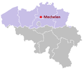
 Mechelen Antwerp Belgium Map.svg 987 × 742; 2.85 MB
-
 MechelenLocatie.png 270 × 203; 5 KB
-
 Meerhout Antwerp Belgium Map.svg 987 × 742; 2.85 MB
-
 MeerhoutLocatie.png 270 × 203; 5 KB
-
 Merksplas Antwerp Belgium Map.svg 987 × 742; 2.85 MB
-
 MerksplasLocatie.png 270 × 203; 5 KB
-
 Mol Antwerp Belgium Map.svg 987 × 742; 2.85 MB
-
 MolLocatie.png 270 × 203; 5 KB
-
 Mortsel Antwerp Belgium Map.svg 987 × 742; 2.85 MB
-
 MortselLocatie.png 270 × 203; 5 KB
-
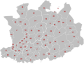 Municipalities Antwerp Belgium Map - Number.svg 987 × 742; 3.14 MB
-
 Municipalities Antwerp Belgium Map.svg 987 × 742; 2.85 MB
-
 Niel Antwerp Belgium Map.svg 987 × 742; 2.85 MB
-
 NielLocatie.png 270 × 203; 5 KB
-
 Nijlen Antwerp Belgium Map.svg 987 × 742; 2.85 MB
-
 NijlenLocatie.png 270 × 203; 5 KB
-
 Olen Antwerp Belgium Map.svg 987 × 742; 2.85 MB
-
 OlenLocatie.png 270 × 203; 5 KB
-
 Oud-Turnhout Antwerp Belgium Map.svg 987 × 742; 2.85 MB
-
 Oud-TurnhoutLocatie.png 270 × 203; 5 KB
-
 Putte Antwerp Belgium Map.svg 987 × 742; 2.85 MB
-
 PutteLocatie.png 270 × 203; 5 KB
-
 Puurs Antwerp Belgium Map.svg 966 × 726; 2.52 MB
-
 Puurs-Sint-Amands Antwerp Belgium Map.svg 987 × 742; 2.85 MB
-
 PuursLocatie.png 270 × 203; 5 KB
-
 Ranst Antwerp Belgium Map.svg 987 × 742; 2.85 MB
-
 RanstLocatie.png 270 × 203; 5 KB
-
 Ravels Antwerp Belgium Map.svg 987 × 742; 2.85 MB
-
 RavelsLocatie.png 270 × 203; 5 KB
-
 Retie Antwerp Belgium Map.svg 987 × 742; 2.85 MB
-
 RetieLocatie.png 270 × 203; 5 KB
-
 Rijkevorsel Antwerp Belgium Map.svg 987 × 742; 2.85 MB
-
 RijkevorselLocatie.png 270 × 203; 5 KB
-
 Rumst Antwerp Belgium Map.svg 987 × 742; 2.85 MB
-
 RumstLocatie.png 270 × 203; 5 KB
-
 Schelle Antwerp Belgium Map.svg 987 × 742; 2.85 MB
-
 SchelleLocatie.png 270 × 203; 5 KB
-
 Schilde Antwerp Belgium Map.svg 987 × 742; 2.85 MB
-
 SchildeLocatie.png 270 × 203; 5 KB
-
 Schoten Antwerp Belgium Map.svg 987 × 742; 2.85 MB
-
 SchotenLocatie.png 270 × 203; 5 KB
-
 Sint-Amands Antwerp Belgium Map.svg 966 × 726; 2.52 MB
-
 Sint-AmandsLocatie.png 270 × 203; 5 KB
-
 Sint-Katelijne-Waver Antwerp Belgium Map.svg 987 × 742; 2.85 MB
-
 Sint-Katelijne-WaverLocatie.png 270 × 203; 5 KB
-
 Stabroek Antwerp Belgium Map.svg 987 × 742; 2.85 MB
-
 StabroekLocatie.png 270 × 203; 5 KB
-
 Turnhout Antwerp Belgium Map.svg 987 × 742; 2.85 MB
-
 TurnhoutLocatie.png 270 × 203; 5 KB
-
 Vorselaar Antwerp Belgium Map.svg 987 × 742; 2.85 MB
-
 VorselaarLocatie.png 270 × 203; 5 KB
-
 Vosselaar Antwerp Belgium Map.svg 987 × 742; 2.85 MB
-
 VosselaarLocatie.png 270 × 203; 5 KB
-
 Westerlo Antwerp Belgium Map.svg 987 × 742; 2.85 MB
-
 WesterloLocatie.png 270 × 203; 5 KB
-
 Wijnegem Antwerp Belgium Map.svg 987 × 742; 2.85 MB
-
 WijnegemLocatie.png 270 × 203; 5 KB
-
 Willebroek Antwerp Belgium Map.svg 987 × 742; 2.85 MB
-
 WillebroekLocatie.png 270 × 203; 5 KB
-
 Wommelgem Antwerp Belgium Map.svg 987 × 742; 2.85 MB
-
 WommelgemLocatie.png 270 × 203; 5 KB
-
 Wuustwezel Antwerp Belgium Map.svg 987 × 742; 2.85 MB
-
 WuustwezelLocatie.png 270 × 203; 5 KB
-
 Zandhoven Antwerp Belgium Map.svg 987 × 742; 2.85 MB
-
 ZandhovenLocatie.png 270 × 203; 5 KB
-
 Zoersel Antwerp Belgium Map.svg 987 × 742; 2.85 MB
-
 ZoerselLocatie.png 270 × 203; 5 KB
-
 Zwijndrecht Antwerp Belgium Map.svg 987 × 742; 2.85 MB
-
 Zwijndrecht-B-Locatie.png 270 × 203; 5 KB


