Category:Locator maps of municipalities in the Landkreis Oberhavel
Jump to navigation
Jump to search
Districts of Brandenburg:
Urban districts (cities):
Media in category "Locator maps of municipalities in the Landkreis Oberhavel"
The following 21 files are in this category, out of 21 total.
-
 Amt Gransee und Gemeinden in OHV.png 299 × 299; 4 KB
-
 Birkenwerder in OHV.png 299 × 299; 4 KB
-
 Fürstenberg-Havel in OHV.png 299 × 299; 4 KB
-
 Glienicke-Nordbahn in OHV.png 299 × 299; 4 KB
-
 Gransee in OHV.png 299 × 299; 4 KB
-
 Großwoltersdorf in OHV.png 299 × 299; 4 KB
-
 Hennigsdorf in OHV.png 299 × 299; 4 KB
-
 Hohen Neuendorf in OHV.png 299 × 299; 4 KB
-
 Kremmen in OHV.png 299 × 299; 4 KB
-
 Leegebruch in OHV.png 299 × 299; 4 KB
-
 Liebenwalde in OHV.png 299 × 299; 4 KB
-
 Löwenberger Land in OHV.png 299 × 299; 4 KB
-
 Municipalities in OHV.png 299 × 299; 4 KB
-
 Mühlenbecker Land in OHV.png 299 × 299; 4 KB
-
 Oberkrämer in OHV.png 299 × 299; 4 KB
-
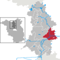
 Oranienburg in OHV.png 299 × 299; 4 KB
-
 Schönermark in OHV.png 299 × 299; 4 KB
-
 Sonnenberg in OHV.png 299 × 299; 4 KB
-
 Stechlin in OHV.png 299 × 299; 4 KB
-
 Velten in OHV.png 299 × 299; 4 KB
-
 Zehdenick in OHV.png 299 × 299; 4 KB


