Category:Locator maps of municipalities in Landkreis Biberach
Jump to navigation
Jump to search
Media in category "Locator maps of municipalities in Landkreis Biberach"
The following 108 files are in this category, out of 108 total.
-
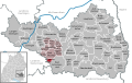
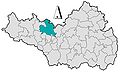
 Achstetten in BC.svg 789 × 499; 971 KB
-
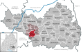
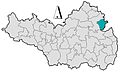
 Alleshausen in BC.svg 789 × 499; 971 KB
-
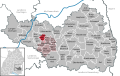
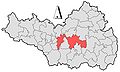
 Allmannsweiler in BC.svg 789 × 499; 971 KB
-
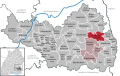
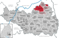
 Altheim in BC.svg 789 × 499; 971 KB
-
 Attenweiler in BC.svg 789 × 499; 971 KB
-
 Bad Buchau in BC.svg 789 × 499; 971 KB
-
 Bad Schussenried in BC.svg 789 × 499; 971 KB
-
 Baden wuerttemberg bc.png 221 × 245; 13 KB
-
 Berkheim in BC.svg 789 × 499; 971 KB
-
 Betzenweiler in BC.svg 789 × 499; 971 KB
-
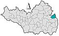
 Biberach an der Riß in BC.svg 789 × 499; 971 KB
-
 Burgrieden in BC.svg 789 × 499; 971 KB
-
 Dettingen an der Iller in BC.svg 789 × 499; 972 KB
-
 Dürmentingen in BC.svg 789 × 499; 971 KB
-
 Dürnau in BC.svg 789 × 499; 971 KB
-
 Eberhardzell in BC.svg 789 × 499; 971 KB
-
 Erlenmoos in BC.svg 789 × 499; 971 KB
-
 Erolzheim in BC.svg 789 × 499; 972 KB
-
 Ertingen in BC.svg 789 × 499; 971 KB
-
 Gemeindeverwaltungsverband Bad Buchau in BC.svg 789 × 499; 971 KB
-
 Gemeindeverwaltungsverband Rot-Tannheim in BC.svg 789 × 499; 971 KB
-
 Gutenzell-Hürbel in BC.svg 789 × 499; 971 KB
-
 Hochdorf in BC.svg 789 × 499; 971 KB
-
 Ingoldingen in BC.svg 789 × 499; 971 KB
-
 Kanzach in BC.svg 789 × 499; 971 KB
-
 Kirchberg an der Iller in BC.svg 789 × 499; 971 KB
-
 Kirchdorf an der Iller in BC.svg 789 × 499; 971 KB
-
 KreisBC GemeindeAchstetten.jpg 854 × 520; 60 KB
-
 KreisBC GemeindeAlleshausen.jpg 854 × 518; 60 KB
-
 KreisBC GemeindeAllmannsweiler.jpg 854 × 517; 60 KB
-
 KreisBC GemeindeAltheim.jpg 854 × 516; 60 KB
-
 KreisBC GemeindeAttenweiler.jpg 854 × 514; 60 KB
-
 KreisBC GemeindeBerkheim.jpg 854 × 517; 60 KB
-
 KreisBC GemeindeBetzenweiler.jpg 854 × 516; 60 KB
-
 KreisBC GemeindeBurgrieden.jpg 854 × 515; 60 KB
-
 KreisBC GemeindeDettingen.jpg 854 × 515; 60 KB
-
 KreisBC GemeindeDürmentingen.jpg 854 × 518; 60 KB
-
 KreisBC GemeindeDürnau.jpg 854 × 516; 60 KB
-
 KreisBC GemeindeEberhardzell.jpg 854 × 519; 60 KB
-
 KreisBC GemeindeErlenmoos.jpg 854 × 518; 60 KB
-
 KreisBC GemeindeErolzheim.jpg 854 × 516; 60 KB
-
 KreisBC GemeindeErtingen.jpg 854 × 515; 60 KB
-
 KreisBC GemeindeGutenzellHürbel.jpg 854 × 519; 60 KB
-
 KreisBC GemeindeHochdorf.jpg 854 × 517; 60 KB
-
 KreisBC GemeindeIngoldingen.jpg 854 × 522; 60 KB
-
 KreisBC GemeindeKanzach.jpg 854 × 517; 60 KB
-
 KreisBC GemeindeKirchberg.jpg 854 × 516; 60 KB
-
 KreisBC GemeindeKirchdorf.jpg 854 × 515; 60 KB
-
 KreisBC GemeindeLangenenslingen.jpg 854 × 516; 60 KB
-
 KreisBC GemeindeMaselheim.jpg 854 × 515; 60 KB
-
 KreisBC GemeindeMietingen.jpg 854 × 516; 60 KB
-
 KreisBC GemeindeMittelbiberach.jpg 854 × 515; 60 KB
-
 KreisBC GemeindeMoosburg.jpg 854 × 514; 60 KB
-
 KreisBC GemeindeOggelshausen.jpg 854 × 514; 60 KB
-
 KreisBC GemeindeRotAnDerRot.jpg 854 × 517; 60 KB
-
 KreisBC GemeindeSchemmerhofen.jpg 854 × 516; 60 KB
-
 KreisBC GemeindeSchwendi.jpg 854 × 516; 60 KB
-
 KreisBC GemeindeSeekirch.jpg 854 × 514; 60 KB
-
 KreisBC GemeindeStadtOchsenhausen.jpg 854 × 515; 60 KB
-
 KreisBC GemeindeSteinhausenAnDerRottum.jpg 854 × 514; 60 KB
-
 KreisBC GemeindeTannheim.jpg 854 × 519; 60 KB
-
 KreisBC GemeindeTiefenbach.jpg 854 × 520; 60 KB
-
 KreisBC GemeindeUmmendorf.jpg 854 × 513; 60 KB
-
 KreisBC GemeindeUnlingen.jpg 854 × 512; 60 KB
-
 KreisBC GemeindeUttenweiler.jpg 854 × 515; 60 KB
-
 KreisBC GemeindeWain.jpg 854 × 515; 60 KB
-
 KreisBC GemeindeWarthausen.JPG 854 × 515; 60 KB
-
 KreisBC StadtBadBuchau.jpg 854 × 513; 60 KB
-
 KreisBC StadtBadSchussenried.jpg 854 × 514; 60 KB
-
 KreisBC StadtBiberach.jpg 854 × 515; 60 KB
-
 KreisBC StadtLaupheim.jpg 854 × 516; 60 KB
-
 KreisBC StadtRiedlingen.jpg 854 × 516; 60 KB
-
 Lage des Landkreises Biberach in Deutschland grey.png 197 × 235; 4 KB
-
 Lage des Landkreises Biberach in Deutschland.png 506 × 599; 87 KB
-
 Lage Landkreis Biberach in BW.svg 1,000 × 1,179; 187 KB
-
 Landkreis Biberach Uebersicht ohne Staedte.JPG 854 × 517; 60 KB
-
 Landkreis Biberach Uebersicht.png 854 × 688; 14 KB
-
 Langenenslingen in BC.svg 789 × 499; 971 KB
-
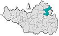
 Laupheim in BC.svg 789 × 499; 971 KB
-
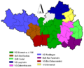 LkrBCVerwaltungsgemeinschaften.png 854 × 688; 13 KB
-
 Locator map BC in Baden-Württemberg.svg 1,058 × 1,161; 278 KB
-
 Locator map BC in Germany.svg 1,075 × 1,273; 404 KB
-
 Maselheim in BC.svg 789 × 499; 971 KB
-
 Mietingen in BC.svg 789 × 499; 971 KB
-
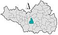
 Mittelbiberach in BC.svg 789 × 499; 971 KB
-
 Moosburg in BC.svg 789 × 499; 971 KB
-
 Municipalities in BC.svg 789 × 499; 971 KB
-
 Ochsenhausen in BC.svg 789 × 499; 971 KB
-
 Oggelshausen in BC.svg 789 × 499; 971 KB
-
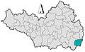
 Riedlingen in BC.svg 789 × 499; 971 KB
-
 Rot an der Rot in BC.svg 789 × 499; 971 KB
-
 Schemmerhofen in BC.svg 789 × 499; 971 KB
-
 Schwendi in BC.svg 789 × 499; 971 KB
-
 Seekirch in BC.svg 789 × 499; 971 KB
-
 Steinhausen an der Rottum in BC.svg 789 × 499; 971 KB
-
 Tannheim in BC.svg 789 × 499; 971 KB
-
 Tiefenbach in BC.svg 789 × 499; 971 KB
-
 Ummendorf in BC.svg 789 × 499; 971 KB
-
 Unlingen in BC.svg 789 × 499; 971 KB
-
 Uttenweiler in BC.svg 789 × 499; 971 KB
-
 Vereinbarte Verwaltungsgemeinschaft Bad Schussenried in BC.svg 789 × 499; 971 KB
-
 Vereinbarte Verwaltungsgemeinschaft Biberach an der Riß in BC.svg 789 × 499; 971 KB
-
 Vereinbarte Verwaltungsgemeinschaft Laupheim in BC.svg 789 × 499; 971 KB
-
 Vereinbarte Verwaltungsgemeinschaft Ochsenhausen in BC.svg 789 × 499; 971 KB
-
 Vereinbarte Verwaltungsgemeinschaft Riedlingen in BC.svg 789 × 499; 971 KB
-
 Vereinbarte Verwaltungsgemeinschaft Schwendi in BC.svg 789 × 499; 971 KB
-
 Wain in BC.svg 789 × 499; 971 KB
-
 Warthausen in BC.svg 789 × 499; 971 KB


