Category:Locator maps of incorporated and unincorporated areas of Los Angeles County, California
Jump to navigation
Jump to search

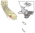
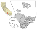
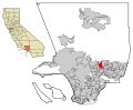
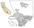
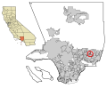
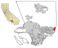
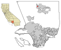
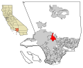
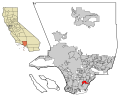
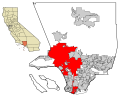
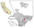
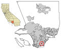
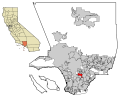
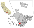
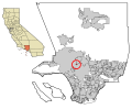
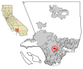
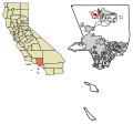
English: Locator maps of Populated places in Los Angeles County — Southern California
- Many of these maps of municipalities and unincorporated areas with boundaries are of the form shown at right.
- Incorporated city boundaries are in black lines.
- Unincorporated community areas are in solid gray.
- A highlighted city or unincorporated community area is in solid red.
- Note: Map data is based on the following file from the Los Angeles County Website: Los Angeles County Incorporated Area and District Map (PDF).
- Note: The locations of San Clemente and Santa Catalina Islands as shown on this map are not the true locations of these islands relative to the rest of Los Angeles County.
Subcategories
This category has only the following subcategory.
Media in category "Locator maps of incorporated and unincorporated areas of Los Angeles County, California"
The following 166 files are in this category, out of 166 total.
-
 LA County Incorporated Areas.svg 950 × 780; 261 KB
-
 LA in LA County map.png 1,008 × 668; 23 KB
-
 CAMap-doton-Avalon.png 209 × 230; 4 KB
-
 CAMap-doton-Long Beach.PNG 1,247 × 1,024; 245 KB
-
 CAMap-doton-Norwalk.PNG 209 × 230; 5 KB
-
 CAMap-doton-Torrance.PNG 209 × 230; 5 KB
-
 LA County Incorporated Areas Acton highlighted.svg 950 × 780; 262 KB
-
 LA County Incorporated Areas Agoura highlighted.svg 950 × 780; 262 KB
-
 LA County Incorporated Areas Agua Dulce highlighted.svg 950 × 780; 262 KB
-
 LA County Incorporated Areas Alhambra highlighted.svg 950 × 780; 261 KB
-
 LA County Incorporated Areas Alondra Park highlighted.svg 950 × 780; 262 KB
-
 LA County Incorporated Areas Altadena highlighted.svg 950 × 780; 262 KB
-
 LA County Incorporated Areas Antelope Acres highlighted.svg 950 × 780; 262 KB
-
 LA County Incorporated Areas Arcadia highlighted.svg 950 × 780; 261 KB
-
 LA County Incorporated Areas Artesia highlighted.svg 950 × 780; 262 KB
-
 LA County Incorporated Areas Athens highlighted.svg 950 × 780; 262 KB
-
 LA County Incorporated Areas Avalon highlighted.svg 950 × 780; 262 KB
-
 LA County Incorporated Areas Avocado Heights highlighted.svg 950 × 780; 262 KB
-
 LA County Incorporated Areas Azusa highlighted.svg 950 × 780; 261 KB
-
 LA County Incorporated Areas Baldwin Park highlighted.svg 950 × 780; 261 KB
-
 LA County Incorporated Areas Bassett highlighted.svg 950 × 780; 262 KB
-
 LA County Incorporated Areas Beach Cities highlighted.png 730 × 599; 246 KB
-
 LA County Incorporated Areas Bell Gardens highlighted.svg 950 × 780; 262 KB
-
 LA County Incorporated Areas Bell highlighted.svg 950 × 780; 262 KB
-
 LA County Incorporated Areas Bellflower highlighted.svg 950 × 780; 261 KB
-
 LA County Incorporated Areas Beverly Hills highlighted.svg 950 × 780; 156 KB
-
 LA County Incorporated Areas Bradbury highlighted.svg 950 × 780; 262 KB
-
 LA County Incorporated Areas Burbank highlighted.svg 950 × 780; 261 KB
-
 LA County Incorporated Areas Calabasas highlighted.svg 950 × 780; 261 KB
-
 LA County Incorporated Areas Carson highlighted.svg 950 × 780; 261 KB
-
 LA County Incorporated Areas Castaic highlighted.svg 950 × 780; 262 KB
-
 LA County Incorporated Areas Cerritos highlighted.svg 950 × 780; 261 KB
-
 LA County Incorporated Areas Charter Oak highlighted.svg 950 × 780; 262 KB
-
 LA County Incorporated Areas Citrus highlighted.svg 950 × 780; 262 KB
-
 LA County Incorporated Areas City Terrace highlighted.svg 950 × 780; 262 KB
-
 LA County Incorporated Areas Claremont highlighted.svg 950 × 780; 261 KB
-
 LA County Incorporated Areas Commerce highlighted.svg 950 × 780; 261 KB
-
 LA County Incorporated Areas Compton highlighted.svg 950 × 780; 261 KB
-
 LA County Incorporated Areas Covina highlighted.svg 950 × 780; 261 KB
-
 LA County Incorporated Areas Cudahy highlighted.svg 950 × 780; 262 KB
-
 LA County Incorporated Areas Del Aire highlighted.svg 950 × 780; 262 KB
-
 LA County Incorporated Areas Del Sur highlighted.svg 950 × 780; 262 KB
-
 LA County Incorporated Areas Desert View Highlands highlighted.svg 950 × 780; 262 KB
-
 LA County Incorporated Areas Diamond Bar highlighted.svg 950 × 780; 261 KB
-
 LA County Incorporated Areas Downey highlighted.svg 950 × 780; 261 KB
-
 LA County Incorporated Areas Duarte highlighted.svg 950 × 780; 262 KB
-
 LA County Incorporated Areas East Compton highlighted.svg 950 × 780; 262 KB
-
 LA County Incorporated Areas East La Mirada highlighted.svg 950 × 780; 262 KB
-
 LA County Incorporated Areas East Los Angeles highlighted.svg 950 × 780; 261 KB
-
 LA County Incorporated Areas East Pasadena highlighted.svg 950 × 780; 262 KB
-
 LA County Incorporated Areas East San Gabriel highlighted.svg 950 × 780; 262 KB
-
 LA County Incorporated Areas El Monte highlighted.svg 950 × 780; 261 KB
-
 LA County Incorporated Areas El Segundo highlighted.svg 950 × 780; 263 KB
-
 LA County Incorporated Areas Florence Graham highlighted.svg 950 × 780; 262 KB
-
 LA County Incorporated Areas Gardena highlighted.svg 950 × 780; 262 KB
-
 LA County Incorporated Areas Glendale highlighted.svg 950 × 780; 261 KB
-
 LA County Incorporated Areas Glendora highlighted.svg 950 × 780; 261 KB
-
 LA County Incorporated Areas Gorman highlighted.svg 950 × 780; 262 KB
-
 LA County Incorporated Areas Hacienda Heights highlighted.svg 950 × 780; 156 KB
-
 LA County Incorporated Areas Hawaiian Gardens highlighted.svg 950 × 780; 262 KB
-
 LA County Incorporated Areas Hawthorne highlighted.svg 950 × 780; 262 KB
-
 LA County Incorporated Areas Hermosa Beach highlighted.svg 950 × 780; 262 KB
-
 LA County Incorporated Areas Hidden Hills highlighted.svg 950 × 780; 262 KB
-
 LA County Incorporated Areas Huntington Park highlighted.svg 950 × 780; 262 KB
-
 LA County Incorporated Areas Industry highlighted.svg 950 × 780; 262 KB
-
 LA County Incorporated Areas Inglewood highlighted.svg 950 × 780; 261 KB
-
 LA County Incorporated Areas Irwindale highlighted.svg 950 × 780; 261 KB
-
 LA County Incorporated Areas Juniper Hills highlighted.svg 950 × 780; 262 KB
-
 LA County Incorporated Areas Kinneloa Mesa highlighted.svg 950 × 780; 262 KB
-
 LA County Incorporated Areas La Canada Flintridge highlighted.svg 950 × 780; 261 KB
-
 LA County Incorporated Areas La Crescenta Montrose highlighted.svg 950 × 780; 157 KB
-
 LA County Incorporated Areas La Habra Heights highlighted.svg 950 × 780; 262 KB
-
 LA County Incorporated Areas La Mirada highlighted.svg 950 × 780; 261 KB
-
 LA County Incorporated Areas La Puente highlighted.svg 950 × 780; 262 KB
-
 LA County Incorporated Areas La Verne highlighted.svg 950 × 780; 261 KB
-
 LA County Incorporated Areas Ladera Heights highlighted.svg 950 × 780; 262 KB
-
 LA County Incorporated Areas Lake Los Angeles highlighted.svg 950 × 780; 262 KB
-
 LA County Incorporated Areas Lakewood highlighted.svg 950 × 780; 261 KB
-
 LA County Incorporated Areas Lancaster highlighted.svg 950 × 780; 261 KB
-
 LA County Incorporated Areas Lawndale highlighted.svg 950 × 780; 262 KB
-
 LA County Incorporated Areas Lennox highlighted.svg 950 × 780; 262 KB
-
 LA County Incorporated Areas Leona Valley highlighted.svg 950 × 780; 262 KB
-
 LA County Incorporated Areas Littlerock highlighted.svg 950 × 780; 262 KB
-
 LA County Incorporated Areas Llano highlighted.svg 950 × 780; 262 KB
-
 LA County Incorporated Areas Lomita highlighted.svg 950 × 780; 262 KB
-
 LA County Incorporated Areas Long Beach highlighted.svg 950 × 780; 156 KB
-
 LA County Incorporated Areas Los Angeles highlighted.svg 950 × 780; 261 KB
-
 LA County Incorporated Areas Lynwood highlighted.svg 950 × 780; 262 KB
-
 LA County Incorporated Areas Malibu highlighted.svg 950 × 780; 261 KB
-
 LA County Incorporated Areas Manhattan Beach highlighted.svg 950 × 780; 262 KB
-
 LA County Incorporated Areas Marina del Rey highlighted.svg 950 × 780; 262 KB
-
 LA County Incorporated Areas Mayflower Village highlighted.svg 950 × 780; 262 KB
-
 LA County Incorporated Areas Maywood highlighted.svg 950 × 780; 262 KB
-
 LA County Incorporated Areas Monrovia highlighted.svg 950 × 780; 261 KB
-
 LA County Incorporated Areas Montebello highlighted.svg 950 × 780; 261 KB
-
 LA County Incorporated Areas Monterey Park highlighted.svg 950 × 780; 261 KB
-
 LA County Incorporated Areas Neenach highlighted.svg 950 × 780; 262 KB
-
 LA County Incorporated Areas North El Monte highlighted.svg 950 × 780; 262 KB
-
 LA County Incorporated Areas Norwalk highlighted.svg 950 × 780; 261 KB
-
 LA County Incorporated Areas Palmdale highlighted.svg 950 × 780; 261 KB
-
 LA County Incorporated Areas Palos Verdes Estates highlighted.svg 950 × 780; 262 KB
-
 LA County Incorporated Areas Paramount highlighted.svg 950 × 780; 262 KB
-
 LA County Incorporated Areas Pasadena highlighted.svg 950 × 780; 261 KB
-
 LA County Incorporated Areas Pearblossom highlighted.svg 950 × 780; 262 KB
-
 LA County Incorporated Areas Pico Rivera highlighted.svg 950 × 780; 261 KB
-
 LA County Incorporated Areas Pomona highlighted.svg 950 × 780; 261 KB
-
 LA County Incorporated Areas Quartz Hill highlighted.svg 950 × 780; 262 KB
-
 LA County Incorporated Areas Rancho Palos Verdes highlighted.svg 950 × 780; 261 KB
-
 LA County Incorporated Areas Redondo Beach highlighted.svg 950 × 780; 261 KB
-
 LA County Incorporated Areas Rolling Hills Estates highlighted.svg 950 × 780; 262 KB
-
 LA County Incorporated Areas Rolling Hills highlighted.svg 950 × 780; 262 KB
-
 LA County Incorporated Areas Rosemead highlighted.svg 950 × 780; 262 KB
-
 LA County Incorporated Areas Rowland Heights highlighted.svg 950 × 780; 262 KB
-
 LA County Incorporated Areas San Dimas highlighted.svg 950 × 780; 261 KB
-
 LA County Incorporated Areas San Fernando highlighted.svg 950 × 780; 262 KB
-
 LA County Incorporated Areas San Gabriel highlighted.svg 950 × 780; 262 KB
-
 LA County Incorporated Areas San Marino highlighted.svg 950 × 780; 262 KB
-
 LA County Incorporated Areas Santa Clarita highlighted.svg 950 × 780; 261 KB
-
 LA County Incorporated Areas Santa Fe Springs highlighted.svg 950 × 780; 261 KB
-
 LA County Incorporated Areas Santa Monica highlighted.svg 950 × 780; 262 KB
-
 LA County Incorporated Areas Sierra Madre highlighted.svg 950 × 780; 262 KB
-
 LA County Incorporated Areas Signal Hill highlighted.svg 950 × 780; 262 KB
-
 LA County Incorporated Areas South El Monte highlighted.svg 950 × 780; 262 KB
-
 LA County Incorporated Areas South Gate highlighted.svg 950 × 780; 261 KB
-
 LA County Incorporated Areas South Pasadena highlighted.svg 950 × 780; 262 KB
-
 LA County Incorporated Areas South San Gabriel highlighted.svg 950 × 780; 262 KB
-
 LA County Incorporated Areas South San Jose Hills highlighted.svg 950 × 780; 262 KB
-
 LA County Incorporated Areas South Whittier highlighted.svg 950 × 780; 262 KB
-
 LA County Incorporated Areas Temple City highlighted.svg 950 × 780; 262 KB
-
 LA County Incorporated Areas Topanga highlighted.svg 950 × 780; 262 KB
-
 LA County Incorporated Areas Torrance highlighted.svg 950 × 780; 261 KB
-
 LA County Incorporated Areas Two Harbors highlighted.svg 950 × 780; 262 KB
-
 LA County Incorporated Areas Universal City highlighted.svg 950 × 780; 262 KB
-
 LA County Incorporated Areas Val Verde highlighted.svg 950 × 780; 262 KB
-
 LA County Incorporated Areas Valinda highlighted.svg 950 × 780; 262 KB
-
 LA County Incorporated Areas Valyermo highlighted.svg 950 × 780; 262 KB
-
 LA County Incorporated Areas Vernon highlighted.svg 950 × 780; 262 KB
-
 LA County Incorporated Areas View Park Windsor Hills highlighted.svg 950 × 780; 262 KB
-
 LA County Incorporated Areas Vincent highlighted.svg 950 × 780; 262 KB
-
 LA County Incorporated Areas Walnut highlighted.svg 950 × 780; 261 KB
-
 LA County Incorporated Areas Walnut Park highlighted.svg 950 × 780; 262 KB
-
 LA County Incorporated Areas West Athens highlighted.svg 950 × 780; 262 KB
-
 LA County Incorporated Areas West Carson highlighted.svg 950 × 780; 262 KB
-
 LA County Incorporated Areas West Compton highlighted.svg 950 × 780; 262 KB
-
 LA County Incorporated Areas West Covina highlighted.svg 950 × 780; 156 KB
-
 LA County Incorporated Areas West Hollywood highlighted.svg 950 × 780; 262 KB
-
 LA County Incorporated Areas West Puente Valley highlighted.svg 950 × 780; 262 KB
-
 LA County Incorporated Areas West Whittier Los Nietos highlighted.svg 950 × 780; 262 KB
-
 LA County Incorporated Areas Westlake Village highlighted.svg 950 × 780; 262 KB
-
 LA County Incorporated Areas Westmont highlighted.svg 950 × 780; 262 KB
-
 LA County Incorporated Areas Whittier highlighted.svg 950 × 780; 261 KB
-
 LA County Incorporated Areas Willowbrook highlighted.svg 950 × 780; 262 KB
-
 Location of Los Angeles within Los Angeles County.jpg 1,372 × 1,090; 463 KB
-

-

-
-

-

-

-

-

-

-

-

-

-