Category:Locator maps of districts of Madhya Pradesh in India
Jump to navigation
Jump to search
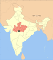
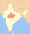
Location of district in Madhya Pradesh and in India
Media in category "Locator maps of districts of Madhya Pradesh in India"
The following 45 files are in this category, out of 45 total.
-
 Madhya Pradesh district location map Balaghat.svg 1,639 × 1,852; 744 KB
-
 Madhya Pradesh district location map Barwani.svg 1,639 × 1,852; 744 KB
-
 Madhya Pradesh district location map Betul.svg 1,639 × 1,852; 744 KB
-
 Madhya Pradesh district location map Bhind.svg 1,639 × 1,852; 744 KB
-
 Madhya Pradesh district location map Bhopal.svg 1,639 × 1,852; 744 KB
-
 Madhya Pradesh district location map Chhatarpur.svg 1,639 × 1,852; 744 KB
-
 Madhya Pradesh district location map Chhindwara.svg 1,639 × 1,852; 744 KB
-
 Madhya Pradesh district location map Damoh.svg 1,639 × 1,852; 744 KB
-
 Madhya Pradesh district location map Datia.svg 1,639 × 1,852; 744 KB
-
 Madhya Pradesh district location map Dewas.svg 1,639 × 1,852; 744 KB
-
 Madhya Pradesh district location map Dhar.svg 1,639 × 1,852; 744 KB
-
 Madhya Pradesh district location map Dindori.svg 1,639 × 1,852; 744 KB
-
 Madhya Pradesh district location map Guna.svg 1,639 × 1,852; 744 KB
-
 Madhya Pradesh district location map Gwalior.svg 1,639 × 1,852; 744 KB
-
 Madhya Pradesh district location map Harda.svg 1,639 × 1,852; 744 KB
-
 Madhya Pradesh district location map Hoshangabad.svg 1,639 × 1,852; 744 KB
-
 Madhya Pradesh district location map Indore.svg 1,639 × 1,852; 744 KB
-
 Madhya Pradesh district location map Jabalpur.svg 1,639 × 1,852; 744 KB
-
 Madhya Pradesh district location map Jhabua.svg 1,639 × 1,852; 744 KB
-
 Madhya Pradesh district location map Katni.svg 1,639 × 1,852; 744 KB
-
 Madhya Pradesh district location map Khandwa.svg 1,639 × 1,852; 744 KB
-
 Madhya Pradesh district location map Khargone.svg 1,639 × 1,852; 744 KB
-
 Madhya Pradesh district location map Mandla.svg 1,639 × 1,852; 744 KB
-
 Madhya Pradesh district location map Mandsaur.svg 1,639 × 1,852; 744 KB
-
 Madhya Pradesh district location map Morena.svg 1,639 × 1,852; 744 KB
-
 Madhya Pradesh district location map Narsinghpur.svg 1,639 × 1,852; 744 KB
-
 Madhya Pradesh district location map Neemuch.svg 1,639 × 1,852; 744 KB
-
 Madhya Pradesh district location map Panna.svg 1,639 × 1,852; 744 KB
-
 Madhya Pradesh district location map Raisen.svg 1,639 × 1,852; 744 KB
-
 Madhya Pradesh district location map Rajgarh.svg 1,639 × 1,852; 744 KB
-
 Madhya Pradesh district location map Ratlam.svg 1,639 × 1,852; 744 KB
-
 Madhya Pradesh district location map Rewa.svg 1,639 × 1,852; 744 KB
-
 Madhya Pradesh district location map Sagar.svg 1,639 × 1,852; 744 KB
-
 Madhya Pradesh district location map Satna.svg 1,639 × 1,852; 744 KB
-
 Madhya Pradesh district location map Sehore.svg 1,639 × 1,852; 744 KB
-
 Madhya Pradesh district location map Seoni.svg 1,639 × 1,852; 744 KB
-
 Madhya Pradesh district location map Shahdol.svg 1,639 × 1,852; 744 KB
-
 Madhya Pradesh district location map Shajapur.svg 1,639 × 1,852; 744 KB
-
 Madhya Pradesh district location map Sheopur.svg 1,639 × 1,852; 744 KB
-
 Madhya Pradesh district location map Shivpuri.svg 1,639 × 1,852; 744 KB
-
 Madhya Pradesh district location map Sidhi.svg 1,639 × 1,852; 744 KB
-
 Madhya Pradesh district location map Tikamgarh.svg 1,639 × 1,852; 744 KB
-
 Madhya Pradesh district location map Ujjain.svg 1,639 × 1,852; 744 KB
-
 Madhya Pradesh district location map Umaria.svg 1,639 × 1,852; 744 KB
-
 Madhya Pradesh district location map Vidisha.svg 1,639 × 1,852; 744 KB


