Category:Locator maps of districts of Järvenpää
Jump to navigation
Jump to search

|
All locator map images in this category could be re-created using vector graphics as SVG files. This has several advantages; see Commons:Media for cleanup for more information. If an SVG form of this image is available, please upload it and afterwards replace this template with
{{vector version available|new image name}}. |
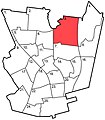
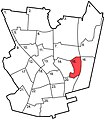
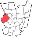
English: Locator maps of districts of the city of Järvenpää, Finland
Suomi: Järvenpään kaupunginosien sijaintikartat
Media in category "Locator maps of districts of Järvenpää"
The following 26 files are in this category, out of 26 total.
-
 Haarajoki.jpg 645 × 735; 116 KB
-
 Isokyto.jpg 645 × 735; 114 KB
-
 Jamppa.jpg 645 × 735; 114 KB
-
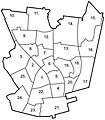 Jarvenpaa neighbourhoods.jpg 645 × 735; 133 KB
-
 Kaakkola.jpg 645 × 735; 115 KB
-
 Keskus.jpg 645 × 735; 114 KB
-
 Kinnari.jpg 645 × 735; 114 KB
-
 Kyrola.jpg 645 × 735; 114 KB
-
 Lepola.jpg 645 × 735; 115 KB
-
 Loutti.jpg 645 × 735; 115 KB
-
 Mikonkorpi.jpg 645 × 735; 115 KB
-
 Mylly.jpg 645 × 735; 115 KB
-
 Nummenkyla.jpg 645 × 735; 115 KB
-
 Pajala.jpg 645 × 735; 115 KB
-
 Peltola.jpg 645 × 735; 114 KB
-
 Pietila.jpg 645 × 735; 115 KB
-
 Poytaalho.jpg 645 × 735; 114 KB
-
 Ristinummi.jpg 645 × 735; 115 KB
-
 Satukallio.jpg 645 × 735; 114 KB
-
 Satumetsa.jpg 645 × 735; 114 KB
-
 Saunakallio.jpg 645 × 735; 115 KB
-
 Sorto.jpg 645 × 735; 114 KB
-
 Terhola.jpg 645 × 735; 114 KB
-
 Terioja.jpg 645 × 735; 114 KB
-
 Vanhakyla.jpg 645 × 735; 115 KB
-
 Wartsila.jpg 645 × 735; 115 KB


