Category:Locator maps of districts in Mecklenburg-Vorpommern
Jump to navigation
Jump to search
Federal states of Germany:
Subcategories
This category has the following 5 subcategories, out of 5 total.
L
Media in category "Locator maps of districts in Mecklenburg-Vorpommern"
The following 9 files are in this category, out of 9 total.
-
 Landkreise Mecklenburg-Vorpommern.svg 859 × 607; 93 KB
-
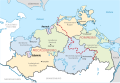
 Mecklenburg-Vorpommern districts 2011 colored labeled district capitals.svg 1,129 × 775; 690 KB
-
 Mecklenburg-Vorpommern districts 2011 colored labeled Meck-Pomm-border.svg 1,129 × 775; 684 KB
-
 Mecklenburg-Vorpommern districts 2011 colored labeled.svg 1,129 × 775; 666 KB
-
 Mecklenburg-Vorpommern districts 2011 colored waterplus labeled.svg 1,129 × 775; 869 KB
-
 Mecklenburg-Vorpommern location map simplified.svg 400 × 269; 343 KB
-
-
 Powiaty Meklemburgii-Pomorza Przedniego.svg 859 × 607; 92 KB
-
 Окрузи во Западна Померанија 2011.svg 1,129 × 775; 926 KB


