Category:Locator maps of district parts of Vienna (gray scheme)
Jump to navigation
Jump to search
Media in category "Locator maps of district parts of Vienna (gray scheme)"
The following 86 files are in this category, out of 86 total.
-
 520px-Karte Lichtental Alsergrund.PNG 520 × 599; 64 KB
-
 Auhof lage in hietzing.png 1,979 × 1,234; 141 KB
-
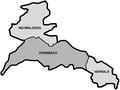
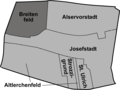
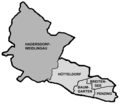
 Bezirksteile Josefstadt.png 1,645 × 1,237; 137 KB
-
 Donaustadt bezirksteile.png 2,000 × 2,655; 231 KB
-
 Donaustadt lage aspern.png 2,000 × 2,655; 227 KB
-
 Donaustadt lage breitenlee.png 2,000 × 2,655; 230 KB
-
 Donaustadt lage essling.png 2,000 × 2,655; 227 KB
-
 Donaustadt lage hirschstetten.png 2,000 × 2,655; 228 KB
-
 Donaustadt lage kagran.png 2,000 × 2,655; 227 KB
-
 Donaustadt lage kaisermuehlen.png 2,000 × 2,655; 229 KB
-
 Donaustadt lage stadlau.png 2,000 × 2,655; 228 KB
-
 Donaustadt lage suessenbrunn.png 2,000 × 2,655; 228 KB
-
 Favoriten bezirksteile.png 2,000 × 1,939; 158 KB
-
 Favoriten lage favoriten.png 2,000 × 1,939; 152 KB
-
 Favoriten lage inzersdorf-stadt.png 2,000 × 1,939; 153 KB
-
 Favoriten lage oberlaa.png 2,000 × 1,939; 145 KB
-
 Favoriten lage rothneusiedl.png 2,000 × 1,939; 153 KB
-
 Favoriten lage unterlaa.png 2,000 × 1,939; 154 KB
-
 Hernals bezirksteile.png 1,942 × 1,453; 127 KB
-
 Hernals lage dornbach.png 1,942 × 1,453; 124 KB
-
 Hernals lage hernals.png 1,942 × 1,453; 121 KB
-
 Hernals lage neuwaldegg.png 1,942 × 1,453; 118 KB
-
 Hietzing bezirksteile.png 1,984 × 1,236; 151 KB
-
 Hietzing lage hacking.png 1,984 × 1,236; 149 KB
-
 Hietzing lage hietzing.png 1,984 × 1,236; 149 KB
-
 Hietzing lage lainz.png 1,984 × 1,236; 150 KB
-
 Hietzing lage ober sankt veit.png 1,984 × 1,236; 147 KB
-
 Hietzing lage rosenberg.png 1,984 × 1,236; 156 KB
-
 Hietzing lage speising.png 1,984 × 1,236; 148 KB
-
 Hietzing lage unter sankt veit.png 1,984 × 1,236; 150 KB
-
 Karte Althan Alsergrund.PNG 520 × 599; 64 KB
-
 Karte Bezirksteile Alsergrund.png 1,869 × 2,153; 197 KB
-
 Karte Bezirksteile Doebling.png 2,050 × 2,075; 272 KB
-
 Karte salmannsdorf neustift.jpg 2,050 × 2,075; 195 KB
-
 Karte Wien-Alservorstadt.png 2,137 × 3,056; 327 KB
-
 Karte Wien-Althangrund.png 1,869 × 2,153; 200 KB
-
 Karte Wien-Breitenfeld.png 1,645 × 1,237; 138 KB
-
 Karte Wien-Grinzing.png 2,050 × 2,075; 299 KB
-
 Karte Wien-Heiligenstadt.png 2,050 × 2,075; 299 KB
-
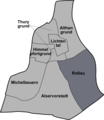
 Karte Wien-Himmelpfortgrund.png 1,869 × 2,153; 199 KB
-
 Karte Wien-Josefsdorf.png 2,050 × 2,075; 295 KB
-
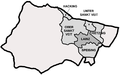
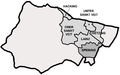
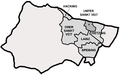
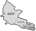
 Karte Wien-Josefstadt.png 1,645 × 1,237; 142 KB
-
 Karte Wien-Kahlenbergerdorf.png 2,050 × 2,075; 295 KB
-
 Karte Wien-Lichtental.png 1,869 × 2,153; 199 KB
-
 Karte Wien-Michelbeuern.png 1,869 × 2,153; 200 KB
-
 Karte Wien-Nussdorf.png 2,050 × 2,075; 276 KB
-
 Karte Wien-Oberdöbling.png 2,050 × 2,075; 295 KB
-
 Karte Wien-Rossau.png 1,869 × 2,153; 200 KB
-
 Karte Wien-Salmannsdorf Neustift am Walde.png 2,050 × 2,075; 299 KB
-
 Karte Wien-Sievering.png 2,050 × 2,075; 298 KB
-
 Karte Wien-Thurygrund.png 1,869 × 2,153; 200 KB
-
 Karte Wien-Unterdoebling.png 2,050 × 2,075; 296 KB
-
 KarteNeubauNeubau.png 945 × 686; 27 KB
-
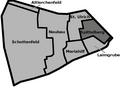
 KarteSchottenfeldNeubau.png 945 × 686; 26 KB
-
 KarteSpittelbergNeubau.png 945 × 686; 26 KB
-
 KarteStUlrichNeubau.png 945 × 686; 26 KB
-
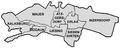
 Liesing Bezirksteile Vienna.png 770 × 310; 61 KB
-
 Liesing bezirksteile.png 1,850 × 760; 99 KB
-
 Liesing lage atzgersdorf.png 1,850 × 760; 100 KB
-
 Liesing lage erlaa.png 1,850 × 760; 100 KB
-
 Liesing lage inzersdorf.png 1,850 × 760; 100 KB
-
 Liesing lage kalksburg.png 1,850 × 760; 98 KB
-
 Liesing lage liesing.png 1,850 × 760; 99 KB
-
 Liesing lage mauer.png 1,850 × 760; 100 KB
-
 Liesing lage rodaun.png 1,850 × 760; 98 KB
-
 Liesing lage siebenhirten.png 1,850 × 760; 98 KB
-
 Ottakring bezirksteile.png 1,944 × 832; 74 KB
-
 Ottakring lage neulerchenfeld.png 1,944 × 832; 73 KB
-
 Ottakring lage ottakring.png 1,944 × 832; 59 KB
-
 Penzing bezirksteile.png 1,938 × 1,686; 89 KB
-
 Penzing lage baumgarten.png 1,938 × 1,686; 79 KB
-
 Penzing lage breitensee.png 1,938 × 1,686; 78 KB
-
 Penzing lage hadersdorf-weidlingau.png 1,938 × 1,686; 82 KB
-
 Penzing lage huetteldorf.png 1,938 × 1,686; 80 KB
-
 Penzing lage penzing.png 1,938 × 1,686; 77 KB
-
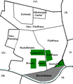 Sechshaus-Karte.PNG 486 × 558; 20 KB
-
 Simmering bezirksteile.png 1,933 × 1,245; 113 KB
-
 Simmering lage albern.png 1,933 × 1,245; 108 KB
-
 Simmering lage kaiserebersdorf.png 1,933 × 1,245; 112 KB
-
 Simmering lage simmering.png 1,933 × 1,245; 106 KB
-
 Strozzigrund.png 1,645 × 1,237; 141 KB
-
 Waehring bezirksteile.png 1,842 × 1,352; 119 KB
-
 Waehring lage gersthof.png 1,842 × 1,352; 117 KB
-
 Waehring lage poetzleinsdorf.png 1,842 × 1,352; 117 KB
-
 Waehring lage waehring.png 1,842 × 1,352; 111 KB
-
 Waehring lage weinhaus.png 1,842 × 1,352; 119 KB


