Category:Locator maps of cities in the Republic of the Congo
Jump to navigation
Jump to search
Media in category "Locator maps of cities in the Republic of the Congo"
The following 24 files are in this category, out of 24 total.
-
 CG-Bomassa.png 504 × 557; 7 KB
-
 CG-Diosso.png 504 × 557; 7 KB
-
 CG-Djambala.png 504 × 557; 7 KB
-
 CG-Ewo.png 504 × 557; 7 KB
-
 CG-Gamboma.png 504 × 557; 7 KB
-
 CG-Impfondo.png 504 × 557; 7 KB
-
 CG-Kayes.png 504 × 557; 7 KB
-
 CG-Kinkala.png 504 × 557; 7 KB
-
 CG-Loubomo.png 504 × 557; 7 KB
-
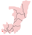
 CG-Madingo Kayes.png 504 × 557; 7 KB
-
 CG-Madingou.png 504 × 557; 7 KB
-
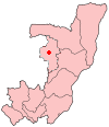
 CG-Makoua.png 504 × 557; 7 KB
-
 CG-Matsanga.png 504 × 557; 7 KB
-
 CG-Mbinda.png 504 × 557; 7 KB
-
 CG-Mossendjo.png 504 × 557; 7 KB
-
 CG-Ngamaba Mfilou.png 504 × 557; 7 KB
-
 CG-Nkayi.png 504 × 557; 7 KB
-
 CG-Ouesso.png 504 × 557; 7 KB
-
 CG-Owando.png 504 × 557; 7 KB
-
 CG-Oyo.png 504 × 557; 7 KB
-
 CG-Pointe Noire.png 504 × 557; 7 KB
-
 CG-Sembe.png 504 × 557; 7 KB
-
 CG-Sibiti.png 504 × 557; 7 KB
-
 Etoumbi.PNG 100 × 116; 3 KB


