Category:Locator maps of cities in Sacramento County, California
Jump to navigation
Jump to search
- See also wikipedia article (english text): Sacramento County, California
Media in category "Locator maps of cities in Sacramento County, California"
The following 53 files are in this category, out of 53 total.
-
 CAMap-doton-Antelope.png 209 × 230; 4 KB
-
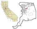
 CAMap-doton-Arden-Arcade.png 209 × 230; 4 KB
-
 CAMap-doton-Carmichael.png 209 × 230; 4 KB
-
 CAMap-doton-Citrus Heights.png 209 × 230; 4 KB
-
 CAMap-doton-Elk Grove.png 209 × 230; 4 KB
-
 CAMap-doton-Fair Oaks.png 209 × 230; 4 KB
-
 CAMap-doton-Florin.png 209 × 230; 4 KB
-
 CAMap-doton-Folsom.png 209 × 230; 4 KB
-
 CAMap-doton-Foothill Farms.png 209 × 230; 4 KB
-
 CAMap-doton-Galt.png 209 × 230; 4 KB
-
 CAMap-doton-Gold River.png 209 × 230; 4 KB
-
 CAMap-doton-Isleton.png 209 × 230; 4 KB
-
 CAMap-doton-La Riviera.png 209 × 230; 4 KB
-
 CAMap-doton-Laguna West-Lakeside.png 209 × 230; 4 KB
-
 CAMap-doton-Laguna.png 209 × 230; 4 KB
-
 CAMap-doton-North Highlands.png 209 × 230; 4 KB
-
 CAMap-doton-Orangevale.png 209 × 230; 4 KB
-
 CAMap-doton-Parkway-South Sacramento.png 209 × 230; 4 KB
-
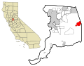
 CAMap-doton-Rancho Cordova.png 209 × 230; 4 KB
-
 CAMap-doton-Rancho Murieta.png 209 × 230; 4 KB
-
 CAMap-doton-Rio Linda.png 209 × 230; 4 KB
-
 CAMap-doton-Rosemont.png 209 × 230; 4 KB
-
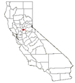
 CAMap-doton-Sacramento.png 595 × 717; 13 KB
-
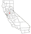
 CAMap-doton-Sacramento.PNG 209 × 230; 4 KB
-
 CAMap-doton-Vineyard.png 209 × 230; 4 KB
-
 CAMap-doton-Walnut Grove.png 209 × 230; 4 KB
-
 CAMap-doton-Wilton.png 209 × 230; 4 KB
-

-

-

-

-

-

-

-

-

-

-

-
-

-

-

-

-

-

-
-
-

-

-

-

-

-
 Sacramento-map.jpg 1,654 × 1,165; 313 KB


