Category:Locator maps of cities in Calaveras County, California
Jump to navigation
Jump to search
- See also wikipedia article (English text): Calaveras County, California.
Media in category "Locator maps of cities in Calaveras County, California"
The following 32 files are in this category, out of 32 total.
-
-

-
-
-
-

-

-

-

-

-

-

-

-
-

-
-
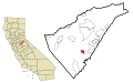
 CAMap-doton-Angels.png 209 × 230; 4 KB
-
 CAMap-doton-Arnold.png 209 × 230; 4 KB
-
 CAMap-doton-Avery.png 209 × 230; 4 KB
-
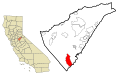
 CAMap-doton-Copperopolis.png 209 × 230; 4 KB
-
 CAMap-doton-Dorrington.png 209 × 230; 4 KB
-
 CAMap-doton-Forest Meadows.png 209 × 230; 4 KB
-
 CAMap-doton-Mokelumne Hill.png 209 × 230; 4 KB
-
 CAMap-doton-Mountain Ranch.png 209 × 230; 4 KB
-
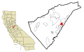
 CAMap-doton-Murphys.png 209 × 230; 4 KB
-
 CAMap-doton-Rail Road Flat.png 209 × 230; 4 KB
-
 CAMap-doton-Rancho Calaveras.png 209 × 230; 4 KB
-
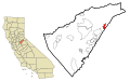
 CAMap-doton-San Andreas.png 209 × 230; 4 KB
-
 CAMap-doton-Vallecito.png 209 × 230; 4 KB
-
 CAMap-doton-Valley Springs.png 209 × 230; 4 KB
-
 CAMap-doton-Wallace.png 209 × 230; 4 KB
-
 CAMap-doton-West Point.png 209 × 230; 4 KB


