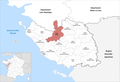
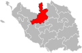
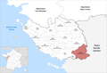
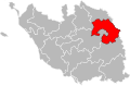
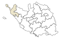
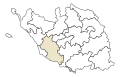
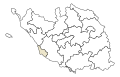
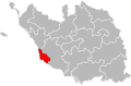
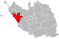
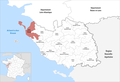
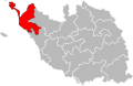
Category:Locator maps of cantons of Vendée
Jump to navigation
Jump to search
Departments of Metropolitan France: Ain [01] · Aisne [02] · Allier [03] · Alpes-de-Haute-Provence [04] · Hautes-Alpes [05] · Alpes-Maritimes [06] · Ardèche [07] · Ardennes [08] · Ariège [09] · Aube [10] · Aude [11] · Aveyron [12] · Bouches-du-Rhône [13] · Calvados [14] · Cantal [15] · Charente [16] · Charente-Maritime [17] · Cher [18] · Corrèze [19] · Corse-du-Sud [2A]† · Haute-Corse [2B]† · Côte-d’Or [21] · Côtes-d'Armor [22] · Creuse [23] · Dordogne [24] · Doubs [25] · Drôme [26] · Eure [27] · Eure-et-Loir [28] · Finistère [29] · Gard [30] · Haute-Garonne [31] · Gers [32] · Gironde [33] · Hérault [34] · Ille-et-Vilaine [35] · Indre [36] · Indre-et-Loire [37] · Isère [38] · Jura [39] · Landes [40] · Loir-et-Cher [41] · Loire [42] · Haute-Loire [43] · Loire-Atlantique [44] · Loiret [45] · Lot [46] · Lot-et-Garonne [47] · Lozère [48] · Maine-et-Loire [49] · Manche [50] · Marne [51] · Haute-Marne [52] · Mayenne [53] · Meurthe-et-Moselle [54] · Meuse [55] · Morbihan [56] · Moselle [57] · Nièvre [58] · Nord [59] · Oise [60] · Orne [61] · Pas-de-Calais [62] · Puy-de-Dôme [63] · Pyrénées-Atlantiques [64] · Hautes-Pyrénées [65] · Pyrénées-Orientales [66] · Bas-Rhin [67] · Haut-Rhin [68] · Haute-Saône [70] · Saône-et-Loire [71] · Sarthe [72] · Savoie [73] · Haute-Savoie [74] · Paris [75] · Seine-Maritime [76] · Seine-et-Marne [77] · Yvelines [78] · Deux-Sèvres [79] · Somme [80] · Tarn [81] · Tarn-et-Garonne [82] · Var [83] · Vaucluse [84] · Vendée [85] · Vienne [86] · Haute-Vienne [87] · Vosges [88] · Yonne [89] · Territoire de Belfort [90] · Essonne [91] · Hauts-de-Seine [92] · Seine-Saint-Denis [93] · Val-de-Marne [94] · Val-d'Oise [95]
Overseas departments and regions: Guadeloupe [971] · Martinique [972] · French Guiana [973] · Réunion [974] · Mayotte [976]
Overseas departments and regions: Guadeloupe [971] · Martinique [972] · French Guiana [973] · Réunion [974] · Mayotte [976]
Subcategories
This category has the following 5 subcategories, out of 5 total.
Media in category "Locator maps of cantons of Vendée"
The following 68 files are in this category, out of 68 total.
-
 Locator map of Kanton Aizenay 2023.png 2,499 × 1,715; 684 KB
-
 Vendée - Canton Aizenay 2015.svg 925 × 604; 1.31 MB
-
 Locator map of Kanton Challans 2023.png 2,499 × 1,715; 684 KB
-
 Vendée - Canton Challans 2015.svg 925 × 604; 1.31 MB
-
 Locator map of Kanton Chantonnay 2024.png 2,499 × 1,715; 687 KB
-
 Vendée - Canton Chantonnay 2015.svg 925 × 604; 1.31 MB
-
 Vendée - Canton La Châtaigneraie 2015.svg 925 × 604; 1.31 MB
-
 Locator map of Kanton Fontenay-le-Comte 2023.png 2,499 × 1,715; 688 KB
-
 Vendée - Canton Fontenay-le-Comte 2015.svg 925 × 604; 1.31 MB
-
 Vendée - Canton Les Herbiers 2015.svg 925 × 604; 1.31 MB
-
 Vendée - Canton L'Île-d'Yeu 2015.svg 925 × 604; 1.31 MB
-
 Locator map of Kanton La Châtaigneraie 2024.png 2,499 × 1,715; 688 KB
-
 Locator map of Kanton La Roche-sur-Yon-1 2023.png 2,499 × 1,715; 682 KB
-
 Locator map of Kanton La Roche-sur-Yon-2 2023.png 2,499 × 1,715; 682 KB
-
 Locator map of Kanton Les Herbiers 2023.png 2,499 × 1,715; 685 KB
-
 Locator map of Kanton Les Sables-d’Olonne 2023.png 2,499 × 1,715; 681 KB
-
 Locator map of the canton de Challans (in Vendée).png 1,600 × 1,050; 176 KB
-
 Locator map of the canton de Challans (since 2015).svg 854 × 547; 41 KB
-
 Locator map of the canton de Chantonnay (in Vendée).png 1,600 × 1,050; 177 KB
-
 Locator map of the canton de Chantonnay (since 2015).svg 854 × 547; 41 KB
-
 Locator map of the canton de Fontenay-le-Comte (in Vendée).png 1,600 × 1,050; 175 KB
-
 Locator map of the canton de Fontenay-le-Comte (since 2015).svg 854 × 547; 41 KB
-
 Locator map of the canton de La Châtaigneraie (in Vendée).png 1,600 × 1,050; 176 KB
-
 Locator map of the canton de La Châtaigneraie (since 2015).svg 854 × 547; 41 KB
-
 Locator map of the canton de La Roche-sur-Yon-1 (since 2015).svg 854 × 547; 41 KB
-
 Locator map of the canton de La Roche-sur-Yon-2 (since 2015).svg 854 × 547; 41 KB
-
 Locator map of the canton de La Roche-sur-Yon-I (in Vendée).png 1,600 × 1,050; 175 KB
-
 Locator map of the canton de La Roche-sur-Yon-II (in Vendée).png 1,600 × 1,050; 175 KB
-
 Locator map of the canton de Luçon (in Vendée).png 1,600 × 1,050; 175 KB
-
 Locator map of the canton de Luçon (since 2015).svg 854 × 547; 41 KB
-
 Locator map of the canton de L’Île-d’Yeu (in Vendée).png 1,600 × 1,050; 173 KB
-
 Locator map of the canton de L’Île-d’Yeu (since 2015).svg 854 × 547; 41 KB
-
 Locator map of the canton de Mareuil-sur-Lay-Dissais (in Vendée).png 1,600 × 1,050; 176 KB
-

-
 Locator map of the canton de Montaigu (in Vendée).png 1,600 × 1,050; 175 KB
-
 Locator map of the canton de Montaigu (since 2015).svg 854 × 547; 41 KB
-
 Locator map of the canton de Mortagne-sur-Sèvre (in Vendée).png 1,600 × 1,050; 175 KB
-
 Locator map of the canton de Mortagne-sur-Sèvre (since 2015).svg 854 × 547; 41 KB
-
 Locator map of the canton de Saint-Hilaire-de-Riez (in Vendée).png 1,600 × 1,050; 175 KB
-
 Locator map of the canton de Saint-Hilaire-de-Riez (since 2015).svg 854 × 547; 41 KB
-
 Locator map of the canton de Saint-Jean-de-Monts (in Vendée).png 1,600 × 1,050; 175 KB
-
 Locator map of the canton de Saint-Jean-de-Monts (since 2015).svg 854 × 547; 41 KB
-
 Locator map of the canton de Talmont-Saint-Hilaire (in Vendée).png 1,600 × 1,050; 176 KB
-
 Locator map of the canton de Talmont-Saint-Hilaire (since 2015).svg 854 × 547; 41 KB
-
 Locator map of the canton des Herbiers (in Vendée).png 1,600 × 1,050; 176 KB
-
 Locator map of the canton des Herbiers (since 2015).svg 854 × 547; 41 KB
-
 Locator map of the canton des Sables-d’Olonne (in Vendée).png 1,600 × 1,050; 174 KB
-
 Locator map of the canton des Sables-d’Olonne (since 2015).svg 854 × 547; 41 KB
-
 Locator map of the canton d’Aizenay (in Vendée).png 1,600 × 1,050; 176 KB
-
 Locator map of the canton d’Aizenay (since 2015).svg 854 × 547; 41 KB
-
 Vendée - Canton Luçon 2015.svg 925 × 604; 1.31 MB
-
 Locator map of Kanton Luçon 2023.png 2,499 × 1,715; 687 KB
-
 Locator map of Kanton L’Île-d’Yeu 2023.png 2,499 × 1,715; 680 KB
-
 Locator map of Kanton Mareuil-sur-Lay-Dissais 2023.png 2,499 × 1,715; 688 KB
-
 Vendée - Canton Mareuil-sur-Lay-Dissais 2015.svg 925 × 604; 1.31 MB
-
 Vendée - Canton Montaigu 2015.svg 925 × 604; 1.31 MB
-
 Locator map of Kanton Montaigu-Vendée 2023.png 2,499 × 1,715; 684 KB
-
 Vendée - Canton Mortagne-sur-Sèvre 2015.svg 925 × 604; 1.31 MB
-
 Locator map of Kanton Mortagne-sur-Sèvre 2023.png 2,499 × 1,715; 682 KB
-
 Vendée - Canton La Roche-sur-Yon-1 2015.svg 925 × 604; 1.31 MB
-
 Vendée - Canton La Roche-sur-Yon-2 2015.svg 925 × 604; 1.31 MB
-
 Vendée - Canton Les Sables-d'Olonne 2015.svg 925 × 604; 1.31 MB
-
 Locator map of Kanton Saint-Hilaire-de-Riez 2023.png 2,499 × 1,715; 684 KB
-
 Vendée - Canton Saint-Hilaire-de-Riez 2015.svg 925 × 604; 1.31 MB
-
 Locator map of Kanton Saint-Jean-de-Monts 2023.png 2,499 × 1,715; 684 KB
-
 Vendée - Canton Saint-Jean-de-Monts 2015.svg 925 × 604; 1.31 MB
-
 Locator map of Kanton Talmont-Saint-Hilaire 2023.png 2,499 × 1,715; 687 KB
-
 Vendée - Canton Talmont-Saint-Hilaire 2015.svg 925 × 604; 1.31 MB


.png)
.svg)
.png)
.svg)
.png)
.svg)
.png)
.svg)
.svg)
.svg)
.png)
.png)
.png)
.svg)
.png)
.svg)
.png)
.svg)
.png)
.svg)
.png)
.svg)
.png)
.svg)
.png)
.svg)
.png)
.svg)
.png)
.svg)
.png)
.svg)
.png)
.svg)


