Category:Locator maps of cantons of Normandie
Jump to navigation
Jump to search
Administrative regions and territorial collectivity of Metropolitan France (‡ since start of 2016):
Auvergne-Rhône-Alpes‡ · Bourgogne-Franche-Comté‡ · Brittany · Centre-Val de Loire · Corsica · Grand Est‡ · Hauts-de-France‡ · Île-de-France · Normandy‡ · New Aquitaine‡ · Occitania‡ · Pays de la Loire · Provence-Alpes-Côte d'Azur
Overseas departments and regions: Guadeloupe · Martinique · French Guiana · Réunion · Mayotte

Subcategories
This category has the following 6 subcategories, out of 6 total.
C
E
M
O
S
Media in category "Locator maps of cantons of Normandie"
The following 27 files are in this category, out of 27 total.
-
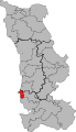
 50-01 Map of canton d'Agon-Coutainville (2015).svg 650 × 1,130; 67 KB
-
 50-02 Map of canton d'Avranches (2015).svg 650 × 1,130; 62 KB
-
 50-03 Map of canton de Bréhal (2015).svg 650 × 1,130; 67 KB
-
 50-04 Map of canton de Bricquebec-en-Cotentin.svg 650 × 1,130; 69 KB
-
 50-05 Map of canton de Carentan-les-Marais.svg 650 × 1,130; 75 KB
-
 50-06 Map of canton de Cherbourg-en-Cotentin-1.svg 650 × 1,130; 52 KB
-
 50-07 Map of canton de Cherbourg-en-Cotentin-2.svg 650 × 1,130; 56 KB
-
 50-08 Map of canton de Cherbourg-en-Cotentin-3.svg 650 × 1,130; 58 KB
-
 50-09 Map of canton de Condé-sur-Vire (2015).svg 650 × 1,130; 73 KB
-
 50-10 Map of canton de Coutances (2015).svg 650 × 1,130; 62 KB
-
 50-11 Map of canton de Créances (2015).svg 650 × 1,130; 71 KB
-
 50-12 Map of canton de Cherbourg-en-Cotentin-4.svg 650 × 1,130; 51 KB
-
 50-13 Map of canton de Granville (2015).svg 650 × 1,130; 53 KB
-
 50-14 Map of canton de la Hague (2015).svg 650 × 1,130; 63 KB
-
 50-15 Map of canton d'Isigny-le-Buat (2015).svg 650 × 1,130; 71 KB
-
 50-16 Map of canton du mortainais (2015).svg 650 × 1,130; 69 KB
-
 50-17 Map of canton des Pieux (2015).svg 650 × 1,130; 68 KB
-
 50-18 Map of canton de Pont-Hébert (2015).svg 650 × 1,130; 70 KB
-
 50-19 Map of canton de Pontorson (2015).svg 650 × 1,130; 66 KB
-
 50-20 Map of canton de Quettreville-sur-Sienne (2015).svg 650 × 1,130; 70 KB
-
 50-21 Map of canton de Saint-Hilaire-du-Harcouët (2015).svg 650 × 1,130; 69 KB
-
 50-22 Map of canton de Saint-Lô-1 (2015).svg 650 × 1,130; 58 KB
-
 50-23 Map of canton de Saint-Lô-2 (2015).svg 650 × 1,130; 61 KB
-
 50-24 Map of canton de Cherbourg-en-Cotentin-5.svg 650 × 1,130; 53 KB
-
 50-25 Map of canton de Valognes (2015).svg 650 × 1,130; 69 KB
-
 50-26 Map of canton du val-de-Saire (2015).svg 650 × 1,130; 68 KB
-
 50-27 Map of canton de Villedieu-les-Poêles-Rouffigny.svg 650 × 1,130; 67 KB
.svg)
.svg)
.svg)


.svg)
.svg)
.svg)

.svg)
.svg)
.svg)
.svg)
.svg)
.svg)
.svg)
.svg)
.svg)
.svg)
.svg)

.svg)
.svg)
