Category:Locator maps of arrondissements of Indre to 2016
Jump to navigation
Jump to search
Media in category "Locator maps of arrondissements of Indre to 2016"
The following 9 files are in this category, out of 9 total.
-
 Carte arrondissement d'Issoudun (canton avant 2015).jpg 1,000 × 1,016; 183 KB
-
 Carte arrondissement de Châteauroux (canton avant 2015).jpg 1,000 × 1,016; 210 KB
-
 Carte arrondissement de La Châtre (canton avant 2015).jpg 1,000 × 1,016; 186 KB
-
 Carte arrondissement du Blanc (canton avant 2015).jpg 1,000 × 1,016; 192 KB
-
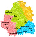 Cartes des arrondissements de l'Indre.jpg 812 × 827; 167 KB
-
 Map arrondissement code 361.svg 451 × 455; 6 KB
-
 Map arrondissement code 362.svg 451 × 455; 6 KB
-
 Map arrondissement code 363.svg 451 × 455; 6 KB
-
 Map arrondissement code 364.svg 451 × 455; 6 KB
.jpg)
.jpg)
.jpg)
.jpg)


