Category:Locator maps of arrondissements of Cher to 2018
Jump to navigation
Jump to search
Media in category "Locator maps of arrondissements of Cher to 2018"
The following 9 files are in this category, out of 9 total.
-
 Locator map of Arrondissement Bourges 2017.png 2,500 × 2,585; 1.52 MB
-
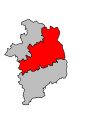
 Cher - Bourges arrondissement.svg 512 × 695; 11 KB
-
 Cher - Saint-Amand-Montrond arrondissement.svg 512 × 695; 11 KB
-
 Cher - Vierzon arrondissement.svg 512 × 695; 11 KB
-
 Map arrondissement code 181.svg 335 × 455; 5 KB
-
 Map arrondissement code 182.svg 335 × 455; 5 KB
-
 Map arrondissement code 183.svg 335 × 455; 5 KB
-
 Locator map of Arrondissement Saint-Amand-Montrond 2017.png 2,500 × 2,585; 1.52 MB
-
 Locator map of Arrondissement Vierzon 2017.png 2,500 × 2,585; 1.52 MB


