Category:Locator maps of South America (gray and green scheme)
Jump to navigation
Jump to search
Subcategories
This category has the following 3 subcategories, out of 3 total.
Media in category "Locator maps of South America (gray and green scheme)"
The following 18 files are in this category, out of 18 total.
-
 America do Sul Uruguay.png 381 × 505; 34 KB
-
 Argentina in South America.png 315 × 320; 9 KB
-
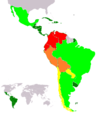
 Bolivarian Games participating countries.PNG 330 × 273; 15 KB
-
 Coruja-orelhuda Localização.png 738 × 705; 59 KB
-
 Map-Latin America and Caribbean.png 390 × 450; 11 KB
-
 Lateinamerika.png 390 × 450; 24 KB
-
 LocationEasterIsland.PNG 250 × 115; 8 KB
-
 LocationSouthAmerica transparent.png 2,759 × 1,404; 43 KB
-
 LocationSouthAmerica.png 2,759 × 1,404; 101 KB
-
 Map-Latin America2-2.png 390 × 450; 33 KB
-
 Map-Latin America2.png 390 × 450; 22 KB
-
 Mapa suramerica1.jpg 411 × 480; 23 KB
-
 MapaPatagonia.JPG 245 × 486; 14 KB
-
 Platina.png 165 × 192; 13 KB
-
 South-America-Andean-states.png 240 × 320; 5 KB
-
 South-America-CAN.sin.Venezuela.png 240 × 320; 3 KB
-
 Southern cone.jpg 376 × 600; 50 KB
-
 TinySouthAmerica.png 54 × 68; 2 KB


