Category:Locator maps of Sabah
Jump to navigation
Jump to search
| NO WIKIDATA ID FOUND! Search for Locator maps of Sabah on Wikidata | |
| Upload media |

Media in category "Locator maps of Sabah"
The following 95 files are in this category, out of 95 total.
-
 Douhu-weizhi-zh.png 240 × 177; 29 KB
-
 DynamicSabahblankcolorschemeKK.PNG 431 × 417; 37 KB
-
 DynamicSabahblankcolorschemeTawau.PNG 431 × 417; 37 KB
-
 DynamicSandakan.PNG 477 × 397; 29 KB
-
 ESSZONE Map.png 2,000 × 1,652; 740 KB
-
 KeningauLocationMap.PNG 431 × 417; 37 KB
-
 Kimanismap.jpg 4,480 × 2,072; 1.9 MB
-
 KotakinabaluMap.PNG 397 × 312; 12 KB
-
 Krisis Pantai Timur Sabah.png 2,000 × 1,652; 847 KB
-
 Kudat & Kota Kinabalu Map.jpg 431 × 417; 25 KB
-
 KudatLocationMap.jpg 431 × 417; 22 KB
-
 KudatLocationMap.PNG 431 × 417; 37 KB
-
 LahadDatu Sabah Location-of-LahadDatuStandoff-01a.png 2,000 × 1,652; 977 KB
-
 LahadDatuMap.PNG 431 × 417; 37 KB
-
 Location of Kinabalu Ecolinc Project.jpg 614 × 435; 29 KB
-
 LocationMapPenampang.PNG 431 × 417; 37 KB
-
 Malaysia Regions Sabah.png 786 × 286; 49 KB
-
 MalaysiaSabah.png 400 × 144; 16 KB
-
 Map-Sabah-Interior.gif 415 × 315; 5 KB
-
 Map-Sabah-Kudat.PNG 415 × 315; 9 KB
-
 Map-Sabah-Sandakan Division.PNG 415 × 315; 7 KB
-
 Map-Sabah-Tawau.PNG 415 × 315; 7 KB
-
 Map-Sabah-West Coast Division.PNG 415 × 315; 7 KB
-
 Map-Sabah-WestCoast.gif 548 × 416; 8 KB
-
 North Borneo Dispute territory.PNG 431 × 417; 37 KB
-
 Sabah state locator.PNG 3,000 × 1,025; 118 KB
-
 Sabah-InteriorDivision.png 1,800 × 1,487; 591 KB
-
 Sabah-Islands-DarvelBay PulauBait-Pushpin.png 1,672 × 1,326; 284 KB
-
 Sabah-Islands-DarvelBay PulauBatik-Pushpin.png 1,672 × 1,326; 282 KB
-
 Sabah-Islands-DarvelBay PulauBatikKulambu-Pushpin.png 1,672 × 1,326; 282 KB
-
 Sabah-Islands-DarvelBay PulauBohayan-Pushpin.png 1,672 × 1,326; 285 KB
-
 Sabah-Islands-DarvelBay PulauBoheyDulang-Pushpin.png 1,672 × 1,326; 287 KB
-
 Sabah-Islands-DarvelBay PulauBumBum-Pushpin.png 1,672 × 1,326; 285 KB
-
 Sabah-Islands-DarvelBay PulauDanawan-Pushpin.png 1,672 × 1,326; 287 KB
-
 Sabah-Islands-DarvelBay PulauKalumpang-Pushpin.png 1,672 × 1,326; 285 KB
-
 Sabah-Islands-DarvelBay PulauKapalai-Pushpin.png 1,672 × 1,326; 285 KB
-
 Sabah-Islands-DarvelBay PulauLarapan-Pushpin.png 1,672 × 1,326; 283 KB
-
 Sabah-Islands-DarvelBay PulauLigitan-Pushpin.png 1,672 × 1,326; 287 KB
-
 Sabah-Islands-DarvelBay PulauMabul-Pushpin.png 1,672 × 1,326; 279 KB
-
 Sabah-Islands-DarvelBay PulauMataPahi-Pushpin.png 1,672 × 1,326; 286 KB
-
 Sabah-Islands-DarvelBay PulauOmadal-Pushpin.png 1,672 × 1,326; 288 KB
-
 Sabah-Islands-DarvelBay PulauPababag-Pushpin.png 1,672 × 1,326; 286 KB
-
 Sabah-Islands-DarvelBay PulauSakar-Pushpin.png 1,672 × 1,326; 284 KB
-
 Sabah-Islands-DarvelBay PulauSiAmil-Pushpin.png 1,672 × 1,326; 286 KB
-
 Sabah-Islands-DarvelBay PulauSilawa-Pushpin.png 1,672 × 1,326; 285 KB
-
 Sabah-Islands-DarvelBay PulauSilumpat-Pushpin.png 1,672 × 1,326; 282 KB
-
 Sabah-Islands-DarvelBay PulauSipadan-Pushpin.png 1,672 × 1,326; 285 KB
-
 Sabah-Islands-DarvelBay PulauTabawan-Pushpin.png 1,672 × 1,326; 285 KB
-
 Sabah-Islands-DarvelBay PulauTimbunMata-Pushpin.png 1,672 × 1,326; 285 KB
-
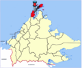
 Sabah-Islands-PulauMalawali-Pushpin.png 1,994 × 1,280; 294 KB
-
 Sabah-Islands-PulauTigabu-Pushpin.png 1,994 × 1,280; 294 KB
-
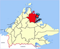
 Sabah-KudatDivision.png 1,800 × 1,487; 593 KB
-
 Sabah-SandakanDivision.png 1,800 × 1,487; 590 KB
-
 Sabah-TawauDivision.png 1,800 × 1,487; 592 KB
-
 Sabah-WestCoastDivision.png 1,800 × 1,487; 593 KB
-
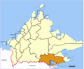 SabahDistrict-Tawau.png 2,000 × 1,652; 913 KB
-
 SabahDistricts-Beaufort-pp.png 2,000 × 1,652; 921 KB
-
 SabahDistricts-Beaufort.png 2,000 × 1,652; 903 KB
-
 SabahDistricts-Beluran-pp.png 2,000 × 1,652; 868 KB
-
 SabahDistricts-Keningau-pp.png 2,000 × 1,652; 923 KB
-
 SabahDistricts-Kinabatangan-pp.png 2,000 × 1,652; 926 KB
-
 SabahDistricts-Kota Belud-pp.png 2,000 × 1,652; 925 KB
-
 SabahDistricts-KotaKinabalu-pp.png 2,000 × 1,652; 927 KB
-
 SabahDistricts-KotaMarudu-pp.png 2,000 × 1,652; 917 KB
-
 SabahDistricts-KualaPenyu-pp.png 2,000 × 1,652; 933 KB
-
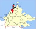
 SabahDistricts-Kudat-pp.png 2,000 × 1,652; 929 KB
-
 SabahDistricts-Kunak-pp.png 2,000 × 1,652; 928 KB
-
 SabahDistricts-LahadDatu-pp.png 2,000 × 1,652; 933 KB
-
 SabahDistricts-Nabawan-pp.png 2,000 × 1,652; 924 KB
-
 SabahDistricts-Papar-pp.png 2,000 × 1,652; 921 KB
-
 SabahDistricts-Papar.png 2,000 × 1,652; 905 KB
-
 SabahDistricts-Penampang-pp.png 2,000 × 1,652; 925 KB
-
 SabahDistricts-Pitas-pp.png 2,000 × 1,652; 936 KB
-
 SabahDistricts-Putatan-pp.png 2,000 × 1,652; 925 KB
-
 SabahDistricts-Ranau-pp.png 2,000 × 1,652; 925 KB
-
 SabahDistricts-Sandakan-pp.png 2,000 × 1,652; 938 KB
-
 SabahDistricts-Semporna-pp.png 2,000 × 1,652; 932 KB
-
 SabahDistricts-Sipitang-pp.png 2,000 × 1,652; 920 KB
-
 SabahDistricts-Tambunan-pp.png 2,000 × 1,652; 923 KB
-
 SabahDistricts-Telupid-pp.png 2,000 × 1,652; 991 KB
-
 SabahDistricts-Tenom-pp.png 2,000 × 1,652; 924 KB
-
 SabahDistricts-Tongod-pp.png 2,000 × 1,652; 933 KB
-
 SabahDistricts-Tuaran-pp.png 2,000 × 1,652; 933 KB
-
 SabahDistrikte-Tawau-pp.png 2,000 × 1,652; 924 KB
-
 SandakanLocationMap.PNG 431 × 417; 37 KB
-
 SandakanMap.PNG 400 × 309; 8 KB
-
 SempornaLocation.PNG 431 × 417; 37 KB
-
 SipitangLocationMap.png 431 × 417; 37 KB
-
 SouthernPartofSabah Scheme-PulauJambongan Pushpin.png 1,994 × 1,280; 297 KB
-
 SouthernPartofSabah-Scheme TelukMarudu.png 1,994 × 1,280; 274 KB
-
 SouthernPartofSabah-Scheme-PulauBalambangan Pushpin.png 1,994 × 1,280; 297 KB
-
 SouthernPartofSabah-Scheme-PulauBanggi Pushpin.png 1,994 × 1,280; 297 KB
-
 SouthernPartofSabah-Scheme-PulauJambongan 1024 px Pushpin.png 1,024 × 657; 199 KB
-
 TambunanDistrictMap.jpg 431 × 417; 106 KB
-
 Tawaumap.PNG 374 × 309; 12 KB


