Category:Locator maps of Japanese islands
Jump to navigation
Jump to search
Subcategories
This category has the following 3 subcategories, out of 3 total.
Media in category "Locator maps of Japanese islands"
The following 77 files are in this category, out of 77 total.
-
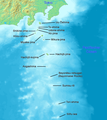
 Amami archaeology-en.png 1,500 × 1,540; 418 KB
-
 Amami Islands-de.png 1,500 × 1,540; 391 KB
-
 Amami Islands-de2.png 1,500 × 1,540; 392 KB
-
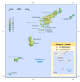
 Amami Islands-en.png 1,500 × 1,540; 392 KB
-
 Amami Islands-ja.png 1,500 × 1,540; 376 KB
-
 Daito islands en.png 1,458 × 884; 324 KB
-
 Daito islands ja.png 1,458 × 884; 304 KB
-
 Hokkaido Nemuro Br 16cl.png 768 × 429; 6 KB
-
 Honshu Island in Japan.svg 413 × 373; 1.19 MB
-
 Hoppo.png 384 × 215; 4 KB
-
 Ilhas ogasawara.png 1,011 × 798; 730 KB
-
 Iriomote-wilold-cat-distrib.png 1,000 × 1,000; 48 KB
-
 Ishigaki in Okinawa Map.gif 702 × 400; 18 KB
-
 Izu islands.png 300 × 400; 30 KB
-
 Izu Torishima.PNG 756 × 546; 496 KB
-
 Izu-Islands-Japanese-Map.png 1,257 × 1,409; 655 KB
-
 Japan awaji map small.png 235 × 300; 6 KB
-
 Japan hokkaido map small.png 235 × 300; 6 KB
-
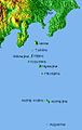
 Japan Honshu large.png 1,397 × 1,593; 77 KB
-
 Japan honshu map small.png 235 × 300; 6 KB
-
 Japan honshu map.svg 413 × 373; 973 KB
-
 Japan kyushu map small.png 235 × 300; 6 KB
-
 Japan satellite with Hachijōjima marked.png 1,557 × 1,419; 382 KB
-
 Japan shikoku map small.png 235 × 300; 22 KB
-
 JP Okinawa Ie-jima Location.png 1,351 × 1,206; 35 KB
-
 JP Okinawa Kitadaito-jima Location.png 1,496 × 925; 26 KB
-
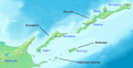 Kuril-Islands-Northern-Territories-of-Japan-Map.png 1,787 × 917; 415 KB
-
 Kyushu Island in Japan.svg 413 × 373; 1.19 MB
-
 Location IzuIlands.jpg 639 × 698; 244 KB
-
 Location of Sado In The Sea of Japan.jpg 400 × 400; 19 KB
-
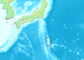
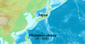
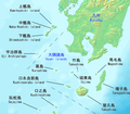
 Location of the Ryukyu Islands.JPG 800 × 733; 310 KB
-
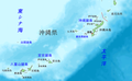
 Location Ryukyu Islands.PNG 906 × 987; 151 KB
-
 Location-of-Liancourt-rocks-ko.png 640 × 320; 58 KB
-
 Location-of-Liancourt-rocks-zh-classical.png 640 × 320; 55 KB
-
 Location-of-Sado-island-japan.jpg 400 × 400; 20 KB
-
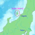 Location-of-Sadogashima-island-en.png 400 × 400; 14 KB
-
 Location-of-Sadogashima-island-ja.png 400 × 400; 15 KB
-
 Location-of-Sadogashima-island-ko.png 400 × 400; 13 KB
-
 LocationMapHonshū.png 250 × 115; 8 KB
-
 LocationMinamiTorishima.PNG 250 × 158; 6 KB
-
 LocationOkinotorishima.PNG 250 × 158; 5 KB
-
 Map IzuIslandsShuttle.jpg 331 × 523; 32 KB
-
 Map of Izu Islands-de.png 1,257 × 1,409; 693 KB
-
 Map of Izu Islands.png 1,257 × 1,409; 691 KB
-
 Map of ogasawara islands ja.png 1,011 × 798; 246 KB
-
 Map of ogasawara islands.png 1,011 × 798; 253 KB
-
 Map-of-Ogasawara-islands-ko.png 1,011 × 798; 265 KB
-
 Mosals ejdeha.jpg 480 × 307; 65 KB
-
 North 4 islands.png 768 × 429; 13 KB
-
 Northern-Territories-of-Japan-Map-日本の北方領土の地図.png 1,787 × 917; 414 KB
-
 Ogasawara Islands.jpg 856 × 541; 69 KB
-
 Ogasawara islands.png 1,011 × 798; 296 KB
-
 Ogasawara Kita Iwojima.PNG 756 × 546; 496 KB
-
 Ogasawara LocationBoninIs.PNG 756 × 546; 496 KB
-
 Ogasawara LocationNishinoIs.PNG 756 × 546; 496 KB
-
 Ogasawara LocationVolcanoIs.PNG 756 × 546; 496 KB
-
 Ogasawara Minami Iwojima.PNG 756 × 546; 496 KB
-
 Ogasawara Minamitorishima.png 756 × 546; 496 KB
-
 Okinawakenchizu.png 1,250 × 773; 916 KB
-
 Okinotorishima-en.svg 1,796 × 927; 5.21 MB
-
 Okinotorishima.png 4,445 × 2,534; 1.4 MB
-
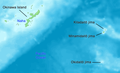
 Osumi Islands Map Japan.png 1,364 × 1,188; 525 KB
-
 Satsunan-Islands-Kagoshima-Japan.png 1,622 × 2,484; 1.24 MB
-
 Sea-of-Okhotsk-Full-Map-Hokkaido-Kuril-Kamchatka-Sakhalin.png 5,188 × 3,548; 14.83 MB
-
 Shikoku Island in Japan.svg 413 × 373; 1.19 MB
-
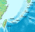
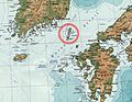
 Tsushima fr.png 538 × 540; 229 KB
-
 Tsushima island de.png 540 × 540; 61 KB
-
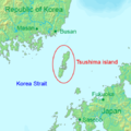 Tsushima island en.png 540 × 540; 59 KB
-
 Tsushima island fa.png 540 × 540; 137 KB
-
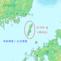
 Tsushima island ja.png 540 × 540; 59 KB
-
 Tsushima island ko.png 540 × 540; 60 KB
-
 Tsushima-geo.jpg 315 × 245; 24 KB
-
 Tsushima-sat.jpg 250 × 170; 22 KB
-
 Uji Islands.png 425 × 322; 71 KB
-
 Yagaji Island in Okinawa.gif 558 × 680; 29 KB
-
 Остров Панафидина.png 619 × 618; 59 KB
-
 岡村島位置図.png 700 × 450; 112 KB


