Category:Locator maps of Hawaiian islands
Jump to navigation
Jump to search
Media in category "Locator maps of Hawaiian islands"
The following 22 files are in this category, out of 22 total.
-
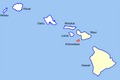
 Hawaii Islands - Hawaii.PNG 436 × 414; 26 KB
-
 Hawaii Island location (Southeastern Islands).png 1,024 × 692; 80 KB
-
 Hawaii Islands - Kahoolawe.PNG 436 × 414; 26 KB
-
 Kahoolawe Island location (Southeastern Islands).png 1,010 × 677; 60 KB
-
 Hawaii Islands - Kauai.PNG 436 × 414; 26 KB
-
 Hawaii Islands - Lanai.PNG 436 × 414; 26 KB
-
 Lanai Island location (Southeastern Islands).png 1,010 × 677; 60 KB
-
 Map of Hawaii highlighting Hawaii (island).svg 6,063 × 4,081; 12 KB
-
 Map of Hawaii highlighting Kahoolawe.svg 6,063 × 4,081; 13 KB
-
 Map of Hawaii highlighting Kauai.svg 6,063 × 4,081; 12 KB
-
 Map of Hawaii highlighting Lanai.svg 6,063 × 4,081; 12 KB
-
 Map of Hawaii highlighting Lehua.svg 1,213 × 681; 12 KB
-
 Map of Hawaii highlighting Maui.svg 6,063 × 4,081; 12 KB
-
 Map of Hawaii highlighting Molokai.svg 6,063 × 4,081; 12 KB
-
 Map of Hawaii highlighting Niihau.svg 6,063 × 4,081; 12 KB
-
 Map of Hawaii highlighting Oahu.svg 6,063 × 4,081; 12 KB
-
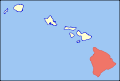
 Hawaii Islands - Maui.PNG 436 × 414; 26 KB
-
 Maui Island Locator.jpg 582 × 401; 64 KB
-
 Hawaii Islands - Molokai.PNG 436 × 414; 26 KB
-
 Hawaii Islands - Ni ihau.PNG 436 × 414; 26 KB
-
 Hawaii Islands - Oahu.PNG 436 × 414; 26 KB
-
 Oahu Island Locator.jpg 292 × 184; 39 KB

.png)

.png)


.png)
.svg)


