Category:Locator maps of Baden-Württemberg
Jump to navigation
Jump to search
Federal states of Germany:
Urban districts (cities): Mannheim ·
Subcategories
This category has the following 11 subcategories, out of 11 total.
!
H
L
M
Media in category "Locator maps of Baden-Württemberg"
The following 18 files are in this category, out of 18 total.
-
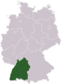 Germany Laender Baden-Wuerttemberg.png 668 × 910; 13 KB
-
 Baden Wuerttemberg Bayern Region Donau-Iller.png 450 × 350; 94 KB
-
 Baden Wuerttemberg Region Bodensee-Oberschwaben.png 221 × 250; 14 KB
-
 Baden Wuerttemberg Region Neckar-Alb.png 221 × 250; 14 KB
-
 Bahnstadt (without associated neighborhoods) in HD-City.svg 210 × 169; 36 KB
-
 Germany lv nordbaden.gif 166 × 225; 5 KB
-
 Germany lv südbaden.gif 166 × 225; 5 KB
-
 Germany lv württemberg.gif 166 × 226; 5 KB
-
 Geschaeftsgebiet.JPG 590 × 630; 30 KB
-
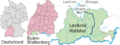
 Karte Alb-Lage.gif 640 × 211; 31 KB
-
 Karte Mettma-Lage.gif 640 × 390; 43 KB
-
 Karte Schluecht-Lage.png 640 × 240; 34 KB
-
 Karte Seina-Lage.png 640 × 240; 30 KB
-
 Karte-schlatthof.jpg 580 × 628; 31 KB
-
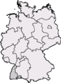
 MapGermanyFreiburgRus.JPG 418 × 564; 83 KB
-
 MarkoRastatt.JPG 328 × 449; 31 KB
-
 Relief Map of Germany, Black Forest.png 1,000 × 1,185; 1.48 MB
-
 Upper Swabia.png 139 × 166; 10 KB


_in_HD-City.svg)


