Category:Llantrisant, Rhondda Cynon Taf
Jump to navigation
Jump to search
Wikimedia category | |||||
| Upload media | |||||
| Instance of | |||||
|---|---|---|---|---|---|
| |||||
Български: 300px|мини|Изглед от Лантрисант
Cymraeg: Mae Llantrisant yn dref yn Rhondda Cynon Taf yn ne Cymru. Mae'n enwog yn bennaf am fod y Bathdy Brenhinol wedi'i leoli yno. Roedd hefyd yn enwog am ganolfan gwneud ymchwil ar arfau niwclar a bu llawer o brotestio yno gan CND ar un amser.
English: Llantrisant is a town in the county borough of Rhondda Cynon Taf, within the historic county boundaries of Glamorgan, Wales, lying on the River Ely and the Afon Clun. The town's name translates as The Parish of the Three Saints. The three saints in question are St Illtyd, St Gwynno and St Dyfodwg. Llantrisant is a hilltop settlement, at an altitude of 174 m (565 ft) above sea level.
Norsk bokmål: Llantrisant er en by i Rhondda Cynon Taff, Wales. Den ligger ved elvene Ely og Clun, og er best kjent som stedet hvor Royal Mint, som lager alle britiske mynter, holder til. Navnet betyr «De tre helgnenes sogn».
Subcategories
This category has the following 8 subcategories, out of 8 total.
B
C
- Cross Inn, Rhondda Cynon Taf (6 F)
I
L
- Llantrisant Colliery (5 F)
- Llantrisant Castle (2 F)
- Llantrisant Guildhall (1 F)
R
- Rhiwsaeson (7 F)
T
- Talbot Green (29 F)
Media in category "Llantrisant, Rhondda Cynon Taf"
The following 200 files are in this category, out of 486 total.
(previous page) (next page)-
 (my)dentist, Talbot Green - geograph.org.uk - 5520803.jpg 800 × 550; 132 KB
-

-
 2 Yr Allt, Llantrisant.jpg 4,032 × 3,024; 3.36 MB
-
 2010 Wales Rhondda Cynon Taf Community Llantrisant map.svg 512 × 737; 416 KB
-
 2024 Wales Rhondda Cynon Taf Community Llantrisant map.svg 512 × 737; 369 KB
-
 A bend in the road near Rhiwfelin Farm - geograph.org.uk - 5610397.jpg 4,608 × 3,456; 3.51 MB
-
 A4119 near Llantrisant, Wales (Geograph 2441787 by Gareth James).jpg 2,816 × 2,112; 1.89 MB
-
 A473 overbridge, Llantrisant - geograph.org.uk - 5521941.jpg 770 × 800; 146 KB
-
 Abandoned railway bridge Ystrad Barwig Isaf - geograph.org.uk - 3407857.jpg 3,648 × 2,736; 1.72 MB
-
 Abandoned wagons at Cwm Coke works - geograph.org.uk - 2441869.jpg 2,701 × 1,953; 2.39 MB
-
 ACF Hut, Heol Ida, Beddau - geograph.org.uk - 5730906.jpg 800 × 649; 110 KB
-
 ACF hut, Talbot Green - geograph.org.uk - 2305430.jpg 640 × 480; 66 KB
-
 Amber's Cafe, Beddau - geograph.org.uk - 5731021.jpg 800 × 633; 106 KB
-

-

-
 Ascent from Tynant towards Beddau - geograph.org.uk - 5729652.jpg 800 × 755; 126 KB
-
 Autumnal forest path at Llantrisant - geograph.org.uk - 1009719.jpg 640 × 480; 161 KB
-
 B4595 mini-roundabout, Beddau - geograph.org.uk - 5723460.jpg 800 × 798; 134 KB
-
 Backlit cross - geograph.org.uk - 6328726.jpg 1,536 × 2,048; 382 KB
-
 Banks of Nant Castellau, Castellau - geograph.org.uk - 5727697.jpg 800 × 524; 126 KB
-
 Barclays Bank, Talbot Green - geograph.org.uk - 5519986.jpg 793 × 800; 147 KB
-
 Bear Inn - geograph.org.uk - 5306110.jpg 3,264 × 2,448; 2.38 MB
-
 Beddau boundary sign - geograph.org.uk - 5721504.jpg 800 × 725; 138 KB
-

-
 Beddau Post Office - geograph.org.uk - 5730822.jpg 800 × 546; 89 KB
-

-
 Bench on a Llantrisant corner - geograph.org.uk - 5521682.jpg 800 × 596; 156 KB
-
 Bend in Cardiff Road, Llantrisant - geograph.org.uk - 5521818.jpg 800 × 702; 155 KB
-
 Bend in the road, Cross Inn - geograph.org.uk - 5669212.jpg 800 × 670; 126 KB
-
 Bernies in Tynant - geograph.org.uk - 5729818.jpg 680 × 800; 105 KB
-

-
 Bliss in Talbot Green - geograph.org.uk - 5520870.jpg 800 × 714; 147 KB
-
 Blooms Boutique, Tynant - geograph.org.uk - 5729678.jpg 800 × 704; 129 KB
-
 Boundary of Llantrisant Common - geograph.org.uk - 5611401.jpg 4,608 × 3,456; 3.89 MB
-
 Boundary stone of the Borough of Llantrisant, Castellau Rd - geograph.org.uk - 5611384.jpg 3,456 × 4,608; 5.86 MB
-
 Boundary Stone, Llantrisant - geograph.org.uk - 5431046.jpg 1,200 × 1,600; 653 KB
-
 Boutique Box, Talbot Green - geograph.org.uk - 5519840.jpg 800 × 746; 125 KB
-
 Bowling green, Llantrisant - geograph.org.uk - 5521616.jpg 800 × 600; 115 KB
-
 Bridge over disused railway cutting, Llantrisant Common - geograph.org.uk - 5612251.jpg 4,608 × 3,456; 4.03 MB
-
 Bridge over the Clun, Pontyclun - geograph.org.uk - 5615677.jpg 4,320 × 3,240; 2.95 MB
-
 Bridge over the new A473 near Llantrisant - geograph.org.uk - 2441828.jpg 2,816 × 2,112; 1.87 MB
-

-
 Bullring General Store, Llantrisant.jpg 900 × 675; 174 KB
-
 Burgesse Crescent houses, Llantrisant - geograph.org.uk - 5521847.jpg 800 × 496; 126 KB
-
 Car park entrance - geograph.org.uk - 6097417.jpg 3,147 × 2,358; 2.71 MB
-
 Cardiff Road bridge, Llantrisant - geograph.org.uk - 5521966.jpg 800 × 481; 108 KB
-
 Cardiff Road houses, Llantrisant - geograph.org.uk - 5521674.jpg 800 × 647; 154 KB
-

-
 Castellau Independent Chapel - geograph.org.uk - 5610451.jpg 3,456 × 4,608; 3.42 MB
-
 Castellau Road - geograph.org.uk - 2613138.jpg 640 × 480; 73 KB
-
 Castle ruin - geograph.org.uk - 6329166.jpg 1,536 × 2,048; 1.75 MB
-
 Cattle at Ty Uchaf - geograph.org.uk - 5757684.jpg 3,264 × 2,448; 1.34 MB
-
 Cattle grid at boundary of Llantrisant Common - geograph.org.uk - 5611397.jpg 4,608 × 3,456; 3.86 MB
-
 Cattle grid from Llantrisant on to Llantrisant Common - geograph.org.uk - 5612257.jpg 4,608 × 3,456; 4.03 MB
-
 Cattle grid on Heol-y-sarn - geograph.org.uk - 2613197.jpg 640 × 480; 60 KB
-
 Chartist Road, Talbot Green - geograph.org.uk - 5533800.jpg 800 × 577; 114 KB
-
 Clock roundabout in Beddau - geograph.org.uk - 2441850.jpg 2,816 × 2,112; 1.64 MB
-
 Clump of trees, Castellau - geograph.org.uk - 5727724.jpg 800 × 720; 198 KB
-
 Co-op Llantrisant - geograph.org.uk - 5519528.jpg 800 × 521; 105 KB
-
 Co-op, Commercial Street, Tynant - geograph.org.uk - 5729778.jpg 800 × 758; 124 KB
-

-
 Cobbled street - geograph.org.uk - 6328813.jpg 1,536 × 2,048; 998 KB
-
 Comin Llantrisant Common - geograph.org.uk - 4634478.jpg 640 × 480; 57 KB
-
 Commemorative plaque - geograph.org.uk - 6328827.jpg 1,921 × 1,636; 1.1 MB
-
 Commercial Street, Tynant - geograph.org.uk - 5729715.jpg 800 × 520; 83 KB
-
 Common Rd, Llantrisant - geograph.org.uk - 5612277.jpg 4,608 × 3,456; 3.82 MB
-

-
 Cottages and Shops - geograph.org.uk - 5306097.jpg 3,264 × 2,448; 2.34 MB
-
 Cottesmore Way houses, Cross Inn - geograph.org.uk - 5669122.jpg 800 × 524; 87 KB
-
 Cows near Cross Inn - geograph.org.uk - 2435220.jpg 2,816 × 2,112; 2.01 MB
-
 Cross Inn boundary sign - geograph.org.uk - 5669161.jpg 800 × 787; 243 KB
-

-
 Cross Inn name sign near Llantrisant - geograph.org.uk - 5520505.jpg 623 × 800; 104 KB
-

-
 Cross Inn Road houses, Llantrisant - geograph.org.uk - 5669233.jpg 800 × 600; 116 KB
-
 Cross Inn Road, Lantrisant - geograph.org.uk - 5755600.jpg 640 × 480; 55 KB
-
 Cross Roads Convenience Store, Beddau - geograph.org.uk - 5721306.jpg 800 × 680; 111 KB
-

-
 Cwm Coke Works - geograph.org.uk - 2441913.jpg 2,741 × 2,026; 2.4 MB
-
 Cwm Coke Works - geograph.org.uk - 2441923.jpg 2,112 × 2,816; 1.64 MB
-
 Cwm Coke Works - geograph.org.uk - 2441948.jpg 2,112 × 2,816; 2.02 MB
-
 Cwm ^ Llantwit Welfare Hall, Tynant - geograph.org.uk - 5730874.jpg 800 × 548; 84 KB
-
 Cwrt Castellau, Beddau - geograph.org.uk - 5723349.jpg 800 × 642; 101 KB
-
 Cwrt Illtyd, Cross Inn near Llantrisant - geograph.org.uk - 5520491.jpg 771 × 800; 138 KB
-
 Cyclepath beside the new A473 near Llantrisant - geograph.org.uk - 2441822.jpg 2,816 × 2,112; 1.94 MB
-
 D J Llantrisant - geograph.org.uk - 5520537.jpg 800 × 503; 90 KB
-
 Dan Caerlan - geograph.org.uk - 5306112.jpg 2,904 × 2,051; 1.29 MB
-

-

-

-

-
 Dereliction at Cwm Coke Works - geograph.org.uk - 2441884.jpg 2,816 × 2,112; 2.24 MB
-
 DG Weaver, Talbot Road, Talbot Green - geograph.org.uk - 5519924.jpg 800 × 493; 103 KB
-

-

-

-
 Directions sign at the edge of Cross Inn - geograph.org.uk - 5669148.jpg 800 × 639; 161 KB
-

-

-
 Disused railway bridge across river Ely - geograph.org.uk - 159416.jpg 640 × 480; 158 KB
-
 Disused railway bridge near Cross Inn - geograph.org.uk - 2435229.jpg 2,816 × 2,112; 2.53 MB
-
 Disused railway bridge over the road, Rhiwsaeson - geograph.org.uk - 5590401.jpg 4,608 × 3,456; 3.87 MB
-
 Disused railway bridge over the road, Rhiwsaeson - geograph.org.uk - 5590485.jpg 4,320 × 3,240; 3.04 MB
-
 Disused railway line - geograph.org.uk - 5757699.jpg 2,448 × 3,264; 2.41 MB
-
 Dr William Price - Statue.jpg 1,440 × 1,920; 463 KB
-
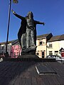 Dr.William Price - geograph.org.uk - 5306106.jpg 2,448 × 3,264; 1.81 MB
-

-
 Ear and Foot Clinic, Talbot Green - geograph.org.uk - 5520797.jpg 800 × 636; 133 KB
-
 Earthworks of Caerau Fort - geograph.org.uk - 2435202.jpg 2,816 × 2,112; 2.01 MB
-
 Earthworks of Caerau Fort - geograph.org.uk - 2435204.jpg 2,112 × 2,816; 2.43 MB
-

-
 Eastern boundary of Llantrisant - geograph.org.uk - 5520528.jpg 800 × 640; 140 KB
-

-
 Electricity pylon, Castellau - geograph.org.uk - 5727719.jpg 800 × 687; 115 KB
-

-

-

-

-
 Ely Valley Road - geograph.org.uk - 2613194.jpg 640 × 480; 74 KB
-
 Ely Valley Road - geograph.org.uk - 2613195.jpg 640 × 480; 47 KB
-

-

-
 Entrance to Coedcae-mawr Farm - geograph.org.uk - 5610419.jpg 4,608 × 3,456; 3.72 MB
-
 Entrance to Llantrisant Business Park - geograph.org.uk - 5610361.jpg 4,608 × 3,456; 3.6 MB
-

-
 Entrance to Penuel Cemetery, Llantrisant - geograph.org.uk - 5612269.jpg 4,608 × 3,456; 3.86 MB
-
 Entrance to Royal Mint, Llantrisant - geograph.org.uk - 5480539.jpg 5,184 × 3,456; 6.7 MB
-
 Entrance to the Royal Glamorgan Hospital - geograph.org.uk - 5610355.jpg 4,608 × 3,456; 3.96 MB
-
 Entrance to track to Rhiwfelin Farm - geograph.org.uk - 5610404.jpg 4,608 × 3,456; 4.11 MB
-
 Entrance to track to Treferig Isha Farm - geograph.org.uk - 5610432.jpg 4,608 × 3,456; 4.03 MB
-
 Entrance to Tyclwyddau Farm - geograph.org.uk - 5611393.jpg 4,608 × 3,456; 3.8 MB
-
 Entrance to Y Pant School - geograph.org.uk - 5616234.jpg 4,320 × 3,240; 2.86 MB
-

-

-
 Fairview, Tynant - geograph.org.uk - 5731044.jpg 800 × 651; 105 KB
-
 Field in Beddau - geograph.org.uk - 2441845.jpg 2,816 × 2,112; 2.3 MB
-
 Fields near Caerau Fort - geograph.org.uk - 2435208.jpg 2,816 × 2,112; 2.37 MB
-
 Filco market in Talbot Green - geograph.org.uk - 5519994.jpg 678 × 800; 129 KB
-

-
 Footbridge over the A473 at its junction with the A4222 - geograph.org.uk - 5616237.jpg 4,320 × 3,240; 2.92 MB
-
 Footbridge to Royal Mint Experience - geograph.org.uk - 5479663.jpg 5,179 × 3,451; 4.51 MB
-
 Footpath beside the Afon Clun, Pontyclun - geograph.org.uk - 5615667.jpg 4,320 × 3,240; 2.98 MB
-
 Footpath beside the Afon Clun, Pontyclun - geograph.org.uk - 5615675.jpg 4,320 × 3,240; 3.05 MB
-
 Footpath near Cross Inn - geograph.org.uk - 2435235.jpg 2,816 × 2,112; 2.81 MB
-
 Footpath to Royal Mint Experience - geograph.org.uk - 5480552.jpg 5,184 × 3,456; 7.51 MB
-
 Forecourt of Royal Mint Experience - geograph.org.uk - 5479781.jpg 5,184 × 3,456; 7.64 MB
-
 Former Lloyds Bank branch, Talbot Green - geograph.org.uk - 5519960.jpg 800 × 734; 158 KB
-
 Former railway bridge in Tynant - geograph.org.uk - 2441968.jpg 2,816 × 2,112; 2.14 MB
-
 Former railway line near Llantrisant - geograph.org.uk - 2441793.jpg 2,112 × 2,816; 2.72 MB
-
 Former railway line near Pontyclun - geograph.org.uk - 2441757.jpg 2,112 × 2,816; 2.52 MB
-
 Former railway line near Pontyclun - geograph.org.uk - 2441774.jpg 2,816 × 2,112; 2.5 MB
-
 Former Stable adjoining 2 Yr Allt, Llantisant.jpg 4,032 × 3,024; 3.9 MB
-
 Former weighbridge, Cwm Coke Works - geograph.org.uk - 2441879.jpg 2,816 × 2,112; 1.56 MB
-
 Foxgloves beside the Ridgeway Footpath - geograph.org.uk - 2435197.jpg 2,816 × 2,112; 2.48 MB
-

-
 From 20 to 30, Penycoedcae Road, Beddau - geograph.org.uk - 5721410.jpg 800 × 558; 102 KB
-
 From 30 to 20 on Brynhyfryd, Tynant - geograph.org.uk - 5730856.jpg 800 × 591; 97 KB
-
 From 30 to 20, Fairview, Tynant - geograph.org.uk - 5729647.jpg 800 × 635; 101 KB
-
 Garth View, Beddau - geograph.org.uk - 5730838.jpg 800 × 536; 80 KB
-

-
 Gate and footpath - geograph.org.uk - 5757696.jpg 3,264 × 2,448; 2.66 MB
-
 Gate to Taff Ely Ridgeway Walk footpath, north of Rhiwsaeson - geograph.org.uk - 5590417.jpg 4,608 × 3,456; 3.82 MB
-
 Glamflag.jpg 403 × 537; 25 KB
-
 Glamorgan Vale Retail Park - geograph.org.uk - 6183868.jpg 4,032 × 1,908; 2.1 MB
-

-
 Gorse flower - geograph.org.uk - 6328742.jpg 2,659 × 1,871; 791 KB
-
 Gospel Court, Beddau - geograph.org.uk - 5730931.jpg 800 × 742; 153 KB
-

-

-
 Green Space - geograph.org.uk - 5306140.jpg 3,264 × 2,448; 2.49 MB
-
 Greggs, 48 Talbot Road, Talbot Green - geograph.org.uk - 5648604.jpg 800 × 796; 137 KB
-
 Guild Hall, Llantrisant.jpg 4,032 × 3,024; 2.76 MB
-

-
 Gwaunmiskin Road - geograph.org.uk - 5306135.jpg 3,065 × 2,335; 1.61 MB
-
 Gwaunmiskin Road, Beddau - geograph.org.uk - 5722195.jpg 800 × 483; 67 KB
-

-
 Hairpin bend in the B4595, Llantrisant - geograph.org.uk - 5519568.jpg 800 × 540; 138 KB
-
 Hairs 'n' Graces, Talbot Green - geograph.org.uk - 5520784.jpg 754 × 800; 188 KB
-
 Heol ddu, Llantrisant - geograph.org.uk - 5610412.jpg 4,608 × 3,456; 4.03 MB
-

-
 Heol Ida, Beddau - geograph.org.uk - 5730952.jpg 800 × 551; 106 KB
-
 Heol Johnson, Talbot Green - geograph.org.uk - 5519716.jpg 800 × 741; 138 KB
-
 Heol Pen-y-parc, Llantrisant - geograph.org.uk - 5521660.jpg 800 × 620; 114 KB
-
 Heol Sticil y Beddau - geograph.org.uk - 4634012.jpg 640 × 480; 109 KB
-
 Heol-y-Sarn, Llantrisant.jpg 900 × 675; 145 KB
-

-
 Highadmit in Beddau - geograph.org.uk - 5727631.jpg 800 × 696; 135 KB
-
 Hillfort embankment - geograph.org.uk - 5757690.jpg 3,264 × 2,448; 3.17 MB
-
 Hillfort slope - geograph.org.uk - 5757691.jpg 3,264 × 2,448; 2.04 MB
-
 Hollybush Tyres, Beddau - geograph.org.uk - 5721214.jpg 800 × 614; 86 KB
-
 Horses in Paddock - geograph.org.uk - 5306117.jpg 3,264 × 2,448; 3.36 MB
-
 Houses, Lanelay Rd, Talbot Green - geograph.org.uk - 5616253.jpg 4,320 × 3,240; 3.08 MB
-
 HSBC UK, Talbot Green - geograph.org.uk - 5520009.jpg 800 × 600; 103 KB
-

-
 Insole Terrace, Llantrisant - geograph.org.uk - 5520882.jpg 800 × 634; 140 KB
-
 Interior of Castellau Chapel - geograph.org.uk - 5610450.jpg 4,608 × 3,456; 3.95 MB
-
 Ironing Matters in Beddau - geograph.org.uk - 5721395.jpg 742 × 800; 120 KB
-
 Jade Garden, Talbot Green - geograph.org.uk - 5520475.jpg 787 × 800; 188 KB
-
 Jamuna in Tynant - geograph.org.uk - 5729789.jpg 797 × 800; 145 KB
-
 Jewellery Gallery in Talbot Green - geograph.org.uk - 5648591.jpg 760 × 800; 150 KB
dentist,_Talbot_Green_-_geograph.org.uk_-_5520803.jpg)


.jpg)


