Category:Llangynwyd Middle
Jump to navigation
Jump to search
community in Bridgend County Borough, Wales, UK   | |||||
| Upload media | |||||
| Instance of | |||||
|---|---|---|---|---|---|
| Location | Bridgend County Borough, Wales | ||||
| Population |
| ||||
| Area |
| ||||
 | |||||
Media in category "Llangynwyd Middle"
The following 165 files are in this category, out of 165 total.
-
 A Brick Wall - geograph.org.uk - 5258547.jpg 3,264 × 2,448; 4.87 MB
-
 A4063 Maesteg Road - geograph.org.uk - 2617831.jpg 640 × 480; 56 KB
-
 Afon Llynfi, Garth, Maesteg - geograph.org.uk - 4367729.jpg 687 × 800; 168 KB
-
 Ainon Welsh Baptist Chapel, Llangynwyd - geograph.org.uk - 5292655.jpg 800 × 694; 135 KB
-
 Alternative Energy - geograph.org.uk - 5258021.jpg 3,264 × 2,448; 565 KB
-
 AstroTurf Pitch - geograph.org.uk - 5243389.jpg 3,264 × 2,448; 2.45 MB
-

-
 Blinds Express, Maesteg Road, Maesteg - geograph.org.uk - 5295102.jpg 800 × 792; 123 KB
-
 Boundary Fence - geograph.org.uk - 5258051.jpg 3,264 × 2,448; 2.48 MB
-
 Bridgend Road - geograph.org.uk - 2617842.jpg 640 × 480; 56 KB
-
 Bridgend Road 2019-7-17 - geograph.org.uk - 6213228.jpg 3,840 × 2,160; 1.39 MB
-
 Bryn Celyn, Maesteg - geograph.org.uk - 5295115.jpg 799 × 800; 238 KB
-
 Bus Shelter at Llangynwyd School - geograph.org.uk - 5243604.jpg 3,264 × 2,448; 2.95 MB
-

-
 Cerddin Brewery, Maesteg - geograph.org.uk - 5295096.jpg 800 × 640; 112 KB
-

-
 Country Lane in Winter - geograph.org.uk - 5243317.jpg 2,448 × 2,448; 1.94 MB
-
 Cross Inn, Maesteg - geograph.org.uk - 5294768.jpg 800 × 632; 95 KB
-

-
 Cwmdu Isaf - geograph.org.uk - 5258047.jpg 3,264 × 2,448; 790 KB
-
 Cwmfelin boundary sign - geograph.org.uk - 5638136.jpg 800 × 642; 195 KB
-

-
 Down Llan Road, Llangynwyd - geograph.org.uk - 5292586.jpg 721 × 800; 123 KB
-
 Down Station Road, Llangynwyd - geograph.org.uk - 5292726.jpg 800 × 754; 138 KB
-
 Earth bank - geograph.org.uk - 5542697.jpg 3,264 × 2,448; 3.59 MB
-
 East to Parc Tyn-y-Waun 2019-7-17 - geograph.org.uk - 6213212.jpg 3,840 × 2,160; 2.68 MB
-

-
 Electricity Pylon - geograph.org.uk - 5243321.jpg 2,228 × 2,971; 957 KB
-
 Farm Buildings at Bryn-y-Fro - geograph.org.uk - 5243291.jpg 3,264 × 2,448; 2.62 MB
-

-

-
 Footpath between Heol Tyn-y-Waun and Heol-yr-Ysgol 2019-7-20 - geograph.org.uk - 6216312.jpg 3,840 × 2,160; 1.91 MB
-

-
 Forestry light and shade - geograph.org.uk - 5542512.jpg 3,264 × 2,448; 2.34 MB
-
 Forestry Workings at Craig yr Aber - geograph.org.uk - 1957015.jpg 3,968 × 2,976; 5.22 MB
-
 Garth Mountain - geograph.org.uk - 2515591.jpg 4,000 × 3,000; 2.6 MB
-
 Garth railway station - geograph.org.uk - 5289142.jpg 800 × 613; 143 KB
-
 Gate and power lines - geograph.org.uk - 5542497.jpg 3,264 × 2,448; 2.9 MB
-
 Gate and public footpath - geograph.org.uk - 5542482.jpg 3,264 × 2,448; 3.26 MB
-
 Gate into Field - geograph.org.uk - 5258575.jpg 3,264 × 2,448; 3.03 MB
-
 Gelli Heblyg - geograph.org.uk - 5258009.jpg 3,264 × 2,448; 3.13 MB
-
 Ger Craig yr Aber - Near Craig yr Aber - geograph.org.uk - 5121479.jpg 640 × 480; 157 KB
-

-

-
 Gilfach Uchaf Farm - geograph.org.uk - 5259087.jpg 3,035 × 2,054; 1.17 MB
-
 Glan yr Afon, Garth, Maesteg - geograph.org.uk - 4367703.jpg 800 × 567; 98 KB
-
 Glan yr Afon, Garth, Maesteg - geograph.org.uk - 5289116.jpg 800 × 591; 76 KB
-
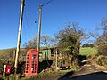
 Grade II listed red phonebox, Llangynwyd - geograph.org.uk - 5293622.jpg 800 × 690; 166 KB
-
 Grass hollows - geograph.org.uk - 5542723.jpg 2,448 × 3,264; 3.06 MB
-
 Happy City in Llangynwyd - geograph.org.uk - 5292812.jpg 800 × 754; 131 KB
-
 Heol Cadrawd 2019-7-17 - geograph.org.uk - 6213231.jpg 3,840 × 2,160; 1.89 MB
-
 Heol Cadrawd 2019-7-17 - geograph.org.uk - 6213232.jpg 3,840 × 2,160; 1.76 MB
-
 Heol Cadrawd, Llangynwyd - geograph.org.uk - 5292532.jpg 800 × 580; 79 KB
-
 Heol Cynwyd, Llangynwyd - geograph.org.uk - 5292491.jpg 760 × 800; 112 KB
-
 Heol Tyn-y-Waun, Llangynwyd, 2019-7-20 - geograph.org.uk - 6216311.jpg 3,840 × 2,160; 2.45 MB
-
 Heol-yr-Ysgol 2019-7-17 - geograph.org.uk - 6213233.jpg 3,840 × 2,160; 2.23 MB
-
 Heol-yr-Ysgol 2019-7-17 - geograph.org.uk - 6213236.jpg 3,840 × 2,160; 2.07 MB
-
 Heol-yr-Ysgol 2019-7-17 - geograph.org.uk - 6213237.jpg 3,840 × 2,160; 1.7 MB
-
 Heol-yr-Ysgol 2019-7-17 - geograph.org.uk - 6213238.jpg 3,840 × 2,160; 1.83 MB
-
 Heol-yr-Ysgol 2019-7-20 - geograph.org.uk - 6216314.jpg 3,840 × 2,160; 1.52 MB
-
 Heol-yr-Ysgol 2019-7-20 - geograph.org.uk - 6216318.jpg 3,840 × 2,160; 1.62 MB
-
 Heol-yr-Ysgol 2019-7-20 - geograph.org.uk - 6216320.jpg 3,840 × 2,160; 1.54 MB
-
 Heol-yr-Ysgol playground 2019-7-20 - geograph.org.uk - 6216316.jpg 3,840 × 2,160; 1.72 MB
-
 Horses at Feeding Station - geograph.org.uk - 5258593.jpg 2,593 × 1,895; 1.68 MB
-

-

-

-
 Infrastructure at Llety Brongu - geograph.org.uk - 5258567.jpg 3,264 × 2,448; 3.15 MB
-
 Jenkins Terrace, Garth - geograph.org.uk - 5294762.jpg 800 × 659; 96 KB
-

-
 Lane at Gilfach Houses - geograph.org.uk - 5066894.jpg 640 × 480; 65 KB
-
 Lane east of Mynydd-Ty-Talwyrn - geograph.org.uk - 5066867.jpg 640 × 481; 36 KB
-
 Lane entering Llangynwyd - geograph.org.uk - 5066897.jpg 640 × 480; 106 KB
-
 Lane junction north of Craig yr Aber - geograph.org.uk - 5066872.jpg 640 × 479; 44 KB
-
 Lane junction south of Gilfach-uchaf - geograph.org.uk - 5066892.jpg 640 × 480; 43 KB
-
 Lane south of Gilfach - geograph.org.uk - 5066889.jpg 640 × 481; 60 KB
-

-
 Llan Mini Market, Llangynwyd - geograph.org.uk - 5292782.jpg 800 × 797; 129 KB
-
 Llan Road at Cwmfelin village boundary - geograph.org.uk - 5066903.jpg 640 × 479; 108 KB
-

-
 Llan Road semis near Cwmfelin - geograph.org.uk - 5638169.jpg 800 × 717; 127 KB
-
-
 Llan Road towards Llangynwyd - geograph.org.uk - 5638144.jpg 800 × 682; 208 KB
-

-
 Llangynwyd Historic Village sign - geograph.org.uk - 5293591.jpg 800 × 650; 105 KB
-
 Llangynwyd Post Office - geograph.org.uk - 5292800.jpg 800 × 701; 115 KB
-
 Llangynwyd railway station (site), Bridgend - geograph.org.uk - 4125595.jpg 1,024 × 768; 273 KB
-
 Llangynwyd Village Hall - geograph.org.uk - 5292836.jpg 800 × 600; 110 KB
-
 Llangynwyd War Memorial - geograph.org.uk - 5292761.jpg 800 × 593; 112 KB
-
 Llwybr ger Garth - A footpath near Garth - geograph.org.uk - 5125337.jpg 640 × 480; 108 KB
-

-

-
 Looking east from Llangynwyd - geograph.org.uk - 2273023.jpg 2,048 × 1,536; 1.08 MB
-
 Maescadlawr Farm - geograph.org.uk - 5243308.jpg 2,991 × 1,646; 768 KB
-
 Maiden Street, Cwmfelin - geograph.org.uk - 5638110.jpg 800 × 582; 124 KB
-
 Main entrance to Garth railway station - geograph.org.uk - 4380959.jpg 738 × 800; 224 KB
-
 Memorial to the Maid of Cefn Ydfa - geograph.org.uk - 2667265.jpg 3,024 × 4,032; 2.66 MB
-
 Mill House - geograph.org.uk - 5257996.jpg 3,264 × 2,448; 2.27 MB
-

-
 Mill Street houses, Garth - geograph.org.uk - 5294625.jpg 800 × 547; 92 KB
-
 Moel Cynhordy - geograph.org.uk - 5258043.jpg 2,448 × 3,264; 3.32 MB
-
 Nant y Gadlys - geograph.org.uk - 5243338.jpg 3,264 × 2,448; 4.43 MB
-
 Nant y Gadlys Bridge - geograph.org.uk - 5243332.jpg 2,448 × 3,264; 3.49 MB
-
 North east on Bridgend Road 2019-7-17 - geograph.org.uk - 6213211.jpg 3,840 × 2,160; 1.83 MB
-
 North on Bridgend Road 2019-7-17 - geograph.org.uk - 6213214.jpg 3,840 × 2,160; 1.67 MB
-
 North to Prospect Place 2019-7-17 - geograph.org.uk - 6213210.jpg 3,840 × 2,160; 1.81 MB
-
 Old House Inn, Llangynwyd - geograph.org.uk - 5293604.jpg 800 × 603; 110 KB
-
 Orchard House - geograph.org.uk - 5243326.jpg 3,264 × 2,448; 2.61 MB
-
 Ordnance Survey Cut Mark - geograph.org.uk - 4857001.jpg 480 × 640; 113 KB
-
 Ordnance Survey Cut Mark - geograph.org.uk - 4857009.jpg 480 × 640; 135 KB
-
 Ordnance Survey Cut Mark - geograph.org.uk - 5539433.jpg 640 × 365; 73 KB
-
 Ordnance Survey Cut Mark - geograph.org.uk - 5539436.jpg 640 × 367; 100 KB
-
 Ordnance Survey Cut Mark - geograph.org.uk - 5539445.jpg 640 × 376; 79 KB
-
 Ordnance Survey Cut Mark - geograph.org.uk - 5539447.jpg 640 × 397; 108 KB
-
 Ordnance Survey Cut Mark - geograph.org.uk - 5539448.jpg 640 × 418; 116 KB
-
 Ordnance Survey Cut Mark - geograph.org.uk - 5539449.jpg 640 × 424; 133 KB
-
 Paper mill in the Llynfi Valley - geograph.org.uk - 2711453.jpg 1,920 × 2,560; 1.58 MB
-

-
 Penned Sheep - geograph.org.uk - 5259083.jpg 3,198 × 1,850; 1.28 MB
-
 Pipe over the Afon Llynfi, Garth - geograph.org.uk - 4367705.jpg 738 × 800; 182 KB
-
 Pont Rhyd-y-Cyff - geograph.org.uk - 5125322.jpg 640 × 480; 115 KB
-
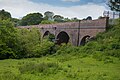 Pont Rhyd-y-cyff viaduct - geograph.org.uk - 4486128.jpg 4,865 × 3,243; 5.2 MB
-

-
-
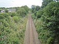
 Railway from Garth towards Tondu - geograph.org.uk - 4381016.jpg 800 × 799; 192 KB
-
 Railway Noticeboard - geograph.org.uk - 5257830.jpg 3,264 × 2,448; 3.11 MB
-
 Railway Viaduct - geograph.org.uk - 5258003.jpg 3,264 × 2,448; 2.84 MB
-
 Row of houses, Mill Street, Garth - geograph.org.uk - 5294715.jpg 800 × 589; 107 KB
-
 Sheep at Gelli Siriol - geograph.org.uk - 5243341.jpg 3,264 × 2,448; 1.59 MB
-

-

-
 Signpost at Llangynwyd - geograph.org.uk - 5243371.jpg 2,448 × 3,264; 1.79 MB
-
 Signpost at Llangynwyd - geograph.org.uk - 5243384.jpg 2,448 × 3,264; 1.67 MB
-

-

-
 South along Llan Road towards Llangynwyd - geograph.org.uk - 5638229.jpg 721 × 800; 163 KB
-
 Southern boundary of Maesteg - geograph.org.uk - 4364245.jpg 800 × 679; 129 KB
-
 Station Road, Llangynwyd - geograph.org.uk - 5292790.jpg 800 × 667; 111 KB
-
 Summers day - geograph.org.uk - 2508317.jpg 3,191 × 1,203; 3.13 MB
-
 Telecoms cabinet on a Llangynwyd corner - geograph.org.uk - 5292642.jpg 800 × 642; 122 KB
-

-
 The Old House Inn, Llangynwyd - geograph.org.uk - 3135746.jpg 640 × 480; 156 KB
-
 The Old House Inn. Llangynwyd, Maesteg - geograph.org.uk - 3135731.jpg 640 × 480; 158 KB
-

-

-
-
 Up Llan Road, Llangynwyd - geograph.org.uk - 5292630.jpg 800 × 593; 97 KB
-
 Up Maiden Street, Maesteg - geograph.org.uk - 5295074.jpg 800 × 585; 98 KB
-
 Up Station Road, Llangynwyd - geograph.org.uk - 5292733.jpg 800 × 678; 136 KB
-

-

-
 Wales Bridgend Community Llangynwyd Middle map.svg 512 × 509; 326 KB
-

-
 Water Tower on Moel Troed-y-Rhiw - geograph.org.uk - 1950982.jpg 1,024 × 768; 95 KB
-

-
 West along Maiden Street, Garth - geograph.org.uk - 5294756.jpg 800 × 535; 79 KB
-
 West side of Heol Cynwyd, Llangynwyd - geograph.org.uk - 5292509.jpg 800 × 755; 109 KB
-
 West to Heol Tyn-y-Waun - geograph.org.uk - 6213205.jpg 3,840 × 2,160; 1.65 MB
-
 Western boundary of Cwmfelin - geograph.org.uk - 5295076.jpg 800 × 629; 113 KB
-
 Y Bwlwarcau - geograph.org.uk - 5542560.jpg 3,264 × 2,448; 2.49 MB
-
 Y Bwlwarcau - geograph.org.uk - 5542706.jpg 3,264 × 2,448; 1.74 MB
-
 Y Dderwen, Llangynwyd - geograph.org.uk - 5292487.jpg 800 × 488; 79 KB
-

-
 Yr Hen Felin, Garth - geograph.org.uk - 5294679.jpg 800 × 773; 160 KB
-
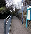
 Zigzag path to Garth railway station - geograph.org.uk - 4380960.jpg 800 × 600; 194 KB


,_Bridgend_-_geograph.org.uk_-_4125595.jpg)


