Category:Llangattock-Vibon-Avel
Jump to navigation
Jump to search
Cymraeg: Pentref a chymuned yn Sir Fynwy yw Llangatwg Feibion Afel (Seisnigiad: Llangattock-Vibon-Avel).
hamlet and former community in Monmouthshire, Wales, UK  Eglwys Llangatwg Feibion Afel | |||||
| Upload media | |||||
| Instance of | |||||
|---|---|---|---|---|---|
| Location |
| ||||
 | |||||
Subcategories
This category has the following 4 subcategories, out of 4 total.
Media in category "Llangattock-Vibon-Avel"
The following 200 files are in this category, out of 464 total.
(previous page) (next page)-

-
 2010 Wales Monmouthshire Community Llangattock-Vibon-Avel map.svg 512 × 682; 699 KB
-
 30 mph speed limit in Rockfield - geograph.org.uk - 2776378.jpg 640 × 410; 55 KB
-
 Abandoned lodge - geograph.org.uk - 3895054.jpg 1,024 × 680; 250 KB
-
 Across Skenfrith Bridge - geograph.org.uk - 3561883.jpg 800 × 600; 115 KB
-
 Across the fields to Hilston Park - geograph.org.uk - 2108684.jpg 640 × 480; 119 KB
-

-
 Another oak by the same lane - geograph.org.uk - 3772252.jpg 800 × 602; 363 KB
-
 Approaching Crossway - geograph.org.uk - 1346717.jpg 640 × 480; 248 KB
-
 Approaching Rockfield, Monmouthshire - geograph.org.uk - 3849329.jpg 2,560 × 1,920; 1.98 MB
-

-
 Approaching the B4347 near The Boot - geograph.org.uk - 2940872.jpg 640 × 480; 49 KB
-
 Approaching the Monnow bridge at Skenfrith, Monmouthshire - geograph.org.uk - 2081536.jpg 3,008 × 2,000; 1.53 MB
-
 Arable land by Crwys Wood - geograph.org.uk - 1346284.jpg 640 × 480; 266 KB
-
 Arable land near Round Wood - geograph.org.uk - 1346227.jpg 640 × 480; 258 KB
-
 Arable Monmouthshire - geograph.org.uk - 1346231.jpg 640 × 480; 256 KB
-
 Around Edmund's Tump (3) - geograph.org.uk - 2723441.jpg 4,320 × 3,240; 4.68 MB
-
 Around Edmund's Tump (4) - geograph.org.uk - 2723445.jpg 4,320 × 3,240; 5.04 MB
-
 Around Edmund's Tump (5) - geograph.org.uk - 2723450.jpg 4,320 × 3,240; 4.73 MB
-

-
 B4233 near Hillgrove - geograph.org.uk - 2135046.jpg 800 × 597; 106 KB
-
 B4347 at Nant-y-gern - geograph.org.uk - 2942729.jpg 640 × 480; 67 KB
-

-

-
 B4347 near Park Brake - geograph.org.uk - 2942717.jpg 640 × 480; 86 KB
-

-
 B4347 south of Newcastle Farm - geograph.org.uk - 2942722.jpg 640 × 480; 76 KB
-
 B4347 SW of Crossway - geograph.org.uk - 3558953.jpg 800 × 600; 85 KB
-
 B4521 approaching a crossroads - geograph.org.uk - 2940870.jpg 640 × 481; 86 KB
-
 B4521 at Norton - geograph.org.uk - 2940866.jpg 640 × 481; 68 KB
-
 B4521 at Walson - geograph.org.uk - 2940868.jpg 640 × 481; 51 KB
-
 B4521 looking west - geograph.org.uk - 2940869.jpg 640 × 480; 64 KB
-

-
 Barns at Nant - geograph.org.uk - 4252174.jpg 800 × 451; 201 KB
-
 Barns in field - geograph.org.uk - 5157779.jpg 1,499 × 1,051; 1.13 MB
-
 Bend in the B4521, near Cross Ash - geograph.org.uk - 3861277.jpg 2,560 × 1,920; 1.97 MB
-
 Bend in the lane below Ellis's Wood - geograph.org.uk - 3023444.jpg 640 × 480; 136 KB
-
 Bend in the road at Mayfield, near The Hendre - geograph.org.uk - 3851453.jpg 2,560 × 1,920; 1.97 MB
-

-
 Bendy lane - geograph.org.uk - 1346683.jpg 640 × 480; 258 KB
-
 Black Brook Valley - geograph.org.uk - 1190141.jpg 640 × 480; 155 KB
-
 Black silage bales, Trothy valley - geograph.org.uk - 2704435.jpg 680 × 1,024; 261 KB
-
 Bridge at The Hendre - geograph.org.uk - 3438930.jpg 1,024 × 680; 289 KB
-
 Bridge Cottage, Rockfield - geograph.org.uk - 3551781.jpg 800 × 557; 85 KB
-
 Brook House Farm - geograph.org.uk - 3584747.jpg 1,024 × 680; 253 KB
-

-
 Caldy House, Crossway - geograph.org.uk - 3559036.jpg 640 × 480; 60 KB
-
 Cattle and electricity poles - geograph.org.uk - 3584517.jpg 680 × 1,024; 148 KB
-
 Caution advised near Skenfrith - geograph.org.uk - 3731915.jpg 640 × 480; 108 KB
-
 Celyn Farm (1) - geograph.org.uk - 2723487.jpg 4,320 × 3,240; 4.55 MB
-
 Celyn Farm (2) - geograph.org.uk - 2723516.jpg 4,320 × 3,240; 4.67 MB
-
 Celyn Farm (4) - geograph.org.uk - 2723775.jpg 4,320 × 3,240; 4.79 MB
-
 Ceyln Farm (3) - geograph.org.uk - 2723766.jpg 4,320 × 3,240; 4.82 MB
-
 Cheerful aubretia - geograph.org.uk - 1243170.jpg 486 × 640; 96 KB
-
 Church Farm, Garway - geograph.org.uk - 3585380.jpg 1,024 × 680; 195 KB
-
 Churchyard, Llangattock-Viben-Avel - geograph.org.uk - 2027587.jpg 1,496 × 1,122; 805 KB
-
 Cider orchards - geograph.org.uk - 3772244.jpg 800 × 450; 215 KB
-
 Climb the hill - geograph.org.uk - 2723505.jpg 4,320 × 3,240; 5.27 MB
-
 Coed-y-pwll - geograph.org.uk - 1240805.jpg 640 × 480; 129 KB
-
 Converted Llanfaenor church - geograph.org.uk - 1346305.jpg 480 × 640; 208 KB
-
 Copse on the brow of a hill - geograph.org.uk - 1346744.jpg 640 × 480; 241 KB
-
 Corner of a barley field - geograph.org.uk - 929140.jpg 640 × 480; 110 KB
-
 Corrugated barns - geograph.org.uk - 1241417.jpg 640 × 417; 85 KB
-
 Cottage at Dry Bridge - geograph.org.uk - 3584767.jpg 1,024 × 680; 265 KB
-
 Cottage at Llanfaenor - geograph.org.uk - 1346315.jpg 640 × 480; 256 KB
-
 Cottage with solar panels - geograph.org.uk - 3772218.jpg 800 × 450; 242 KB
-
 Cottages at Crossway - geograph.org.uk - 1009794.jpg 640 × 426; 82 KB
-
 Cottages with churchyard view, Skenfrith - geograph.org.uk - 714551.jpg 640 × 480; 210 KB
-
 Country road on Linthill - geograph.org.uk - 3437768.jpg 1,024 × 680; 342 KB
-
 Country road, Llangattock-Vibon-Avel - geograph.org.uk - 3438080.jpg 680 × 1,024; 212 KB
-
 Countryside south-west of Newcastle - geograph.org.uk - 1346358.jpg 640 × 480; 243 KB
-
 Cross roads at The Hendre - geograph.org.uk - 3849390.jpg 2,560 × 1,920; 2.21 MB
-
 Cross roads near Wayne Wood - geograph.org.uk - 5203356.jpg 4,000 × 3,000; 2.58 MB
-
 Crossway Cottage, Crossway - geograph.org.uk - 3559040.jpg 800 × 618; 99 KB
-
 Crossway, cider production - geograph.org.uk - 1810902.jpg 1,024 × 768; 158 KB
-
 Curious cows at Old Chapel farm - geograph.org.uk - 4651217.jpg 640 × 480; 217 KB
-
 Currant bushes, Upper Grove - geograph.org.uk - 3437457.jpg 1,024 × 680; 222 KB
-

-

-

-
 Distances from Newcastle - geograph.org.uk - 3558876.jpg 766 × 800; 131 KB
-
 Distances from Norton, Monmouthshire - geograph.org.uk - 3559087.jpg 800 × 600; 155 KB
-

-
 Disused houses in Cross Ash - geograph.org.uk - 3023817.jpg 640 × 480; 66 KB
-
 Disused lodge near The Hendre - geograph.org.uk - 3381067.jpg 640 × 480; 82 KB
-
 Down the hill - geograph.org.uk - 2723465.jpg 4,320 × 3,240; 4.62 MB
-
 Drive to Blackmoor Farm - geograph.org.uk - 3772231.jpg 800 × 450; 226 KB
-
 Drive to Pool Lane Cottage - geograph.org.uk - 3438070.jpg 1,024 × 680; 192 KB
-
 Driveway to Ricketts Farm - geograph.org.uk - 3585408.jpg 1,024 × 680; 259 KB
-
 Driveway to the farm - geograph.org.uk - 2108648.jpg 640 × 480; 177 KB
-
 Drybridge House, Skenfrith - geograph.org.uk - 3731888.jpg 800 × 677; 142 KB
-
 Dubious footbridge over the Trothy - geograph.org.uk - 2698285.jpg 680 × 1,024; 290 KB
-
 Ducks on Norton Brook, Norton - geograph.org.uk - 3559192.jpg 800 × 600; 220 KB
-
 Duke's Farm - geograph.org.uk - 2697071.jpg 1,024 × 768; 673 KB
-
 Dwelling with a distinctive gateway, The Hendre - geograph.org.uk - 3849372.jpg 2,560 × 1,920; 1.93 MB
-
 Earthen field on north side of B4521 - geograph.org.uk - 5157775.jpg 1,500 × 1,125; 1.28 MB
-

-

-
 Edge of Birches Wood - geograph.org.uk - 5217932.jpg 1,600 × 899; 896 KB
-
 Edge of St. Fraed's Wood - geograph.org.uk - 3772264.jpg 800 × 450; 224 KB
-
 Edmund's Tump (1) - geograph.org.uk - 2722521.jpg 4,320 × 3,240; 4.5 MB
-
 Edmund's Tump (2) - geograph.org.uk - 2722549.jpg 4,320 × 3,240; 4.64 MB
-
 Edmund's Tump (3) - geograph.org.uk - 2722556.jpg 4,320 × 3,240; 4.78 MB
-
 Edmund's Tump (4) - geograph.org.uk - 2722568.jpg 4,320 × 3,240; 4.68 MB
-
 Edmund's Tump (5) - geograph.org.uk - 2736725.jpg 3,232 × 4,310; 5.02 MB
-
 End of the 30mph zone through Rockfield - geograph.org.uk - 3552358.jpg 800 × 600; 137 KB
-

-
 Entrance in Malthouse Wood - geograph.org.uk - 3584771.jpg 1,024 × 680; 312 KB
-
 Entrance to Hilston Park - geograph.org.uk - 4651248.jpg 640 × 480; 166 KB
-
 Entrance to Home Farm, Rockfield - geograph.org.uk - 3551736.jpg 800 × 575; 114 KB
-

-

-

-
 Farm track on the Three Castles Walk - geograph.org.uk - 2108678.jpg 640 × 480; 80 KB
-
 Farmland above Llymon Brook - geograph.org.uk - 3446788.jpg 1,024 × 680; 182 KB
-
 Farmland and trees near Bryn-garth - geograph.org.uk - 3584495.jpg 1,024 × 680; 194 KB
-
 Farmland around Nant-yr-ych - geograph.org.uk - 3584505.jpg 1,024 × 680; 229 KB
-
 Farmland at Lower Hendre - geograph.org.uk - 2698293.jpg 1,024 × 680; 207 KB
-
 Farmland below Rockfield Farm - geograph.org.uk - 3438074.jpg 1,024 × 680; 167 KB
-
 Farmland in the Monnow valley - geograph.org.uk - 3585399.jpg 1,024 × 680; 204 KB
-
 Farmland near Skenfrith - geograph.org.uk - 3584757.jpg 1,024 × 680; 227 KB
-
 Farmland near the Monnow valley - geograph.org.uk - 2768805.jpg 1,024 × 680; 167 KB
-
 Farmland on Graig Syfyrddin - geograph.org.uk - 3582683.jpg 1,024 × 680; 257 KB
-
 Farmland, Monmouthshire - geograph.org.uk - 889889.jpg 640 × 481; 123 KB
-
 Farmland, Monmouthshire - geograph.org.uk - 889894.jpg 640 × 481; 177 KB
-
 Field at Walson, Monmouthshire - geograph.org.uk - 5282313.jpg 2,592 × 1,944; 1.41 MB
-
 Field edge footpath in March - geograph.org.uk - 3380809.jpg 640 × 480; 96 KB
-
 Field next to the B4521 - geograph.org.uk - 4651259.jpg 640 × 480; 184 KB
-
 Field on Linthill - geograph.org.uk - 3437769.jpg 1,024 × 680; 219 KB
-

-
 Fingerpost near the entrance to Box Farm - geograph.org.uk - 1190177.jpg 640 × 480; 109 KB
-
 First day out - geograph.org.uk - 1190228.jpg 640 × 480; 129 KB
-
 Fishing lakes, Newlands, near Cross Ash - geograph.org.uk - 3861267.jpg 2,560 × 1,920; 2.17 MB
-
 Footbridge in the field corner - geograph.org.uk - 3380778.jpg 640 × 480; 143 KB
-

-
 Footpath finger post and stile in March - geograph.org.uk - 3381055.jpg 640 × 480; 110 KB
-

-
 Footpath gate near Bryn-garth - geograph.org.uk - 3582707.jpg 1,024 × 680; 244 KB
-
 Footpath In Skenfrith - geograph.org.uk - 2031415.jpg 1,496 × 1,122; 726 KB
-
 Footpath leaves the road - geograph.org.uk - 2723495.jpg 4,320 × 3,240; 5.15 MB
-
 Footpath to Middle Farm - geograph.org.uk - 1346749.jpg 640 × 480; 262 KB
-

-
 Former petrol station, Cross Ash - geograph.org.uk - 2861187.jpg 1,024 × 680; 220 KB
-
 Former Rockfield post office - geograph.org.uk - 3551593.jpg 799 × 800; 124 KB
-
 Former shop, Skenfrith - geograph.org.uk - 3043732.jpg 640 × 480; 104 KB
-
 Garway Hill and the Monnow valley - geograph.org.uk - 3582725.jpg 1,024 × 680; 301 KB
-
 Gate house to The Hendre - geograph.org.uk - 3939631.jpg 4,320 × 3,240; 3.28 MB
-
 Ger - Near Hendre - geograph.org.uk - 4495932.jpg 640 × 449; 53 KB
-
 Ger - Near Lower Hendre - geograph.org.uk - 4495925.jpg 640 × 454; 82 KB
-

-
 Graig House entrance - geograph.org.uk - 5217916.jpg 1,600 × 901; 740 KB
-
 Graig Syfyrddin (Edmund's Tump) - geograph.org.uk - 3363230.jpg 2,592 × 1,944; 1.54 MB
-
 Graig Syfyrddin - geograph.org.uk - 3584499.jpg 1,024 × 680; 223 KB
-
 Gravestone of Charles Rolls - geograph.org.uk - 2027579.jpg 1,122 × 1,496; 884 KB
-
 Here come the boys^ - geograph.org.uk - 1346283.jpg 640 × 480; 269 KB
-

-
 Hillside pastures - geograph.org.uk - 1190157.jpg 640 × 480; 106 KB
-
 Hilston Park - geograph.org.uk - 98334.jpg 640 × 426; 127 KB
-

-
 House at a bend in the road, Rockfield - geograph.org.uk - 3552356.jpg 800 × 637; 136 KB
-
 Houses at Crossway - geograph.org.uk - 4651253.jpg 640 × 480; 138 KB
-
 Isolated barn on a hillside - geograph.org.uk - 5217930.jpg 1,600 × 899; 975 KB
-
 It's seen better days - geograph.org.uk - 2108626.jpg 640 × 480; 152 KB
-
 Junction and bend in the road, near Redhouse Farm, Rockfield - geograph.org.uk - 3849333.jpg 2,560 × 1,920; 2.12 MB
-
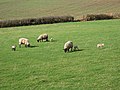
 Just a few sheep in the field - geograph.org.uk - 4651232.jpg 640 × 480; 116 KB
-

-
 Lane at Nant - geograph.org.uk - 1346338.jpg 640 × 480; 259 KB
-
 Lane at Pen-y-lan - geograph.org.uk - 1346248.jpg 640 × 480; 259 KB
-
 Lane at Pen-y-lan - geograph.org.uk - 4252203.jpg 800 × 451; 305 KB
-
 Lane bend near Lettravane Farm - geograph.org.uk - 2940871.jpg 640 × 480; 66 KB
-
 Lane in the Monnow valley - geograph.org.uk - 3772226.jpg 800 × 450; 233 KB
-
 Lane junction - geograph.org.uk - 4651241.jpg 640 × 480; 157 KB
-

-
 Lane past Brook House Farm November 2011 - geograph.org.uk - 2697062.jpg 1,024 × 768; 658 KB
-
 Lane through beechwood - geograph.org.uk - 2697067.jpg 1,024 × 768; 691 KB
-

-
 Lane through woodland - geograph.org.uk - 3772241.jpg 800 × 450; 230 KB
-
 Lane through woodland - geograph.org.uk - 4252208.jpg 800 × 450; 304 KB
-
 Lane to Birch Hill Farm near Skenfrith - geograph.org.uk - 3731918.jpg 800 × 600; 178 KB
-
 Lane to Nant - geograph.org.uk - 1242420.jpg 640 × 480; 152 KB
-

-
 Last of the line... - geograph.org.uk - 3438072.jpg 1,024 × 680; 205 KB
-
 Lea's Cottage, Rockfield - geograph.org.uk - 3552340.jpg 800 × 681; 167 KB
-

-
 Llangattock Church (1133960).jpg 1,281 × 727; 809 KB
-

-
 Llangattock Place.jpeg 900 × 692; 420 KB
-
 Llangattock-Vibon-Avel 11.jpg 768 × 1,024; 210 KB
-
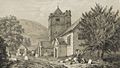
 Llangattock-Vibon-Avel church - geograph.org.uk - 247457.jpg 480 × 640; 142 KB
-
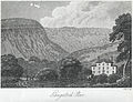
 Llangattrick House, Monmouthshire. Seat of Vice Adml. Call.jpeg 700 × 339; 166 KB
-
 Llymon Brook valley - geograph.org.uk - 1346297.jpg 640 × 480; 235 KB
-
 Looking towards Llan-creaver, near The Hendre - geograph.org.uk - 3851496.jpg 2,560 × 1,920; 2.19 MB
-
 Looking towards Walson from Norton, near Skenfrith - geograph.org.uk - 3862833.jpg 2,560 × 1,920; 2.15 MB
-
 Looking up the main road (B4347) from Norton to Pontrilas - geograph.org.uk - 5175188.jpg 3,264 × 2,448; 2.71 MB
-
 Lower Hendre Farmhouse, Monmouthshire - geograph.org.uk - 3502429.jpg 640 × 480; 105 KB
-
 Lych gate, St Cenedlon Rockfield - geograph.org.uk - 3552337.jpg 800 × 625; 130 KB
-
 Maerdy Bridge - geograph.org.uk - 4651208.jpg 640 × 480; 195 KB
-
 Malthouse farm buildings in Skenfrith - geograph.org.uk - 3731884.jpg 800 × 600; 110 KB
-
 Malthouse, Skenfrith - geograph.org.uk - 3585419.jpg 1,024 × 680; 200 KB
-
 Maypole 2013 - geograph.org.uk - 3772216.jpg 800 × 450; 217 KB


_-_geograph.org.uk_-_2723441.jpg)
_-_geograph.org.uk_-_2723445.jpg)
_-_geograph.org.uk_-_2723450.jpg)


_-_geograph.org.uk_-_2723487.jpg)
_-_geograph.org.uk_-_2723516.jpg)
_-_geograph.org.uk_-_2723775.jpg)
_-_geograph.org.uk_-_2723766.jpg)


_-_geograph.org.uk_-_2722521.jpg)
_-_geograph.org.uk_-_2722549.jpg)
_-_geograph.org.uk_-_2722556.jpg)
_-_geograph.org.uk_-_2722568.jpg)
_-_geograph.org.uk_-_2736725.jpg)


_-_geograph.org.uk_-_3363230.jpg)


.jpg)


_from_Norton_to_Pontrilas_-_geograph.org.uk_-_5175188.jpg)


