Category:Llanfarian
Jump to navigation
Jump to search
village and community in Ceredigion, Wales, United Kingdom  | |||||
| Upload media | |||||
| Instance of | |||||
|---|---|---|---|---|---|
| Location | Ceredigion, Wales | ||||
| Population |
| ||||
| Area |
| ||||
 | |||||
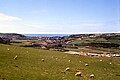
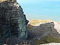
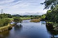
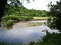
English: Llanfarian is a village and community located in the county of Ceredigion, Wales, south of the administrative centre Aberystwyth.
Subcategories
This category has the following 8 subcategories, out of 8 total.
Media in category "Llanfarian"
The following 200 files are in this category, out of 465 total.
(previous page) (next page)-
 3 Miles to Aberystwyth - Mile Stone - geograph.org.uk - 3395830.jpg 3,456 × 4,608; 3.77 MB
-
 40 mph signs for Llanfarian - geograph.org.uk - 3558221.jpg 640 × 426; 96 KB
-
 A bitterly cold day over Aberystwyth - geograph.org.uk - 5983415.jpg 1,024 × 725; 613 KB
-
 A cold day over the Rheidol valley - geograph.org.uk - 5983421.jpg 1,024 × 681; 622 KB
-
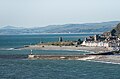
 A Distant View Over Aberystwyth - geograph.org.uk - 5735277.jpg 3,599 × 2,399; 1.32 MB
-
 A dreary day over Aberystwyth - geograph.org.uk - 5980812.jpg 1,024 × 687; 753 KB
-
 A fine evening light over the Rheidol valley - geograph.org.uk - 6301523.jpg 1,024 × 681; 839 KB
-
 A January view over Aberystwyth - geograph.org.uk - 2221980.jpg 1,000 × 750; 223 KB
-
 A new house in Moriah - geograph.org.uk - 2102966.jpg 640 × 480; 47 KB
-
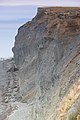
 A sheer drop from Allt-Wen - geograph.org.uk - 2102699.jpg 640 × 480; 83 KB
-
 A4120 towards Devils Bridge - geograph.org.uk - 4260615.jpg 1,024 × 768; 125 KB
-
 A485 junction ahead at Llanfarian - geograph.org.uk - 3558223.jpg 640 × 400; 88 KB
-

-

-
 Abermad viewed from the Ystwyth Trail - geograph.org.uk - 4917623.jpg 1,024 × 768; 585 KB
-
 Aberystwyth a Phenparcau - Aberystwyth and Penparcau - geograph.org.uk - 3991573.jpg 3,264 × 2,448; 3.61 MB
-

-
 Aberystwyth ATS - geograph.org.uk - 5631713.jpg 640 × 480; 78 KB
-
 Aberystwyth from Allt Wen - geograph.org.uk - 4579105.jpg 800 × 530; 444 KB
-
 Aberystwyth from Allt Wen - geograph.org.uk - 4579115.jpg 800 × 530; 431 KB
-
 Aberystwyth from Allt Wen - geograph.org.uk - 4579121.jpg 530 × 800; 521 KB
-
 Aberystwyth From the A4120 - geograph.org.uk - 4259939.jpg 1,024 × 768; 141 KB
-
 Aberystwyth from the east - geograph.org.uk - 4837531.jpg 1,000 × 1,000; 1.06 MB
-
 Aberystwyth Fundamental - geograph.org.uk - 5647460.jpg 1,346 × 1,795; 1.35 MB
-

-
 Above Allt Wen - geograph.org.uk - 4691547.jpg 530 × 800; 577 KB
-
 Above Allt Wen - geograph.org.uk - 4691560.jpg 800 × 530; 396 KB
-
 Above Allt Wen - geograph.org.uk - 4691576.jpg 800 × 530; 572 KB
-
 Above Allt Wen - geograph.org.uk - 4691685.jpg 800 × 530; 483 KB
-
 Above Allt Wen - geograph.org.uk - 4691720.jpg 800 × 530; 461 KB
-
 Afon Llolwyn - geograph.org.uk - 3920063.jpg 3,600 × 2,400; 4.03 MB
-
 Afon Rheidol - geograph.org.uk - 3771687.jpg 800 × 530; 458 KB
-
 Afon Rheidol - geograph.org.uk - 3887288.jpg 800 × 530; 479 KB
-
 Afon Rheidol - geograph.org.uk - 5010940.jpg 1,600 × 1,200; 510 KB
-
 Afon Rheidol - geograph.org.uk - 6248832.jpg 3,600 × 2,400; 7.72 MB
-
 Afon Rheidol - geograph.org.uk - 6248839.jpg 3,360 × 2,240; 7.65 MB
-
 Afon Ystwyth at Llanfarian - geograph.org.uk - 2104050.jpg 640 × 480; 131 KB
-
 Afon Ystwyth at Llanfarian - geograph.org.uk - 3494323.jpg 3,872 × 2,592; 5.93 MB
-
 Afon Ystwyth near Rhydyfelin - geograph.org.uk - 2103032.jpg 640 × 480; 121 KB
-
 Afon Ystwyth near Tanybwlch - geograph.org.uk - 4257264.jpg 1,024 × 683; 238 KB
-
 Allt Wen - geograph.org.uk - 4691536.jpg 530 × 800; 643 KB
-
 Allt Wen - geograph.org.uk - 4691537.jpg 800 × 530; 509 KB
-
 Allt Wen - geograph.org.uk - 4691722.jpg 530 × 800; 662 KB
-
 Allt Wen - geograph.org.uk - 5091970.jpg 1,600 × 1,200; 405 KB
-

-
 Allt-Wen - geograph.org.uk - 2102656.jpg 480 × 640; 90 KB
-
 Allt-Wen - geograph.org.uk - 2102706.jpg 640 × 480; 60 KB
-
 Allt-wen - geograph.org.uk - 935113.jpg 640 × 480; 166 KB
-
 Allt-Wen cliffs - geograph.org.uk - 2102659.jpg 640 × 480; 68 KB
-
 Alltwen - geograph.org.uk - 4082120.jpg 640 × 287; 42 KB
-
 Almost missed it^ - geograph.org.uk - 4916105.jpg 480 × 640; 306 KB
-
 Along the lane above Bryn-dû farm - geograph.org.uk - 5647464.jpg 1,469 × 1,102; 701 KB
-
 An unfortunate accident on the A4120 - geograph.org.uk - 3562284.jpg 3,872 × 2,592; 3.83 MB
-
 Approaching Blaenplwyf on the A487 - geograph.org.uk - 3397334.jpg 4,590 × 2,521; 2.04 MB
-
 Approaching the summit of Allt Wen - geograph.org.uk - 2102696.jpg 640 × 480; 85 KB
-

-
 B4320 at the Glan Paith junction - geograph.org.uk - 6046803.jpg 1,795 × 1,346; 1.02 MB
-
 B4320 running SE towards New Cross - geograph.org.uk - 6046805.jpg 1,469 × 1,102; 717 KB
-
 B4340 by Llechwedd-llwyfen - geograph.org.uk - 6052738.jpg 1,795 × 1,346; 1.23 MB
-
 Bales in a field near Pen-y-Banc - geograph.org.uk - 3562289.jpg 3,872 × 2,592; 4.21 MB
-
 Below Allt Wen - geograph.org.uk - 4579089.jpg 800 × 530; 479 KB
-
 Below Allt Wen - geograph.org.uk - 4691539.jpg 800 × 530; 653 KB
-
 Bluebells by the coastal path - geograph.org.uk - 3492762.jpg 3,872 × 2,592; 5.73 MB
-
 Boundary sign, Capel Seion - geograph.org.uk - 4545393.jpg 640 × 480; 73 KB
-
 Boundary sign, Moriah - geograph.org.uk - 4545386.jpg 640 × 480; 45 KB
-
 Bridge over the Nant Llolwyn, and nearby house - geograph.org.uk - 3606359.jpg 4,320 × 3,240; 3.11 MB
-
 Bridge removed - geograph.org.uk - 4916099.jpg 640 × 480; 292 KB
-
 Bridge to Penygraig - geograph.org.uk - 3494415.jpg 3,872 × 2,592; 7.2 MB
-
 Bridleway east of the Afon Ystwyth - geograph.org.uk - 1938969.jpg 1,000 × 669; 341 KB
-
 Bryn Eglur - geograph.org.uk - 3494365.jpg 3,872 × 2,592; 3.95 MB
-
 Bryn Eglur - geograph.org.uk - 4915059.jpg 640 × 480; 176 KB
-
 Bryn-dû farm - geograph.org.uk - 5647467.jpg 1,469 × 1,102; 709 KB
-
 Brynyrychain farm - geograph.org.uk - 1711835.jpg 640 × 434; 102 KB
-
 Building in Chancery-Rhydgaled - geograph.org.uk - 3494245.jpg 3,872 × 2,592; 4.05 MB
-
 Cae ger Cefnmelgoed -Field near Cefnmelgoed - geograph.org.uk - 3931069.jpg 3,600 × 2,400; 3.78 MB
-

-
 Camfa di-angen - Un-needed stile - geograph.org.uk - 3918629.jpg 3,600 × 2,400; 3.89 MB
-
 Caravan site - geograph.org.uk - 838578.jpg 640 × 480; 56 KB
-
 Cardigan Bay - geograph.org.uk - 2102713.jpg 640 × 252; 36 KB
-
 Cardigan Bay viewed from Allt-wen - geograph.org.uk - 935732.jpg 640 × 480; 113 KB
-

-
 Castle Point from Allt Wen - geograph.org.uk - 4579129.jpg 800 × 530; 396 KB
-
 Ceredigion Coast Path - geograph.org.uk - 2484944.jpg 640 × 480; 78 KB
-
 Ceredigion Coast Path - geograph.org.uk - 2485255.jpg 640 × 480; 83 KB
-
 Ceredigion Coast Path - geograph.org.uk - 2485697.jpg 640 × 480; 55 KB
-
 Ceredigion Coast Path - geograph.org.uk - 2485989.jpg 640 × 480; 81 KB
-
 Ceredigion Coast Path - geograph.org.uk - 2485994.jpg 640 × 480; 74 KB
-
 Ceredigion Coast Path - geograph.org.uk - 2485998.jpg 640 × 480; 76 KB
-
 Ceredigion Coast Path - geograph.org.uk - 2486003.jpg 640 × 480; 71 KB
-
 Ceredigion Coast Path - geograph.org.uk - 2486008.jpg 480 × 640; 118 KB
-
 Ceredigion Coast Path - geograph.org.uk - 2486016.jpg 640 × 480; 49 KB
-
 Ceredigion Coast Path - geograph.org.uk - 2488820.jpg 480 × 640; 131 KB
-
 Ceredigion Coast Path - geograph.org.uk - 2488824.jpg 640 × 480; 87 KB
-
 Ceredigion Coast Path - geograph.org.uk - 2489172.jpg 640 × 480; 80 KB
-
 Ceredigion Coast Path - geograph.org.uk - 2489190.jpg 640 × 480; 74 KB
-
 Ceredigion Coast Path - geograph.org.uk - 2489196.jpg 640 × 443; 63 KB
-
 Ceredigion Coast Path - geograph.org.uk - 2490208.jpg 640 × 480; 61 KB
-
 Ceredigion Coast Path - geograph.org.uk - 2490225.jpg 480 × 640; 47 KB
-
 Ceredigion Coast Path - geograph.org.uk - 2490231.jpg 640 × 480; 72 KB
-
 Ceredigion Coast Path - geograph.org.uk - 2490269.jpg 640 × 480; 70 KB
-
 Ceredigion Coast Path - geograph.org.uk - 2490800.jpg 640 × 480; 56 KB
-
 Ceredigion Coast Path - geograph.org.uk - 2535564.jpg 2,592 × 1,944; 1.78 MB
-
 Ceredigion Coast Path north of Ffos-las - geograph.org.uk - 1960151.jpg 1,536 × 2,048; 1.2 MB
-
 Ceredigion coastline - geograph.org.uk - 2488601.jpg 640 × 480; 64 KB
-
 Ceredigion Hills - geograph.org.uk - 2485251.jpg 640 × 480; 54 KB
-
 Ceredigion lane - geograph.org.uk - 2948015.jpg 640 × 480; 80 KB
-
 Chapel conversion by Gib-dda - geograph.org.uk - 5647201.jpg 1,469 × 1,102; 867 KB
-
 Choughs, Ceredigion Coast - geograph.org.uk - 2490797.jpg 640 × 480; 52 KB
-
 Choughs, Ceredigion Coast - geograph.org.uk - 2490799.jpg 640 × 462; 58 KB
-
 Cliffs close to Ffos Las - geograph.org.uk - 1963236.jpg 1,200 × 1,600; 656 KB
-

-

-
 Clogwyni ger Ffos-las - Cliffs near Ffos-las - geograph.org.uk - 4188135.jpg 2,400 × 3,600; 4.05 MB
-
 Clogwyni meddal ger Ffos Las - Soft cliffs near Ffos Las - geograph.org.uk - 3918599.jpg 3,600 × 2,400; 4.2 MB
-
 Coarse grass near Ty'n Fron - geograph.org.uk - 3494194.jpg 3,872 × 2,592; 4.56 MB
-
 Coast of Cardigan Bay north of Mynachdy'r-graig - geograph.org.uk - 1960113.jpg 2,048 × 1,536; 1.23 MB
-

-
 Coastal Erosion, Ceredigion Coast - geograph.org.uk - 2490793.jpg 640 × 480; 70 KB
-
 Coastal Erosion, Ceredigion Coast - geograph.org.uk - 2490794.jpg 480 × 640; 83 KB
-
 Coastal Erosion, Ceredigion Coast - geograph.org.uk - 2490795.jpg 640 × 480; 94 KB
-
 Coastal Erosion, Ceredigion Coast - geograph.org.uk - 2490796.jpg 640 × 480; 94 KB
-
 Coed Cwm-lletty - geograph.org.uk - 6249046.jpg 3,000 × 2,000; 7.66 MB
-
 Coed Cwm-lletty - geograph.org.uk - 6249049.jpg 3,120 × 2,080; 7.59 MB
-
 Coil of drainage pipe - geograph.org.uk - 1963343.jpg 1,600 × 1,461; 963 KB
-
 Conveyor Beside the Railway - geograph.org.uk - 4608957.jpg 3,994 × 2,662; 7.52 MB
-
 Country lane near Aberystwyth - geograph.org.uk - 2948020.jpg 640 × 480; 96 KB
-
 Crugiau House at Llanfarian - geograph.org.uk - 6058830.jpg 2,774 × 2,081; 1.82 MB
-
 Crugiau Lodge - geograph.org.uk - 6058823.jpg 2,285 × 1,714; 1.65 MB
-
 Cwm Ceirw farm - geograph.org.uk - 2489176.jpg 640 × 480; 86 KB
-
 Cwm-ceirw Farm - geograph.org.uk - 1960161.jpg 2,048 × 1,536; 1.11 MB
-
 Cwmcoedwig Hall - geograph.org.uk - 2558289.jpg 640 × 480; 108 KB
-
 Cwmcoedwig Hall.jpg 4,000 × 3,000; 2.66 MB
-
 Cwrt-y-fancy cottage - geograph.org.uk - 5647238.jpg 1,142 × 857; 625 KB
-

-

-
 Dismantled Railway Bridge - geograph.org.uk - 72391.jpg 640 × 480; 201 KB
-
 Doleos Farm - geograph.org.uk - 5646254.jpg 1,469 × 1,102; 647 KB
-
 Doleos Farm buildings - geograph.org.uk - 5646250.jpg 1,469 × 1,102; 630 KB
-
 Double bends ahead on A487 - geograph.org.uk - 3558220.jpg 640 × 363; 99 KB
-
 Dyffryn Rheidol - geograph.org.uk - 4914753.jpg 640 × 480; 470 KB
-
 Dyffryn Rheidol - geograph.org.uk - 4915187.jpg 640 × 480; 549 KB
-
 Dyffryn Rheidol - geograph.org.uk - 6249029.jpg 4,260 × 2,396; 7.65 MB
-
 Dyffryn Rheidol - geograph.org.uk - 6249033.jpg 3,660 × 2,440; 7.77 MB
-
 Dyffryn Rheidol viewed from Pant Da - geograph.org.uk - 4899125.jpg 640 × 480; 159 KB
-

-
 End of public road at Molecatcher's Wood - geograph.org.uk - 2538671.jpg 1,000 × 669; 564 KB
-
 Entering Blaenplwyf on A487 - geograph.org.uk - 3558213.jpg 640 × 435; 43 KB
-
 Entering Moriah from the south - geograph.org.uk - 5516950.jpg 1,024 × 683; 452 KB
-
 Entrance pillars - geograph.org.uk - 838574.jpg 640 × 480; 96 KB
-
 Entrance to Bryneithyn Hall - geograph.org.uk - 838568.jpg 640 × 480; 85 KB
-
 Entrance to Morfa Bychan Holiday Park - geograph.org.uk - 1711855.jpg 640 × 428; 123 KB
-
 Entrance to the sewage works at Llanfarian - geograph.org.uk - 3494294.jpg 3,872 × 2,592; 5.87 MB
-
 Entrance to Troedrhiwfronfrech Farm - geograph.org.uk - 3562301.jpg 3,872 × 2,592; 5.34 MB
-
 Entrance to Tyllwyd - geograph.org.uk - 972057.jpg 640 × 480; 142 KB
-
 Eroded coast near Ffos Las - geograph.org.uk - 2490259.jpg 640 × 480; 89 KB
-
 Eroded west side of Allt Wen - geograph.org.uk - 2486033.jpg 480 × 640; 75 KB
-
 Evening shadows on the hillside - geograph.org.uk - 5427213.jpg 4,320 × 3,240; 3.68 MB
-
 Farm and uplands seen from the A4120 - geograph.org.uk - 3188842.jpg 640 × 480; 71 KB
-
 Farm ruins at Ffos Las - geograph.org.uk - 1963373.jpg 1,600 × 1,024; 567 KB
-
 Farmland above Penybwlch - geograph.org.uk - 3492740.jpg 3,872 × 2,592; 4.76 MB
-
 Farmland around Blaenplwyf - geograph.org.uk - 1711891.jpg 640 × 428; 100 KB
-
 Farmland near Rhydyfelin - geograph.org.uk - 3494432.jpg 3,872 × 2,592; 6.21 MB
-
 Farmland, Ystywth valley - geograph.org.uk - 51563.jpg 640 × 480; 148 KB
-
 Fence beside a bridleway below Bryn-dû - geograph.org.uk - 5647448.jpg 1,469 × 1,102; 796 KB
-
 Ffarm Ffos Las Farm - geograph.org.uk - 4082101.jpg 640 × 480; 73 KB
-

-
 Ffos Las - geograph.org.uk - 2490214.jpg 640 × 480; 79 KB
-
 Ffos-las - geograph.org.uk - 4188189.jpg 3,600 × 2,400; 4.21 MB
-
 Ffos-lâs - geograph.org.uk - 3918605.jpg 3,600 × 2,400; 3.86 MB
-
 Field above Morfa Bychan Holiday Park - geograph.org.uk - 3494154.jpg 3,872 × 2,592; 5.05 MB
-
 Field and housing, Llanfarian - geograph.org.uk - 18740.jpg 640 × 480; 153 KB
-
 Field near Bryn-dû farm - geograph.org.uk - 1712060.jpg 640 × 428; 134 KB
-
 Field west of Home Farm - geograph.org.uk - 2150550.jpg 640 × 480; 167 KB
-
 Fields above Llechwedd-llwyfen - geograph.org.uk - 6052741.jpg 2,122 × 1,591; 1.21 MB
-
 Fields near Brynglas Farm - geograph.org.uk - 3494250.jpg 3,872 × 2,592; 3.93 MB
-
 Fields near Cwrtycwm - geograph.org.uk - 1752891.jpg 1,000 × 669; 252 KB
-
 Fields north of Mynachdy'r-graig - geograph.org.uk - 1960121.jpg 2,048 × 1,536; 1,015 KB
-
 Fields on the south side of the Nant Paith valley - geograph.org.uk - 5646251.jpg 1,469 × 1,102; 594 KB
-
 Flat grassland - geograph.org.uk - 5927787.jpg 3,264 × 2,448; 2.28 MB
-

-
 Footpath beside River Ystwyth - geograph.org.uk - 2025636.jpg 768 × 1,024; 210 KB
-
 Footpath beside River Ystwyth - seaward - geograph.org.uk - 2025637.jpg 768 × 1,024; 274 KB
-
 Footpath beside the Afon Ystwyth - geograph.org.uk - 2558359.jpg 640 × 480; 95 KB
-

-
 Garden wall, building - geograph.org.uk - 838561.jpg 640 × 480; 114 KB
-
 Gate and gorse on the Ceredigion Coast Path - geograph.org.uk - 3492769.jpg 3,872 × 2,592; 5.38 MB
-
 Gate on the Ceredigion Coast Path - geograph.org.uk - 2486012.jpg 480 × 640; 59 KB
-
 Gate to Large House - geograph.org.uk - 1111683.jpg 480 × 640; 102 KB
-
 Gates to Cwmcoedwig Hall - geograph.org.uk - 2103845.jpg 640 × 480; 121 KB
-
 Ger Mynachdy'r Graig - Near Mynachdy'r Graig - geograph.org.uk - 4188112.jpg 3,600 × 2,400; 3.97 MB
-
 Glanyrafon Bridge - geograph.org.uk - 3772673.jpg 800 × 530; 412 KB
-
 Glanyrafon Industrial Estate - geograph.org.uk - 3765193.jpg 800 × 530; 408 KB
-
 Glanyrafon Industrial Estate - geograph.org.uk - 3765198.jpg 800 × 530; 429 KB
-
 Glanyrafon Industrial Estate - geograph.org.uk - 6267407.jpg 640 × 427; 58 KB
-
 Glanyrafon railway station, Ceredigion - geograph.org.uk - 5421531.jpg 1,600 × 1,200; 543 KB
-

-

-
 Glenyrafon Industrial Estate - geograph.org.uk - 4915335.jpg 640 × 480; 612 KB
-
 Golygfa anerferol o Rydgaled - Unusual view of Chancery - geograph.org.uk - 3919823.jpg 3,600 × 2,400; 4.06 MB
-


_in_hedge_-_geograph.org.uk_-_3606362.jpg)


