Category:Littlehempston
Jump to navigation
Jump to search
English: A village near Totnes in Devon, England.
village in the United Kingdom  | |||||
| Upload media | |||||
| Instance of | |||||
|---|---|---|---|---|---|
| Location | South Hams, Devon, South West England, England | ||||
 | |||||
Subcategories
This category has the following 3 subcategories, out of 3 total.
Media in category "Littlehempston"
The following 200 files are in this category, out of 408 total.
(previous page) (next page)-

-
 1369 At Totnes Riverside - geograph.org.uk - 5618751.jpg 2,848 × 2,144; 1.51 MB
-
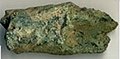 A Copper alloy item of unknown date (FindID 614205).jpg 202 × 100; 9 KB
-
 A Devon Hillside - geograph.org.uk - 5514329.jpg 640 × 426; 78 KB
-
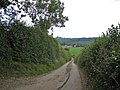
 A Devon lane - geograph.org.uk - 5040566.jpg 640 × 446; 54 KB
-
 A fine railway bridge - geograph.org.uk - 3894985.jpg 4,764 × 3,061; 4.77 MB
-
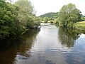
 A quiet stretch of the River Dart - geograph.org.uk - 1935951.jpg 1,024 × 768; 210 KB
-
 A South Devon field - geograph.org.uk - 4953882.jpg 640 × 426; 34 KB
-

-
 A381 at Gatcombe Bridge - geograph.org.uk - 3894936.jpg 4,208 × 2,840; 2.59 MB
-
 A381 bridge and causeway over Gatcombe Brook - geograph.org.uk - 3034497.jpg 1,000 × 750; 623 KB
-
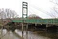
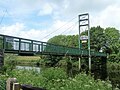
 Access bridge to Totnes Riverside railway station - geograph.org.uk - 6186527.jpg 1,600 × 1,200; 1.03 MB
-
-
 An installation - geograph.org.uk - 5282824.jpg 640 × 426; 59 KB
-
 An old orchard on the edge of Littlehempston - geograph.org.uk - 3034495.jpg 1,000 × 750; 596 KB
-
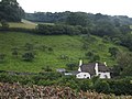
 Anonymous building, perhaps a pumping station - geograph.org.uk - 1935963.jpg 1,024 × 768; 185 KB
-
 Approach to Totnes riverside Station - geograph.org.uk - 5445267.jpg 640 × 427; 118 KB
-
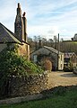
 Barn - geograph.org.uk - 5403818.jpg 640 × 426; 48 KB
-
 Barn, Lillisford Farm - geograph.org.uk - 5401263.jpg 640 × 426; 57 KB
-
 Barn, Lillisford Farm - geograph.org.uk - 5749648.jpg 640 × 426; 39 KB
-
 Barn, Lillisford Farm - geograph.org.uk - 5834276.jpg 1,024 × 771; 165 KB
-
 Barn, Lillisford Farm - geograph.org.uk - 5927712.jpg 1,024 × 681; 131 KB
-
 Barns, Grattons Farm - geograph.org.uk - 5443680.jpg 640 × 426; 56 KB
-
 Between Railway and River - geograph.org.uk - 1589583.jpg 640 × 480; 104 KB
-
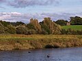 Birds on the River Dart at Totnes - geograph.org.uk - 5246626.jpg 1,024 × 768; 82 KB
-
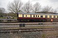
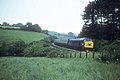
 Brake van on the South Devon Railway - geograph.org.uk - 5246723.jpg 1,024 × 768; 153 KB
-
 Bridge and brook in Littlehempston - geograph.org.uk - 5541735.jpg 1,024 × 768; 464 KB
-
 Bridge and causeway over Gatcombe Brook - geograph.org.uk - 3034492.jpg 1,000 × 750; 542 KB
-

-
 Bridge at Littlehempston - geograph.org.uk - 1041073.jpg 640 × 480; 141 KB
-
-
 Bridge over the Am Brook - geograph.org.uk - 4066265.jpg 640 × 427; 87 KB
-
 Bridge ^ Old Sleepers - geograph.org.uk - 5114253.jpg 3,595 × 3,000; 3.05 MB
-
 Bridge, Littlehempston - geograph.org.uk - 2903668.jpg 640 × 434; 82 KB
-
 Bridge, Littlehempston - geograph.org.uk - 942519.jpg 640 × 480; 121 KB
-
 Bridge, Littlehempston - geograph.org.uk - 943070.jpg 640 × 480; 129 KB
-
 Bridge, Littlehempston - geograph.org.uk - 943088.jpg 640 × 480; 119 KB
-
 Bridges at Littlehempston - geograph.org.uk - 943015.jpg 640 × 480; 105 KB
-
 Bridges at Littlehempston - geograph.org.uk - 943160.jpg 640 × 480; 134 KB
-
 Buildings by Gatcombe Brook - geograph.org.uk - 982658.jpg 640 × 427; 139 KB
-
 Buildings near Gatcombe House - geograph.org.uk - 982644.jpg 640 × 427; 97 KB
-

-

-

-
 Cafe of Totnes Rare Breeds Farm - geograph.org.uk - 4360726.jpg 3,648 × 2,736; 4.1 MB
-
 Caravans near Coombe Park - geograph.org.uk - 3433991.jpg 640 × 477; 63 KB
-
 Carriages at Totnes Station - geograph.org.uk - 5891026.jpg 1,024 × 681; 195 KB
-
 Carriages awaiting an engine - geograph.org.uk - 5891023.jpg 1,024 × 681; 113 KB
-
 Cattle grazing - geograph.org.uk - 5401255.jpg 640 × 426; 31 KB
-
 Cattle near Littlehempston - geograph.org.uk - 2903495.jpg 640 × 409; 70 KB
-
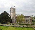
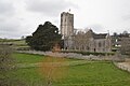
 Church of St John - geograph.org.uk - 5460928.jpg 640 × 426; 49 KB
-
 Church of St John - geograph.org.uk - 5601274.jpg 640 × 549; 68 KB
-
 Church of St John - geograph.org.uk - 5709086.jpg 640 × 426; 34 KB
-
 Church of St John - geograph.org.uk - 5709089.jpg 640 × 426; 39 KB
-
 Church of St John - geograph.org.uk - 5726130.jpg 640 × 487; 79 KB
-
 Church of St John - geograph.org.uk - 5769146.jpg 640 × 426; 53 KB
-
 Church of St John - geograph.org.uk - 5891038.jpg 1,024 × 681; 133 KB
-
 Church of St John - geograph.org.uk - 5891039.jpg 1,024 × 681; 104 KB
-
 Church of St John - geograph.org.uk - 5891041.jpg 1,024 × 681; 162 KB
-
 Church of St John - geograph.org.uk - 6040200.jpg 1,024 × 681; 179 KB
-
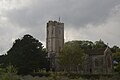
 Church of St John the Baptist - geograph.org.uk - 5425139.jpg 640 × 426; 48 KB
-
 Church of St John the Baptist - geograph.org.uk - 5425171.jpg 640 × 426; 49 KB
-

-
 Climbing Dainton Bank - geograph.org.uk - 2155420.jpg 640 × 426; 55 KB
-
 Combepark Cross - geograph.org.uk - 4550521.jpg 800 × 532; 115 KB
-
 Combepark Cross - geograph.org.uk - 982624.jpg 640 × 427; 102 KB
-
 Converted farm buildings, Gatcombe - geograph.org.uk - 4550538.jpg 800 × 532; 122 KB
-
 Cottage, Littlehempston - geograph.org.uk - 2903679.jpg 640 × 480; 76 KB
-
 Cottage, Littlehempston - geograph.org.uk - 5801795.jpg 640 × 426; 59 KB
-
 Cottages, Littlehempston (geograph 7087900).jpg 2,773 × 3,862; 1.23 MB
-
 Countryside near Buckyette - geograph.org.uk - 40499.jpg 640 × 425; 129 KB
-
 Crossing the River Hems - geograph.org.uk - 3894983.jpg 4,797 × 3,264; 5.97 MB
-
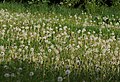 Dandelion clocks, Gatcombe - geograph.org.uk - 804277.jpg 640 × 437; 109 KB
-
 Dart valley - geograph.org.uk - 3776391.jpg 1,920 × 1,440; 515 KB
-
 Dartington Morris Men.jpg 5,104 × 3,403; 9.09 MB
-
 Devon grazing - geograph.org.uk - 5040586.jpg 640 × 301; 18 KB
-
 Devon hillside - geograph.org.uk - 5525948.jpg 640 × 426; 48 KB
-
 Devon hillside - geograph.org.uk - 5749644.jpg 640 × 426; 33 KB
-
 Devon hillside - geograph.org.uk - 5927705.jpg 1,024 × 681; 82 KB
-
 Devon hillside - geograph.org.uk - 5927717.jpg 959 × 1,024; 127 KB
-
 Devon lane - geograph.org.uk - 4953833.jpg 640 × 322; 44 KB
-
 Devon pasture - geograph.org.uk - 5040585.jpg 640 × 492; 47 KB
-
 Devon pasture - geograph.org.uk - 5801805.jpg 640 × 426; 36 KB
-
 Devon pasture - geograph.org.uk - 5801828.jpg 640 × 426; 38 KB
-
 Diverging railway lines - geograph.org.uk - 1935924.jpg 1,024 × 768; 193 KB
-
 Down the hill to Totnes - geograph.org.uk - 4066224.jpg 640 × 427; 61 KB
-
 Engine 6412, South Devon Railway - geograph.org.uk - 5891019.jpg 1,024 × 654; 190 KB
-
 Engineer's train on the main line - geograph.org.uk - 5246720.jpg 1,024 × 768; 193 KB
-
 Entrance to Totnes Riverside Station - geograph.org.uk - 5946539.jpg 1,024 × 680; 299 KB
-
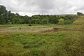
 Extensive field - geograph.org.uk - 5838616.jpg 1,024 × 681; 88 KB
-
 Farming, littlehempston - geograph.org.uk - 4504710.jpg 640 × 426; 49 KB
-
 Farmland near Hemsford - geograph.org.uk - 4816518.jpg 640 × 426; 41 KB
-
 Farmland, Hemsford - geograph.org.uk - 4821866.jpg 640 × 426; 59 KB
-
 Ferns, Littlehempston - geograph.org.uk - 943082.jpg 480 × 640; 127 KB
-
 Field near Littlehempston - geograph.org.uk - 943446.jpg 640 × 480; 102 KB
-
 Fields near Coombe Park - geograph.org.uk - 804192.jpg 640 × 480; 90 KB
-
 Fields west of Littlehempston - geograph.org.uk - 2183741.jpg 640 × 480; 87 KB
-
 First train of the day - geograph.org.uk - 5947533.jpg 1,024 × 680; 281 KB
-
 Fish Ladder by the Weir on the River Dart - geograph.org.uk - 993282.jpg 640 × 502; 110 KB
-
 Flooding by the River Hems - geograph.org.uk - 4953827.jpg 640 × 426; 53 KB
-
 Floodplain and forest, River Hems - geograph.org.uk - 4496561.jpg 414 × 640; 48 KB
-
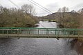
 Footbridge across the River Dart - geograph.org.uk - 5726102.jpg 640 × 426; 66 KB
-
 Footbridge Over River Dart Totnes - geograph.org.uk - 4686935.jpg 640 × 480; 76 KB
-
 Footbridge over River Dart, Totnes - geograph.org.uk - 5370987.jpg 1,600 × 1,200; 903 KB
-
 Footbridge over the Dart - geograph.org.uk - 5142233.jpg 640 × 426; 57 KB
-
 Footbridge over the Dart - geograph.org.uk - 5439183.jpg 4,320 × 3,240; 3.07 MB
-
 Footbridge Over The River Dart - geograph.org.uk - 5037374.jpg 508 × 640; 92 KB
-
 Footbridge over the River Dart - geograph.org.uk - 5275093.jpg 640 × 426; 77 KB
-
 Footbridge over the River Dart - geograph.org.uk - 5275512.jpg 640 × 426; 71 KB
-
 Footbridge over the River Dart - geograph.org.uk - 5460907.jpg 640 × 426; 60 KB
-
 Footbridge over the River Dart - geograph.org.uk - 5891016.jpg 1,024 × 681; 170 KB
-
 Footbridge over the River Dart - geograph.org.uk - 5946530.jpg 1,024 × 680; 223 KB
-
 Footbridge over the River Dart - geograph.org.uk - 6036707.jpg 1,024 × 681; 201 KB
-
 Footbridge to South Devon Railway and Rare Breeds Centre - geograph.org.uk - 4360572.jpg 3,648 × 2,736; 2.02 MB
-
 Footbridge to the South Devon Railway at Totnes - geograph.org.uk - 2662941.jpg 768 × 1,024; 226 KB
-
 Footbridge, River Dart - geograph.org.uk - 4821846.jpg 640 × 426; 76 KB
-
 Footbridge, River Dart - geograph.org.uk - 5425130.jpg 640 × 426; 51 KB
-
 Footbridge, River Dart - geograph.org.uk - 5601249.jpg 640 × 426; 57 KB
-
 Footbridge, River Dart - geograph.org.uk - 5769127.jpg 640 × 426; 69 KB
-
 Fork off road for Gatcombe Mill - geograph.org.uk - 3034487.jpg 1,000 × 750; 500 KB
-
 Gatcombe Bridge and causeway - geograph.org.uk - 3716815.jpg 1,536 × 1,152; 957 KB
-
 Gatcombe Brook - geograph.org.uk - 4816491.jpg 640 × 525; 74 KB
-
 Gatcombe Brook by the road - geograph.org.uk - 5749649.jpg 640 × 426; 82 KB
-
 Gatcombe Mill - geograph.org.uk - 804263.jpg 640 × 480; 94 KB
-
 Gatcombe Mill - geograph.org.uk - 804294.jpg 480 × 640; 104 KB
-
 Gently flows the Dart - geograph.org.uk - 5439193.jpg 4,320 × 3,240; 3.16 MB
-
 Gnomes by the Dart - geograph.org.uk - 1401856.jpg 640 × 447; 139 KB
-
 Grattons Farm - geograph.org.uk - 5275553.jpg 640 × 426; 45 KB
-

-
 Grazing near Hemsford - geograph.org.uk - 4335757.jpg 640 × 410; 36 KB
-
 Grazing near Hemsford - geograph.org.uk - 4504704.jpg 640 × 426; 38 KB
-
 Grazing, Littlehempston - geograph.org.uk - 4496573.jpg 640 × 396; 49 KB
-
 Great Western locomotive 1369 at Totnes - geograph.org.uk - 4360748.jpg 3,648 × 2,736; 2.4 MB
-
 Green Lane by Coombe Park - geograph.org.uk - 982499.jpg 427 × 640; 137 KB
-
 Green Lane near Combe Park - geograph.org.uk - 804220.jpg 480 × 640; 140 KB
-
 Green lane to Littlehempston - geograph.org.uk - 2903690.jpg 640 × 490; 97 KB
-
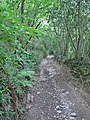
 Green tunnel - geograph.org.uk - 2532041.jpg 768 × 1,024; 392 KB
-
 Gulls on shingle, River Dart - geograph.org.uk - 4360561.jpg 3,648 × 2,736; 2.56 MB
-
 GWR 0-6-0PT at Totnes - geograph.org.uk - 4896993.jpg 640 × 480; 75 KB
-
 GWR boundary marker and notice - geograph.org.uk - 5246763.jpg 768 × 1,024; 379 KB
-
 Hardup Bridge - geograph.org.uk - 4066231.jpg 640 × 427; 72 KB
-
 Hedgerow, Hemsford - geograph.org.uk - 5282834.jpg 640 × 426; 47 KB
-
 Hemsford - geograph.org.uk - 5891056.jpg 1,024 × 681; 117 KB
-
 Heritage railway wagons - geograph.org.uk - 5439202.jpg 4,320 × 3,240; 2.41 MB
-
 High Speed Train approaching Totnes - geograph.org.uk - 5246760.jpg 1,024 × 768; 201 KB
-
 Higher Court Farm - geograph.org.uk - 3894935.jpg 4,393 × 2,717; 2.28 MB
-

-
 Hillside grazing near Littlehempston - geograph.org.uk - 4335756.jpg 640 × 398; 37 KB
-
 Hillside near Parsonage Cross - geograph.org.uk - 5282838.jpg 640 × 426; 67 KB
-
 Horse on a hillside - geograph.org.uk - 5040577.jpg 640 × 426; 65 KB
-

-
 Junction, Littlehempston - geograph.org.uk - 943047.jpg 640 × 354; 66 KB
-
 Knaves Ash Cross - geograph.org.uk - 2532006.jpg 1,280 × 960; 1.4 MB
-
 Lake, Hems Valley - geograph.org.uk - 5275544.jpg 640 × 426; 61 KB
-
 Lake, Hems Valley - geograph.org.uk - 5443678.jpg 640 × 426; 68 KB
-
 Lake, Hems Valley - geograph.org.uk - 5769141.jpg 640 × 426; 61 KB
-
 Lane at Coombe Park - geograph.org.uk - 804238.jpg 480 × 640; 136 KB
-
 Lane near Lillisford Farm - geograph.org.uk - 981225.jpg 480 × 640; 114 KB
-
 Lane near Sand Lane - geograph.org.uk - 3034621.jpg 750 × 1,000; 696 KB
-
 Lane through Penny's Wood - geograph.org.uk - 2532051.jpg 1,280 × 1,707; 2.62 MB
-
 Lane to Uphempston - geograph.org.uk - 2532088.jpg 1,280 × 960; 1.42 MB
-
 Lane to works near Grattons - geograph.org.uk - 3034664.jpg 750 × 1,000; 420 KB
-
 Lillisford Farm - geograph.org.uk - 4504695.jpg 640 × 426; 36 KB
-
 Lillisford Farm - geograph.org.uk - 5749645.jpg 640 × 426; 31 KB
-
 Lillisford Farm - geograph.org.uk - 5801819.jpg 640 × 426; 40 KB
-
 Lillisford Farm - geograph.org.uk - 5838611.jpg 1,024 × 681; 86 KB
-
 Lillisford Farm - geograph.org.uk - 5927710.jpg 1,024 × 681; 73 KB
-
 Littlehempston - geograph.org.uk - 15303.jpg 512 × 630; 123 KB
-
 Littlehempston - geograph.org.uk - 4821858.jpg 640 × 426; 71 KB
-
 Littlehempston - geograph.org.uk - 520205.jpg 640 × 480; 89 KB
-
 Littlehempston - geograph.org.uk - 5460930.jpg 640 × 426; 53 KB
-
 Littlehempston - geograph.org.uk - 943407.jpg 640 × 480; 104 KB
-
 Littlehempston Bridge (geograph 7088118).jpg 4,288 × 2,718; 2.59 MB
-
 Littlehempston Church - geograph.org.uk - 4821853.jpg 640 × 426; 58 KB
-
 Littlehempston Church - geograph.org.uk - 4821856.jpg 640 × 426; 53 KB
-
 Littlehempston Church - geograph.org.uk - 5142507.jpg 640 × 426; 50 KB
-
 Littlehempston Church - geograph.org.uk - 5142511.jpg 640 × 426; 51 KB
-
 Littlehempston Church - geograph.org.uk - 5142514.jpg 640 × 426; 44 KB
-
 Littlehempston Church - geograph.org.uk - 5275564.jpg 640 × 579; 71 KB
-
 Littlehempston Church - geograph.org.uk - 5275567.jpg 640 × 433; 55 KB
-
 Littlehempston Church - geograph.org.uk - 5275570.jpg 640 × 426; 84 KB
-
 Littlehempston Church Devon - geograph.org.uk - 4686088.jpg 640 × 491; 87 KB
-
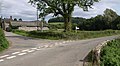
 Littlehempston crossroads - geograph.org.uk - 40495.jpg 640 × 425; 132 KB
-
 Littlehempston Farm Buildings - geograph.org.uk - 2344993.jpg 3,264 × 2,448; 4.75 MB
-
 Littlehempston Farm Buildings - geograph.org.uk - 2345004.jpg 3,264 × 2,448; 4.42 MB
-
 Littlehempston Farm Buildings - geograph.org.uk - 2345009.jpg 3,264 × 2,448; 5.28 MB
-
 Locomotive "Carnarvon" of South Devon Railway - geograph.org.uk - 4360643.jpg 3,648 × 2,736; 1.95 MB
-
 Mail Service on the South Devon Railway - geograph.org.uk - 5037386.jpg 411 × 640; 126 KB
-
 Marshy pond by the River Hems - geograph.org.uk - 4821850.jpg 640 × 426; 62 KB
-
 Meadow alongside the Dart - geograph.org.uk - 1935959.jpg 1,024 × 768; 153 KB
-
 Meander, River Hems - geograph.org.uk - 5443681.jpg 640 × 426; 73 KB
-
 Meander, River Hems - geograph.org.uk - 5601278.jpg 640 × 426; 88 KB
-

-
 Minor road north of Parsonage Cross - geograph.org.uk - 3034908.jpg 1,000 × 750; 516 KB
-
 Near Fishacre Cross - geograph.org.uk - 4821872.jpg 640 × 426; 76 KB
-
 Near Hardup Bridge - geograph.org.uk - 5525949.jpg 640 × 426; 53 KB
-
 Near Hemsford - geograph.org.uk - 4504701.jpg 640 × 426; 52 KB
-
 Near Lillisford Farm - geograph.org.uk - 4504678.jpg 640 × 426; 34 KB
-
 Near Tallyho Bridge - geograph.org.uk - 4816514.jpg 640 × 426; 48 KB
-
 Newhouse Barton - geograph.org.uk - 5425146.jpg 640 × 426; 38 KB


.jpg)


.jpg)


.jpg)


