Category:Littlebredy
Jump to navigation
Jump to search
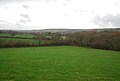
English: Littlebredy (sometimes written Little Bredy) is a village in south west Dorset, England, seven miles west of Dorchester. The village has a population of 85 (2001).
village in Dorset, United Kingdom  | |||||
| Upload media | |||||
| Instance of | |||||
|---|---|---|---|---|---|
| Location | Dorset, South West England, England | ||||
| official website | |||||
 | |||||
Subcategories
This category has the following 4 subcategories, out of 4 total.
Media in category "Littlebredy"
The following 132 files are in this category, out of 132 total.
-
 Bales near Top Parts - geograph.org.uk - 1122625.jpg 640 × 421; 70 KB
-
 Benchmark by the Estate Yard - geograph.org.uk - 2754855.jpg 800 × 787; 242 KB
-
 Benchmark on gatepost - geograph.org.uk - 2752453.jpg 800 × 780; 186 KB
-
 Big Wood Lodge - geograph.org.uk - 2779954.jpg 640 × 430; 45 KB
-
 Black Down , Dorset - geograph.org.uk - 1021342.jpg 640 × 428; 74 KB
-
 Blacksmith's Cottage - geograph.org.uk - 2781662.jpg 640 × 414; 65 KB
-
 Bog in the Bride Valley - geograph.org.uk - 2784150.jpg 640 × 430; 71 KB
-
 Bridehead - geograph.org.uk - 402367.jpg 640 × 480; 143 KB
-
 Bridehead Lake - geograph.org.uk - 4180100.jpg 1,024 × 768; 177 KB
-
 Bridle Path near Kingston Russel - geograph.org.uk - 1122917.jpg 640 × 452; 104 KB
-
 Bridleway to Long Bredy - geograph.org.uk - 4180090.jpg 1,024 × 768; 162 KB
-
 Broken Fence on White Hill - geograph.org.uk - 1218674.jpg 640 × 428; 106 KB
-
 Corrugated iron roofs, Little Bredy - geograph.org.uk - 4180108.jpg 1,024 × 768; 293 KB
-
 Countryside near Kingston Russell - geograph.org.uk - 1123106.jpg 640 × 423; 72 KB
-
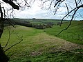
 Countryside near Littlebredy - geograph.org.uk - 1218647.jpg 640 × 428; 66 KB
-
 Countryside, Littlebredy - geograph.org.uk - 2784139.jpg 640 × 430; 47 KB
-
 Cowshed, Littlebredy Farm - geograph.org.uk - 4784665.jpg 1,024 × 768; 179 KB
-
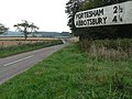
 Crossroads on Portisham Hill - geograph.org.uk - 1087472.jpg 640 × 480; 55 KB
-
 Entering Littlebredy - geograph.org.uk - 2752420.jpg 800 × 708; 212 KB
-
 Entering Littlebredy - geograph.org.uk - 2781625.jpg 640 × 430; 90 KB
-
 Entering Littlebredy - geograph.org.uk - 2784140.jpg 640 × 430; 73 KB
-

-
 Farm Track on Crow Hill - geograph.org.uk - 1122624.jpg 640 × 428; 76 KB
-
 Farmland near Foxhole Coppice - geograph.org.uk - 2784171.jpg 640 × 430; 56 KB
-
 Footpath by the hedge - geograph.org.uk - 2784166.jpg 640 × 430; 83 KB
-
 Footpath into the Bride Valley - geograph.org.uk - 2784146.jpg 640 × 430; 80 KB
-

-
 Foxholes Farm - geograph.org.uk - 1122737.jpg 640 × 428; 50 KB
-
 Freshly seeded field at Little Bredy - geograph.org.uk - 1021371.jpg 640 × 430; 125 KB
-
 Freshly sown Field on Black Down, Dorset - geograph.org.uk - 1021343.jpg 640 × 428; 105 KB
-
 Gate posts, Littlebredy - geograph.org.uk - 2784134.jpg 640 × 430; 53 KB
-
 Gated footpath - geograph.org.uk - 2784175.jpg 640 × 430; 84 KB
-
 Harts-tongue Fern, Littlebredy - geograph.org.uk - 2770938.jpg 480 × 640; 125 KB
-
 Heiligenschein near Foxholes Farm - geograph.org.uk - 1122736.jpg 640 × 424; 87 KB
-
 House near Littlebredy - geograph.org.uk - 4784659.jpg 1,024 × 768; 163 KB
-
 House near Littlebredy Farm - geograph.org.uk - 5059303.jpg 5,184 × 3,456; 3.82 MB
-
 In the Bride Valley - geograph.org.uk - 2784169.jpg 640 × 430; 42 KB
-
 Jubilee Trail - geograph.org.uk - 2779968.jpg 640 × 430; 63 KB
-
 Jubilee Way on White Hill - geograph.org.uk - 1218675.jpg 640 × 428; 64 KB
-
 Kingston Russell, Road from Littlebredy - geograph.org.uk - 1816734.jpg 800 × 535; 531 KB
-
 Lane in Littlebredy - geograph.org.uk - 2781647.jpg 640 × 430; 86 KB
-
 Lane junction near White Hill Wood - geograph.org.uk - 2779981.jpg 640 × 430; 59 KB
-
 Lane south from White Hill Barn - geograph.org.uk - 2779977.jpg 640 × 430; 41 KB
-
 Lane to Littlebredy - geograph.org.uk - 5059293.jpg 5,116 × 3,344; 2.2 MB
-
 Lane west of Littlebredy - geograph.org.uk - 2784143.jpg 640 × 430; 67 KB
-
 Lay by on Combe Road - geograph.org.uk - 2545317.jpg 640 × 480; 83 KB
-
 Lay by on Combe Road - geograph.org.uk - 2545343.jpg 640 × 480; 100 KB
-

-
 Little Bredy Farm - geograph.org.uk - 1269452.jpg 640 × 462; 81 KB
-
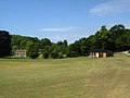
 Littlebredy Cricket Club - geograph.org.uk - 4180105.jpg 1,024 × 768; 194 KB
-
 Littlebredy cricket pitch - geograph.org.uk - 1967436.jpg 640 × 480; 63 KB
-
 Littlebredy Farm - geograph.org.uk - 2781637.jpg 640 × 430; 102 KB
-
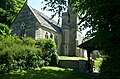 Littlebredy parish church - geograph.org.uk - 5838019.jpg 1,024 × 677; 259 KB
-

-
 Littlebredy, Bridehead Grounds - geograph.org.uk - 1814731.jpg 800 × 535; 407 KB
-
 Littlebredy, cattle grazing - geograph.org.uk - 3376226.jpg 1,024 × 768; 178 KB
-
 Littlebredy, Crow Hill - geograph.org.uk - 3376288.jpg 1,024 × 768; 199 KB
-
 Littlebredy, Lane junction - geograph.org.uk - 1834267.jpg 800 × 535; 394 KB
-

-
 Littlebredy, mobile milking parlour - geograph.org.uk - 3376210.jpg 1,024 × 768; 130 KB
-
 Littlebredy, phone box and horse - geograph.org.uk - 1354210.jpg 640 × 480; 90 KB
-
-
 Littlebredy, Track alongside stream - geograph.org.uk - 1834228.jpg 800 × 535; 505 KB
-
 Littlebredy, Track alongside stream - geograph.org.uk - 1834238.jpg 800 × 535; 519 KB
-

-
 Littlebredy, Walled garden car park - geograph.org.uk - 1816718.jpg 800 × 535; 450 KB
-
 Littlebredy, war memorial - geograph.org.uk - 3376275.jpg 1,024 × 768; 227 KB
-
 Littlebredy, Wooden Shelter - geograph.org.uk - 1834222.jpg 799 × 513; 416 KB
-
 Longland's Lane - geograph.org.uk - 2781610.jpg 640 × 430; 72 KB
-
 Longland's Lane - geograph.org.uk - 2781612.jpg 640 × 430; 81 KB
-

-
 Low Flying Warning Sign Kingston Russell - geograph.org.uk - 1123109.jpg 640 × 428; 115 KB
-
 Milk churn stand, Pitcombe - geograph.org.uk - 2752405.jpg 800 × 600; 275 KB
-
 Minor road to Littlebredy - geograph.org.uk - 5217681.jpg 427 × 640; 100 KB
-
 New stone circle - geograph.org.uk - 5906772.jpg 2,048 × 1,536; 1.23 MB
-

-
 Past Pitcombe - geograph.org.uk - 2752412.jpg 800 × 600; 166 KB
-
 Pig Shelters at Foxholes farm - geograph.org.uk - 1122738.jpg 640 × 438; 83 KB
-
 Pitcombe - geograph.org.uk - 3218569.jpg 640 × 480; 93 KB
-
 Pitcombe Down - geograph.org.uk - 3218566.jpg 640 × 480; 63 KB
-
 Pitcombe Farm - geograph.org.uk - 2784162.jpg 640 × 430; 40 KB
-
 Ploughed Field on White Hill - geograph.org.uk - 1218673.jpg 640 × 428; 97 KB
-
 Portesham, bridleway - geograph.org.uk - 1525136.jpg 640 × 480; 71 KB
-
 Portesham, sheep - geograph.org.uk - 1524961.jpg 640 × 480; 67 KB
-
 River Bride - geograph.org.uk - 2784154.jpg 640 × 430; 127 KB
-
 Road junction - geograph.org.uk - 4417554.jpg 640 × 480; 40 KB
-
 Road through Littlebredy - geograph.org.uk - 1218646.jpg 640 × 400; 83 KB
-
 Round shelter, Littlebredy - geograph.org.uk - 2759015.jpg 640 × 480; 63 KB
-
 Ruins of Black Down Barn - geograph.org.uk - 5966028.jpg 1,024 × 768; 228 KB
-
 Shelter on the green - geograph.org.uk - 2754905.jpg 800 × 643; 133 KB
-
 Shelter, Littlebredy - geograph.org.uk - 2784127.jpg 640 × 430; 70 KB
-
 Signpost near Littlebredy - geograph.org.uk - 4834390.jpg 640 × 480; 99 KB
-
 Small clump of trees, Littlebredy - geograph.org.uk - 2784125.jpg 640 × 430; 62 KB
-
 Small woodland - geograph.org.uk - 2779959.jpg 640 × 430; 45 KB
-
 Steep hill approaching - geograph.org.uk - 2781607.jpg 640 × 430; 92 KB
-
 Stile on the path from Littlebredy - geograph.org.uk - 2784158.jpg 640 × 430; 61 KB
-
 Strip Lynchets - geograph.org.uk - 2784149.jpg 640 × 430; 63 KB
-
 Strip Lynchets, Littlebredy - geograph.org.uk - 2784163.jpg 640 × 430; 42 KB
-
 Telephone Box, Littlebredy - geograph.org.uk - 2781655.jpg 640 × 315; 61 KB
-
 The Green, Little Bredy - geograph.org.uk - 4180095.jpg 1,024 × 768; 129 KB
-
 The Valley of Stones - geograph.org.uk - 4784669.jpg 1,024 × 768; 161 KB
-
 The Valley of Stones - geograph.org.uk - 558942.jpg 640 × 480; 137 KB
-
 The Valley of Stones - geograph.org.uk - 559580.jpg 640 × 480; 112 KB
-
 The Valley of Stones - geograph.org.uk - 559592.jpg 640 × 480; 156 KB
-
 The village green - geograph.org.uk - 2754887.jpg 800 × 643; 197 KB
-
 Through the old gate - geograph.org.uk - 2752435.jpg 800 × 708; 198 KB
-
 To the junction - geograph.org.uk - 2754819.jpg 800 × 600; 171 KB
-
 Top Parts - geograph.org.uk - 1122626.jpg 640 × 406; 54 KB
-
 Top Parts - geograph.org.uk - 1122627.jpg 640 × 416; 63 KB
-
 Trees in a ploughed field - geograph.org.uk - 2779971.jpg 640 × 430; 63 KB
-
 Valley of Stones - geograph.org.uk - 1529550.jpg 640 × 480; 71 KB
-
 Valley of Stones NNR - geograph.org.uk - 1529541.jpg 640 × 480; 80 KB
-
 Valley of Stones, sarsons - geograph.org.uk - 1529567.jpg 640 × 480; 100 KB
-
 Valley of the stones - geograph.org.uk - 2990908.jpg 1,024 × 683; 130 KB
-
 View across the Valley of the Stones - geograph.org.uk - 435889.jpg 640 × 480; 74 KB
-
 View south from Longland's Lane - geograph.org.uk - 2781626.jpg 640 × 430; 75 KB
-
 Village Hall, Littlebredy - geograph.org.uk - 2784129.jpg 640 × 430; 56 KB
-
 Water Trough near Foxholes Farm - geograph.org.uk - 1122628.jpg 640 × 408; 129 KB
-
 Waterfall at the Bridehead Outflow - geograph.org.uk - 402374.jpg 640 × 480; 199 KB
-
 Waterfall in Bridehead grounds - geograph.org.uk - 5219490.jpg 640 × 427; 62 KB
-
 West Lodge - geograph.org.uk - 2754799.jpg 800 × 600; 164 KB
-
 West Lodge - geograph.org.uk - 2784132.jpg 640 × 452; 60 KB
-
 West Lodge, Littlebredy - geograph.org.uk - 2784137.jpg 640 × 430; 85 KB
-
 Western entrance to Valley of the Stones - geograph.org.uk - 5217675.jpg 640 × 427; 139 KB
-
 White Hill Barn - geograph.org.uk - 2779973.jpg 640 × 430; 92 KB
-
 White Hill Barn - geograph.org.uk - 2779988.jpg 640 × 430; 104 KB
-
 White Hill Barn in the trees - geograph.org.uk - 2779979.jpg 640 × 430; 129 KB
-
 White Hill Wood - geograph.org.uk - 2781608.jpg 640 × 430; 127 KB
-
 White Hill Wood - geograph.org.uk - 2781614.jpg 640 × 430; 149 KB
-
 Winter sunset from Blackdown - geograph.org.uk - 435892.jpg 640 × 634; 69 KB
-
 Woodland by the Jubilee Trail - geograph.org.uk - 2779944.jpg 640 × 430; 124 KB
-
 Woodland by the Jubilee Trail - geograph.org.uk - 2779948.jpg 640 × 430; 130 KB


