Category:Little Totham
Jump to navigation
Jump to search
English: Little Totham is a village in Essex, England, with a population of about 300. The parish extends from the extensive common and heath-land of Tiptree down to the River Blackwater. The village lies about 6 miles 10 km) from Maldon and 5 miles (8 km) from Tiptree and lies on the back road between Goldhanger and the Maldon to Colchester road. It is part of Maldon District Council.
village in the United Kingdom .jpg) | |||||
| Upload media | |||||
| Instance of | |||||
|---|---|---|---|---|---|
| Location | Maldon, Essex, East of England, England | ||||
 | |||||
Subcategories
This category has the following 2 subcategories, out of 2 total.
L
S
- The Swan, Little Totham (3 F)
Media in category "Little Totham"
The following 47 files are in this category, out of 47 total.
-
 Beckingham Street, Little Totham - geograph.org.uk - 4535019.jpg 640 × 480; 123 KB
-

-
 Chappel Farm - geograph.org.uk - 2191015.jpg 1,600 × 1,067; 430 KB
-
 Chigborough Road - geograph.org.uk - 5381928.jpg 640 × 480; 83 KB
-
 Crop field, Wash Bridge - geograph.org.uk - 5381936.jpg 640 × 480; 62 KB
-
 Evangelical Church, Little Totham, Essex - geograph.org.uk - 2037917.jpg 640 × 458; 112 KB
-
 Field of wheat - geograph.org.uk - 3526420.jpg 640 × 480; 93 KB
-

-

-
 Footpath signpost near Clarks Farm, Little Totham - geograph.org.uk - 4324563.jpg 2,736 × 3,420; 4.72 MB
-
 Footpath to Little Totham Hall - geograph.org.uk - 3451996.jpg 640 × 424; 79 KB
-
 Footpath towards Little Totham church - geograph.org.uk - 4535012.jpg 640 × 480; 115 KB
-
 Footpath ^ Farm Machinery - geograph.org.uk - 3452053.jpg 640 × 424; 82 KB
-
 Footpath ^ Signs of Spring - geograph.org.uk - 3452030.jpg 424 × 640; 111 KB
-
 Gadwall Lake, Chigborough Lakes - geograph.org.uk - 3526450.jpg 640 × 480; 102 KB
-
 Gadwall Lake, Chigborough Lakes Nature Reserve - geograph.org.uk - 4314938.jpg 1,600 × 1,064; 393 KB
-

-
 Grazing near Chigborough Farm - geograph.org.uk - 5381926.jpg 640 × 480; 50 KB
-
 Green Lane - geograph.org.uk - 3451903.jpg 640 × 424; 99 KB
-

-
 Lake at Little Totham Hall - geograph.org.uk - 4314947.jpg 1,600 × 1,064; 574 KB
-
 Lake near Little Tottham Hall - geograph.org.uk - 3452040.jpg 640 × 424; 58 KB
-

-
 Minor road, Wash Bridge - geograph.org.uk - 5381941.jpg 640 × 480; 68 KB
-
 Near Vine Farm - geograph.org.uk - 3451887.jpg 424 × 640; 100 KB
-
 Office Lane - geograph.org.uk - 4535161.jpg 640 × 480; 150 KB
-
 Old Farm - geograph.org.uk - 3451981.jpg 640 × 424; 62 KB
-
 Path to Green Lane - geograph.org.uk - 3451896.jpg 424 × 640; 78 KB
-
 Playground in Little Totham - geograph.org.uk - 3451929.jpg 640 × 424; 95 KB
-
 Pond by the Footpath to Little Totham Hall (geograph 3451988).jpg 640 × 424; 101 KB
-
 Stream in Little Totham - geograph.org.uk - 3451960.jpg 424 × 640; 87 KB
-
 The Village Pond Little Totham - geograph.org.uk - 3451941.jpg 640 × 424; 94 KB
-
 The White House - geograph.org.uk - 3451972.jpg 640 × 424; 64 KB
-
 Totham Plains - geograph.org.uk - 4535173.jpg 640 × 480; 129 KB
-
 Towards Beckingham St - geograph.org.uk - 3440975.jpg 424 × 640; 70 KB
-
 Towards Little Tottham Hall - geograph.org.uk - 3452063.jpg 424 × 640; 66 KB
-
 Tree on Maldon Road east of Heybridge - geograph.org.uk - 6081530.jpg 1,920 × 1,280; 1.36 MB
-
 Wash Lane - geograph.org.uk - 4317966.jpg 1,600 × 1,064; 573 KB
-
 Winding lane east of Heybridge - geograph.org.uk - 5911308.jpg 1,024 × 777; 166 KB
-
-
 Blind Lane - geograph.org.uk - 288186.jpg 640 × 426; 107 KB
-
 Chigborough Road - geograph.org.uk - 262633.jpg 640 × 423; 64 KB
-
 Farmhouse at Little Renters Farm - geograph.org.uk - 262682.jpg 640 × 480; 71 KB
-
 Farmhouse at Voucher's Farm - geograph.org.uk - 262645.jpg 640 × 426; 63 KB
-
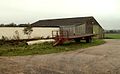
 Old barn at Brick House Farm - geograph.org.uk - 262696.jpg 640 × 480; 93 KB
-
 Wash Lane - geograph.org.uk - 288169.jpg 640 × 426; 104 KB
-

,_Wash_Bridge_-_geograph.org.uk_-_5381944.jpg)


.jpg)


