Category:Little Cowarne
Jump to navigation
Jump to search
village and civil parish in Herefordshire, England  | |||||
| Upload media | |||||
| Instance of | |||||
|---|---|---|---|---|---|
| Location | Herefordshire, West Midlands, England | ||||
 | |||||
Subcategories
This category has the following 2 subcategories, out of 2 total.
O
- Oasts in Little Cowarne (1 F)
Media in category "Little Cowarne"
The following 108 files are in this category, out of 108 total.
-

-
 Little Cowarne detail in OS Hereford (Hills) sheet 198 - 1898.jpg 790 × 677; 602 KB
-
 A field with a view - geograph.org.uk - 6175513.jpg 800 × 600; 126 KB
-
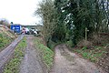 A five-ways junction at Hundred Bank - geograph.org.uk - 1345217.jpg 640 × 427; 300 KB
-
 Animal shelters near The Bank - geograph.org.uk - 1209589.jpg 640 × 399; 224 KB
-
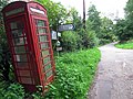
 Autumn of the phone box - geograph.org.uk - 1005942.jpg 640 × 480; 132 KB
-
 Autumn Tree at St. Guthlac's Church (Little Cowarne) - geograph.org.uk - 6296795.jpg 3,648 × 2,736; 4.64 MB
-
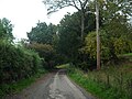
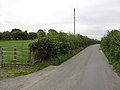
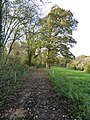
 Back lane at Little Cowarne - geograph.org.uk - 1005935.jpg 640 × 480; 147 KB
-

-

-
 Ceiling at St. Guthlac's Church (Nave ^ Little Cowarne) - geograph.org.uk - 5934298.jpg 3,648 × 2,736; 2.71 MB
-
 Converted barn at Upper House - geograph.org.uk - 4638024.jpg 1,200 × 900; 852 KB
-
 East window, Little Cowarne church - geograph.org.uk - 5193238.jpg 768 × 1,024; 188 KB
-
 Eddy Croft, Hundred Bank - geograph.org.uk - 1345113.jpg 640 × 427; 280 KB
-
 Entrance Gate to St. Guthlac's Church (Little Cowarne) - geograph.org.uk - 6296785.jpg 3,648 × 2,736; 4.69 MB
-
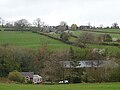
 Farmland near Little Cowarne - geograph.org.uk - 5189680.jpg 800 × 600; 155 KB
-
 Farmland near Little Cowarne - geograph.org.uk - 5193260.jpg 1,024 × 768; 319 KB
-
 Farmland near Stoke Lacy - geograph.org.uk - 5189623.jpg 800 × 600; 172 KB
-
 Farmland track, Little Cowarne - geograph.org.uk - 5193270.jpg 800 × 600; 139 KB
-
 Farmland, Little Cowarne - geograph.org.uk - 6175526.jpg 800 × 600; 146 KB
-
 Field next to Little Cowarne church - geograph.org.uk - 1005931.jpg 640 × 480; 71 KB
-
 Fields near Little Cowarne - geograph.org.uk - 5189629.jpg 800 × 600; 148 KB
-

-
 Floor inside St. Guthlac's Church (Nave ^ Little Cowarne) - geograph.org.uk - 6296791.jpg 3,648 × 2,056; 1.87 MB
-
 Gate and farmland track - geograph.org.uk - 5193302.jpg 800 × 600; 184 KB
-
 Gate at St. Guthlac's Church (Little Cowarne) - geograph.org.uk - 5934366.jpg 3,648 × 2,736; 3.86 MB
-
 Inside St. Guthlac's Church (Bell Tower ^ Little Cowarne) - geograph.org.uk - 5934117.jpg 3,648 × 2,736; 3.04 MB
-
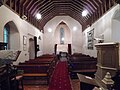
 Interior of Little Cowarne church - geograph.org.uk - 5192645.jpg 600 × 800; 92 KB
-
 Junction at Pencombe Hall - geograph.org.uk - 4281811.jpg 800 × 451; 195 KB
-
 K6 phone box at Little Cowarne - geograph.org.uk - 4640802.jpg 4,000 × 3,000; 4.64 MB
-
 Lane at Little Cowarne - geograph.org.uk - 6296780.jpg 3,648 × 2,736; 4.71 MB
-
 Lane by St. Guthlac's Church (Little Cowarne) - geograph.org.uk - 5931706.jpg 3,648 × 2,736; 5.04 MB
-
 Lane to Birches Cottage (Little Cowarne) - geograph.org.uk - 5934420.jpg 3,648 × 2,736; 4.86 MB
-
 Lane to Bromyard at Little Farm - geograph.org.uk - 1006078.jpg 640 × 480; 76 KB
-
 Little Cowarne - geograph.org.uk - 6175543.jpg 800 × 600; 219 KB
-
 Little Cowarne - geograph.org.uk - 6175545.jpg 800 × 600; 143 KB
-
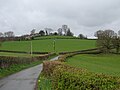
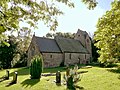
 Little Cowarne church - geograph.org.uk - 5189657.jpg 1,024 × 768; 267 KB
-
 Meadow first - then polythene - geograph.org.uk - 5454708.jpg 800 × 600; 152 KB
-
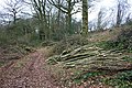
 Meeting of paths, Broxash Wood - geograph.org.uk - 1345231.jpg 640 × 427; 339 KB
-

-
 Overlooking the Lodon - geograph.org.uk - 6175528.jpg 800 × 600; 160 KB
-
 Pastoral hillside - geograph.org.uk - 4301257.jpg 800 × 451; 180 KB
-
 Path to St. Guthlac's Church (Little Cowarne) - geograph.org.uk - 5931632.jpg 3,648 × 2,736; 4.7 MB
-
 Path to St. Guthlac's Church (Little Cowarne) - geograph.org.uk - 6296783.jpg 3,648 × 2,736; 4.5 MB
-
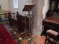
 Pulpit in Little Cowarne church - geograph.org.uk - 5192647.jpg 600 × 800; 84 KB
-
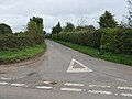
 Road junction at Little Cowarne - geograph.org.uk - 6291521.jpg 1,024 × 574; 193 KB
-
 Scenic lane to Little Cowarne - geograph.org.uk - 4289354.jpg 800 × 451; 160 KB
-
-
 Shortwood Family Farm - geograph.org.uk - 1347352.jpg 640 × 427; 271 KB
-
 Shortwood Farm - geograph.org.uk - 1200771.jpg 640 × 480; 211 KB
-
 St Guthlac, Little Cowarne - geograph.org.uk - 3273036.jpg 3,365 × 2,392; 1.35 MB
-
 St Guthlac, Little Cowarne - geograph.org.uk - 3273118.jpg 3,336 × 2,382; 1.57 MB
-
 St Guthlac, Little Cowarne - geograph.org.uk - 3273131.jpg 3,333 × 2,401; 1.05 MB
-
 St Guthlac, Little Cowarne - geograph.org.uk - 3273140.jpg 2,592 × 3,456; 3.2 MB
-
 St Guthlac, Little Cowarne - geograph.org.uk - 3273149.jpg 3,456 × 2,592; 2.59 MB
-
 St Guthlac. Little Cowarne - geograph.org.uk - 3273090.jpg 3,333 × 2,610; 1.93 MB
-
 St. Guthlac's Church (Altar ^ Little Cowarne) - geograph.org.uk - 5934268.jpg 3,648 × 2,736; 2.8 MB
-
 St. Guthlac's Church (Bell Tower ^ Little Cowarne) - geograph.org.uk - 5931852.jpg 3,648 × 2,736; 4.14 MB
-
 St. Guthlac's Church (Bell Tower ^ Little Cowarne) - geograph.org.uk - 5934344.jpg 3,648 × 2,736; 4.06 MB
-
 St. Guthlac's Church (Bell Tower ^ Little Cowarne) - geograph.org.uk - 5934357.jpg 4,096 × 4,096; 5.33 MB
-
 St. Guthlac's Church (Bell Tower ^ Little Cowarne) - geograph.org.uk - 6296789.jpg 2,736 × 3,648; 4.07 MB
-
 St. Guthlac's Church (Bell Tower ^ Porch ^ Little Cowarne) - geograph.org.uk - 5931851.jpg 3,648 × 2,736; 4.75 MB
-
 St. Guthlac's Church (Chancel ^ Little Cowarne) - geograph.org.uk - 5934136.jpg 3,648 × 2,736; 2.46 MB
-
 St. Guthlac's Church (Font ^ Little Cowarne) - geograph.org.uk - 5934123.jpg 3,648 × 2,736; 2.69 MB
-
 St. Guthlac's Church (Font ^ Little Cowarne) - geograph.org.uk - 6296794.jpg 3,648 × 2,736; 2.62 MB
-
 St. Guthlac's Church (Lectern ^ Little Cowarne) - geograph.org.uk - 5934198.jpg 3,648 × 2,736; 3.5 MB
-
 St. Guthlac's Church (Little Cowarne) - geograph.org.uk - 5931712.jpg 3,648 × 2,736; 4.56 MB
-
 St. Guthlac's Church (Little Cowarne) - geograph.org.uk - 5931797.jpg 3,648 × 2,736; 4.78 MB
-
 St. Guthlac's Church (Little Cowarne) - geograph.org.uk - 5933365.jpg 3,648 × 2,736; 3.12 MB
-
 St. Guthlac's Church (Little Cowarne) - geograph.org.uk - 5934339.jpg 1,920 × 1,080; 741 KB
-
 St. Guthlac's Church (Little Cowarne) - geograph.org.uk - 5934379.jpg 3,648 × 2,736; 4.15 MB
-
 St. Guthlac's Church (Little Cowarne) - geograph.org.uk - 5934382.jpg 3,648 × 2,736; 3.99 MB
-
 St. Guthlac's Church (Little Cowarne) - geograph.org.uk - 5934392.jpg 3,648 × 2,736; 4.14 MB
-
 St. Guthlac's Church (Little Cowarne) - geograph.org.uk - 5934400.jpg 3,648 × 2,736; 4.27 MB
-
 St. Guthlac's Church (Little Cowarne) - geograph.org.uk - 5934406.jpg 3,648 × 2,736; 4.42 MB
-
 St. Guthlac's Church (Little Cowarne) - geograph.org.uk - 6296784.jpg 3,648 × 2,736; 4.86 MB
-
 St. Guthlac's Church (Little Cowarne) - geograph.org.uk - 6296787.jpg 3,648 × 2,736; 4.7 MB
-
 St. Guthlac's Church (Little Cowarne) - geograph.org.uk - 6296790.jpg 3,648 × 2,056; 2.43 MB
-
 St. Guthlac's Church (Nave ^ Little Cowarne) - geograph.org.uk - 5934276.jpg 3,648 × 2,736; 2.72 MB
-
 St. Guthlac's Church (Organ ^ Little Cowarne) - geograph.org.uk - 5934146.jpg 3,648 × 2,736; 2.66 MB
-
 St. Guthlac's Church (Porch ^ Little Cowarne) - geograph.org.uk - 5934413.jpg 3,648 × 2,736; 4.03 MB
-
 St. Guthlac's Church (Porch ^ Little Cowarne) - geograph.org.uk - 6296788.jpg 3,648 × 2,736; 3.92 MB
-
 St. Guthlac's Church (Porch ^ Little Cowarne) - geograph.org.uk - 6296796.jpg 3,648 × 2,736; 4.25 MB
-
 St. Guthlac's Church (Pulpit ^ Little Cowarne) - geograph.org.uk - 5934131.jpg 3,648 × 2,736; 3.09 MB
-
 St. Guthlac's Church (War Memorial ^ Little Cowarne) - geograph.org.uk - 5934126.jpg 3,648 × 2,736; 2.32 MB
-
 Stained glass window, Little Cowarne church - geograph.org.uk - 5193233.jpg 576 × 1,024; 149 KB
-
 Stained glass window, Little Cowarne church - geograph.org.uk - 5193237.jpg 576 × 1,024; 124 KB
-
 Telephone Box at Little Cowarne - geograph.org.uk - 5934431.jpg 3,648 × 2,736; 4.77 MB
-
 Telephone Box at Little Cowarne - geograph.org.uk - 6296782.jpg 3,648 × 2,736; 4.34 MB
-
 The Court, Little Cowarne - geograph.org.uk - 123734.jpg 640 × 479; 120 KB
-
 The lane to Stoke Hill - geograph.org.uk - 1005924.jpg 640 × 480; 60 KB
-
 The path to Little Cowarne church - geograph.org.uk - 5189661.jpg 800 × 600; 222 KB
-
 The Three Rivers Ride, Little Cowarne - geograph.org.uk - 5189677.jpg 1,024 × 768; 422 KB
-
 The White House, Little Cowarne - geograph.org.uk - 113658.jpg 640 × 479; 145 KB
-
 Three Elms from Hundred Bank - geograph.org.uk - 1345243.jpg 640 × 427; 275 KB
-
 Three Horseshoes, Little Cowarne - geograph.org.uk - 6175534.jpg 800 × 600; 148 KB
-
 Track and footpath, Little Cowarne - geograph.org.uk - 5193277.jpg 768 × 1,024; 386 KB
-
 Trees in a hedgerow - geograph.org.uk - 5193265.jpg 800 × 600; 163 KB
-
 White House (Little Cowarne) - geograph.org.uk - 5934439.jpg 3,648 × 2,736; 3.02 MB
-
 White House - geograph.org.uk - 4640799.jpg 3,762 × 2,508; 3.44 MB
-
 White House, Little Cowarne - geograph.org.uk - 5193309.jpg 800 × 600; 156 KB
-
 White House, Little Cowarne - geograph.org.uk - 6291523.jpg 1,024 × 575; 147 KB
-

-

-
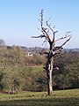 Dead Tree in Old Orchard - geograph.org.uk - 113390.jpg 479 × 640; 94 KB
-
 Footpath to Little Cowarne Brook - geograph.org.uk - 123737.jpg 640 × 479; 104 KB
-
 Shortwood Working Farm - geograph.org.uk - 210769.jpg 640 × 480; 51 KB
-
 Valley of the River Odon - geograph.org.uk - 123476.jpg 640 × 479; 83 KB

_sheet_198_-_1898.jpg)


_-_geograph.org.uk_-_6296795.jpg)

_-_geograph.org.uk_-_5934387.jpg)
_-_geograph.org.uk_-_5934205.jpg)
_-_geograph.org.uk_-_5934298.jpg)


_-_geograph.org.uk_-_6296785.jpg)


_-_geograph.org.uk_-_6296791.jpg)

_-_geograph.org.uk_-_5934366.jpg)
_-_geograph.org.uk_-_5934117.jpg)


_-_geograph.org.uk_-_5931706.jpg)
_-_geograph.org.uk_-_5934420.jpg)


_-_geograph.org.uk_-_5931632.jpg)
_-_geograph.org.uk_-_6296783.jpg)


_-_geograph.org.uk_-_5934268.jpg)
_-_geograph.org.uk_-_5931852.jpg)
_-_geograph.org.uk_-_5934344.jpg)
_-_geograph.org.uk_-_5934357.jpg)
_-_geograph.org.uk_-_6296789.jpg)
_-_geograph.org.uk_-_5931851.jpg)
_-_geograph.org.uk_-_5934136.jpg)
_-_geograph.org.uk_-_5934123.jpg)
_-_geograph.org.uk_-_6296794.jpg)
_-_geograph.org.uk_-_5934198.jpg)
_-_geograph.org.uk_-_5931712.jpg)
_-_geograph.org.uk_-_5931797.jpg)
_-_geograph.org.uk_-_5933365.jpg)
_-_geograph.org.uk_-_5934339.jpg)
_-_geograph.org.uk_-_5934379.jpg)
_-_geograph.org.uk_-_5934382.jpg)
_-_geograph.org.uk_-_5934392.jpg)
_-_geograph.org.uk_-_5934400.jpg)
_-_geograph.org.uk_-_5934406.jpg)
_-_geograph.org.uk_-_6296784.jpg)
_-_geograph.org.uk_-_6296787.jpg)
_-_geograph.org.uk_-_6296790.jpg)
_-_geograph.org.uk_-_5934276.jpg)
_-_geograph.org.uk_-_5934146.jpg)
_-_geograph.org.uk_-_5934413.jpg)
_-_geograph.org.uk_-_6296788.jpg)
_-_geograph.org.uk_-_6296796.jpg)
_-_geograph.org.uk_-_5934131.jpg)
_-_geograph.org.uk_-_5934126.jpg)


_-_geograph.org.uk_-_5934439.jpg)


_-_geograph.org.uk_-_5934246.jpg)
_-_geograph.org.uk_-_6296792.jpg)


