Category:Liss
Jump to navigation
Jump to search
village and civil parish in Hampshire, England, UK  | |||||
| Upload media | |||||
| Instance of | |||||
|---|---|---|---|---|---|
| Location | East Hampshire, Hampshire, South East England, England | ||||
| Population |
| ||||
| Elevation above sea level |
| ||||
| Said to be the same as | Liss (Wikimedia duplicated page, civil parish) | ||||
 | |||||
Subcategories
This category has the following 12 subcategories, out of 12 total.
B
- Brethren Meeting Room, Liss (8 F)
C
- Crossing Gates pub, Liss (4 F)
L
- Liss railway station (31 F)
O
- Oasts in Liss (1 F)
R
S
T
W
- Whistle Stop pub, Liss (2 F)
Media in category "Liss"
The following 200 files are in this category, out of 331 total.
(previous page) (next page)-
 "The Vibe" in Station Road - geograph.org.uk - 1272735.jpg 640 × 480; 69 KB
-

-
 2016, a year on Geograph (Day 172) - geograph.org.uk - 5006491.jpg 640 × 480; 48 KB
-
 2016, a year on Geograph (Day 28) - geograph.org.uk - 4807294.jpg 640 × 480; 115 KB
-
 2016, a year on Geograph (Day 280) - geograph.org.uk - 5145203.jpg 640 × 480; 78 KB
-

-

-
 A3 looking north - geograph.org.uk - 3754406.jpg 640 × 480; 131 KB
-
 A3 northbound - geograph.org.uk - 3052336.jpg 640 × 480; 35 KB
-
 A3 northbound - geograph.org.uk - 3052339.jpg 640 × 464; 56 KB
-
 A3 northbound - geograph.org.uk - 3052340.jpg 640 × 480; 49 KB
-
 A3 northbound - geograph.org.uk - 3052342.jpg 640 × 480; 51 KB
-
 A3 Petersfield bypass and farmland. - geograph.org.uk - 10876.jpg 640 × 426; 70 KB
-

-
 A3, Liss - geograph.org.uk - 4256196.jpg 640 × 350; 33 KB
-
 A3, northbound - geograph.org.uk - 4256204.jpg 640 × 371; 36 KB
-

-
 Andlers Ash Road - geograph.org.uk - 644224.jpg 640 × 480; 66 KB
-
 Andlers Ash Road at Liss boundary - geograph.org.uk - 3119415.jpg 640 × 480; 101 KB
-
 Andlers Ash Road level crossing - geograph.org.uk - 5254891.jpg 5,054 × 3,262; 2.99 MB
-
 Andlers Ash Road, Liss - geograph.org.uk - 5254846.jpg 5,184 × 3,456; 5.53 MB
-
 Andlers Ash tree nursery - geograph.org.uk - 5254852.jpg 640 × 427; 90 KB
-
 Approaching Liss from the B3006 - geograph.org.uk - 2497684.jpg 640 × 480; 71 KB
-
 B3006 at Liss boundary - geograph.org.uk - 3119344.jpg 640 × 480; 78 KB
-
 B3006 crosses the River Rother - geograph.org.uk - 3492780.jpg 3,325 × 2,531; 1.51 MB
-
 B3006 passes The Spread Eagle - geograph.org.uk - 3492757.jpg 3,236 × 2,392; 1.35 MB
-
 B3006, A3 roundabout - geograph.org.uk - 2794675.jpg 640 × 337; 37 KB
-
 Beer garden at The Spread Eagle - geograph.org.uk - 2497677.jpg 640 × 480; 65 KB
-
 Bridge for the London to Portsmouth line - geograph.org.uk - 3683583.jpg 3,264 × 2,448; 5.05 MB
-
 Bridge over River Rother - geograph.org.uk - 5254955.jpg 5,202 × 3,465; 4.56 MB
-
 Buildings at Barefoots Farm - geograph.org.uk - 2215802.jpg 800 × 600; 148 KB
-
 Bungalow on Warren Road, Liss - geograph.org.uk - 5978872.jpg 1,824 × 1,120; 1.52 MB
-
 Bungalows on Mint Rd - geograph.org.uk - 2623427.jpg 640 × 430; 77 KB
-
 Car park at Liss Village Centre - geograph.org.uk - 1279515.jpg 640 × 480; 102 KB
-
 Cattle grazing - geograph.org.uk - 2623435.jpg 640 × 430; 63 KB
-
 Cattle with a view - geograph.org.uk - 3754503.jpg 640 × 480; 76 KB
-
 Charity shop in Station Road - geograph.org.uk - 1279513.jpg 480 × 640; 60 KB
-
 Classic car heading up Mill Road - geograph.org.uk - 1279500.jpg 640 × 480; 69 KB
-
 Commemorative Bench, Durford Wood - geograph.org.uk - 300699.jpg 640 × 480; 84 KB
-
 Crossing the border - geograph.org.uk - 3685576.jpg 3,264 × 2,448; 5.2 MB
-
 Crossing the border on Hatch Lane - geograph.org.uk - 3553890.jpg 3,264 × 2,448; 4.92 MB
-
 Crossover in Station Road - geograph.org.uk - 1273448.jpg 480 × 640; 76 KB
-
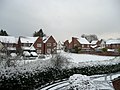 December 2009 snow in Liss 1.jpg 3,072 × 2,304; 3.4 MB
-
 December 2009 snow in Liss 2.jpg 2,304 × 3,072; 3.29 MB
-
 December 2009 snow in Liss 3.jpg 3,072 × 2,304; 3.55 MB
-
 December 2009 snow in Liss 4.jpg 3,072 × 2,304; 3.28 MB
-
 December 2009 snow in Liss 5.jpg 3,072 × 2,304; 3.35 MB
-
 Early morning at Liss station - geograph.org.uk - 5254795.jpg 5,184 × 3,456; 6.69 MB
-
 East Hampshire , London Road B2070 - geograph.org.uk - 5739054.jpg 6,000 × 4,000; 5.67 MB
-
 East Hampshire , London Road B2070 - geograph.org.uk - 5739181.jpg 6,000 × 4,000; 5.37 MB
-
 East Hampshire , Pruetts Lane - geograph.org.uk - 5739109.jpg 6,000 × 4,000; 6.24 MB
-
 Electrical Sub-station near Liss - geograph.org.uk - 2629936.jpg 640 × 430; 66 KB
-
 Entrance at Stodham Park - geograph.org.uk - 2195049.jpg 800 × 600; 133 KB
-
 Entrance to Highbrook Hall at Lyss Place - geograph.org.uk - 1321372.jpg 640 × 480; 126 KB
-
 Entrance to Sussex Gate on the B 2070 - geograph.org.uk - 2542311.jpg 1,600 × 1,200; 601 KB
-
 Farmland on the edge of Liss - geograph.org.uk - 2623432.jpg 640 × 430; 52 KB
-
 Farmland on the edge of Liss - geograph.org.uk - 2629945.jpg 640 × 430; 49 KB
-
 Farnham Road at A3 roundabout - geograph.org.uk - 3119407.jpg 640 × 480; 56 KB
-
 Farnham Road, Liss - geograph.org.uk - 3822934.jpg 640 × 480; 63 KB
-
 Farnham Road, Liss - geograph.org.uk - 3822936.jpg 640 × 480; 65 KB
-
 Field adjacent to Rake Village Hall - geograph.org.uk - 1848785.jpg 640 × 480; 77 KB
-
 Field along Batt's Brook - geograph.org.uk - 3754483.jpg 640 × 480; 138 KB
-

-
 Field north of Rake Road - geograph.org.uk - 3754323.jpg 640 × 480; 102 KB
-
 Fields near Wheatham Farm - geograph.org.uk - 5900144.jpg 4,000 × 3,000; 4.37 MB
-
 Fish and chip shop in Station Road - geograph.org.uk - 1279524.jpg 640 × 480; 59 KB
-
 Florists in Station Road - geograph.org.uk - 1279519.jpg 480 × 640; 90 KB
-
 Flying Bull car park at Rake - geograph.org.uk - 1852959.jpg 640 × 480; 79 KB
-
 Flying Bull- beer garden - geograph.org.uk - 1852972.jpg 640 × 480; 127 KB
-
 Footbridge over the A3 - geograph.org.uk - 4256194.jpg 640 × 412; 45 KB
-
 Footbridge over the A3 - geograph.org.uk - 4256202.jpg 640 × 371; 38 KB
-

-

-
 Former Mill Building, Mill Road, Liss (July 2019).JPG 2,000 × 1,800; 1.28 MB
-

-
 Frogs laying frogspawn on Liss Common, Hampshire, UK.jpg 2,333 × 1,366; 1.05 MB
-
 Gateway to Highbrook Stables - geograph.org.uk - 1321388.jpg 640 × 480; 134 KB
-
 Hawkley Road (2) - geograph.org.uk - 1321382.jpg 480 × 640; 90 KB
-
 Hawkley Road - geograph.org.uk - 3754426.jpg 640 × 428; 90 KB
-
 Hawkley Road Bridge, A3 - geograph.org.uk - 4256199.jpg 640 × 430; 40 KB
-
 Highfield Gardens, East Liss - geograph.org.uk - 5977175.jpg 1,920 × 1,280; 1.86 MB
-
 Hill - panoramio (2).jpg 3,648 × 1,929; 3.96 MB
-
 Hill Brow , London Road B2070 - geograph.org.uk - 5739113.jpg 6,000 × 4,000; 6.09 MB
-
 Hill Brow , London Road B2070 - geograph.org.uk - 5739179.jpg 6,000 × 4,000; 6.78 MB
-
 Hillbrow Road Allotments - geograph.org.uk - 1276434.jpg 640 × 480; 116 KB
-
 Hillbrow Road Car Park - geograph.org.uk - 1273528.jpg 640 × 480; 65 KB
-
 Hillbrow Road Car Park - geograph.org.uk - 1276414.jpg 640 × 480; 86 KB
-
 House and bungalow, Mint Rd - geograph.org.uk - 2623429.jpg 640 × 365; 57 KB
-
 House at Wheatham Farm - geograph.org.uk - 2215820.jpg 800 × 600; 176 KB
-
 Houses in School Lane - geograph.org.uk - 1279398.jpg 640 × 465; 81 KB
-

-
 Inside St Peter, West Liss (A) - geograph.org.uk - 4999783.jpg 640 × 480; 68 KB
-
 Inside St Peter, West Liss (B) - geograph.org.uk - 4999784.jpg 640 × 480; 57 KB
-
 Inside St Peter, West Liss (C) - geograph.org.uk - 4999787.jpg 480 × 640; 44 KB
-
 Inside St Peter, West Liss (D) - geograph.org.uk - 4999795.jpg 640 × 480; 50 KB
-
 Inside St Peter, West Liss (E) - geograph.org.uk - 4999797.jpg 480 × 640; 40 KB
-
 Intriguing topiary in London Road - geograph.org.uk - 1846990.jpg 640 × 480; 88 KB
-
 Joining the B3006, West Liss - geograph.org.uk - 5208840.jpg 640 × 426; 56 KB
-
 Junction of Stodham Lane and Pruetts Lane - geograph.org.uk - 5254933.jpg 5,016 × 3,241; 3.79 MB
-

-
 Lane from Flexcombe - geograph.org.uk - 3758457.jpg 640 × 480; 140 KB
-
 Large conifer in Highfield Gardens - geograph.org.uk - 1437458.jpg 640 × 360; 55 KB
-

-
 Liss Business Centre - geograph.org.uk - 1272742.jpg 640 × 480; 91 KB
-
 Liss Cricket Club car park - geograph.org.uk - 2497690.jpg 640 × 480; 78 KB
-
 Liss Forest, postbox № GU33 75 - geograph.org.uk - 1989889.jpg 480 × 640; 91 KB
-
 Liss Forest, red telephone box - geograph.org.uk - 1989886.jpg 480 × 640; 86 KB
-
 Liss Forest, the post office - geograph.org.uk - 1989883.jpg 640 × 480; 68 KB
-
 Liss railway station, Hampshire - geograph.org.uk - 3292853.jpg 1,024 × 768; 164 KB
-
 Liss Recreation Ground - geograph.org.uk - 1272737.jpg 640 × 480; 71 KB
-
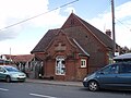
 Liss Scout Hut in Station Road - geograph.org.uk - 1272712.jpg 480 × 640; 93 KB
-
 Liss Station - geograph.org.uk - 2629937.jpg 640 × 430; 76 KB
-
 Liss Station - geograph.org.uk - 2629940.jpg 640 × 402; 90 KB
-
 Liss station - geograph.org.uk - 4652922.jpg 4,000 × 3,000; 3.88 MB
-
 Liss Triangle Community Centre.JPG 3,072 × 2,304; 2.79 MB
-
 Liss Veterinary Centre in Mill Road - geograph.org.uk - 1279487.jpg 486 × 640; 81 KB
-
 Liss Village Hall - geograph.org.uk - 644202.jpg 640 × 480; 67 KB
-
 Liss village hall and bus shelter - geograph.org.uk - 5254839.jpg 5,184 × 3,456; 6.07 MB
-
 Liss Village Hall.JPG 3,072 × 2,304; 2.8 MB
-

-
 London Road near Liss - geograph.org.uk - 2542320.jpg 1,600 × 1,200; 553 KB
-
 Longmoor Military Railway 01.jpg 3,096 × 4,128; 7.52 MB
-
 Longmoor Military Railway 03.jpg 4,128 × 3,096; 7.64 MB
-
 Longmoor Military Railway 07.jpg 3,096 × 4,128; 5.23 MB
-
-

-

-
 Looking eastwards along Rake Road - geograph.org.uk - 1279363.jpg 640 × 435; 80 KB
-

-

-

-

-

-

-

-

-

-

-
 Mint Road near its junction with Forest Road, Liss Forest - geograph.org.uk - 3683530.jpg 3,264 × 2,448; 3.55 MB
-
 Newman Collard Park Entrance.JPG 3,072 × 2,304; 2.86 MB
-
 Newman Collard Playing Fields, Liss - geograph.org.uk - 599706.jpg 640 × 480; 66 KB
-
 Newsagents in Station Road - geograph.org.uk - 1279523.jpg 480 × 640; 76 KB
-

-

-

-
 Parking area and footbridge on A3 - geograph.org.uk - 4712976.jpg 800 × 449; 72 KB
-
 Path to Newfield Road - geograph.org.uk - 3754313.jpg 640 × 480; 166 KB
-
 Pine Walk, Liss - geograph.org.uk - 5977168.jpg 1,872 × 1,204; 1.38 MB
-

-

-
 Pond, Liss - geograph.org.uk - 3754363.jpg 640 × 480; 176 KB
-
 Post box at Prince's Marsh - geograph.org.uk - 5254865.jpg 4,956 × 3,137; 4.04 MB
-

-

-
 Private drive to Coldhayes Farm - geograph.org.uk - 3758437.jpg 640 × 480; 111 KB
-
 Pruetts on the Shipwrights Way - geograph.org.uk - 5254935.jpg 5,184 × 3,456; 5.21 MB
-
 Railway line towards Petersfield - geograph.org.uk - 5254901.jpg 4,846 × 3,104; 3.23 MB
-
 Railway towards Liss - geograph.org.uk - 3067836.jpg 640 × 480; 164 KB
-
 Rake Road, East Liss - geograph.org.uk - 5977174.jpg 1,920 × 1,280; 1.77 MB
-
 Rake Village Hall, late January 2016 - geograph.org.uk - 4812966.jpg 640 × 480; 35 KB
-
 River Rother, At Prince's Bridge, Liss (1) - geograph.org.uk - 5905321.jpg 1,024 × 768; 278 KB
-
 River Rother, At Prince's Bridge, Liss (2) - geograph.org.uk - 5905323.jpg 1,024 × 768; 260 KB
-

-
 Safe parking area for Liss Infants and Junior Schools - geograph.org.uk - 3683502.jpg 3,264 × 2,448; 3.98 MB
-
 Saint Mary Liss, banner - geograph.org.uk - 4999919.jpg 480 × 640; 47 KB
-
 Saint Mary Liss, incumbency board - geograph.org.uk - 4999917.jpg 480 × 640; 42 KB
-
 Saint Mary, Liss, CWGC grave (I) - geograph.org.uk - 4999943.jpg 480 × 640; 88 KB
-
 Saint Mary, Liss, CWGC grave (II) - geograph.org.uk - 4999955.jpg 480 × 640; 91 KB
-
 Saint Mary, Liss, CWGC grave (III) - geograph.org.uk - 4999958.jpg 480 × 640; 90 KB
-
 Saint Mary, Liss, CWGC grave (IV) - geograph.org.uk - 4999964.jpg 480 × 640; 93 KB
-
 Saint Mary, Liss, CWGC grave (IX) - geograph.org.uk - 5000017.jpg 480 × 640; 88 KB
-
 Saint Mary, Liss, CWGC grave (V) - geograph.org.uk - 4999970.jpg 480 × 640; 101 KB
-
 Saint Mary, Liss, CWGC grave (VI) - geograph.org.uk - 4999974.jpg 480 × 640; 88 KB
-
 Saint Mary, Liss, CWGC grave (VII) - geograph.org.uk - 4999980.jpg 480 × 640; 93 KB
-
 Saint Mary, Liss, CWGC grave (VIII) - geograph.org.uk - 4999989.jpg 501 × 640; 90 KB
-
 Saint Mary, Liss, CWGC grave (X) - geograph.org.uk - 5000018.jpg 480 × 640; 82 KB
-
 Saint Mary, Liss, CWGC grave (XI) - geograph.org.uk - 5000033.jpg 480 × 640; 98 KB
-
 Saint Mary, Liss, military grave (a) - geograph.org.uk - 5000035.jpg 480 × 640; 90 KB
-
 Saint Mary, Liss, military grave (b) - geograph.org.uk - 5000055.jpg 640 × 480; 116 KB
-

-
 Shipwrights Way down to River Rother - geograph.org.uk - 5254950.jpg 4,819 × 3,076; 4.3 MB
-
 Shipwrights Way past Stodham Park - geograph.org.uk - 5254949.jpg 5,184 × 3,456; 6.2 MB
-
 Shipwrights' Way 111 - geograph.org.uk - 5391503.jpg 800 × 600; 110 KB
-
 Shipwrights' Way 112 - geograph.org.uk - 5391506.jpg 800 × 600; 156 KB
-
 Shipwrights' Way 113 - geograph.org.uk - 5391510.jpg 800 × 600; 228 KB
-
 Shipwrights' Way 114 - geograph.org.uk - 5391516.jpg 800 × 600; 210 KB
-
 Shipwrights' Way 115 - geograph.org.uk - 5391519.jpg 800 × 600; 110 KB
-
 Shipwrights' Way 81 - geograph.org.uk - 5084816.jpg 800 × 600; 192 KB
-
 Shipwrights' Way 82 - geograph.org.uk - 5084821.jpg 800 × 600; 204 KB
-
 Shipwrights' Way 83 - geograph.org.uk - 5084826.jpg 800 × 600; 187 KB
-
 Shipwrights' Way 84 - geograph.org.uk - 5084830.jpg 800 × 600; 235 KB
-
 Shipwrights' Way 85 - geograph.org.uk - 5084836.jpg 800 × 600; 198 KB
-
 Shipwrights' Way 86 - geograph.org.uk - 5084845.jpg 800 × 600; 165 KB
-
 Shipwrights' Way 88 - geograph.org.uk - 5083970.jpg 800 × 600; 112 KB
-
 Shipwrights' Way 90 - geograph.org.uk - 5382915.jpg 800 × 600; 134 KB
-
 Shipwrights' Way 91 - geograph.org.uk - 5382919.jpg 800 × 600; 140 KB
-
 Shipwrights' Way 92 - geograph.org.uk - 5382924.jpg 800 × 475; 173 KB
-
 Shipwrights' Way 93 - geograph.org.uk - 5382939.jpg 800 × 600; 188 KB
-
 Shipwrights' Way 94 - geograph.org.uk - 5382942.jpg 800 × 600; 170 KB
-
 Shipwrights' Way 95 - geograph.org.uk - 5382950.jpg 800 × 600; 135 KB

_-_geograph.org.uk_-_2497513.jpg)
_-_geograph.org.uk_-_5006491.jpg)
_-_geograph.org.uk_-_4807294.jpg)
_-_geograph.org.uk_-_5145203.jpg)


_-_geograph.org.uk_-_2629947.jpg)


.JPG)


_-_geograph.org.uk_-_1321382.jpg)


.jpg)


_-_geograph.org.uk_-_4999783.jpg)
_-_geograph.org.uk_-_4999784.jpg)
_-_geograph.org.uk_-_4999787.jpg)
_-_geograph.org.uk_-_4999795.jpg)
_-_geograph.org.uk_-_4999797.jpg)


_-_geograph.org.uk_-_2497693.jpg)
_-_geograph.org.uk_-_2497698.jpg)


_-_geograph.org.uk_-_5905321.jpg)
_-_geograph.org.uk_-_5905323.jpg)


_-_geograph.org.uk_-_4999943.jpg)
_-_geograph.org.uk_-_4999955.jpg)
_-_geograph.org.uk_-_4999958.jpg)
_-_geograph.org.uk_-_4999964.jpg)
_-_geograph.org.uk_-_5000017.jpg)
_-_geograph.org.uk_-_4999970.jpg)
_-_geograph.org.uk_-_4999974.jpg)
_-_geograph.org.uk_-_4999980.jpg)
_-_geograph.org.uk_-_4999989.jpg)
_-_geograph.org.uk_-_5000018.jpg)
_-_geograph.org.uk_-_5000033.jpg)
_-_geograph.org.uk_-_5000035.jpg)
_-_geograph.org.uk_-_5000055.jpg)
_-_geograph.org.uk_-_4999938.jpg)


