Category:Linthwaite
Jump to navigation
Jump to search
village in the United Kingdom  | |||||
| Upload media | |||||
| Instance of |
| ||||
|---|---|---|---|---|---|
| Location | Kirklees, West Yorkshire, Yorkshire and the Humber, England | ||||
 | |||||
Subcategories
This category has the following 5 subcategories, out of 5 total.
B
- Blackmoorfoot Reservoir (10 F)
C
- Christ Church, Linthwaite (2 F)
M
- Manchester Road, Linthwaite (13 F)
R
- Ramsden Mills, Linthwaite (10 F)
T
- Titanic Mill (13 F)
Media in category "Linthwaite"
The following 78 files are in this category, out of 78 total.
-
 4 Mile Post, A62 road.jpg 2,000 × 1,479; 986 KB
-

-
 Bridge No 38, Huddersfield Narrow Canal.jpg 4,000 × 2,248; 6.23 MB
-
 Buildings at Upper Clough, Linthwaite - geograph.org.uk - 495950.jpg 640 × 454; 113 KB
-
 Byway at Crosland Hill - geograph.org.uk - 749979.jpg 640 × 458; 81 KB
-
 Canal Bridge to Bankfield Linthwaite - geograph.org.uk - 856519.jpg 640 × 480; 138 KB
-
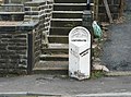
 Canal Milestone, Linthwaite.jpg 427 × 640; 91 KB
-
 Causeway Crescent - Causeway Side - geograph.org.uk - 5059724.jpg 640 × 480; 64 KB
-
 Causeway Side - Gillroyd Lane - geograph.org.uk - 5059649.jpg 640 × 473; 79 KB
-

-
 Cottage, Linfit Fold, Linthwaite - geograph.org.uk - 528450.jpg 640 × 464; 107 KB
-
 Cowlersley Lane, Linthwaite - geograph.org.uk - 628595.jpg 640 × 375; 40 KB
-

-

-
-

-
 Field with a view, Linthwaite - geograph.org.uk - 528374.jpg 640 × 449; 85 KB
-
 Florence Elizabeth Lockwood burial Linthwaite.jpg 4,128 × 3,096; 6.2 MB
-
 Footpath - Manchester Road, Linthwaite - geograph.org.uk - 915067.jpg 588 × 640; 346 KB
-
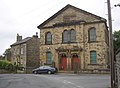 Former Methodist Chapel, Linthwaite - geograph.org.uk - 495992.jpg 640 × 472; 86 KB
-

-

-

-
 Headwell Green - geograph.org.uk - 19080.jpg 640 × 480; 111 KB
-

-

-
 Ignore sat nav & engage brain sign, Lees Mill Lane, Linthwaite.jpg 3,109 × 3,109; 8.94 MB
-
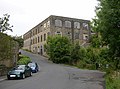
 Industrial buildings, Linthwaite - geograph.org.uk - 628866.jpg 640 × 470; 81 KB
-
 Jerusalem Road, Linthwaite - geograph.org.uk - 528407.jpg 640 × 474; 98 KB
-
 Jerusalem Road, Linthwaite - geograph.org.uk - 529164.jpg 640 × 480; 94 KB
-
 Linfit Lane, Linthwaite - geograph.org.uk - 528418.jpg 640 × 446; 72 KB
-
 Linfit Lane, Linthwaite - geograph.org.uk - 528476.jpg 640 × 480; 97 KB
-
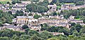 Linthwaite - geograph.org.uk - 3126960.jpg 1,445 × 686; 466 KB
-
 Linthwaite - geograph.org.uk - 4641524.jpg 640 × 426; 51 KB
-
 Linthwaite - panoramio (419).jpg 3,648 × 2,736; 3.34 MB
-
 Linthwaite, chimney - geograph.org.uk - 1548681.jpg 640 × 480; 71 KB
-
 Linthwaite, Colne Valley, Huddersfield, UK -RLH-.JPG 2,286 × 854; 1.47 MB
-
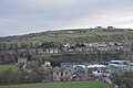
 Linthwaite, valley - geograph.org.uk - 1548666.jpg 640 × 480; 81 KB
-
 Low Westwood Mill.jpg 640 × 427; 76 KB
-
 Manchester Road - Linthwaite - geograph.org.uk - 915077.jpg 640 × 462; 173 KB
-
 Methodist Assembly Hall, Linthwaite - geograph.org.uk - 496028.jpg 640 × 468; 81 KB
-

-

-
 Mill building, Waingate, Linthwaite - geograph.org.uk - 496041.jpg 640 × 474; 93 KB
-

-

-

-
 Office building, Linthwaite - geograph.org.uk - 628871.jpg 640 × 449; 79 KB
-
 Old mill machinery (1) Linthwaite - geograph.org.uk - 495871.jpg 480 × 640; 131 KB
-
 Old mill machinery (2) Linthwaite - geograph.org.uk - 495878.jpg 480 × 640; 135 KB
-
 Old mill machinery (3) Linthwaite - geograph.org.uk - 495886.jpg 640 × 480; 122 KB
-
 Part of Ramsden Mills, Golcar - geograph.org.uk - 494073.jpg 640 × 474; 103 KB
-
 Pennine View - Causeway Side - geograph.org.uk - 5059664.jpg 640 × 480; 73 KB
-

-
 Pennine View - Royd House Lane - geograph.org.uk - 5059710.jpg 640 × 480; 63 KB
-
 Pipe bridge, Golcar - Linthwaite - geograph.org.uk - 494070.jpg 480 × 640; 140 KB
-
 Ramsden Mill Lane, Linthwaite - geograph.org.uk - 856505.jpg 640 × 480; 165 KB
-
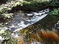 River Colne at Linthwaite.jpg 3,264 × 2,448; 1.77 MB
-

-
 School, Chapel Hill, Linthwaite - geograph.org.uk - 496666.jpg 640 × 463; 82 KB
-

-
 Slant Gate - Manchester Road, Linthwaite - geograph.org.uk - 915072.jpg 640 × 473; 214 KB
-
 Slant Gate, Linthwaite - geograph.org.uk - 529247.jpg 470 × 640; 98 KB
-
 Slant Gate, Linthwaite - geograph.org.uk - 529250.jpg 640 × 480; 122 KB
-

-

-

-
 The River Colne, Linthwaite - Golcar - geograph.org.uk - 628625.jpg 640 × 476; 118 KB
-
 Track to Sands House Lane - geograph.org.uk - 749621.jpg 640 × 463; 100 KB
-
 Upper Clough Road, Linthwaite - geograph.org.uk - 495973.jpg 640 × 480; 69 KB
-
 Upper Clough Road, Linthwaite - geograph.org.uk - 495982.jpg 640 × 506; 72 KB
-
 Victorian postbox, Upper Clough - geograph.org.uk - 5972361.jpg 1,129 × 2,336; 806 KB
-
 View from Linfit Lane, Linthwaite - geograph.org.uk - 529153.jpg 640 × 473; 90 KB
-

-
 Waingate - Parkgate - geograph.org.uk - 2154760.jpg 640 × 480; 82 KB
-
 Waingate Park - Waingate - geograph.org.uk - 5059779.jpg 640 × 480; 83 KB
-
 Westwood Christian Centre.jpg 800 × 600; 140 KB
-
 Triangulation Post and Observatory - geograph.org.uk - 37379.jpg 640 × 585; 372 KB


.jpg)


_Linthwaite_-_geograph.org.uk_-_495871.jpg)
_Linthwaite_-_geograph.org.uk_-_495878.jpg)
_Linthwaite_-_geograph.org.uk_-_495886.jpg)


_-_geograph.org.uk_-_529174.jpg)
_-_geograph.org.uk_-_529178.jpg)


