Category:Linguistic maps of Belgium
Jump to navigation
Jump to search
Countries of Europe: Albania · Armenia‡ · Austria · Azerbaijan‡ · Belarus · Belgium · Bosnia and Herzegovina · Bulgaria · Croatia · Cyprus‡ · Czech Republic · Denmark · Estonia · Finland · France‡ · Georgia‡ · Germany · Greece · Hungary · Republic of Ireland · Italy · Kazakhstan‡ · Latvia · Lithuania · Luxembourg · Moldova · Montenegro · Netherlands‡ · North Macedonia · Norway · Poland · Portugal‡ · Romania · Russia‡ · Serbia · Slovakia · Slovenia · Spain‡ · Sweden · Switzerland · Turkey‡ · Ukraine · United Kingdom
Specific status: Faroe Islands – Limited recognition: Kosovo
‡: partly located in Europe
Specific status: Faroe Islands – Limited recognition: Kosovo
‡: partly located in Europe
Subcategories
This category has the following 3 subcategories, out of 3 total.
Media in category "Linguistic maps of Belgium"
The following 41 files are in this category, out of 41 total.
-
 Ardennais - dialecte de transition.png 1,617 × 2,077; 886 KB
-
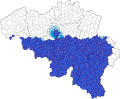
 Ardennais en Belgique.png 1,261 × 1,024; 368 KB
-
 Ardennais.png 1,024 × 1,024; 276 KB
-
 Arrondissement BHV.PNG 1,090 × 720; 40 KB
-
 Belgique-francophone en 2021.gif 888 × 734; 61 KB
-
 Belgiquefrancophonne.gif 888 × 734; 59 KB
-
 Brabant francophone.jpg 317 × 201; 37 KB
-
 Brabant2.jpg 341 × 245; 37 KB
-
 Brabants.PNG 346 × 301; 15 KB
-
 Brabantse dialecten.png 1,160 × 960; 457 KB
-
 BrabantseSubdialecten.png 714 × 618; 244 KB
-
 Comunidades lingüísticas de Bélgica.png 405 × 333; 8 KB
-
 DialectenbeideLimburgen.png 800 × 1,096; 61 KB
-
 DialectenLimburgBelgie.png 948 × 936; 522 KB
-
 Donmène-picard-jpg.jpg 2,432 × 2,124; 1.26 MB
-
 Dutch Dialects according to Heeringa.jpg 2,152 × 1,984; 756 KB
-
 Dutch-in-France.png 918 × 555; 53 KB
-
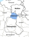
 Environnement linguistique de l'Ardennais.png 1,485 × 1,335; 495 KB
-
 France Flanders language-no.svg 504 × 346; 62 KB
-
 Frans-Vlaanderen.jpg 1,241 × 833; 168 KB
-
 Languages Belgium.png 926 × 756; 54 KB
-
 Languages Benelux (cropped).PNG 699 × 920; 23 KB
-
 Languages Benelux (cropped1).PNG 699 × 910; 17 KB
-
 Languages Benelux (cropped2).PNG 699 × 915; 90 KB
-
 Languages Benelux.PNG 699 × 2,737; 170 KB
-
 Languages in Belgium.jpg 617 × 426; 51 KB
-
 LimburgsIk.png 250 × 350; 9 KB
-
 Linguistic map of Wallonia-fr.svg 646 × 359; 128 KB
-
 Linguistic map of Wallonia.png 663 × 358; 12 KB
-
 Location map of Walloon language-wa-rif.svg 646 × 359; 107 KB
-
 Map of Dutch dialects according to Heeringa.png 1,996 × 1,968; 720 KB
-
 Map of Northern champenois.jpg 878 × 618; 83 KB
-
 Moezelfrankische dialecten.png 1,502 × 958; 722 KB
-
 NederlandsBelgië.jpg 304 × 373; 20 KB
-
 Platdietse streek.PNG 290 × 220; 7 KB
-
 Platdietsestreek.png 500 × 400; 17 KB
-
 Raploû Lile djåzant atlasse mape Beldjike Philippe Boula.jpg 2,256 × 1,496; 419 KB
-
 VerbreitungsgebietDeutscheMundarten.png 571 × 648; 60 KB
-
 Vlaams - dialectes néerlandais de Belgique et proches environs.png 2,514 × 2,048; 629 KB
-
 Wallonie-linguistique-fr.svg 1,052 × 744; 88 KB
-
 Wallonie-linguistique-wa.svg 1,052 × 744; 84 KB


.PNG)
.PNG)
.PNG)


