Category:Lincolnshire photographs taken on 2008-02-17
Jump to navigation
Jump to search
Media in category "Lincolnshire photographs taken on 2008-02-17"
The following 14 files are in this category, out of 14 total.
-

-
 Relic of the Anchor Brewery - geograph.org.uk - 693805.jpg 640 × 610; 156 KB
-
 Raymond Mays Memorial - geograph.org.uk - 693267.jpg 640 × 480; 99 KB
-
 Deeping-StJames-Lockup-geograph-693417-by-Ian-Paterson.jpg 640 × 480; 57 KB
-
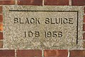 Detail on pumping station - geograph.org.uk - 702900.jpg 640 × 430; 77 KB
-
 Drainage pump - geograph.org.uk - 702885.jpg 640 × 470; 82 KB
-
 Farm on Ewerby Fen - geograph.org.uk - 702878.jpg 640 × 456; 57 KB
-
 Corner Cottage - geograph.org.uk - 693635.jpg 640 × 427; 84 KB
-
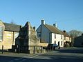
 Under the Spreading Chestnut Tree - geograph.org.uk - 693620.jpg 640 × 427; 117 KB
-
 Arched Brick Wall - geograph.org.uk - 693809.jpg 640 × 427; 81 KB
-
 Rippingale Village Sign - geograph.org.uk - 693673.jpg 480 × 640; 108 KB
-
 St Guthlac's Churchyard - geograph.org.uk - 700753.jpg 640 × 480; 158 KB
-
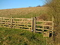 Stile at valley bottom - geograph.org.uk - 693203.jpg 640 × 480; 123 KB
-
 Pumping station on Carr Dyke - geograph.org.uk - 702891.jpg 640 × 480; 98 KB


