Category:Lillerød Kirke
Jump to navigation
Jump to search
| Object location | | View all coordinates using: OpenStreetMap |
|---|
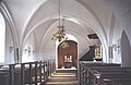
church building in Allerød Municipality, Denmark  | |||||
| Upload media | |||||
| Instance of | |||||
|---|---|---|---|---|---|
| Location | Lillerød, Allerød Municipality, Capital Region of Denmark, Denmark | ||||
| Street address |
| ||||
| Diocese | |||||
| Religion or worldview | |||||
| official website | |||||
 | |||||
Media in category "Lillerød Kirke"
The following 7 files are in this category, out of 7 total.
-
 LilleroedKirke.jpg 2,352 × 1,560; 2.96 MB
-
 Lillerød kirke (Allerød).jpg 736 × 595; 254 KB
-
 Lillerød Kirke 21-09-06 01.jpg 2,272 × 1,704; 1.72 MB
-
 Nordenskirker Lilleroed(01).jpg 800 × 541; 104 KB
-
 Nordenskirker Lilleroed(04).jpg 800 × 539; 167 KB
-
 Nordenskirker Lilleroed(06).jpg 800 × 521; 75 KB
-
 Nordenskirker Lilleroed(08).jpg 404 × 600; 55 KB

.jpg)
.jpg)
.jpg)
.jpg)
.jpg)