Category:Liebfrauenkirche (Marburg)
Jump to navigation
Jump to search
| Object location | | View all coordinates using: OpenStreetMap |
|---|
| Upload media | |||||
| Instance of | |||||
|---|---|---|---|---|---|
| Location | Fulda, Kassel Government Region, Hesse, Germany | ||||
 | |||||
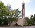
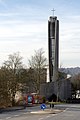
Media in category "Liebfrauenkirche (Marburg)"
The following 6 files are in this category, out of 6 total.
-
 Liebfrauenkirche Marburg 1.jpg 2,834 × 4,279; 3.66 MB
-
 Liebfrauenkirche Marburg 2.jpg 3,157 × 2,623; 3.42 MB
-
 Liebfrauenkirche Marburg 3.jpg 2,878 × 4,346; 4.29 MB
-
 Liebfrauenkirche Marburg 4.jpg 3,120 × 2,544; 3.99 MB
-
 Liebfrauenkirche Marburg 5.jpg 2,464 × 3,696; 4.94 MB
-
 Marburg - kath Liebfrauenkirche - Orgel.JPG 5,184 × 3,456; 3.66 MB


