Category:Level crossings in Berkshire
Jump to navigation
Jump to search
Ceremonial counties of England: Bedfordshire · Berkshire · Buckinghamshire · Cambridgeshire · Cheshire · Cornwall · Cumbria · Derbyshire · Devon · Dorset · Durham · East Riding of Yorkshire · East Sussex · Essex · Gloucestershire · Greater London · Greater Manchester · Hampshire · Herefordshire · Hertfordshire · Kent · Lancashire · Leicestershire · Lincolnshire · Merseyside · North Yorkshire · Northamptonshire · Northumberland · Nottinghamshire · Oxfordshire · Rutland · Shropshire · Somerset · South Yorkshire · Staffordshire · Suffolk · Surrey · Tyne and Wear · Warwickshire · West Midlands · West Sussex · West Yorkshire · Wiltshire · Worcestershire
City-counties: Bristol ·
Former historic counties:
Other former counties:
City-counties: Bristol ·
Former historic counties:
Other former counties:
Subcategories
This category has the following 4 subcategories, out of 4 total.
C
- Colthrop level crossing (11 F)
G
P
- Padworth crossing, Berkshire (1 F)
U
- Ufton level crossing (19 F)
Media in category "Level crossings in Berkshire"
The following 45 files are in this category, out of 45 total.
-
 2018 at Datchet station - level crossing.JPG 1,366 × 910; 504 KB
-
 Another unmanned railway crossing - geograph.org.uk - 2835039.jpg 1,024 × 683; 281 KB
-
 Compeday level crossing - geograph.org.uk - 4375731.jpg 640 × 428; 108 KB
-
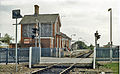 Cookham station geograph-3086572-by-Ben-Brooksbank.jpg 897 × 553; 439 KB
-
 Cranwell Bridge Level Crossing - geograph.org.uk - 4759199.jpg 640 × 426; 109 KB
-
 DSCF0934 Mays Level Crossing, Queen's Road, Datchet.jpg 3,072 × 1,728; 1.35 MB
-
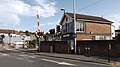
 DSCF0942 Wokingham signal box and level crossing.jpg 3,072 × 1,728; 1.4 MB
-
 DSCF0944 Wokingham signal box and level crossing.jpg 3,072 × 1,728; 1.36 MB
-
 Hamstead Crossing - geograph.org.uk - 5677206.jpg 3,763 × 2,259; 2.29 MB
-
 Hungerford - Level Crossing - geograph.org.uk - 831245.jpg 640 × 480; 89 KB
-
 Hungerford Level Crossing - FGW 43091.jpg 1,024 × 768; 265 KB
-
 Hungerford level crossing.jpg 4,128 × 3,096; 6.38 MB
-
 Hungerford station 01.jpg 4,128 × 3,096; 5.41 MB
-
 Kintbury train station and level crossing 01.jpg 4,128 × 3,096; 6.83 MB
-
 Kintbury train station and level crossing 02.jpg 4,128 × 3,096; 9.19 MB
-
 Kintbury train station and level crossing 03.jpg 4,128 × 3,096; 8.53 MB
-
 Kintbury train station and level crossing 04.jpg 4,128 × 3,096; 7.7 MB
-
 Kintbury train station and level crossing 05.jpg 4,128 × 3,096; 8.09 MB
-
 Kintbury train station and level crossing 06.jpg 5,152 × 3,864; 6.9 MB
-
 Level crossing at Kintbury - geograph.org.uk - 3861427.jpg 1,500 × 991; 177 KB
-
 Level crossing at Marsh Benham - geograph.org.uk - 967951.jpg 640 × 426; 49 KB
-
 Level crossing at Midgham Station - geograph.org.uk - 2792270.jpg 800 × 600; 121 KB
-
 Level crossing on Easthampstead Road - geograph.org.uk - 1881282.jpg 1,500 × 1,084; 255 KB
-
 Level Crossing on the A30 - geograph.org.uk - 137451.jpg 640 × 480; 51 KB
-
 Level crossing on the Wraysbury to Horton path - geograph.org.uk - 5491272.jpg 5,202 × 3,465; 4.45 MB
-
 Level Crossing signage, Harrow Lane Furze Platt - geograph.org.uk - 3961022.jpg 1,024 × 768; 584 KB
-

-
 Level crossing, Station Rd - geograph.org.uk - 4755148.jpg 640 × 426; 90 KB
-
 Level crossing, Station Rd - geograph.org.uk - 4907675.jpg 640 × 426; 91 KB
-
 Level crossing, Sunningdale - geograph.org.uk - 3504215.jpg 2,048 × 1,536; 1.64 MB
-
 Level crossing, Woolhampton - geograph.org.uk - 4377379.jpg 640 × 480; 106 KB
-
 Pedestrian level crossing - geograph.org.uk - 5517333.jpg 640 × 427; 92 KB
-
 Star Lane level crossing, Easthampstead Road - geograph.org.uk - 4367503.jpg 1,024 × 683; 197 KB
-
 Star Lane level crossing, Easthampstead Road - geograph.org.uk - 4526542.jpg 2,304 × 1,728; 794 KB
-
 Sunningdale Station - geograph.org.uk - 4159930.jpg 640 × 480; 277 KB
-
 Thatcham - GWR 800028 Bedwyn service departing.JPG 1,366 × 1,024; 675 KB
-
 Thatcham - GWR 802114 Penzance train.JPG 1,366 × 820; 425 KB
-
 The level crossing in Sunningdale - geograph.org.uk - 1521982.jpg 640 × 427; 60 KB
-
 The level crossing in Sunningdale - geograph.org.uk - 1521988.jpg 640 × 427; 62 KB
-
 Ufton Nervet level crossing (2022).jpg 1,704 × 1,278; 564 KB
-
 Up to London - geograph.org.uk - 1521985.jpg 640 × 418; 84 KB
-
 Waterloo Crossing - geograph.org.uk - 3012743.jpg 640 × 427; 96 KB
-
 2017 at Wokingham station - level crossing footbridge.JPG 1,366 × 910; 286 KB
-
 Wokingham - fGWR 166201 Reigate service.JPG 1,366 × 910; 279 KB
-
 Wokingham - Waterloo Crossing - geograph.org.uk - 135124.jpg 640 × 480; 96 KB


.jpg)


