Category:Lenting
Jump to navigation
Jump to search
municipality of Germany .jpg)   | |||||
| Upload media | |||||
| Pronunciation audio | |||||
|---|---|---|---|---|---|
| Instance of |
| ||||
| Part of |
| ||||
| Location |
| ||||
| Head of government |
| ||||
| Population |
| ||||
| Area |
| ||||
| Elevation above sea level |
| ||||
| official website | |||||
 | |||||
Subcategories
This category has the following 2 subcategories, out of 2 total.
C
Media in category "Lenting"
The following 25 files are in this category, out of 25 total.
-
 DEU Lenting COA.svg 968 × 1,059; 131 KB
-
 Wappen von Lenting.png 261 × 281; 17 KB
-
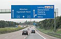 A 9 AS Lenting (2009).jpg 3,172 × 2,033; 1.37 MB
-
 Branches (179595163).jpeg 1,365 × 2,048; 909 KB
-
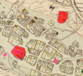 Burgstall Lenting.png 643 × 588; 822 KB
-
 DOP40 - Landkreis Eichstätt 32681 5409 (Bayerische Vermessungsverwaltung).tif 2,500 × 2,500; 14.47 MB
-
 GER Lenting Alte Landstraße 001.jpg 3,024 × 4,032; 3.26 MB
-
 GER Lenting Gänsberg 01.jpg 4,032 × 3,024; 3.32 MB
-
 GER Lenting Gänsberg 02.jpg 4,032 × 3,024; 3.61 MB
-
 GER Lenting Gänsberg 03.jpg 4,032 × 3,024; 3.76 MB
-
 GER Lenting Gänsberg 04.jpg 4,032 × 3,024; 3.6 MB
-
 GER Lenting Ingolstädter Straße 001.jpg 4,032 × 3,024; 3.1 MB
-
 GER Lenting Ingolstädter Straße 002.jpg 2,893 × 2,038; 280 KB
-
 GER Lenting Kapellenweg 001.jpg 4,032 × 3,024; 442 KB
-
 GER Lenting Mailinger Weg 01.jpg 4,032 × 3,024; 3.26 MB
-
 GER Lenting Rathausplatz 001.jpg 512 × 384; 114 KB
-
 Lenting - Lage im Landkreis.png 281 × 185; 31 KB
-
 Lenting 00622 B.jpg 2,592 × 1,728; 1.6 MB
-
 Lenting 00622 B2.jpg 1,600 × 1,067; 479 KB
-
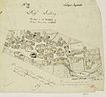 Lenting 1813 L39 a.jpg 1,247 × 1,142; 419 KB
-
 Lenting 1813 L39.jpg 2,500 × 2,504; 352 KB
-
 Lenting EI 001.jpg 4,000 × 6,000; 5.15 MB
-
 Lenting EI 006.jpg 6,000 × 4,000; 7.72 MB
-
 Lenting EI 007.jpg 6,000 × 4,000; 6.97 MB
-
 Lenting in EI.svg 804 × 580; 1.12 MB

.jpeg)


