Category:Leigh, Kent
Jump to navigation
Jump to search
English: Leigh is a village and a civil parish located in the borough of Sevenoaks, Kent, England. It is located six miles (10 km) south of Sevenoaks town and three miles (5 km) west of Tonbridge. Although it derives its name from the same source as Lea, it is "lye".
Norsk bokmål: Leigh er en landsby og et verdslig sogn i Kent i England. Den ligger omkring ti km sør for Sevenoaks og fem km vest for Tonbridge. Navnet kommer fra samme rot som lea, men uttales som lie .
village and civil parish in Kent, UK  | |||||
| Upload media | |||||
| Instance of | |||||
|---|---|---|---|---|---|
| Location | Sevenoaks, Kent, South East England, England | ||||
| Population |
| ||||
| Area |
| ||||
| Elevation above sea level |
| ||||
 | |||||
Subcategories
This category has the following 4 subcategories, out of 4 total.
Media in category "Leigh, Kent"
The following 200 files are in this category, out of 1,878 total.
(previous page) (next page)-
 1-3 Cinder Hill Cottages - geograph.org.uk - 5292558.jpg 4,000 × 3,000; 3.66 MB
-
 1-3, Cinder Hill Cottages - geograph.org.uk - 5292557.jpg 4,000 × 3,000; 3.1 MB
-
 A carpet of bluebells in Covert Wood - geograph.org.uk - 4446405.jpg 4,000 × 3,000; 3.81 MB
-
 A couple of retail units entering Leigh - geograph.org.uk - 1537632.jpg 640 × 430; 124 KB
-
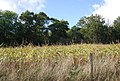
 A field of maize - geograph.org.uk - 1027984.jpg 640 × 430; 103 KB
-
 A field of Maize - geograph.org.uk - 2035274.jpg 640 × 430; 157 KB
-
 A field of Maize - geograph.org.uk - 2035283.jpg 640 × 430; 143 KB
-
 A field of Maize near Home Covert Wood - geograph.org.uk - 1535295.jpg 640 × 430; 180 KB
-
 A green scummy pond - geograph.org.uk - 4178721.jpg 640 × 430; 127 KB
-
 A herd of cattle - geograph.org.uk - 4217404.jpg 640 × 430; 97 KB
-
 A large field of wheat north of Charcott - geograph.org.uk - 1950554.jpg 640 × 430; 123 KB
-
 A large field of wheat north of Charcott - geograph.org.uk - 1950569.jpg 640 × 430; 112 KB
-
 A lightning tree - geograph.org.uk - 4645533.jpg 426 × 640; 73 KB
-
 A lonesome cow^ - geograph.org.uk - 4204809.jpg 640 × 430; 62 KB
-
 A mighty Oak - geograph.org.uk - 4645566.jpg 426 × 640; 146 KB
-
 A path through the bluebells in Covert Wood - geograph.org.uk - 4448327.jpg 4,000 × 3,000; 4.16 MB
-
 A rutted track - geograph.org.uk - 4178789.jpg 640 × 430; 123 KB
-
 A sea of bluebells in Covert Wood - geograph.org.uk - 4448334.jpg 4,000 × 3,000; 4.23 MB
-
 A single tree - geograph.org.uk - 5216036.jpg 640 × 426; 62 KB
-
 A single tree - geograph.org.uk - 5216041.jpg 640 × 426; 72 KB
-
 A single tree in the Kent countryside - geograph.org.uk - 2047083.jpg 640 × 430; 138 KB
-
 A small pond - geograph.org.uk - 4711081.jpg 640 × 426; 153 KB
-
 A small tributary of the River Eden - geograph.org.uk - 4178945.jpg 640 × 430; 115 KB
-
 A stand of Conifers. - geograph.org.uk - 1029151.jpg 640 × 430; 99 KB
-
 A very muddy footpath. - geograph.org.uk - 1027963.jpg 640 × 430; 116 KB
-

-
 A wet Copping's Road - geograph.org.uk - 2748361.jpg 640 × 428; 146 KB
-
 A wet Eggpie Lane - geograph.org.uk - 2748428.jpg 640 × 428; 168 KB
-
 A wooded pond - geograph.org.uk - 4178782.jpg 640 × 430; 133 KB
-
 A young crop - geograph.org.uk - 4233701.jpg 640 × 430; 105 KB
-
 A young crop - geograph.org.uk - 4234021.jpg 640 × 430; 92 KB
-
 A young crop, Penshurst Park - geograph.org.uk - 4233706.jpg 640 × 430; 96 KB
-
 A21 - parking 1-2 mile - geograph.org.uk - 2725095.jpg 640 × 428; 66 KB
-
 A21 northbound - geograph.org.uk - 3485156.jpg 2,049 × 1,210; 1.16 MB
-
 A21 Northbound - geograph.org.uk - 4310697.jpg 640 × 480; 55 KB
-
 A21, footbridge - geograph.org.uk - 2035016.jpg 640 × 430; 67 KB
-
 A21, northbound - geograph.org.uk - 4505844.jpg 640 × 449; 50 KB
-
 A21, southbound - geograph.org.uk - 2035023.jpg 640 × 430; 127 KB
-
 A21, southbound - geograph.org.uk - 5115050.jpg 640 × 527; 71 KB
-
 A21, southbound - geograph.org.uk - 5719469.jpg 640 × 426; 51 KB
-
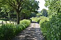
 Access track to Penshurst Road - geograph.org.uk - 1700081.jpg 2,580 × 1,932; 2.78 MB
-
 Alcove in Penshurst Road - geograph.org.uk - 2979597.jpg 480 × 640; 108 KB
-
 Almshouses, Leigh - geograph.org.uk - 1537767.jpg 640 × 380; 84 KB
-
 Along the edge of Redleaf Wood - geograph.org.uk - 4243940.jpg 640 × 430; 73 KB
-
 An ancient Chestnut tree, Penshurst Park - geograph.org.uk - 4623897.jpg 426 × 640; 141 KB
-
 An ancient Chestnut tree, Penshurst Park - geograph.org.uk - 4623906.jpg 426 × 640; 140 KB
-
 An ancient Chestnut tree, Penshurst Park - geograph.org.uk - 4623908.jpg 426 × 640; 117 KB
-
 An ancient Oak - geograph.org.uk - 4645567.jpg 426 × 640; 115 KB
-
 An ancient Oak - geograph.org.uk - 4645574.jpg 426 × 640; 124 KB
-
 An ancient Oak - geograph.org.uk - 4688718.jpg 426 × 640; 143 KB
-
 An ancient Oak, Penshurst Park - geograph.org.uk - 5215864.jpg 426 × 640; 120 KB
-
 An avenue of trees - geograph.org.uk - 4711083.jpg 640 × 426; 127 KB
-
 An isolated tree - geograph.org.uk - 4233222.jpg 640 × 430; 78 KB
-
 An isolated tree in the Kent countryside - geograph.org.uk - 2047077.jpg 640 × 430; 126 KB
-
 An odd shed, Wickhurst Farm - geograph.org.uk - 2035656.jpg 640 × 430; 139 KB
-
 An old Chestnut tree - geograph.org.uk - 4645528.jpg 426 × 640; 128 KB
-
 An old Chestnut tree - geograph.org.uk - 4645531.jpg 426 × 640; 137 KB
-
 An overgrown ride - geograph.org.uk - 4623911.jpg 640 × 426; 103 KB
-
 Ancient Oak - geograph.org.uk - 5185563.jpg 426 × 640; 144 KB
-
 Ancient Oak - geograph.org.uk - 5185583.jpg 426 × 640; 92 KB
-
 Ancient tree on The Green at Leigh - geograph.org.uk - 3180173.jpg 4,000 × 3,000; 4.35 MB
-
 Approach to the Barrier - geograph.org.uk - 3996144.jpg 800 × 513; 107 KB
-

-

-
 Approaching Charcott - geograph.org.uk - 4204850.jpg 640 × 430; 83 KB
-
 Approaching Ensfield Bridge - geograph.org.uk - 4697466.jpg 2,304 × 1,728; 849 KB
-
 Approaching Killick's Bank - geograph.org.uk - 2096674.jpg 2,816 × 2,112; 2.03 MB
-

-

-

-

-

-

-
 Archery in the woods - geograph.org.uk - 5162400.jpg 640 × 426; 111 KB
-
 Archery targets - geograph.org.uk - 4645584.jpg 640 × 426; 102 KB
-
 Archway, Hall Place - geograph.org.uk - 4189378.jpg 640 × 430; 108 KB
-
 Ashpit Plantation - geograph.org.uk - 1535373.jpg 640 × 430; 115 KB
-
 Avenue of trees - geograph.org.uk - 4233377.jpg 640 × 430; 123 KB
-
 Avenue of trees - geograph.org.uk - 4623876.jpg 640 × 426; 107 KB
-
 Avenue of trees on the Penshurst Estate - geograph.org.uk - 6075521.jpg 4,000 × 3,000; 4.94 MB
-
 Avenue of trees, Penshurst Park - geograph.org.uk - 4664489.jpg 640 × 426; 111 KB
-
 Avenue of trees, Penshurst Park - geograph.org.uk - 4664491.jpg 640 × 426; 98 KB
-
 Avenue of trees, Penshurst Park - geograph.org.uk - 4711076.jpg 640 × 426; 104 KB
-
 Avenue of trees, Penshurst Park - geograph.org.uk - 4711078.jpg 640 × 426; 100 KB
-
 Avenue towards Penhurst Park - geograph.org.uk - 1545863.jpg 640 × 427; 120 KB
-
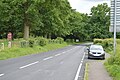
 B2027 - geograph.org.uk - 4209410.jpg 640 × 430; 78 KB
-
 B2027 - geograph.org.uk - 4681324.jpg 640 × 426; 64 KB
-
 B2027 - geograph.org.uk - 4681328.jpg 640 × 426; 69 KB
-
 B2027 - geograph.org.uk - 5197139.jpg 640 × 426; 93 KB
-
 B2027 - geograph.org.uk - 5197165.jpg 640 × 426; 96 KB
-
 B2027 - geograph.org.uk - 5197169.jpg 640 × 426; 81 KB
-
 B2027 - geograph.org.uk - 5197174.jpg 640 × 426; 102 KB
-
 B2027 - geograph.org.uk - 5223254.jpg 640 × 426; 86 KB
-
 B2027 along Price's Wood - geograph.org.uk - 4320751.jpg 800 × 558; 180 KB
-
 B2027 in Blackhoath Wood - geograph.org.uk - 4681411.jpg 640 × 426; 102 KB
-

-

-
 B2027, Blackhoath Wood - geograph.org.uk - 4209440.jpg 640 × 430; 106 KB
-
 B2027, eastbound - geograph.org.uk - 4209429.jpg 640 × 430; 72 KB
-
 B2027, eastbound - geograph.org.uk - 4209438.jpg 640 × 430; 101 KB
-
 B2027, entering Leigh - geograph.org.uk - 1537519.jpg 640 × 440; 153 KB
-
 B2027, Leigh - geograph.org.uk - 4658594.jpg 640 × 426; 83 KB
-
 B2027, Leigh - geograph.org.uk - 4664230.jpg 640 × 426; 74 KB
-
 B2027, Penshurst Rd - geograph.org.uk - 4652444.jpg 640 × 426; 72 KB
-
 B2176 - geograph.org.uk - 4268774.jpg 640 × 430; 91 KB
-
 B2176 - geograph.org.uk - 4709973.jpg 640 × 426; 98 KB
-
 B2176 at Moorden - geograph.org.uk - 4672469.jpg 640 × 426; 107 KB
-
 B2176 at Moorden - geograph.org.uk - 4672470.jpg 640 × 426; 86 KB
-
 B2176, B2027 junction - geograph.org.uk - 4209405.jpg 640 × 430; 79 KB
-
 B2176, B2927 junction - geograph.org.uk - 5223253.jpg 640 × 426; 90 KB
-
 B2176, north - geograph.org.uk - 4672496.jpg 640 × 426; 87 KB
-
 Bales of hay - geograph.org.uk - 3143981.jpg 4,000 × 3,000; 3.96 MB
-
 Baling at Killick's Bank - geograph.org.uk - 3091676.jpg 640 × 427; 78 KB
-
 Baling at Killick's Bank - geograph.org.uk - 3091679.jpg 640 × 427; 89 KB
-
 Bare field - geograph.org.uk - 6004445.jpg 1,024 × 681; 223 KB
-
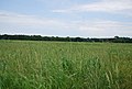
 Barley field - geograph.org.uk - 5220114.jpg 640 × 387; 55 KB
-
 Barn at Moorden - geograph.org.uk - 4243954.jpg 640 × 430; 62 KB
-
 Barn at Wickhurst Farm - geograph.org.uk - 6157504.jpg 4,000 × 3,000; 4.14 MB
-
 Barn at Wickhurst Farm - geograph.org.uk - 6157505.jpg 5,184 × 3,456; 2.06 MB
-
 Barn conversion, Moorden - geograph.org.uk - 4672468.jpg 640 × 403; 83 KB
-
 Barn, Cinder Hill Farm - geograph.org.uk - 4652277.jpg 640 × 426; 80 KB
-
 Barn, Cinder Hill Farm - geograph.org.uk - 5224896.jpg 640 × 426; 97 KB
-
 Barn, Moorden Farm - geograph.org.uk - 4672497.jpg 640 × 387; 68 KB
-
 Barn, Price's Farm - geograph.org.uk - 5216034.jpg 640 × 426; 77 KB
-
 Barn, Sevton Farm, Powder Mills - geograph.org.uk - 1952563.jpg 640 × 430; 100 KB
-
 Barnett's Wood Picnic Area - geograph.org.uk - 5643081.jpg 640 × 440; 77 KB
-
 Barnett's Wood, Picnic Site - geograph.org.uk - 3115391.jpg 3,264 × 2,448; 1.86 MB
-
 Barnetts Road, Leigh - geograph.org.uk - 4997584.jpg 3,264 × 2,448; 1.86 MB
-
 Barnetts Wood amenity area, A21 - geograph.org.uk - 3834577.jpg 1,600 × 1,064; 650 KB
-
 Barns, Leigh Park Farm - geograph.org.uk - 1537270.jpg 640 × 430; 140 KB
-
 Barns, Leigh Park Farm - geograph.org.uk - 1537303.jpg 640 × 396; 98 KB
-
 Barns, Leigh Park Farm - geograph.org.uk - 5216053.jpg 640 × 426; 51 KB
-
 Barns, Sevton Farm, Powder Mills - geograph.org.uk - 1391816.jpg 640 × 430; 141 KB
-
 Barrier, Ensfield Rd - geograph.org.uk - 1526123.jpg 640 × 430; 152 KB
-
 Bat and Ball, Leigh - geograph.org.uk - 4189089.jpg 640 × 430; 72 KB
-
 Bat ^ Ball public house, Leigh - geograph.org.uk - 2093848.jpg 2,048 × 1,536; 1.11 MB
-
 Bat ^ Ball, Leigh - geograph.org.uk - 4997613.jpg 3,264 × 2,448; 1.72 MB
-

-
 Bend, B2027 - geograph.org.uk - 4681409.jpg 640 × 426; 123 KB
-
 Bend, Cinder Hill Lane - geograph.org.uk - 5224895.jpg 640 × 426; 99 KB
-
-
 Big house by the B2176 - geograph.org.uk - 4243964.jpg 640 × 430; 80 KB
-
 Big tree, little tree - geograph.org.uk - 4645573.jpg 426 × 640; 112 KB
-
 Blackhoath Wood - geograph.org.uk - 4209459.jpg 640 × 430; 124 KB
-
 Blackhoath Wood - geograph.org.uk - 4209460.jpg 640 × 430; 133 KB
-
 Blackhoath Wood - geograph.org.uk - 4681414.jpg 640 × 426; 130 KB
-
 Blackhoath Wood - geograph.org.uk - 4681415.jpg 640 × 426; 123 KB
-
 Bluebells and wood anemones in Redleaf Wood - geograph.org.uk - 3941036.jpg 4,000 × 3,000; 4.19 MB
-
 Bluebells in Covert Wood - geograph.org.uk - 4448330.jpg 4,000 × 3,000; 4.26 MB
-
 Bluebells in Covert Wood - geograph.org.uk - 4448338.jpg 4,000 × 3,000; 4.26 MB
-
 Bluebells in Home Covert - geograph.org.uk - 5750296.jpg 4,000 × 3,000; 4.54 MB
-
 Bluebells in Home Covert - geograph.org.uk - 5750300.jpg 4,000 × 3,000; 4.8 MB
-
 Bluebells in Home Covert - geograph.org.uk - 5750304.jpg 4,000 × 3,000; 4.85 MB
-
 Bluebells in Home Covert - geograph.org.uk - 5750308.jpg 4,000 × 3,000; 4.77 MB
-
 Bluebells in Home Covert - geograph.org.uk - 5750313.jpg 4,000 × 3,000; 4.67 MB
-
 Bluebells in Home Covert - geograph.org.uk - 5750315.jpg 4,000 × 3,000; 4.82 MB
-
 Bluebells in Home Covert near Leigh - geograph.org.uk - 5750316.jpg 4,000 × 3,000; 4.87 MB
-
 Bluebells in Penshurst Park - geograph.org.uk - 3487545.jpg 4,000 × 3,000; 4.33 MB
-
 Bluebells in Penshurst Park - geograph.org.uk - 3497447.jpg 4,000 × 3,000; 4.23 MB
-
 Bluebells near the path to Chiddingstone - geograph.org.uk - 3941095.jpg 4,000 × 3,000; 4.22 MB
-
 Bluebells through an archway - geograph.org.uk - 5750303.jpg 4,000 × 3,000; 4.94 MB
-
 Boathouse, Hall Place Park, Leigh - geograph.org.uk - 1537610.jpg 640 × 350; 88 KB
-
 Boundary wall to Hall Place - geograph.org.uk - 4217371.jpg 640 × 430; 100 KB
-
 Bracken - geograph.org.uk - 4645535.jpg 426 × 640; 133 KB
-
 Bracken - geograph.org.uk - 4645577.jpg 640 × 426; 112 KB
-
 Bracken and conifers - geograph.org.uk - 4623891.jpg 640 × 426; 108 KB
-
 Bracken and woodland - geograph.org.uk - 5185592.jpg 640 × 426; 119 KB
-
 Bracken below trees - geograph.org.uk - 4645583.jpg 640 × 426; 116 KB
-
 Bracken, bushes and trees - geograph.org.uk - 4233379.jpg 640 × 430; 167 KB
-
 Bracken, Ingleby Toll - geograph.org.uk - 4233373.jpg 640 × 430; 127 KB
-
 Brampton House, Scabharbour Rd - geograph.org.uk - 1536557.jpg 640 × 430; 174 KB
-
 Bridge at Hall Place lake - geograph.org.uk - 4971752.jpg 4,000 × 4,000; 7.1 MB
-
 Bridge at Hall Place lake - geograph.org.uk - 4971938.jpg 4,500 × 3,000; 7.7 MB
-
 Bridge at Hall Place lake - geograph.org.uk - 4971941.jpg 4,775 × 3,183; 7.44 MB
-
 Bridge at Hall Place lake - geograph.org.uk - 4971943.jpg 5,000 × 3,333; 7.76 MB
-
 Bridge over A21 - geograph.org.uk - 2725105.jpg 640 × 428; 63 KB
-

-
 Bridleway to Ashour Farm - geograph.org.uk - 4724756.jpg 640 × 426; 69 KB
-
 Bridleway to Haysden - geograph.org.uk - 2047127.jpg 640 × 430; 189 KB
-
 Bridleway, south - geograph.org.uk - 4724275.jpg 640 × 426; 117 KB
-
 Bridleway, Tapners Wood - geograph.org.uk - 4724303.jpg 640 × 426; 105 KB
-
 British Legion Hall - geograph.org.uk - 4188990.jpg 640 × 446; 75 KB
-
 British Legion Hall - geograph.org.uk - 4189003.jpg 640 × 466; 87 KB
-
 British Legion Hall - geograph.org.uk - 4658035.jpg 640 × 426; 76 KB
-
 British Legion Hall - geograph.org.uk - 5193721.jpg 426 × 640; 76 KB
-
 British Legion Hall - geograph.org.uk - 5197113.jpg 640 × 426; 80 KB
-
 Broad footpath, Penshurst Park - geograph.org.uk - 4233376.jpg 640 × 430; 107 KB
-
 Building site just below the church - geograph.org.uk - 2979656.jpg 640 × 480; 71 KB
-
 Building, Park Farm - geograph.org.uk - 4633702.jpg 640 × 426; 107 KB
-
 Bunker in field - geograph.org.uk - 4681310.jpg 640 × 426; 64 KB
-
 Bunker in field - geograph.org.uk - 4681319.jpg 640 × 426; 63 KB
-
 Bunting on a cottage in Lower Green - geograph.org.uk - 2979607.jpg 640 × 480; 60 KB
-
 Bus shelter at Leigh - geograph.org.uk - 2979661.jpg 640 × 459; 61 KB
-

-
 Bus Stop, Leigh - geograph.org.uk - 1537777.jpg 640 × 430; 137 KB
-
 Bushes, Ingleby Toll - geograph.org.uk - 4233374.jpg 640 × 430; 142 KB
-
 Bushes, Penshurst Park - geograph.org.uk - 4271829.jpg 640 × 430; 88 KB
-
 Buttercup meadow - geograph.org.uk - 5224875.jpg 640 × 426; 82 KB
-
 Buttercup meadow in the Eden Valley - geograph.org.uk - 4244000.jpg 640 × 430; 77 KB
-
 Buttercups and grass - geograph.org.uk - 5216410.jpg 640 × 426; 113 KB


