Category:Leathley
Jump to navigation
Jump to search
village and civil parish in the Harrogate district of North Yorkshire, England, UK  | |||||
| Upload media | |||||
| Instance of | |||||
|---|---|---|---|---|---|
| Location | Harrogate, North Yorkshire, Yorkshire and the Humber, England | ||||
| Said to be the same as | Leathley (Wikimedia duplicated page, civil parish) | ||||
 | |||||
English: Leathley is a village and civil parish in the Harrogate district of North Yorkshire, England. It is near the border with West Yorkshire and the River Wharfe, 1 mile north east of Otley.
Subcategories
This category has the following 4 subcategories, out of 4 total.
Media in category "Leathley"
The following 200 files are in this category, out of 271 total.
(previous page) (next page)-
 A cluttered farmyard - geograph.org.uk - 249491.jpg 640 × 480; 86 KB
-
 A public footpath at Pool Bridge - geograph.org.uk - 2549823.jpg 800 × 600; 205 KB
-
 A658 towards Harrogate - geograph.org.uk - 5987515.jpg 640 × 480; 52 KB
-
 Animal feeder - geograph.org.uk - 4943717.jpg 640 × 426; 121 KB
-
 Ashfield Farm - geograph.org.uk - 5373298.jpg 3,002 × 1,695; 781 KB
-
 Awkward stile, Leathley Park - geograph.org.uk - 5373639.jpg 2,710 × 1,537; 789 KB
-
 Awkward stile, Leathley Park - geograph.org.uk - 5373678.jpg 3,072 × 2,048; 1.1 MB
-
 Awkward stile, Leathley Park - geograph.org.uk - 5373689.jpg 1,897 × 2,070; 1.09 MB
-
 B6161 - geograph.org.uk - 4932337.jpg 640 × 426; 58 KB
-
 B6161 - geograph.org.uk - 4932339.jpg 640 × 426; 63 KB
-
 B6161 at Leathley village boundary - geograph.org.uk - 5365193.jpg 640 × 480; 54 KB
-
 B6161 near River View Farm - geograph.org.uk - 5365186.jpg 640 × 480; 38 KB
-
 B6161 northbound near Fishpool Farm - geograph.org.uk - 5365201.jpg 640 × 480; 48 KB
-
 B6161, Leathley - geograph.org.uk - 1888243.jpg 1,024 × 683; 167 KB
-
 Bank Erosion, Riffa Beck - geograph.org.uk - 1756287.jpg 683 × 1,024; 229 KB
-
 Barn (3929280952).jpg 2,449 × 1,861; 4.54 MB
-

-

-
 Barn, River View Farm - geograph.org.uk - 5373320.jpg 3,072 × 2,048; 1.14 MB
-
 Bench Marked Milestone, Leathley - geograph.org.uk - 1888284.jpg 1,024 × 683; 230 KB
-
 Beside the B6161 - geograph.org.uk - 5373358.jpg 3,072 × 2,048; 1.32 MB
-

-
 Bolt Bench Mark (close-up) - geograph.org.uk - 1888387.jpg 1,024 × 683; 207 KB
-
 Bolt Bench Mark, Pool Bridge - geograph.org.uk - 3456747.jpg 1,024 × 682; 219 KB
-
 Broken stile into Riffa Wood, Leathley - geograph.org.uk - 6206629.jpg 2,000 × 1,500; 1.11 MB
-
 Byway open to all traffic - geograph.org.uk - 4936820.jpg 640 × 426; 90 KB
-
 Carved stone - geograph.org.uk - 2332641.jpg 3,072 × 2,304; 1.4 MB
-
 Carved Stone in Riffa Wood - geograph.org.uk - 1756275.jpg 1,024 × 683; 198 KB
-
 Castley Lane - geograph.org.uk - 4932290.jpg 640 × 426; 63 KB
-
 Castley Lane - geograph.org.uk - 5987469.jpg 5,184 × 3,888; 4.17 MB
-
 Castley Lane crossing Riffa Beck - geograph.org.uk - 5790737.jpg 4,000 × 3,000; 4.15 MB
-
 Cattle feeder - geograph.org.uk - 4933308.jpg 640 × 426; 58 KB
-
 Close up, Elizabeth II postbox on Castley Lane - geograph.org.uk - 5987468.jpg 2,104 × 3,948; 2.17 MB
-
 Close up, Elizabeth II postbox, Leathley - geograph.org.uk - 5987490.jpg 2,382 × 4,930; 2.45 MB
-
 Cottages on Leathley Lane, Leathley - geograph.org.uk - 5986496.jpg 640 × 420; 65 KB
-
 Crossing a field to Riffa Beck - geograph.org.uk - 4936824.jpg 640 × 426; 71 KB
-
 Cut Bench Mark (close-up) - geograph.org.uk - 1888201.jpg 1,024 × 683; 181 KB
-
 Cut Bench Mark (close-up) - geograph.org.uk - 1888248.jpg 683 × 1,024; 170 KB
-
 Cut Bench Mark (close-up) - geograph.org.uk - 1888290.jpg 683 × 1,024; 179 KB
-
 Cut Bench Mark (close-up) - geograph.org.uk - 1888435.jpg 683 × 1,024; 203 KB
-
 Cut Bench Mark, The Mill House - geograph.org.uk - 1888192.jpg 1,024 × 683; 236 KB
-
 Cyclists on Castley Lane - geograph.org.uk - 5987522.jpg 640 × 482; 42 KB
-
 Damp patch on a footpath in Riffa Wood, Leathley - geograph.org.uk - 6206261.jpg 2,000 × 1,500; 1 MB
-

-
 Double stile, Leathley Park - geograph.org.uk - 5373737.jpg 2,048 × 3,072; 1.29 MB
-
 Elizabeth II postbox and phonebox, Leathley - geograph.org.uk - 5987489.jpg 5,184 × 3,888; 5.42 MB
-
 Elizabeth II postbox on Castley Lane - geograph.org.uk - 5987467.jpg 4,301 × 3,176; 4.49 MB
-
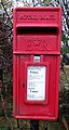
 Elizabeth II Postbox, Leathley - geograph.org.uk - 1426417.jpg 683 × 1,024; 158 KB
-
 End pier, Pool Bridge - geograph.org.uk - 5373265.jpg 2,048 × 3,072; 1.07 MB
-
 Entering Leathley - geograph.org.uk - 2898076.jpg 4,320 × 3,240; 3.47 MB
-
 Entering Leathley on Leathley Lane - geograph.org.uk - 2549798.jpg 800 × 600; 285 KB
-
 Entering North Yorkshire, A658 - geograph.org.uk - 4932325.jpg 640 × 426; 76 KB
-
 Entrance to Hilltop Farm - geograph.org.uk - 2899149.jpg 4,320 × 3,240; 2.82 MB
-
 Entrance to Riffa Business Park, Castley - geograph.org.uk - 6206285.jpg 2,000 × 1,289; 749 KB
-
 Extension of Leafield Lane towards Riffa Wood - geograph.org.uk - 3214112.jpg 2,048 × 1,536; 506 KB
-
 Fallen tree on a footpath in Riffa Wood, Leathley - geograph.org.uk - 6206266.jpg 2,000 × 1,500; 1.4 MB
-
 Farm Machinery off Stainburn Lane - geograph.org.uk - 2899004.jpg 1,600 × 1,200; 554 KB
-
 Farmland by Riffa Lane - geograph.org.uk - 4943689.jpg 640 × 426; 76 KB
-
 Farmland in Wharfedale - geograph.org.uk - 4921877.jpg 640 × 426; 41 KB
-
 Farmland in Wharfedale - geograph.org.uk - 4932281.jpg 640 × 426; 48 KB
-
 Farmland in Wharfedale - geograph.org.uk - 4932285.jpg 640 × 426; 43 KB
-
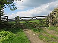
 Fence and gate, Crosby Close - geograph.org.uk - 5373421.jpg 2,048 × 3,072; 1.33 MB
-
 Field boundary, Hugman Bank - geograph.org.uk - 5373423.jpg 3,072 × 2,048; 1.42 MB
-
 Field boundary, Leathley Park - geograph.org.uk - 5373714.jpg 3,072 × 2,048; 1.55 MB
-
 Field boundary, Leathley Park - geograph.org.uk - 5373731.jpg 3,072 × 2,048; 1.35 MB
-
 Field in Wharfedale - geograph.org.uk - 4933245.jpg 640 × 426; 81 KB
-
 Field off Castley Lane - geograph.org.uk - 3561660.jpg 1,024 × 682; 227 KB
-
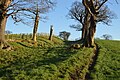
 Five trees in a line - geograph.org.uk - 4936783.jpg 640 × 426; 63 KB
-
 Flock of Geese in Wharfedale - geograph.org.uk - 4933241.jpg 640 × 426; 75 KB
-
 Flooded Fields - geograph.org.uk - 4789855.jpg 640 × 430; 48 KB
-
 Flooded fields - geograph.org.uk - 4932289.jpg 640 × 393; 47 KB
-
 Flooding in Wharfedale - geograph.org.uk - 4936772.jpg 640 × 426; 60 KB
-
 Flooding, Wharfedale - geograph.org.uk - 4933294.jpg 640 × 426; 66 KB
-
 Floodplain, River Wharfe - geograph.org.uk - 4933251.jpg 640 × 426; 82 KB
-
 Footbridge over the River Washburn - geograph.org.uk - 2899197.jpg 4,320 × 3,240; 4.86 MB
-
 Footpath along fence line - geograph.org.uk - 4936469.jpg 640 × 426; 77 KB
-
 Footpath at Hall Lane - geograph.org.uk - 5373594.jpg 2,570 × 1,742; 1.12 MB
-
 Footpath crossing Riffa Beck - geograph.org.uk - 3214121.jpg 2,048 × 1,536; 536 KB
-
 Footpath entering field through a gate from Scale Hill - geograph.org.uk - 5758375.jpg 4,000 × 3,000; 3.14 MB
-
 Footpath gate into Riffa Wood, Leathley - geograph.org.uk - 6206632.jpg 2,000 × 1,500; 1.19 MB
-
 Footpath off Leathley Lane - geograph.org.uk - 5987506.jpg 640 × 480; 53 KB
-
 Footpath on the driveway to Riffa Manor, Leathley - geograph.org.uk - 6206281.jpg 2,000 × 1,499; 813 KB
-
 Footpath out of Wharfedale - geograph.org.uk - 4933319.jpg 640 × 426; 104 KB
-

-
 Footpath to Riffa Farm - geograph.org.uk - 4936780.jpg 640 × 426; 98 KB
-
 Footpath towards Riffa Wood - geograph.org.uk - 3214115.jpg 2,048 × 1,536; 543 KB
-
 Footpath, Crosby Close - geograph.org.uk - 5373347.jpg 3,068 × 1,911; 1.33 MB
-
 Frost, River View Farm - geograph.org.uk - 5373289.jpg 3,059 × 1,830; 1.06 MB
-
 Frosted birch near Leathley Park - geograph.org.uk - 5241243.jpg 2,030 × 2,501; 1.37 MB
-
 Frosty field and path, Wharfe flood plain - geograph.org.uk - 5373250.jpg 2,875 × 1,179; 539 KB
-
 Frosty fields near Ashfield Farm - geograph.org.uk - 5373344.jpg 3,072 × 2,048; 1.1 MB
-
 Frosty hill by Stainburn Lane - geograph.org.uk - 5374454.jpg 3,072 × 2,048; 1.4 MB
-
 Gate, Riffa Lane - geograph.org.uk - 4943685.jpg 640 × 426; 134 KB
-
 Gate, Riffa Lane - geograph.org.uk - 4943732.jpg 640 × 426; 115 KB
-
 Gateway, Hugman Bank - geograph.org.uk - 5373427.jpg 3,072 × 2,048; 1.45 MB
-
 Glebe Farm - geograph.org.uk - 1888428.jpg 1,024 × 683; 155 KB
-
 Glebe Farm - geograph.org.uk - 5373917.jpg 2,864 × 1,731; 993 KB
-
 Grassy field - geograph.org.uk - 4936485.jpg 640 × 426; 77 KB
-
 Grazing cattle - geograph.org.uk - 5850785.jpg 1,500 × 832; 925 KB
-
 Grazing land - geograph.org.uk - 4933314.jpg 640 × 426; 50 KB
-
 Grazing land, Wharfedale - geograph.org.uk - 4932322.jpg 640 × 426; 50 KB
-
 Grazing, Crosby Close - geograph.org.uk - 5987513.jpg 640 × 480; 57 KB
-
 Green Lane Heading towards Leathley - geograph.org.uk - 2898992.jpg 4,320 × 3,240; 5.04 MB
-
 Hall Lane - geograph.org.uk - 4936499.jpg 640 × 426; 124 KB
-
 Hall Lane - geograph.org.uk - 4936502.jpg 640 × 426; 129 KB
-
 Hall Lane - geograph.org.uk - 5241361.jpg 2,048 × 3,072; 1.35 MB
-
 Hall Lane - geograph.org.uk - 5241364.jpg 2,048 × 3,072; 1.21 MB
-
 Hall Lane, Leathley - geograph.org.uk - 1756319.jpg 1,024 × 683; 242 KB
-
 Hedge in Wharfedale - geograph.org.uk - 4932332.jpg 640 × 426; 52 KB
-
 Hilly cornfield, Leathley Moor - geograph.org.uk - 46077.jpg 640 × 480; 166 KB
-
 Hold Gills - geograph.org.uk - 4943703.jpg 640 × 426; 74 KB
-
 Hold Gills - geograph.org.uk - 4943721.jpg 640 × 426; 64 KB
-
 Hold Gills - geograph.org.uk - 4943743.jpg 640 × 426; 73 KB
-
 Hold Gills - geograph.org.uk - 4943757.jpg 640 × 426; 86 KB
-
 Hold Gills - geograph.org.uk - 5374487.jpg 3,072 × 2,048; 1.37 MB
-
 House on Leathley Lane, Fishpool - geograph.org.uk - 5986489.jpg 640 × 460; 61 KB
-
 Ice spike in bird bath.jpg 5,312 × 2,988; 3.78 MB
-
 Indistinct path - geograph.org.uk - 4932330.jpg 640 × 426; 55 KB
-
 Leafield - geograph.org.uk - 4936779.jpg 640 × 426; 56 KB
-
 Leafield - geograph.org.uk - 4936785.jpg 640 × 426; 53 KB
-
 Leafield Bank - geograph.org.uk - 4936767.jpg 640 × 426; 55 KB
-
 Leafield Lane - geograph.org.uk - 4936768.jpg 640 × 426; 114 KB
-
 Leafield Lane - geograph.org.uk - 4936771.jpg 640 × 426; 114 KB
-
 Leafield Lane - geograph.org.uk - 4936774.jpg 640 × 426; 112 KB
-
 Leafield Lane - geograph.org.uk - 4936819.jpg 640 × 426; 116 KB
-
 Leafield Lane at Leafield Bank, looking east - geograph.org.uk - 3214104.jpg 2,048 × 1,536; 601 KB
-
 Leafield Lane at Leafield Bank, looking southwest - geograph.org.uk - 3214099.jpg 2,048 × 1,536; 651 KB
-
 Leathley Bridge - geograph.org.uk - 1057929.jpg 640 × 480; 120 KB
-
 Leathley Bridge - geograph.org.uk - 1058474.jpg 518 × 640; 94 KB
-
 Leathley Bridge - geograph.org.uk - 3214070.jpg 2,048 × 1,536; 673 KB
-
 Leathley Bridge - geograph.org.uk - 46053.jpg 640 × 480; 263 KB
-
 Leathley Bridge spanning the River Washburn - geograph.org.uk - 4443475.jpg 4,291 × 3,075; 6.84 MB
-
 Leathley Hall - geograph.org.uk - 3214090.jpg 2,048 × 1,536; 613 KB
-
 Leathley Lane (B6161) - geograph.org.uk - 5986499.jpg 640 × 480; 71 KB
-
 Leathley Lane (B6161) - geograph.org.uk - 5986507.jpg 640 × 480; 64 KB
-
 Leathley Lane (B6161) - geograph.org.uk - 5987509.jpg 640 × 480; 46 KB
-

-
 Leathley Lane - geograph.org.uk - 5986488.jpg 640 × 480; 89 KB
-
 Leathley Lane, Fishpool - geograph.org.uk - 5986491.jpg 640 × 480; 95 KB
-
 Leathley Lodge - geograph.org.uk - 3214076.jpg 2,048 × 1,536; 658 KB
-
 Leathley near Otley - geograph.org.uk - 3265213.jpg 4,608 × 3,072; 1.26 MB
-
 Leathley near Otley - geograph.org.uk - 3265220.jpg 4,608 × 3,072; 1.47 MB
-
 Leathley near Otley - geograph.org.uk - 3265864.jpg 4,608 × 3,072; 1.41 MB
-
 Leathley Park - geograph.org.uk - 4936466.jpg 640 × 426; 58 KB
-
 Leathley Park - geograph.org.uk - 4936481.jpg 640 × 426; 72 KB
-
 Leathley Village Hall - geograph.org.uk - 5987491.jpg 5,184 × 3,888; 5.82 MB
-
 Localised flooding - geograph.org.uk - 4932335.jpg 640 × 426; 67 KB
-
 Localised flooding, Leathley Park - geograph.org.uk - 4936493.jpg 640 × 426; 83 KB
-
 Localised flooding, Wharfedale - geograph.org.uk - 4933263.jpg 640 × 426; 77 KB
-
 Localised flooding, Wharfedale - geograph.org.uk - 4933281.jpg 640 × 426; 78 KB
-
 Localised flooding, Wharfedale - geograph.org.uk - 4933290.jpg 640 × 426; 55 KB
-
 Localised flooding, Wharfedale - geograph.org.uk - 4933326.jpg 640 × 426; 74 KB
-
 Looking South from Leathley - geograph.org.uk - 1426426.jpg 1,024 × 683; 170 KB
-
 Looking Towards Barks Hill From Low End - geograph.org.uk - 5565040.jpg 1,024 × 683; 231 KB
-
 Looking West from Pool Bridge - geograph.org.uk - 3456752.jpg 1,024 × 682; 167 KB
-
 Low End Farm - geograph.org.uk - 764297.jpg 640 × 427; 67 KB
-
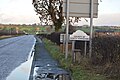
 Milepost - geograph.org.uk - 578904.jpg 640 × 611; 192 KB
-
 Milepost on Leathley Lane - geograph.org.uk - 3214086.jpg 2,048 × 1,536; 513 KB
-
 Muddy Riffa Lane - geograph.org.uk - 4943691.jpg 640 × 426; 139 KB
-
 North Field - geograph.org.uk - 4943700.jpg 640 × 426; 63 KB
-
 Old Milestone, on the A658, Riffa Farm (geograph 6734126).jpg 333 × 660; 43 KB
-
 Old Milestone, on the B6161, Leathley Lane (geograph 6734131).jpg 501 × 689; 74 KB
-
 On Leathley Bridge - geograph.org.uk - 2898070.jpg 4,320 × 3,240; 3 MB
-
 Pasture below Leafield Bank - geograph.org.uk - 5373546.jpg 3,056 × 1,799; 1.49 MB
-
 Pasture land - geograph.org.uk - 4943686.jpg 640 × 426; 67 KB
-
 Pasture on Scale Hill - geograph.org.uk - 2899166.jpg 4,320 × 3,240; 4.89 MB
-
 Pasture, Leathley Park - geograph.org.uk - 5373603.jpg 3,064 × 1,928; 1.35 MB
-
 Path approaching Ashfield Farm - geograph.org.uk - 5373281.jpg 3,060 × 1,674; 1.46 MB
-
 Path meeting Hall Lane - geograph.org.uk - 5373562.jpg 2,973 × 2,039; 1.35 MB
-
 Path near Hartmires - geograph.org.uk - 5373889.jpg 2,754 × 1,843; 1.3 MB
-
 Path to Leathley - geograph.org.uk - 5241264.jpg 2,836 × 1,992; 1.32 MB
-
 Pond by Riffa Farm, Leathley - geograph.org.uk - 3380957.jpg 3,456 × 2,304; 3.52 MB
-
 Pool Bridge - geograph.org.uk - 4932329.jpg 640 × 426; 57 KB
-
 Riffa Beck - geograph.org.uk - 4936830.jpg 640 × 426; 104 KB
-
 Riffa Beck - geograph.org.uk - 4936832.jpg 640 × 426; 111 KB
-
 Riffa Beck - geograph.org.uk - 4936833.jpg 640 × 426; 118 KB
-
 Riffa Beck - geograph.org.uk - 4943682.jpg 640 × 426; 111 KB
-
 Riffa Farm - geograph.org.uk - 129080.jpg 640 × 480; 112 KB
-
 Riffa Farm - geograph.org.uk - 4936773.jpg 640 × 426; 78 KB
-
 Riffa Farm - geograph.org.uk - 4936777.jpg 640 × 426; 50 KB
-
 Riffa Farm - geograph.org.uk - 4936784.jpg 640 × 426; 67 KB
-
 Riffa Lane - geograph.org.uk - 4943683.jpg 640 × 426; 104 KB
-
 Riffa Lane - geograph.org.uk - 4943692.jpg 640 × 426; 120 KB
-
 Riffa Lane - geograph.org.uk - 4943698.jpg 640 × 426; 115 KB
-
 Riffa Lane - geograph.org.uk - 4943723.jpg 640 × 426; 134 KB
-
 Riffa Lane - geograph.org.uk - 4943728.jpg 640 × 426; 107 KB
-
 Riffa Lane - geograph.org.uk - 4943730.jpg 640 × 426; 101 KB
-
 Riffa Wood - geograph.org.uk - 1756261.jpg 683 × 1,024; 270 KB
-
 Riffa Wood - geograph.org.uk - 4936822.jpg 640 × 426; 66 KB
-
 Riffa Wood - geograph.org.uk - 4936825.jpg 640 × 426; 70 KB
-
 Riffa Wood - geograph.org.uk - 4936827.jpg 640 × 426; 55 KB
-
 Riffa Wood - geograph.org.uk - 4936837.jpg 640 × 426; 58 KB
-
 River Washburn - geograph.org.uk - 1057940.jpg 480 × 640; 141 KB
-
 River Washburn at Leathley - geograph.org.uk - 46067.jpg 640 × 480; 273 KB
-
 River Washburn, Leathley - geograph.org.uk - 3265224.jpg 4,608 × 3,072; 1.77 MB
-
 River Wharfe - geograph.org.uk - 4932292.jpg 640 × 426; 43 KB
-
 River Wharfe - geograph.org.uk - 4932319.jpg 640 × 426; 67 KB
-
 River Wharfe at Pool Bridge - geograph.org.uk - 5241152.jpg 2,942 × 1,844; 1.23 MB
-
 River Wharfe at Pool Bridge - geograph.org.uk - 5373232.jpg 3,068 × 1,801; 987 KB
-
 Roots exposed, Riffa Beck - geograph.org.uk - 4936835.jpg 640 × 426; 119 KB


.jpg)


_-_geograph.org.uk_-_1888387.jpg)


_-_geograph.org.uk_-_1888201.jpg)
_-_geograph.org.uk_-_1888248.jpg)
_-_geograph.org.uk_-_1888290.jpg)
_-_geograph.org.uk_-_1888435.jpg)


_-_geograph.org.uk_-_5986499.jpg)
_-_geograph.org.uk_-_5986507.jpg)
_-_geograph.org.uk_-_5987509.jpg)
_approaching_junction_with_the_A658_-_geograph.org.uk_-_5987512.jpg)


.jpg)
.jpg)


