Category:Lawrencetown, County Down
Jump to navigation
Jump to search
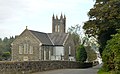
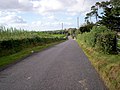
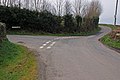
English: Lawrencetown or Laurencetown , is a small village in County Down, Northern Ireland. It is situated on the main route between Banbridge and Portadown. In the 2001 Census it had a population of 629 people. It resides in the Parish and townland of Tullylish.
village in County Down, Northern Ireland, UK | |||||
| Upload media | |||||
| Instance of | |||||
|---|---|---|---|---|---|
| Location | Northern Ireland | ||||
 | |||||
Subcategories
This category has only the following subcategory.
L
- Laurencetown railway station (5 F)
Media in category "Lawrencetown, County Down"
The following 25 files are in this category, out of 25 total.
-
 Fire hydrant marker, Laurencetown - geograph.org.uk - 3700962.jpg 591 × 479; 98 KB
-
 Hazelbank Mill - geograph.org.uk - 5440032.jpg 2,560 × 1,920; 2.78 MB
-
 Laurencetown - geograph-3700675-by-Albert-Bridge.jpg 640 × 365; 107 KB
-
 Laurencetown - geograph-3700703-by-Albert-Bridge.jpg 640 × 392; 102 KB
-

-

-
-
 The Hollymount Road - geograph.org.uk - 1352887.jpg 640 × 480; 139 KB
-
 The Hollymount Road - geograph.org.uk - 1352891.jpg 640 × 480; 124 KB
-
 Approaching Laurencetown - geograph.org.uk - 341335.jpg 640 × 426; 143 KB
-
 Ballynabragget Road, Waringstown. - geograph.org.uk - 567660.jpg 640 × 480; 87 KB
-
 Boggle Hill Road, Gilford. - geograph.org.uk - 567669.jpg 640 × 480; 126 KB
-
 Drumlin country (12) - geograph.org.uk - 341356.jpg 640 × 426; 139 KB
-
 Hay field on the Point Road - geograph.org.uk - 567181.jpg 640 × 480; 86 KB
-

-

-

-
 Kiddswell Road, Donaghacloney. - geograph.org.uk - 567705.jpg 640 × 480; 91 KB
-
 Ploughed field - geograph.org.uk - 567192.jpg 640 × 480; 87 KB
-
 The Banbridge Road, Tullylish (2) - geograph.org.uk - 482825.jpg 640 × 427; 94 KB
-
 The Broken Bridge Road near Banbridge - geograph.org.uk - 508820.jpg 640 × 426; 115 KB
-
 The Kernan Road near Banbridge - geograph.org.uk - 372832.jpg 640 × 426; 121 KB
-
 The Lisnafiffy Road near Banbridge - geograph.org.uk - 265013.jpg 640 × 426; 150 KB
-
 The Point Road, Laurencetown - geograph.org.uk - 260855.jpg 640 × 426; 162 KB
-
 Tullylish Road, Gilford - geograph.org.uk - 677293.jpg 640 × 480; 67 KB


_-_geograph.org.uk_-_341356.jpg)


_-_geograph.org.uk_-_482825.jpg)


