Category:Lava Beds National Monument
Jump to navigation
Jump to search
national monument in the United States  | |||||
| Upload media | |||||
| Instance of |
| ||||
|---|---|---|---|---|---|
| Location |
| ||||
| Visitor center | |||||
| Operator | |||||
| Heritage designation | |||||
| IUCN protected areas category | |||||
| Inception |
| ||||
| Area |
| ||||
| Visitors per year |
| ||||
| official website | |||||
 | |||||
Subcategories
This category has the following 13 subcategories, out of 13 total.
*
+
C
- Caldwell Butte (3 F)
- Canby's Cross (6 F)
- Cave Loop Road (4 F)
D
- Devils Homestead Flow (6 F)
- Devils Homestead Overlook (1 F)
L
- Lava Beds Visitor Center (2 F)
M
- Mushpot Cave (4 F)
S
Pages in category "Lava Beds National Monument"
This category contains only the following page.
Media in category "Lava Beds National Monument"
The following 93 files are in this category, out of 93 total.
-
 Sign at southeastern entrance to Lava Beds National Monument.JPG 2,031 × 2,708; 2.92 MB
-
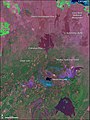 LavaBedsNatlMnmt L7 14jun01.jpg 540 × 720; 151 KB
-

-
 A caver in Crystal Ice Cave (9b607d08-1dd8-b71b-0b79-c19fb279a6e9).jpg 5,414 × 3,614; 6.99 MB
-

-

-

-

-
 Capt Jack Cave.jpg 1,100 × 1,150; 269 KB
-
 Catacombs Cave 1.jpg 5,980 × 3,987; 2.92 MB
-
 Catacombs Cave 2.jpg 5,980 × 3,987; 2.76 MB
-
 Cave Ice Pictures (0d048f9c-aa38-4780-9b7c-56e7cfc90c55).jpg 682 × 909; 199 KB
-
 Cave Ice Pictures (0dc3287c-7e7a-4dac-a218-d8f30f11b3b5).jpg 909 × 682; 199 KB
-
 Cave Ice Pictures (256ebc65-bf85-48bd-a978-e1315312bfdf).jpg 1,000 × 1,504; 290 KB
-
 Cave Ice Pictures (775207c8-bc8f-4277-9e9c-696333563c4f).jpg 2,100 × 1,575; 519 KB
-
 Cave Ice Pictures (93ee337f-5a29-473b-8268-75c3be29b303).jpg 1,024 × 768; 284 KB
-
 Cave Ice Pictures (9b4b0504-8985-4916-b808-1063a3bde395).jpg 1,478 × 980; 361 KB
-
 Cave Ice Pictures (af998b5a-3c8e-4845-abce-57f3a70af3e1).jpg 1,000 × 1,504; 303 KB
-
 Cave Ice Pictures (d6c4af02-f4ff-41e6-b3fd-fcd67d10f0f5).jpg 968 × 1,461; 397 KB
-

-
 Double Hole Crater showing lava pool-1200px.JPG 1,200 × 900; 217 KB
-
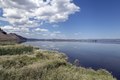
 Headwaters of the Sacramento River-750px.JPG 750 × 554; 114 KB
-
 HPC-000902 (27112475055).jpg 869 × 704; 85 KB
-
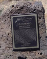 J.D.Howard plaque (cropped).png 240 × 300; 166 KB
-
 J.D.Howard plaque.png 520 × 842; 926 KB
-
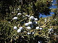
 Juniper in Lava Beds.JPG 4,320 × 3,240; 5.67 MB
-
 Juniperus occidentalis 8221.jpg 800 × 600; 242 KB
-
 Labe bluegrotto.jpg 800 × 555; 104 KB
-
 Labe Crystalicecave.JPG 600 × 725; 124 KB
-
 Labe Crystalicecave02.JPG 800 × 600; 113 KB
-
 Labe devils homestead flow 20090718182831.jpg 2,000 × 3,008; 2.93 MB
-
 Labe devils homestead flow details.jpg 1,200 × 1,600; 1.82 MB
-
 Labe devils homestead flow pano.jpg 1,600 × 1,200; 1.53 MB
-
 Lava Beds Bational Mon.ument (7975481192).jpg 1,414 × 2,121; 4.12 MB
-
 Lava Beds Bational Mon.ument (7975481780).jpg 1,414 × 2,121; 3.66 MB
-
 Lava Beds Bational Mon.ument (7975482422).jpg 2,121 × 1,414; 4.34 MB
-
 Lava Beds National Monument in summer 2012 (1).JPG 4,000 × 3,000; 3.31 MB
-
 Lava Beds National Monument in summer 2012 (10).JPG 4,000 × 3,000; 3.09 MB
-
 Lava Beds National Monument in summer 2012 (2).JPG 4,000 × 3,000; 3.29 MB
-
 Lava Beds National Monument in summer 2012 (3).JPG 4,000 × 3,000; 3.04 MB
-
 Lava Beds National Monument in summer 2012 (4).JPG 4,000 × 3,000; 3.15 MB
-
 Lava Beds National Monument in summer 2012 (5).JPG 4,000 × 3,000; 2.95 MB
-
 Lava Beds National Monument in summer 2012 (7).JPG 4,000 × 3,000; 3.94 MB
-
 Lava Beds National Monument in summer 2012 (9).JPG 4,000 × 3,000; 3.25 MB
-

-

-

-

-

-
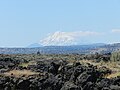
 Lava Beds National Monument with Mt Shasta (15121699451).jpg 5,722 × 2,663; 7.99 MB
-

-
 Lava Beds National Monument, Hospital Rock.jpg 5,184 × 3,456; 6.03 MB
-
 Lava Beds Panorama.jpg 7,118 × 2,858; 5.5 MB
-
 Lava license.jpg 2,078 × 1,008; 543 KB
-
 Lava Mountain-Motoring Magazine-1915-010.jpg 1,522 × 2,051; 1.19 MB
-
 Lava25.jpg 1,336 × 1,002; 316 KB
-
 Map Tule Lake National Monument.png 1,076 × 829; 460 KB
-

-
 Medicine Lake Volcano from Captain Jack's Stronghold in Lava Beds NM.jpg 1,200 × 421; 66 KB
-
 Merrill Cave.jpg 1,599 × 900; 177 KB
-
 Milky Way over Lava Beds (26972708345).jpg 2,400 × 886; 1.3 MB
-
 Mt shasta from captain jacks stronghold, lava beds.JPG 4,000 × 3,000; 2.47 MB
-
 Mule Deer at Lava Beds Monument (5711529236).jpg 3,364 × 2,242; 2.3 MB
-

-
 Oregon High Desert Grotto members.jpg 1,920 × 1,385; 2.52 MB
-
 Petroglyph Point at Lava Beds Nat'l Monument (1).jpg 960 × 1,280; 1.69 MB
-
 Petroglyph Point at Lava Beds Nat'l Monument.jpg 1,280 × 960; 1.69 MB
-
 Petroglyph Point.JPG 3,240 × 4,320; 4.85 MB
-
 Photo of Petroglyph Point 001 (7cd69df1-d18f-4386-960b-42c613795ad0).JPG 5,184 × 3,456; 9.8 MB
-
 Photo of Petroglyph Point 002 (ed11611e-1757-428a-b5f1-b1a8f6f6b8fd).JPG 5,184 × 3,456; 10.13 MB
-
 Photo of Petroglyph Point 003 (cf002f09-dd7c-4bb2-ae32-ef362863abb5).JPG 5,184 × 3,456; 8.47 MB
-
 Photo of Petroglyph Point 004 (1b4925fe-188c-493b-a7dc-684a509fb542).JPG 5,184 × 3,456; 10.82 MB
-
 Photo of Petroglyph Point 005 (d85ac067-d52e-47a8-b3be-447a9061181c).JPG 5,184 × 3,456; 9.73 MB
-
 Photo of Petroglyph Point 006 (87e7b158-f1e4-4fc1-a850-664f185d9f14).JPG 5,184 × 3,456; 7.83 MB
-
 Photo of Petroglyph Point 007 (79716159-2856-404a-baf4-cbb595a116a2).JPG 5,184 × 3,456; 11.28 MB
-
 Photo of Petroglyph Point 008 (1c934dc7-7974-4745-99b3-b6e9b5ef8557).JPG 5,184 × 3,456; 7.52 MB
-

-
 Sagebrush site postfire (34756452641).jpg 1,074 × 720; 271 KB
-
 Sagebrush site recovery (34077675643).jpg 957 × 720; 304 KB
-
 Scenic view near the Lava Beds National Park in Northern California LCCN2013633492.tif 6,144 × 4,096; 144.03 MB
-
 SchonchDawn-01.jpg 1,024 × 455; 103 KB
-

-
 Sentinel Cave.jpg 5,548 × 3,699; 2.6 MB
-
 Shasta Valley.jpg 750 × 299; 26 KB
-
 Siskiyou County, CA, USA - panoramio - starscream1211 (1).jpg 4,032 × 3,024; 3.41 MB
-
 Siskiyou County, CA, USA - panoramio - starscream1211 (3).jpg 16,382 × 3,702; 18.74 MB
-
 Siskiyou County, CA, USA - panoramio - starscream1211 (4).jpg 4,032 × 3,024; 7.02 MB
-
 Siskiyou County, CA, USA - panoramio - starscream1211.jpg 16,382 × 3,784; 16.94 MB
-
 The Lava Beds - Scene of the Modoc War (1).jpg 2,142 × 1,716; 991 KB
-
 The Lava Beds - Scene of the Modoc War (2).jpg 2,288 × 1,734; 1.71 MB
-

-
 Volcanic Legacy Scenic Byway - View North from Petroglyph Point - NARA - 7722663.jpg 2,256 × 1,496; 806 KB
-


.jpg)
.jpg)


.jpg)
.jpg)


.jpg)
.jpg)
.jpg)
.jpg)
.jpg)
.jpg)
.jpg)
.jpg)
_camp_at_Lava_Beds_National_Monument._North_entrance_on_site_of_Gillenes_camp_looking_north_(7b787222f5b6412a864b524f9734d819).jpg)


.jpg)
.png)


.jpg)
.jpg)
.jpg)
.JPG)
.JPG)
.JPG)
.JPG)
.JPG)
.JPG)
.JPG)
.JPG)
.jpg)
.jpg)


.jpg)


.jpg)


.JPG)
.JPG)
.JPG)
.JPG)
.JPG)
.JPG)
.JPG)
.JPG)

.jpg)
.jpg)

_(15829040696).jpg)

.jpg)
.jpg)
.jpg)
.jpg)
,_London_Illustrated_News,_1873_-_Mount_Shasta_Sisson_Museum_-_DSC02860.JPG)


.jpg)
.jpg)
Categories:
- National Monuments of California
- National Monuments of the United States by name
- Volcanoes in California
- Volcanic fields in California
- Caves of California
- Medicine Lake Volcano
- Modoc County, California
- Parks in Siskiyou County, California
- Volcanic landforms in California
- Lava fields in California
- Mafic volcanism in California
- Geology of Siskiyou County, California
- Geology of Modoc County, California
- National Park Service in California