Category:Landschaftsschutzgebiet Südlich von Gevelsberg/nördlich von Voerde
Jump to navigation
Jump to search
| Diese Kategorie repräsentiert ein Schutzgebiet nach Naturschutzrecht in Deutschland. |
|---|
| Diese Kategorie wurde nach einem klaren Schema angelegt, sie sollte nicht verschoben, gelöscht oder umkategorisiert werden. Sie ist unter anderem in dieser Uploadkarte hinterlegt. Beschreibung und Hintergründe auf der Seite des Wikiprojekts |
| Foto zu Wiki Loves Earth hochladen! - Seite von Wiki Loves Earth Deutschland |
This is the category of the protected area listed at WDPA under the ID Unknown
|
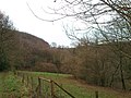
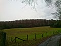
Deutsch: Landschaftsschutzgebiet „Südlich von Gevelsberg/nördlich von Voerde“, LSG 3.2.9 in Ennepetal und Gevelsberg, Ennepe-Ruhr-Kreis, Nordrhein-Westfalen
protected landscape in Germany | |||||
| Upload media | |||||
| Instance of | |||||
|---|---|---|---|---|---|
| Named after |
| ||||
| Location |
| ||||
| IUCN protected areas category | |||||
| Inception |
| ||||
| Area |
| ||||
 | |||||
Media in category "Landschaftsschutzgebiet Südlich von Gevelsberg/nördlich von Voerde"
The following 8 files are in this category, out of 8 total.
-
 Brabandstaller Weg Ennepetal, 25.12.13 - panoramio (3).jpg 2,592 × 1,944; 950 KB
-
 Brabandstaller Weg Ennepetal, 25.12.13 - panoramio (4).jpg 2,592 × 1,944; 982 KB
-
 Brabandstaller Weg Ennepetal, 25.12.13 - panoramio (5).jpg 1,944 × 2,592; 1.04 MB
-
 Brabandstaller Weg Ennepetal, 25.12.13 - panoramio (6).jpg 2,592 × 1,944; 1,006 KB
-
 Brabandstaller Weg Ennepetal, 25.12.13 - panoramio (7).jpg 2,592 × 1,944; 1,000 KB
-
 Brabandstaller Weg Ennepetal, 25.12.13 - panoramio (8).jpg 1,944 × 2,592; 1.05 MB
-
 Brabandstaller Weg Ennepetal, 25.12.13 - panoramio (9).jpg 2,592 × 1,944; 1.1 MB
-
 Brabandstaller Weg Ennepetal, 25.12.13 - panoramio.jpg 2,592 × 1,944; 679 KB
.jpg)
.jpg)
.jpg)
.jpg)
.jpg)
.jpg)
.jpg)
