Category:Landscapes of Scotland
Jump to navigation
Jump to search
overview of landscape art in Scotland | |||||
| Upload media | |||||
| Subclass of | |||||
|---|---|---|---|---|---|
| Location |
| ||||
| |||||

Subcategories
This category has the following 7 subcategories, out of 7 total.
Media in category "Landscapes of Scotland"
The following 200 files are in this category, out of 374 total.
(previous page) (next page)-
 "Alien Scene" - geograph.org.uk - 1253243.jpg 640 × 481; 88 KB
-
 "The Glen", western Gigha - geograph.org.uk - 523803.jpg 640 × 480; 52 KB
-
 'The Cottage' - geograph.org.uk - 479775.jpg 640 × 480; 119 KB
-
 2001-ScotlandHighlands-TheQuirang2.jpg 1,134 × 776; 547 KB
-
 20210306 HP20Pro IMG 154935.jpg 3,648 × 2,736; 4.66 MB
-
 20210306 HP20Pro IMG 155746.jpg 9,792 × 3,008; 9.53 MB
-
 A boundary fence looking towards Bennan Hill - geograph.org.uk - 3366931.jpg 4,000 × 3,000; 2.49 MB
-
 A peat bog below the top of Doune Hill, Luss Hills, Scotland.jpg 5,472 × 3,401; 16.86 MB
-
 A small loch in the saddle between Beinn an Dothaidh and Beinn Dorain, Scotland 01.jpg 5,090 × 2,962; 7.16 MB
-

-
 Above Fort William - geograph.org.uk - 837134.jpg 640 × 480; 82 KB
-
 After the shower - geograph.org.uk - 243314.jpg 640 × 480; 66 KB
-
 Alternative Coastal Route.jpg 1,041 × 737; 584 KB
-
 Arran from the Dalry moor road.jpg 1,600 × 1,200; 299 KB
-
 Back to Town - Flickr - Neillwphoto.jpg 5,545 × 3,687; 10.88 MB
-
 Balcary Bay Auchincairn - panoramio.jpg 3,264 × 2,448; 989 KB
-
 Beautiful landscape in black and white, Scotland (5831890202).jpg 3,629 × 2,429; 4.31 MB
-
 Beinn Eighe Coire Dubh Mor.jpg 2,304 × 3,456; 3.68 MB
-
 Beinn Eighe Ruadh-stac Mor.jpg 3,347 × 2,231; 2.15 MB
-
 Beinn Eighe Sail Mhor.jpg 3,456 × 2,304; 1.69 MB
-
 Beinn Eighe.jpg 3,456 × 2,304; 3.07 MB
-
 Beinn na h-Aire - geograph.org.uk - 229344.jpg 640 × 480; 78 KB
-
 Beinn Narnain, Arrochar Alps, Scotland 09.jpg 5,472 × 3,648; 18.74 MB
-
 Ben Wyvis from Cromarty Firth, Black Isle, Ross-Shire, Scotland..jpg 3,761 × 1,846; 4.48 MB
-
 Bennachie from the North.jpg 800 × 216; 80 KB
-
 Boat (5790750143).jpg 1,200 × 833; 1,020 KB
-
-
 Bus in a moorland landscape (geograph 3457180).jpg 3,264 × 2,448; 5.17 MB
-

-
 Califer Viewpoint - geograph.org.uk - 586939.jpg 640 × 480; 132 KB
-
 Callander banner Crags.JPG 2,800 × 400; 424 KB
-
 Callander-Cracks.JPG 3,872 × 2,592; 4.19 MB
-
 Camas Cuil an t-Saimh.jpg 1,600 × 1,200; 439 KB
-
 Captain Horatio Ross - River Landscape, Scotland - 1997.44 - Cleveland Museum of Art.tif 5,000 × 3,988; 57.07 MB
-
 Captain Horatio Ross - River Landscape, Scotland - 1997.44.a - Cleveland Museum of Art.tif 5,000 × 3,988; 57.07 MB
-
 Captain Horatio Ross - River Landscape, Scotland - 1997.44.b - Cleveland Museum of Art.tif 5,540 × 4,208; 66.72 MB
-
 Castle stalker and loch laich.jpg 2,042 × 1,332; 627 KB
-
 Clouds over Scotland.jpg 1,638 × 1,179; 560 KB
-
 Clouds over the mountains, Scotland (5700257876).jpg 3,872 × 2,592; 6.39 MB
-
 Coastal woodland, Dunglas - geograph.org.uk - 148585.jpg 640 × 480; 103 KB
-
 Count the ridges - geograph.org.uk - 241614.jpg 640 × 427; 60 KB
-
 Covenanter Monument to John Hunter Devil's Beef Tub.JPG 3,648 × 2,736; 13.31 MB
-
 Cross on the top of Dodd Hill Carsphairn hills.jpg 900 × 598; 138 KB
-
 Devil's Beef Tub, near Moffat - geograph.org.uk - 156141.jpg 640 × 480; 97 KB
-
 Dodgy bridge in a farm track - geograph.org.uk - 1725021.jpg 1,024 × 768; 831 KB
-
 Dornoch Firth 058 B9176.jpg 1,920 × 1,080; 2.06 MB
-
 Down through the Glen - geograph.org.uk - 662513.jpg 640 × 480; 56 KB
-
 Drumburn Viewpoint - geograph.org.uk - 739992.jpg 640 × 480; 87 KB
-
 Drumochter March2007.jpg 1,500 × 793; 107 KB
-
 Dunadd Fort - view.jpg 700 × 471; 126 KB
-
 Dunnet Head - geograph.org.uk - 14727.jpg 640 × 313; 88 KB
-
 Dunnet Head, viewpoint car park - geograph.org.uk - 596849.jpg 640 × 480; 46 KB
-
 Durisdeer Hills from A702.jpg 620 × 292; 42 KB
-
 Earthwork by Druidhill Burn with Lowther hills in distance.jpg 900 × 594; 122 KB
-
 EildonScottsView (cropped).jpg 811 × 331; 44 KB
-
 EildonScottsView.jpg 1,600 × 1,200; 268 KB
-
 Eilean Donan Castle, Schottland.jpg 6,000 × 4,000; 10.29 MB
-
 Fairy Glen Skye.jpg 5,184 × 3,456; 7.39 MB
-
 Field of barely (43934871412).jpg 6,720 × 3,780; 8.53 MB
-
 Fields at Meadowhead - geograph.org.uk - 597004.jpg 640 × 480; 89 KB
-
 Fields, Woodland and Track to Dunes - geograph.org.uk - 110767.jpg 640 × 475; 55 KB
-
 Fishing On The Water Of Girvan - geograph.org.uk - 1470633.jpg 640 × 480; 109 KB
-
 Flanders Moss 2009.jpg 3,872 × 2,592; 3.64 MB
-
 Flood tide on the Sound of Luing - geograph.org.uk - 168925.jpg 640 × 480; 182 KB
-
 Garrow Scotland.jpeg 640 × 480; 68 KB
-
 Garry Beach, Lewis in Scotland.jpg 2,744 × 4,128; 6.62 MB
-
 Glamaig from Rubha nam Brathairean, Isle of Skye.jpg 5,735 × 1,912; 4.7 MB
-
 Glen Coe, Scottish Hightlands.jpg 2,048 × 868; 1.14 MB
-
 Glen Finglas.JPG 1,600 × 1,200; 937 KB
-
 Glen-Coe-Pano-(1).jpg 7,541 × 2,710; 4.71 MB
-

-
 Glencoe Lochan reflections 1 20211022.jpg 4,600 × 3,456; 11.35 MB
-
 Glencoe Lochan reflections 2 20211022.jpg 9,069 × 4,073; 32.9 MB
-
 Glencoe Lochan reflections 3 20211022.jpg 9,456 × 3,817; 26.46 MB
-
 Heading for Ben Nevis - geograph.org.uk - 598346.jpg 640 × 430; 54 KB
-
 Heather on pathway above Grey Mare's Tail - geograph.org.uk - 552067.jpg 640 × 480; 125 KB
-
 Horses by St John's Point - geograph.org.uk - 479725.jpg 640 × 480; 113 KB
-
 Hoy Sound - geograph.org.uk - 33961.jpg 640 × 480; 48 KB
-
 Hydro Dam Picture.jpg 4,032 × 3,024; 3.9 MB
-
 Inverkeithing, Fife, Scotland.jpg 5,687 × 2,038; 9.89 MB
-
 IsleOfSky.jpg 2,048 × 1,536; 665 KB
-
 Jasper van der Meij 2014 (Unsplash).jpg 4,635 × 3,070; 11.8 MB
-
 Kilchurn Castle and Loch Awe landscape 20211022.jpg 4,278 × 2,797; 7.85 MB
-
 Kilchurn Castle distant 20211022.jpg 4,168 × 3,347; 10.29 MB
-
 King Seat view. - geograph.org.uk - 44230.jpg 640 × 427; 67 KB
-
 Kingseat View East - geograph.org.uk - 44240.jpg 640 × 427; 62 KB
-
 Kinlochleven.JPG 3,072 × 2,304; 2.93 MB
-
 Küste in Schottland 20091017.jpg 2,816 × 2,112; 2.47 MB
-
 Landscape view of Dalbog, near Edzell - geograph.org.uk - 650638.jpg 640 × 425; 64 KB
-
 Landscape with Ben Nevis in Scotland.jpg 6,240 × 4,160; 23.18 MB
-
 Loch Achne01.jpg 2,362 × 1,772; 1.52 MB
-
 Loch eil-1.jpg 3,872 × 2,592; 520 KB
-
 Loch Torridon, Scotland P-SCO Banner.jpg 3,918 × 560; 462 KB
-
 Loch Torridon, Scotland.jpg 7,836 × 2,080; 11.46 MB
-

-
-
 Looking across Tweeddale - geograph.org.uk - 655929.jpg 640 × 480; 89 KB
-

-
 Looking over the Devil's Beef Tub - geograph.org.uk - 564015.jpg 640 × 480; 62 KB
-

-

-
 Low clouds over the mountains, Scotland (5817535580).jpg 3,349 × 1,803; 2.42 MB
-
 Lowther Hills from Cairnkinna.jpg 900 × 244; 57 KB
-
 Lowther Hills from Scaw'd Law.jpg 900 × 214; 26 KB
-
 Mains of Balhaldie Farm - geograph.org.uk - 488607.jpg 640 × 458; 51 KB
-
 Maligoe - geograph.org.uk - 479700.jpg 537 × 357; 44 KB
-
 Maol Chean-dearg 23-June-2011.JPG 3,072 × 2,304; 1.42 MB
-
 New fence - geograph.org.uk - 202973.jpg 640 × 480; 163 KB
-
 Occult Skys (1946191338).jpg 2,619 × 1,153; 2.29 MB
-
 Old man of storr en écosse sur l'ile de skye.jpg 2,048 × 1,534; 845 KB
-
 Old Road - geograph.org.uk - 1017443.jpg 640 × 480; 74 KB
-
-
 Panorama South from Chattan Clan monument at Craig Dhu, Laggan, Scotland.jpg 7,039 × 846; 3.49 MB
-
 Parallel Roads.JPG 3,264 × 2,448; 3.5 MB
-
 Peaceful Road, Appin - geograph.org.uk - 53707.jpg 427 × 640; 154 KB
-
 Peaks of Mamores.JPG 3,072 × 2,304; 2.69 MB
-
 Power Lines through Kirkinch Wood - geograph.org.uk - 733930.jpg 425 × 640; 144 KB
-
 Quiraing Isle of Skye.jpg 5,184 × 3,456; 6.28 MB
-
 Quiraing, Isle of Skye, Scotland - Diliff.jpg 6,976 × 3,444; 5.6 MB
-
 Rain over Beinn Eich, Luss Hills, Scotland.jpg 5,471 × 3,029; 8.37 MB
-
 Remains Of Fence Loch Skerrow Halt - geograph.org.uk - 615830.jpg 427 × 640; 55 KB
-
 River Earn (Uisge Eireann).jpg 1,200 × 897; 397 KB
-
 River Orchy landscape 20211022.jpg 4,632 × 3,026; 11.52 MB
-
 River Orchy panorama 20211022.jpg 9,284 × 3,959; 39.96 MB
-
 Road on the raised beach - geograph.org.uk - 212459.jpg 640 × 480; 85 KB
-
 Road to Braemar, Scotland (48723218958).jpg 3,754 × 2,304; 7.08 MB
-
 Road&mountain@Scotland.jpg 1,440 × 1,080; 379 KB
-
 Ross and Cromarty Wikivoyage Banner.jpg 7,836 × 1,123; 6.34 MB
-
 Rubh' Ardalanish - geograph.org.uk - 633109.jpg 480 × 640; 109 KB
-
 Sandbank View (3661088982).jpg 1,200 × 900; 251 KB
-
 Sandend Bay (43982021961).jpg 6,720 × 4,480; 23.6 MB
-
 Sandend Beach (29044124057).jpg 6,639 × 4,426; 18.51 MB
-
 Scaur hills from Woodend Craig.jpg 900 × 522; 74 KB
-
 Scotland (2647763746).jpg 3,000 × 1,991; 5.53 MB
-
 Scotland 2018-037 (43983395581).jpg 6,642 × 4,428; 13.01 MB
-
 Scotland in blue (5835383304).jpg 3,808 × 1,968; 2.46 MB
-
 Scotland lake view (5727546228).jpg 3,791 × 2,363; 5.85 MB
-
 Scotland landscape (5836413407).jpg 3,872 × 1,928; 2.89 MB
-
 Scotland Landscape DSC 047320140816111152.jpg 14,389 × 3,094; 11.94 MB
-
 Scotland view (5788916227).jpg 3,872 × 1,620; 3.11 MB
-
 Scotland view (5933906808).jpg 3,764 × 2,101; 3.81 MB
-
 Scotland, argyll, isle of mull, loch na keal 37, westview at derryguaig.JPG 1,840 × 1,232; 826 KB
-
 Scotland, Skye, Old man of Storr (5735762649).jpg 3,872 × 2,265; 4.73 MB
-
 Scotland, the lake and the mountians (5712830064).jpg 3,632 × 1,628; 3.04 MB
-
 Scotland-24 (14950971262).jpg 4,075 × 2,716; 2.94 MB
-
 Scotland-uk.jpg 3,900 × 2,616; 4.31 MB
-
 Scott's View - geograph.org.uk - 36860.jpg 640 × 364; 48 KB
-
 Scottish country.jpg 1,280 × 960; 148 KB
-
 Scottish countryside (1).jpg 1,280 × 960; 106 KB
-
 Scottish countryside field.jpg 1,280 × 960; 132 KB
-
 Scottish countryside forrest.jpg 1,280 × 960; 113 KB
-
 Scottish countryside green hill.jpg 1,280 × 960; 117 KB
-
 Scottish countryside in the morning.jpg 1,280 × 960; 65 KB
-
 Scottish countryside yellow green grass.jpg 1,280 × 960; 166 KB
-
 Scottish Highlands Mountains.jpg 4,166 × 2,777; 5.91 MB
-
 Scottish scenery.jpg 1,434 × 884; 548 KB
-
 Scree above Hartfell Spa.jpg 334 × 450; 30 KB
-
 Scree run above Hartfell Spa.jpg 1,536 × 2,048; 3.39 MB
-
 See in Knoydart.JPG 1,818 × 1,228; 622 KB
-
 SettlementLochOlabhat Geograph-2928636-by-Richard-Law.jpg 1,142 × 857; 328 KB
-
 SettlementLochOlabhat Geograph-2928641-by-Richard-Law.jpg 1,142 × 857; 442 KB
-
 Sheep grazing on Colonsay coastal meadow - geograph.org.uk - 1416454.jpg 640 × 480; 107 KB
-
 Silver Flowe from Dungeon Hill.jpg 630 × 473; 93 KB
-
 Solway Firth (3330483175).jpg 3,872 × 2,592; 5.17 MB
-
 StubbleFieldNearAllerton-BlackIsle(SylviaDuckworth)Nov2007.jpg 640 × 480; 103 KB
-
 Suidhe Viewpoint 2.jpg 5,184 × 3,456; 5.47 MB
-
 Sunset over Inch Kenneth - geograph.org.uk - 626410.jpg 640 × 480; 61 KB
-
 Sunset over Sandend Bay (43264842364).jpg 6,720 × 4,480; 21.03 MB
-
 SunsetInInverness.jpg 2,048 × 1,536; 608 KB
-
 The Abhainn Chuaig - geograph.org.uk - 1380200.jpg 1,000 × 669; 278 KB
-
 The anchorage at Rubh Ardalanish - geograph.org.uk - 632233.jpg 500 × 375; 35 KB
-
 The B7016 towards Broughton - geograph.org.uk - 564009.jpg 640 × 480; 81 KB
-
 The Brightest Spot - panoramio.jpg 4,269 × 2,341; 2.73 MB
-

-
 The Far North and beyond - geograph.org.uk - 43782.jpg 640 × 430; 52 KB
-
 The Lochan, Dunoon, Scotland LOC 3450344440.jpg 1,024 × 776; 289 KB
-
 The Luggie - geograph.org.uk - 519298.jpg 640 × 480; 71 KB
-
 The Many Lochs - geograph.org.uk - 505465.jpg 640 × 427; 57 KB
-
 The Marble Road - geograph.org.uk - 494733.jpg 640 × 427; 75 KB
-
 The McMoab - geograph.org.uk - 507274.jpg 640 × 480; 122 KB
-
 The Mill Cottage - geograph.org.uk - 483898.jpg 640 × 480; 151 KB
-
 The Milnholm Cross - geograph.org.uk - 522270.jpg 640 × 480; 98 KB
-
 The Northern Slopes of Ark Hill - geograph.org.uk - 521282.jpg 640 × 480; 73 KB
-

-
 The old path to Loch Choire - geograph.org.uk - 505004.jpg 640 × 480; 53 KB
-
-
 The red loop - geograph.org.uk - 484247.jpg 640 × 480; 135 KB
-
 The road through Gleann Beag - geograph.org.uk - 503551.jpg 640 × 480; 67 KB
-
 The village of Bolton, East Lothian - geograph.org.uk - 659887.jpg 640 × 480; 76 KB
-
 The wee seat - geograph.org.uk - 176895.jpg 640 × 480; 116 KB
-
 Three Sisters Scotland.jpg 2,500 × 1,029; 640 KB
-
 Tigh-Na-Sleubhaich.jpg 900 × 600; 280 KB
-
 Tobha Mor from Howmore. - geograph.org.uk - 612427.jpg 640 × 480; 54 KB
-
 Traprain view northwards.JPG 2,160 × 817; 727 KB
-
 Trig point and Cairn on Cairnkinna.jpg 900 × 277; 51 KB
-
 Tweeddale in winter - geograph.org.uk - 655849.jpg 640 × 480; 118 KB
-
 View across the Solway Firth - geograph.org.uk - 79815.jpg 1,772 × 1,196; 613 KB
-
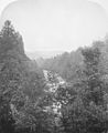 View down to Brann, Dunkeld by Roger Fenton.jpg 4,551 × 5,591; 6.66 MB
-
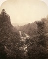 View down to Brann, Dunkeld by Roger Fenton.tif 4,551 × 5,591; 72.82 MB
-


.jpg)


.jpg)

.jpg)


.jpg)


.jpg)


.jpg)


.jpg)


.jpg)


.jpg)


.jpg)


.jpg)
.jpg)
.jpg)

.jpg)
.jpg)
.jpg)
.jpg)
.jpg)
.jpg)
.jpg)

.jpg)
.jpg)
.jpg)


.jpg)


.jpg)
Nov2007.jpg)


.jpg)


.jpg)
.jpg)