Category:Landrake
Jump to navigation
Jump to search
village in Cornwall .jpg) | |||||
| Upload media | |||||
| Instance of | |||||
|---|---|---|---|---|---|
| Location | Cornwall, South West England, England | ||||
 | |||||
Subcategories
This category has the following 3 subcategories, out of 3 total.
Media in category "Landrake"
The following 20 files are in this category, out of 20 total.
-
 Boating Centre - geograph.org.uk - 132697.jpg 640 × 372; 59 KB
-
 Circular lawn big.JPG 3,456 × 2,592; 3.12 MB
-
 Cottage, Lantallack Cross - geograph.org.uk - 98987.jpg 640 × 427; 211 KB
-
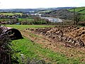
 Countryside to the west of Hatt - geograph.org.uk - 1599662.jpg 640 × 425; 103 KB
-
 Cumble Tor View - geograph.org.uk - 150246.jpg 640 × 480; 129 KB
-
 Dec 2011 Turning on christmas lights - Landrake.JPG 1,141 × 850; 731 KB
-
 Millennium Cross, Landrake - geograph.org.uk - 99003.jpg 427 × 640; 288 KB
-
 Ordnance Survey Drawings - Liskeard, Cornwall (OSD 10).jpg 5,856 × 3,429; 4.18 MB
-
 Broken gate, Lantallack Cross - geograph.org.uk - 98991.jpg 640 × 427; 272 KB
-
 Field east of Tredinnick - geograph.org.uk - 184089.jpg 640 × 427; 263 KB
-
 Field near Landrake - geograph.org.uk - 179871.jpg 640 × 427; 259 KB
-
 Fields and power lines, near Landrake - geograph.org.uk - 179868.jpg 640 × 427; 257 KB
-
 Footbridge over A38, Landrake - geograph.org.uk - 98994.jpg 640 × 427; 198 KB
-
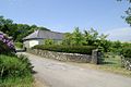
 Hay Lake Farm, Lantallack Cross - geograph.org.uk - 98988.jpg 640 × 427; 249 KB
-
 Lantallack Cross, looking eastward - geograph.org.uk - 98983.jpg 640 × 427; 249 KB
-
 Lantallack Cross, looking westward - geograph.org.uk - 98982.jpg 640 × 427; 226 KB
-
 Road junction, Landrake - geograph.org.uk - 99009.jpg 640 × 427; 198 KB
-
 Treluggan Manor - geograph.org.uk - 184098.jpg 640 × 427; 239 KB
-
 Trevollard - geograph.org.uk - 150238.jpg 640 × 462; 88 KB
-
 Trig Point UKTP3497, Landrake - geograph.org.uk - 179877.jpg 640 × 427; 304 KB


.jpg)


