Category:Lancashire Witches Walk
Jump to navigation
Jump to search
Long-distance footpath in Lancashire, England  | |||||
| Upload media | |||||
| Instance of |
| ||||
|---|---|---|---|---|---|
| Location | Lancashire, North West England, England | ||||
| Length |
| ||||
| Terminus | |||||
 | |||||
- Lancashire Witches Walk — a waymarked 51 mile (82 km) long-distance footpath in Lancashire, England.

Subcategories
This category has the following 4 subcategories, out of 4 total.
Media in category "Lancashire Witches Walk"
The following 119 files are in this category, out of 119 total.
-
 "Old Bridge Inn" Barrowford - geograph.org.uk - 506512.jpg 612 × 460; 150 KB
-
 "Primitive Methodist Chapel 1861" - geograph.org.uk - 410959.jpg 640 × 426; 128 KB
-
 "The Spout" Higham, Lancashire (geograph 1856985).jpg 1,632 × 1,224; 330 KB
-
 A former corner of a field (geograph 2458633).jpg 3,872 × 2,592; 4.5 MB
-
 A6068 eastbound near Ashlar House (geograph 4339778).jpg 640 × 480; 71 KB
-
 About to enter Deer Park Wood (geograph 2266734).jpg 3,872 × 2,592; 6.03 MB
-
 Alice Nutter Statue.tif 2,592 × 3,888; 28.87 MB
-
 Approaching Sabden Road (geograph 3236195).jpg 3,648 × 2,736; 1.9 MB
-
 Approaching Wiswell from Deer Park Wood (geograph 3236317).jpg 3,648 × 2,736; 1.38 MB
-
 Barley - the Pendle Inn - geograph.org.uk - 67351.jpg 640 × 480; 132 KB
-
 Bladder Stone Beck (geograph 3236045).jpg 3,648 × 2,736; 1.16 MB
-
 Bridge and ford at White Hough - geograph.org.uk - 1582122.jpg 640 × 480; 127 KB
-
 Bridge over Water Channel above Lower Ogden Reservoir (geograph 3864564).jpg 4,320 × 3,240; 2.96 MB
-
 Bridleway approach to Wind Turbine farm (geograph 3236072).jpg 3,648 × 2,736; 713 KB
-
 Brungerley Bridge - geograph.org.uk - 827387.jpg 640 × 480; 152 KB
-
 The Black Bull Inn Caton (geograph 3550652).jpg 640 × 425; 253 KB
-
 Caton Moor compass (geograph 2442968).jpg 640 × 425; 280 KB
-
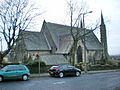 Christ Church, Lancaster.jpeg 640 × 480; 183 KB
-
 Clitheroe Pendle Witches Memorial 8147.JPG 2,448 × 3,264; 3.26 MB
-
 Cottage, Fore Side, Higherford (geograph 2483886).jpg 3,072 × 2,304; 1.11 MB
-
 Cottages at Narrow Gates Barley - geograph.org.uk - 828490.jpg 640 × 479; 122 KB
-
 Cycle track beside the River Lune (geograph 2463987).jpg 1,600 × 1,200; 663 KB
-
 Drystone Wall - geograph.org.uk - 1539809.jpg 640 × 480; 120 KB
-
 Enclosed footpath (geograph 3236342).jpg 3,648 × 2,736; 1,023 KB
-
 Farm Track (geograph 3236185).jpg 3,648 × 2,736; 1.55 MB
-
 Field Entrance near Law Farm (geograph 3236234).jpg 3,648 × 2,736; 1.6 MB
-
 Footbridge southeast of Park Farm (geograph 4529783).jpg 1,600 × 1,200; 484 KB
-
 Ford at Swaintley Hill (geograph 3236056).jpg 3,648 × 2,736; 1.51 MB
-
 Former Railway Bridge Over Artle Beck (geograph 3751350).jpg 1,600 × 1,200; 381 KB
-
-
 Grimeshaw Lane (geograph 2331904).jpg 4,320 × 3,240; 4.15 MB
-
 Halton railway station, Lancashire.jpg 1,645 × 1,161; 437 KB
-
 Haylot Farm near Salter (geograph 3236029).jpg 3,648 × 2,736; 948 KB
-
 High Salter (geograph 2138479).jpg 640 × 480; 76 KB
-
 Higher Fencegate Farm (geograph 4068881).jpg 3,887 × 1,674; 1.94 MB
-
 Hornby Road - geograph.org.uk - 128776.jpg 640 × 480; 75 KB
-
 Hornby Road - geograph.org.uk - 128853.jpg 640 × 480; 76 KB
-
 Hornby Road - geograph.org.uk - 1522082.jpg 640 × 480; 68 KB
-
 Hornby Road near Hawkshead - geograph.org.uk - 1193710.jpg 640 × 380; 64 KB
-
 Houlker's Farmhouse, Read.jpg 4,009 × 3,008; 3.16 MB
-
 House and garage, well no, its - geograph.org.uk - 1201144.jpg 640 × 480; 72 KB
-
 Iron Stile - geograph.org.uk - 1192806.jpg 640 × 480; 79 KB
-
 Isolated Barn - geograph.org.uk - 1246279.jpg 640 × 480; 92 KB
-
 Lancashire Witches Walk - Tercet 10 (geograph 4056887).jpg 640 × 640; 249 KB
-
 Lancashire Witches Walk - Tercet 7 (geograph 4056901).jpg 640 × 481; 135 KB
-
 Lancashire Witches Walk - Tercet 7 (geograph 4202978).jpg 640 × 479; 145 KB
-
 Lancashire Witches Walk - Tercet 8 (geograph 4060980).jpg 640 × 498; 215 KB
-
 Lancashire Witches Walk - Tercet 9 (geograph 4056895).jpg 640 × 554; 211 KB
-
 Lancaster Grammar School.jpg 514 × 640; 108 KB
-
 Lancaster Old Town Hall.jpg 640 × 480; 137 KB
-
 Lancs Witches Walk at Read Hall.jpg 3,609 × 2,707; 4.65 MB
-
 Lancs Witches Walk at Sagar Heys, Read.jpg 3,494 × 2,621; 2.44 MB
-
 Lancs Witches Walk near Easterly Farm, Whalley.jpg 2,569 × 3,426; 4.49 MB
-
 Lone tree - geograph.org.uk - 846754.jpg 640 × 426; 189 KB
-
 Lower Ogden Reservoir - geograph.org.uk - 172239.jpg 640 × 480; 111 KB
-
 Lower White Lee Farm (geograph 2459222).jpg 3,872 × 2,592; 5.82 MB
-
 Mallowdale Bridge over the River Roeburn (geograph 3236013).jpg 3,648 × 2,736; 1.28 MB
-
 Mallowdale, near Salter (geograph 3236018).jpg 3,648 × 2,736; 1.44 MB
-
 Motorway (geograph 2275598).jpg 2,560 × 1,920; 1.58 MB
-
 Myttons - geograph.org.uk - 1701799.jpg 2,592 × 1,944; 1.53 MB
-
 Newchurch - geograph.org.uk - 1214716.jpg 640 × 480; 73 KB
-
 On Hornby Road - geograph.org.uk - 1767774.jpg 2,272 × 1,712; 930 KB
-
 Path across the open field from Haylot Farm (geograph 3236035).jpg 3,648 × 2,736; 706 KB
-
 Path down to Barrowford (geograph 2746103).jpg 3,872 × 2,592; 4.73 MB
-
 Pendle Heritage Centre Sept 2009.jpg 3,072 × 2,304; 1.78 MB
-
 Pendle Way and Lancs Witches Walk, Heys Acre.jpg 4,753 × 2,673; 3.89 MB
-
 Pendle Way and Lancs Witches Walk, Higham.jpg 5,376 × 3,024; 6.17 MB
-
 Pendle Way behind Tinedale Farm (geograph 4082629).jpg 4,320 × 3,240; 4.04 MB
-
 Pendle Way in the Sabden Valley (geograph 4082986).jpg 4,320 × 3,240; 3.97 MB
-
 Picnic Area, Barley Car Park - geograph.org.uk - 1569297.jpg 640 × 426; 153 KB
-
 Quarry Road (geograph 4202989).jpg 640 × 425; 171 KB
-
 Quarry Road Caton Moor (geograph 3550661).jpg 640 × 425; 345 KB
-
 Read Hall Cottages, Hammond Drive, Read.jpg 4,008 × 3,006; 6.12 MB
-
 Read Hall Farm - geograph.org.uk - 58962.jpg 640 × 427; 151 KB
-
 Read Lancashire (geograph 3236253).jpg 3,648 × 2,736; 1.47 MB
-
 Read Old Bridge - geograph.org.uk - 1122019.jpg 640 × 480; 108 KB
-
 Redundant Gateposts - geograph.org.uk - 1246284.jpg 640 × 480; 140 KB
-
 Road junction at Portfield - geograph.org.uk - 486109.jpg 640 × 480; 166 KB
-
 Road Sign, Roughlee, Pendle (geograph 1857012).jpg 1,224 × 1,632; 196 KB
-
 Roeburndale Road (geograph 3236062).jpg 3,648 × 2,736; 647 KB
-
 Roeburndale Road (geograph 3236067).jpg 3,648 × 2,736; 673 KB
-
 Roughlee Hall - geograph.org.uk - 1201159.jpg 640 × 479; 61 KB
-
 Salterfell Track - geograph.org.uk - 1272378.jpg 640 × 480; 72 KB
-
 Sheep on the side of Clerk Hill (geograph 2266748).jpg 3,872 × 2,592; 2.63 MB
-
 Southern end of the Hornby Road - geograph.org.uk - 846752.jpg 640 × 426; 163 KB
-
 Standen Hall ha-ha (geograph 3236352).jpg 3,648 × 2,736; 1.54 MB
-
 Teaching seat, Spring Wood, Whalley - geograph.org.uk - 58921.jpg 640 × 427; 146 KB
-
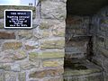
 Tercet marker, Slaidburn (geograph 4256644).jpg 640 × 480; 70 KB
-
 Tercet one, Pendle Heritage Centre.jpg 4,008 × 3,005; 5.44 MB
-
 The Bay Horse, Fence (geograph 2459212).jpg 3,872 × 2,592; 5.11 MB
-
 The Bay Horse, Roughlee - geograph.org.uk - 622713.jpg 608 × 456; 128 KB
-
 The edge of the access land - geograph.org.uk - 1767800.jpg 2,272 × 1,712; 887 KB
-

-
 The Pendle Inn - geograph.org.uk - 1379628.jpg 640 × 480; 67 KB
-
 The Pendle Way, Barley (geograph 4377110).jpg 3,648 × 2,736; 4.73 MB
-
 The Pendleway (geograph 2134622).jpg 878 × 1,024; 549 KB
-
 The railway path, Caton - geograph.org.uk - 639681.jpg 471 × 640; 134 KB
-
 The Red Rock - geograph.org.uk - 1350983.jpg 640 × 438; 96 KB
-
 The western edge of Higham (geograph 2276256).jpg 3,872 × 2,592; 5.7 MB
-
 This Way To Pendle Hill (geograph 2134686).jpg 1,200 × 769; 818 KB
-
 Track approaching Read Old Bridge (geograph 3236278).jpg 3,648 × 2,736; 1.24 MB
-
 Track on Easington Fell - geograph.org.uk - 1246175.jpg 480 × 640; 95 KB
-

-
 Waddinton Almshouses - the pump - geograph.org.uk - 54077.jpg 640 × 480; 158 KB
-
 Wet Track (geograph 2275592).jpg 2,560 × 1,920; 1.68 MB
-
 Whims Lane, Read (geograph 3236264).jpg 3,648 × 2,736; 1.26 MB
-
 White Hough Water near Roughlee.jpg 5,344 × 3,008; 8.67 MB
-
 Wood House Lane - geograph.org.uk - 1522087.jpg 640 × 480; 81 KB
-
 Woodhouse Lane - geograph.org.uk - 1519539.jpg 640 × 480; 85 KB
-
 Woodland Road near Read Hall (geograph 3236273).jpg 3,648 × 2,736; 1.62 MB
-
 Cheaper than a bridge ... - geograph.org.uk - 374596.jpg 640 × 480; 157 KB
-
 Entrance to Hansons Farm - geograph.org.uk - 119650.jpg 640 × 426; 155 KB
-
 Gate at Fell Side Farm - geograph.org.uk - 166383.jpg 640 × 480; 88 KB
-
 Hornby Road - geograph.org.uk - 99199.jpg 640 × 480; 110 KB
-
 Hornby Road - geograph.org.uk - 99200.jpg 640 × 480; 107 KB
-
 Lights on the railway path, Caton - geograph.org.uk - 639686.jpg 480 × 640; 116 KB
-
 Lune Valley from Claughton Moor - geograph.org.uk - 120352.jpg 480 × 640; 152 KB
-
 Old Ned - geograph.org.uk - 166381.jpg 640 × 480; 94 KB
-
 Pendle Heritage Centre, Barrowford - geograph.org.uk - 510629.jpg 640 × 480; 134 KB


.jpg)
.jpg)
.jpg)
.jpg)
.jpg)
.jpg)

.jpg)

.jpg)
.jpg)

.jpg)
.jpg)

.jpg)

.jpg)

.jpg)
.jpg)
.jpg)
.jpg)
.jpg)
.jpg)

.jpg)

.jpg)
.jpg)
.jpg)


.jpg)
.jpg)
.jpg)
.jpg)
.jpg)


.jpg)
.jpg)
.jpg)
.jpg)


.jpg)
.jpg)


.jpg)
.jpg)

.jpg)
.jpg)


.jpg)


.jpg)
.jpg)
.jpg)


.jpg)

.jpg)

.jpg)

.jpg)


.jpg)
.jpg)


.jpg)
.jpg)
.jpg)


.jpg)
.jpg)


.jpg)


