Category:Lamerton
Jump to navigation
Jump to search
village and civil parish in Devon, United Kingdom  | |||||
| Upload media | |||||
| Instance of | |||||
|---|---|---|---|---|---|
| Location | West Devon, Devon, South West England, England | ||||
| Elevation above sea level |
| ||||
 | |||||
Subcategories
This category has the following 4 subcategories, out of 4 total.
Media in category "Lamerton"
The following 200 files are in this category, out of 271 total.
(previous page) (next page)-
 A Bend in the Road - geograph.org.uk - 193533.jpg 640 × 427; 88 KB
-
 A Devon Signpost - geograph.org.uk - 182919.jpg 640 × 420; 134 KB
-
 A Farm Track - geograph.org.uk - 182924.jpg 640 × 427; 119 KB
-
 A Shaded Road - geograph.org.uk - 182935.jpg 640 × 427; 123 KB
-
 Abandoned motorbike, Lamerton - geograph.org.uk - 3885006.jpg 1,920 × 1,473; 870 KB
-
 Access to Collacombe Manor and farm - geograph.org.uk - 2897642.jpg 800 × 600; 326 KB
-
 Acorn Cottage - geograph.org.uk - 428972.jpg 640 × 480; 116 KB
-
 Across the Fields at Longcross - geograph.org.uk - 506259.jpg 640 × 480; 82 KB
-
 Approaching Lamerton Green - geograph.org.uk - 3883972.jpg 1,920 × 1,324; 532 KB
-
 B3362 near Collacombe Barton - geograph.org.uk - 4304405.jpg 1,920 × 1,185; 481 KB
-
 B3362 near Collacombe Barton - geograph.org.uk - 4304464.jpg 1,920 × 1,223; 438 KB
-
 B3362 north of Chipshop - geograph.org.uk - 4304483.jpg 1,920 × 1,420; 707 KB
-
 B3362 on Hurlditch Down - geograph.org.uk - 4304361.jpg 1,920 × 1,418; 518 KB
-
 Ball finials, Lamerton - geograph.org.uk - 3885861.jpg 1,920 × 1,512; 368 KB
-
 Barley north of Chipshop - geograph.org.uk - 4304546.jpg 1,920 × 1,214; 721 KB
-
 Barn and farm machinery near the Lumburn - geograph.org.uk - 3881782.jpg 1,920 × 1,235; 526 KB
-
 Beehives - geograph.org.uk - 183238.jpg 640 × 513; 146 KB
-
 Bend in lane near Ottery - geograph.org.uk - 3881257.jpg 1,920 × 1,440; 533 KB
-
 Blacksmith Arms From my garden - geograph.org.uk - 448141.jpg 640 × 480; 82 KB
-
 Blacksmiths Arms, Lamerton Green - geograph.org.uk - 3884251.jpg 1,920 × 1,352; 323 KB
-
 Blacksmiths Arms, Lamerton Green - geograph.org.uk - 3884273.jpg 1,920 × 1,493; 559 KB
-

-
 Boundary Stone and Road - geograph.org.uk - 193575.jpg 640 × 427; 122 KB
-
 Boundary stone and road to Lamerton - geograph.org.uk - 2897649.jpg 600 × 800; 344 KB
-
 Bridge across the Lumburn - geograph.org.uk - 3882212.jpg 1,920 × 2,876; 1.1 MB
-
 Bridge and gate, River Lumburn - geograph.org.uk - 3881916.jpg 1,920 × 1,396; 969 KB
-
 Car park, Blacksmiths Arms, Lamerton Green - geograph.org.uk - 3884396.jpg 1,920 × 1,326; 385 KB
-
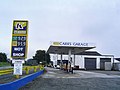
 Carrs Garage - geograph.org.uk - 4304350.jpg 1,920 × 1,189; 340 KB
-
 Carrs Garage at Collacombe Down - geograph.org.uk - 2897631.jpg 800 × 600; 309 KB
-
 Cherrybrook Cross - geograph.org.uk - 3458797.jpg 640 × 480; 51 KB
-
 Cottage, Lamerton - geograph.org.uk - 3884803.jpg 1,920 × 1,195; 391 KB
-
 Cottage, Rushford - geograph.org.uk - 3883738.jpg 1,920 × 1,280; 313 KB
-
 Cottages at Lamerton - geograph.org.uk - 3884829.jpg 1,920 × 1,269; 345 KB
-
 Cottages at Longcross - geograph.org.uk - 506247.jpg 640 × 480; 81 KB
-
 Cottages at Rushford - geograph.org.uk - 3883238.jpg 1,920 × 1,274; 423 KB
-
 Cottages, Lamerton - geograph.org.uk - 3884784.jpg 1,920 × 2,347; 654 KB
-
 Court Barton, Lamerton - geograph.org.uk - 193551.jpg 640 × 451; 98 KB
-
 Court Barton, Lamerton - geograph.org.uk - 3877515.jpg 1,920 × 1,214; 337 KB
-
 Crossroads on the B3362 - geograph.org.uk - 4304303.jpg 1,920 × 1,215; 467 KB
-
 Cut Hay Meadow - geograph.org.uk - 183226.jpg 640 × 427; 120 KB
-

-
 Damaged gabions, River Lumburn - geograph.org.uk - 3881026.jpg 1,920 × 1,440; 886 KB
-

-
 Direction Sign - Signpost by Collacombe Cross (geograph 6102651).jpg 363 × 640; 210 KB
-
 Dragon finial, Lamerton - geograph.org.uk - 3886004.jpg 1,920 × 1,424; 198 KB
-
 Entrance to Hurdwick Golf Club - geograph.org.uk - 3395713.jpg 1,024 × 768; 218 KB
-
 Entrance to Milemead Fisheries - geograph.org.uk - 3881009.jpg 1,920 × 1,182; 466 KB
-
 Entrance, Lamerton Sports ^ Community Centre - geograph.org.uk - 3884519.jpg 1,920 × 1,440; 418 KB
-
 Ewe and lambs near Lamerton - geograph.org.uk - 3882910.jpg 1,920 × 2,660; 841 KB
-
 Ewe and lambs near Rushford - geograph.org.uk - 3883611.jpg 2,169 × 1,644; 884 KB
-
 Farm machinery near the Lumburn - geograph.org.uk - 3881796.jpg 1,920 × 2,465; 653 KB
-
 Farm track - geograph.org.uk - 3759009.jpg 640 × 428; 125 KB
-
 Farmland in the Lumburn valley - geograph.org.uk - 3881753.jpg 3,971 × 2,609; 1.77 MB
-
 Farmland near Ottery - geograph.org.uk - 3881284.jpg 1,920 × 1,182; 427 KB
-
 Field and derelict windmill - geograph.org.uk - 193570.jpg 640 × 487; 100 KB
-
 Field at Rushford - geograph.org.uk - 3884162.jpg 1,920 × 1,365; 603 KB
-
 Field boundary - geograph.org.uk - 429006.jpg 480 × 640; 133 KB
-
 Field boundary near Heathfield - geograph.org.uk - 421473.jpg 640 × 480; 157 KB
-
 Field boundary near Lamerton - geograph.org.uk - 3883070.jpg 1,920 × 2,553; 1.03 MB
-
 Field boundary near Lamerton - geograph.org.uk - 3883148.jpg 1,920 × 2,536; 978 KB
-
 Field by the B3362 - geograph.org.uk - 4304397.jpg 1,920 × 1,181; 507 KB
-
 Field near Lamerton waste water treatment works - geograph.org.uk - 3882690.jpg 1,920 × 1,358; 611 KB
-
 Field near Lamerton waste water treatment works - geograph.org.uk - 3882695.jpg 1,920 × 1,440; 884 KB
-
 Field near Langford Farm - geograph.org.uk - 3882830.jpg 1,920 × 1,335; 461 KB
-
 Field near Langford Farm - geograph.org.uk - 3882832.jpg 1,920 × 1,440; 406 KB
-
 Field north-west of Tavistock - geograph.org.uk - 4433311.jpg 1,920 × 1,240; 699 KB
-
 Field of Oats - geograph.org.uk - 192084.jpg 640 × 427; 97 KB
-
 Field path to Lamerton - geograph.org.uk - 3881603.jpg 1,920 × 1,251; 369 KB
-
 Field path, Lamerton - geograph.org.uk - 3884837.jpg 1,920 × 2,560; 1.23 MB
-
 Field, Chaddlehanger - geograph.org.uk - 4303925.jpg 1,920 × 1,346; 707 KB
-
 Field, Heathfield - geograph.org.uk - 4304007.jpg 1,920 × 1,291; 604 KB
-
 Field, Lamerton Green - geograph.org.uk - 3884178.jpg 1,880 × 1,363; 589 KB
-
 Fields in the River Wallabrook valley - geograph.org.uk - 4303768.jpg 1,920 × 1,240; 479 KB
-
 Fields outside Lamerton Village - geograph.org.uk - 191587.jpg 640 × 427; 90 KB
-
 Footpath along a Field Edge - geograph.org.uk - 191477.jpg 640 × 427; 107 KB
-
 Footpath near Ottery - geograph.org.uk - 3881264.jpg 1,920 × 1,440; 651 KB
-
 Footpath to Hurdwick Farm - geograph.org.uk - 4433365.jpg 2,720 × 1,982; 1.48 MB
-
 Footpath to Lamerton - geograph.org.uk - 383499.jpg 640 × 480; 91 KB
-
 Footpath to Lamerton - geograph.org.uk - 3881372.jpg 1,920 × 1,292; 601 KB
-
 Footpath to Lamerton - geograph.org.uk - 3881395.jpg 1,920 × 1,353; 501 KB
-
 Footpath to Lamerton - geograph.org.uk - 3881823.jpg 1,920 × 1,440; 638 KB
-
 Footpath to Lamerton - geograph.org.uk - 3881855.jpg 1,920 × 1,351; 419 KB
-
 Footpath to Lamerton - geograph.org.uk - 3881903.jpg 1,920 × 2,501; 1.24 MB
-
 Footpath to Ottery - geograph.org.uk - 3882905.jpg 1,920 × 1,416; 653 KB
-
 Footpath, Lamerton - geograph.org.uk - 3884878.jpg 1,920 × 1,372; 645 KB
-
 Footpath, Lamerton - geograph.org.uk - 3884888.jpg 1,920 × 2,235; 1.11 MB
-
 Fork in road, Lamerton - geograph.org.uk - 3883224.jpg 1,920 × 1,162; 336 KB
-
 Fork in the lane near Mana Butts - geograph.org.uk - 4303268.jpg 1,920 × 1,274; 494 KB
-
 Former chapel, Rushford - geograph.org.uk - 3883733.jpg 1,920 × 1,394; 398 KB
-
 Garage at Collacombe Down - geograph.org.uk - 39508.jpg 640 × 480; 110 KB
-
 Gate onto the Lumburn - geograph.org.uk - 3882174.jpg 1,920 × 2,461; 1.4 MB
-
 Grass field near Ottery - geograph.org.uk - 3881327.jpg 1,920 × 1,267; 563 KB
-
 Grass Fields and Valley - geograph.org.uk - 193527.jpg 640 × 427; 98 KB
-
 Gravestone, Lamerton - geograph.org.uk - 3885356.jpg 1,920 × 2,560; 816 KB
-
 Gravestones, Lamerton - geograph.org.uk - 3885152.jpg 1,920 × 1,288; 395 KB
-
 Graveyard, Lamerton - geograph.org.uk - 3885031.jpg 1,920 × 1,486; 937 KB
-
 Green Hill - geograph.org.uk - 3759346.jpg 640 × 428; 87 KB
-
 Green Hill, Lamerton - geograph.org.uk - 3884408.jpg 1,920 × 1,290; 354 KB
-
 Green lane north of Stilesweek - geograph.org.uk - 3880631.jpg 4,000 × 3,000; 3.39 MB
-
 Haye Combe - geograph.org.uk - 383515.jpg 640 × 480; 119 KB
-
 Higher Haye - geograph.org.uk - 429098.jpg 480 × 640; 174 KB
-
 Higher Haye Cottages - geograph.org.uk - 421480.jpg 640 × 480; 108 KB
-
 Higher Lumburn Bridge - geograph.org.uk - 3881050.jpg 1,920 × 1,440; 761 KB
-
 Higher Woodley - geograph.org.uk - 383287.jpg 640 × 431; 83 KB
-
 House at Rushford - geograph.org.uk - 3883882.jpg 1,920 × 1,333; 311 KB
-
 Houses at Chaddlehanger - geograph.org.uk - 4042189.jpg 1,920 × 1,380; 472 KB
-
 Ice on a small lay-by south of Longcross - geograph.org.uk - 3395498.jpg 1,024 × 768; 76 KB
-
 Iron Railings Cross - geograph.org.uk - 3411054.jpg 640 × 480; 57 KB
-
 Junction, Heathfield - geograph.org.uk - 4304010.jpg 1,920 × 1,394; 677 KB
-
 Kennels - geograph.org.uk - 182931.jpg 640 × 427; 105 KB
-
 Lamerton (geograph 3877522).jpg 1,920 × 1,282; 489 KB
-
 Lamerton - geograph.org.uk - 191585.jpg 640 × 427; 108 KB
-
 Lamerton - geograph.org.uk - 191593.jpg 640 × 427; 101 KB
-
 Lamerton Back Road - geograph.org.uk - 193539.jpg 640 × 427; 105 KB
-
 Lamerton Cemetery - geograph.org.uk - 193555.jpg 640 × 441; 109 KB
-
 Lamerton entrance sign - geograph.org.uk - 2423018.jpg 640 × 480; 68 KB
-
 Lamerton Footpath 9 - geograph.org.uk - 429078.jpg 480 × 640; 135 KB
-
 Lamerton Footpath 9 - geograph.org.uk - 429093.jpg 480 × 640; 143 KB
-
 Lamerton Green - geograph.org.uk - 193560.jpg 640 × 427; 90 KB
-
 Lamerton Green - geograph.org.uk - 3884165.jpg 1,920 × 1,382; 592 KB
-
 Lamerton waste water treatment works - geograph.org.uk - 3882407.jpg 1,920 × 1,363; 621 KB
-
 Lamerton, 14th century priest's house - geograph.org.uk - 37543.jpg 640 × 433; 94 KB
-
 Lane at Higher Haye Farm - geograph.org.uk - 429068.jpg 640 × 480; 159 KB
-
 Lane at Higher Lumburn Bridge - geograph.org.uk - 3877402.jpg 1,920 × 1,440; 512 KB
-
 Lane at Lamerton - geograph.org.uk - 3886252.jpg 1,920 × 1,243; 280 KB
-
 Lane at Longcross - geograph.org.uk - 506254.jpg 640 × 480; 156 KB
-
 Lane entering Lamerton - geograph.org.uk - 3886258.jpg 1,920 × 1,152; 390 KB
-
 Lane from Lamerton - geograph.org.uk - 3886353.jpg 3,000 × 4,000; 2.95 MB
-
 Lane junction near Cherrybrook House - geograph.org.uk - 4303340.jpg 1,920 × 1,317; 587 KB
-
 Lane junction near Stilesweek - geograph.org.uk - 3880678.jpg 1,920 × 1,415; 625 KB
-
 Lane junction near Stilesweek - geograph.org.uk - 3880875.jpg 1,920 × 1,299; 684 KB
-
 Lane junction, Lamerton - geograph.org.uk - 3877499.jpg 1,920 × 1,398; 850 KB
-
 Lane near Mary Tavy - geograph.org.uk - 4042159.jpg 3,983 × 2,856; 2.41 MB
-
 Lane near Mary Tavy - geograph.org.uk - 4303297.jpg 1,920 × 1,294; 743 KB
-
 Lane past The Four Winds - geograph.org.uk - 428957.jpg 480 × 640; 136 KB
-
 Lane through Hilltown - geograph.org.uk - 3886321.jpg 1,920 × 1,161; 397 KB
-
 Lane to Higher Haye - geograph.org.uk - 429052.jpg 640 × 480; 170 KB
-
 Lane to Higher Haye - geograph.org.uk - 429106.jpg 480 × 640; 145 KB
-
 Lane to Mary Tavy - geograph.org.uk - 4303284.jpg 1,920 × 2,179; 948 KB
-
 Lane to Millhill - geograph.org.uk - 3877406.jpg 1,920 × 1,440; 1.05 MB
-
 Lane to Millhill - geograph.org.uk - 3881192.jpg 1,920 × 1,434; 659 KB
-
 Lane to Ottery - geograph.org.uk - 3881182.jpg 1,920 × 1,440; 1.01 MB
-
 Lane to Pitland Corner - geograph.org.uk - 4303601.jpg 1,920 × 2,560; 1.53 MB
-
 Lane to Pittescombe - geograph.org.uk - 421471.jpg 640 × 480; 106 KB
-
 Lane to Tavistock - geograph.org.uk - 3877394.jpg 1,920 × 1,440; 697 KB
-
 Lane to Tavistock - geograph.org.uk - 3880481.jpg 1,920 × 2,369; 1.19 MB
-
 Lane to the Sportsmans - geograph.org.uk - 428952.jpg 480 × 640; 149 KB
-
 Lane to the Wallabrook - geograph.org.uk - 4303821.jpg 1,920 × 1,286; 421 KB
-
 Lane to Wilminstone - geograph.org.uk - 4303492.jpg 1,920 × 1,440; 718 KB
-
 Laneside trees above Millhill - geograph.org.uk - 3881185.jpg 1,920 × 1,209; 466 KB
-

-
 Long Cross crossroads - geograph.org.uk - 2897599.jpg 800 × 600; 313 KB
-
 Longcross crossroads - geograph.org.uk - 3395469.jpg 1,024 × 768; 111 KB
-
 Longcross crossroads - geograph.org.uk - 3411040.jpg 640 × 457; 38 KB
-
 Looking down Green Hill, Lamerton - geograph.org.uk - 3760555.jpg 640 × 428; 70 KB
-
 Lower Chaddlehanger - geograph.org.uk - 4303906.jpg 1,920 × 1,188; 388 KB
-
 Lower Chaddlehanger - geograph.org.uk - 4303914.jpg 1,920 × 1,208; 508 KB
-
 Lower Chaddlehanger - geograph.org.uk - 4303918.jpg 1,920 × 1,316; 651 KB
-
 Lower Hill Farm, Lamerton - geograph.org.uk - 3886333.jpg 1,920 × 1,148; 365 KB
-
 Mast near Heathfield - geograph.org.uk - 429062.jpg 480 × 640; 145 KB
-
 Meadow by the Lumburn - geograph.org.uk - 3881874.jpg 3,955 × 2,859; 1.75 MB
-
 Meadow, Chaddlehanger - geograph.org.uk - 4303881.jpg 3,881 × 2,721; 2.74 MB
-
 Milestone near Mana Butts - geograph.org.uk - 4303289.jpg 1,920 × 2,263; 1.28 MB
-
 Millhill Quarry - geograph.org.uk - 3881077.jpg 1,920 × 1,367; 541 KB
-
 Minor road to Kelly and small lay-by - geograph.org.uk - 2897618.jpg 800 × 600; 277 KB
-
 Minor road,Lamerton - geograph.org.uk - 3759428.jpg 640 × 428; 113 KB
-
 Mounds at Kilworthy - geograph.org.uk - 182859.jpg 640 × 407; 102 KB
-
 Muddy track near Ottery - geograph.org.uk - 3881306.jpg 1,920 × 1,314; 565 KB
-
 New Fence Posts - geograph.org.uk - 183232.jpg 640 × 427; 138 KB
-
 Oak above the Lumburn valley - geograph.org.uk - 3877457.jpg 1,920 × 1,388; 447 KB
-
 Oak above the Lumburn valley - geograph.org.uk - 3881678.jpg 1,920 × 1,274; 597 KB
-
 Old Barn near Lamerton - geograph.org.uk - 193568.jpg 640 × 427; 132 KB
-

-

-
 Old Chapel - geograph.org.uk - 506250.jpg 640 × 480; 96 KB
-

-

-

-
 Ottery - geograph.org.uk - 383251.jpg 640 × 429; 75 KB
-
 Ottery - geograph.org.uk - 387153.jpg 640 × 480; 142 KB
-
 Outbuildings at Stilesweek - geograph.org.uk - 88759.jpg 640 × 480; 129 KB
-
 Pallets by the footpath, Lamerton - geograph.org.uk - 3882372.jpg 1,920 × 2,449; 1.41 MB
-
 Pasture above the Wallabrook valley - geograph.org.uk - 4303520.jpg 1,920 × 1,258; 506 KB
-
 Pasture above the Wallabrook valley - geograph.org.uk - 4303574.jpg 1,920 × 1,277; 496 KB
-
 Pasture land - geograph.org.uk - 3759037.jpg 640 × 428; 104 KB
-
 Pasture land - geograph.org.uk - 3759061.jpg 640 × 428; 109 KB
-
 Pasture land - geograph.org.uk - 3759083.jpg 640 × 428; 65 KB
-
 Pasture near Churchpark Cottages - geograph.org.uk - 3880470.jpg 1,920 × 1,346; 529 KB
-
 Pasture near Stilesweek - geograph.org.uk - 3880736.jpg 1,920 × 1,006; 424 KB
-
 Pasture near Stilesweek - geograph.org.uk - 3880754.jpg 1,920 × 1,259; 393 KB
-
 Path, Gulworthy - geograph.org.uk - 5342773.jpg 640 × 480; 151 KB
-
 Pen and shed, Churchpark Cottages - geograph.org.uk - 3880389.jpg 1,920 × 1,211; 394 KB
-
 Pitland Corner - geograph.org.uk - 3395719.jpg 1,024 × 511; 82 KB
-
 Pitland Corner - geograph.org.uk - 3458782.jpg 640 × 480; 69 KB
-
 Priest's House - Lamerton - geograph.org.uk - 39510.jpg 640 × 480; 165 KB
-
 Priests House,Lamerton - geograph.org.uk - 3759384.jpg 640 × 428; 101 KB
-
 Public Footpath, Lamerton - geograph.org.uk - 3759417.jpg 640 × 428; 148 KB
-
 Reading room, Lamerton - geograph.org.uk - 3886183.jpg 1,920 × 1,301; 377 KB
-
 River Lumburn - geograph.org.uk - 3881014.jpg 1,920 × 1,440; 782 KB
-
 River Lumburn - geograph.org.uk - 3881020.jpg 4,000 × 3,000; 3.23 MB


.jpg)


.jpg)


.jpg)
.jpg)


