Category:Lambertkerk, Zelhem
Jump to navigation
Jump to search
| Object location | | View all coordinates using: OpenStreetMap |
|---|
church building in Bronckhorst, Netherlands  | |||||
| Upload media | |||||
| Instance of | |||||
|---|---|---|---|---|---|
| Location | Zelhem, Gelderland, Netherlands | ||||
| Street address |
| ||||
| Located on street |
| ||||
| Heritage designation |
| ||||
| Inception |
| ||||
 | |||||
|
This is a category about rijksmonument number 40412
|
| Address |
|
Subcategories
This category has only the following subcategory.
I
- Interior of Lambertkerk, Zelhem (10 F)
Media in category "Lambertkerk, Zelhem"
The following 33 files are in this category, out of 33 total.
-
 2006-06-09 17.17 Zelhem, kerk.JPG 1,704 × 2,272; 1.2 MB
-
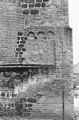
 Bovenste gedeelte van toren met jaartal 1667 - Zelhem - 20429777 - RCE.jpg 900 × 1,200; 216 KB
-

-
 Detail muur met op de voorgrond een zonnebloem - Zelhem - 20429792 - RCE.jpg 900 × 1,200; 331 KB
-
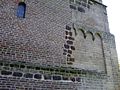
 Detail noordgevel kerktoren - Zelhem - 20371786 - RCE.jpg 791 × 1,200; 311 KB
-

-
 Detail zuidgevel kerktoren - Zelhem - 20371790 - RCE.jpg 783 × 1,200; 315 KB
-
 Gedeelte muur met metselwerk - Zelhem - 20429790 - RCE.jpg 1,200 × 900; 282 KB
-
 Gedeelte van muur met metselwerk - Zelhem - 20429778 - RCE.jpg 1,200 × 900; 272 KB
-
 Gedeelte van muur met metselwerk - Zelhem - 20429779 - RCE.jpg 1,200 × 900; 281 KB
-
-

-
 Kerk naar het noord-oosten - Zelhem - 20221731 - RCE.jpg 883 × 1,200; 225 KB
-
 Kerk naar het noord-oosten - Zelhem - 20221738 - RCE.jpg 898 × 1,200; 218 KB
-
 Kerk naar het noorden - Zelhem - 20221735 - RCE.jpg 1,200 × 883; 287 KB
-
 Kerk naar het oosten - Zelhem - 20221730 - RCE.jpg 881 × 1,200; 221 KB
-
 Kerk naar het zuid-oosten - Zelhem - 20221733 - RCE.jpg 875 × 1,200; 229 KB
-
 Kerk naar het zuid-oosten - Zelhem - 20221734 - RCE.jpg 1,200 × 881; 237 KB
-
 Kerk naar het zuid-westen - Zelhem - 20221737 - RCE.jpg 870 × 1,200; 226 KB
-
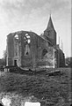 Kerk te Zelhem wordt herbouwd, Bestanddeelnr 903-1013.jpg 2,845 × 4,166; 2.44 MB
-
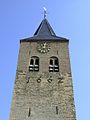
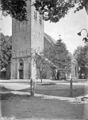
 Lambertkerk Zelhem.jpg 321 × 447; 36 KB
-
 Onderste gedeelte met metselwerk - Zelhem - 20429791 - RCE.jpg 1,200 × 900; 250 KB
-
 Overzicht noordoostgevel - Zelhem - 20359545 - RCE.jpg 1,200 × 947; 260 KB
-
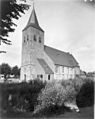
 Protestant church of Zelhem - panoramio.jpg 3,264 × 4,928; 7.5 MB
-
 Sacramentshuisje - Zelhem - 20221740 - RCE.jpg 904 × 1,200; 198 KB
-
 Toren - Zelhem - 20221739 - RCE.jpg 910 × 1,200; 399 KB
-
 Toren - Zelhem - 20221747 - RCE.jpg 800 × 1,200; 268 KB
-
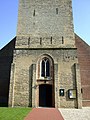 Toren met ingangsportaal - Zelhem - 20429776 - RCE.jpg 900 × 1,200; 320 KB
-
 Zelhem 065.JPG 3,264 × 2,448; 2.18 MB
-
 Zelhem 067.JPG 2,448 × 3,264; 1.8 MB
-
 Zelhem 072.JPG 3,264 × 2,448; 2.72 MB
-
 Zelhem 077.JPG 2,448 × 3,264; 2.01 MB
-
 Zelhem, Lambertikerk op plein foto1 2011-03-02 13.42.jpg 4,416 × 3,312; 9.61 MB


