Category:Lake Roosevelt National Recreation Area
Jump to navigation
Jump to search
| Object location | | View all coordinates using: OpenStreetMap |
|---|
 | |||||
| Upload media | |||||
| Instance of | |||||
|---|---|---|---|---|---|
| Location |
| ||||
| Located in or next to body of water |
| ||||
| Operator | |||||
| IUCN protected areas category | |||||
| Inception |
| ||||
| Area |
| ||||
| official website | |||||
 | |||||
Čeština: Národní rekreační oblast Lake Roosevelt (angl. Lake Roosevelt National Recreation Area) je rekreční oblast, která obklopuje Rooseveltovo jezero mezi přehradou Grand Coulee Dam a Northportem ve východním Washingtonu.
English: Lake Roosevelt National Recreation Area is a U.S. National Recreation Area of the National Park Service that encompasses the long Franklin D. Roosevelt Lake between Grand Coulee Dam and Northport, in eastern Washington state.
Subcategories
This category has the following 5 subcategories, out of 5 total.
Media in category "Lake Roosevelt National Recreation Area"
The following 200 files are in this category, out of 275 total.
(previous page) (next page)-

-
 "Clay banks opposite Hunters" Taken May 22, 1941. (49532733-a95f-439b-ab91-e9e73c0989ec).jpg 5,612 × 4,515; 3.64 MB
-
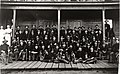 "Co. C, 4th Inf., at Fort Sherman" Taken 1898. (d723b2c9-baa1-4ab8-bd4a-ed526577e7dd).jpg 5,748 × 3,559; 2.58 MB
-

-
-

-

-

-

-

-

-

-
-
-

-

-

-

-
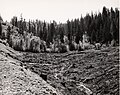
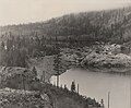
 "Hawk Creek, upper basin" Taken June 9, 1941. (845731b6-5dae-44e5-a527-bf22ea5b27de).jpg 5,710 × 3,959; 2.38 MB
-
-
 "Hell's Gate" Taken c. 1905. (eefe607b-143d-4149-bd3e-19407249da52).jpg 2,976 × 2,049; 526 KB
-

-

-
 "Hunters" Date unknown. Before 1900? (b418603a-beaf-4cfc-9002-83cc7f538539).jpg 3,845 × 2,516; 1.07 MB
-

-
 "John Nee homestead" Taken c. 1900. (8cd0c3af-2dc9-4293-9374-9e900beb78da).jpg 5,694 × 4,548; 4.69 MB
-
-

-

-

-

-

-
-

-
 "Near Cedonia, left bank." Taken April 22, 1941. (f0db36c2-a7a2-4134-9b7f-f17535665d82).jpg 5,678 × 4,548; 3.61 MB
-

-

-

-

-
 "Plum Point facing east" Taken May 21, 1940. (8ca5d2a8-84e8-45c2-8f86-367a45c6dc0c).jpg 5,726 × 4,548; 3.03 MB
-

-

-
-

-

-
-

-
-

-

-

-
 2017 - LARO-Spionkoep sister park.jpg (0bd89ca2-d7c2-4333-a20c-2db702d97663).jpg 3,628 × 2,815; 1.46 MB
-
-

-

-

-

-
 A hamlet. Bossburg or Marble? Taken c. 1930 (02d1385a-1b69-4b95-b5a0-5109acf25014).jpg 2,072 × 2,960; 549 KB
-

-
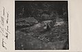
 A ranger picks up trash at Hawk Creek (202f264a-c7b4-4c7c-bd33-4a068458f7e2).jpg 4,608 × 3,456; 3.1 MB
-
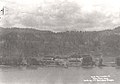
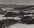
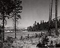
 A view of Lake Roosevelt (6ca5b353-e862-478a-b503-2a1e78697786).jpg 3,888 × 2,592; 3.36 MB
-
-
 A view of St. Paul's Mission near Kettle Falls. (9aa45f0f-1dd8-b71b-0bd8-05bbcc9edad7).jpg 3,888 × 2,592; 6.51 MB
-

-

-

-

-

-

-

-

-

-

-

-
 Bockemuehl house. Taken c. 1895. (4ac9087d-5b43-402c-a576-83bb8723818d).jpg 2,916 × 2,072; 955 KB
-
-

-

-

-

-

-

-
 Canoe - Colin and Mason (e8f3c07e-8808-47cf-ba7a-36cb75c10c45).jpg 3,882 × 2,912; 3.03 MB
-

-
-

-
 Collecting trash along the lake shore (1746e871-abf4-48f4-b297-1ce8cfdcda2c).jpg 4,608 × 3,456; 3.01 MB
-
-
 Columbia River near Gerome. Taken c. 1905. (79af6a09-2abf-4999-a681-394bd6282784).jpg 3,030 × 1,644; 838 KB
-
 Columbia River north of Evans. Take 1938. (c63a5d1c-1706-4013-b431-e2198bbd5880).jpg 5,710 × 4,532; 4.37 MB
-
-
-

-

-

-
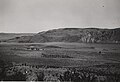
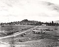
 Columbia Valley, Evans. June 3, 1938. (fa02bb4e-1da8-419a-aa9e-49626bf0106a).jpg 5,302 × 3,697; 3.21 MB
-

-

-

-
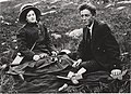 Couple seated below Kettle Falls. Taken 1910. (ab9adec5-5473-47ec-bdd2-40b7c924e15d).jpg 5,744 × 4,188; 2.28 MB
-
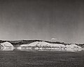
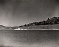
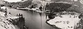
 Crescent Bay and Grand Coulee. Circa 1940. (38b692b8-0f82-4d8a-8ca1-5273ce989bfe).jpg 5,628 × 4,515; 3.42 MB
-
 Crescent Bay and Grand Coulee. Taken c. 1943. (949f3662-b740-453a-8426-9156c20fb329).jpg 5,678 × 4,057; 3.25 MB
-

-
 Crescent Bay. Taken c. 1939. (c3a05ef1-4b91-4a24-8f3a-0a499dade7f0).jpg 5,628 × 4,515; 3.24 MB
-
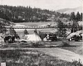
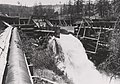 Dam and flumes on Sherman Creek. (04d1cde8-b992-4a50-8836-760db4ea75ab).jpg 5,858 × 4,099; 2.3 MB
-

-
 Detillion Bridge and settlement of Detillion. (eb65b324-77ff-4a52-a5e1-63768c4d0c9d).jpg 2,758 × 2,044; 746 KB
-

-

-

-

-

-

-
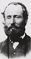 George Blenkinson, Chief Trader. c. 1860. (455b6445-976a-4018-aeb8-55f1db767b1c).jpg 3,059 × 5,748; 2.09 MB
-

-
 Gorge of Kettle River. c. 1910. (7d74ce01-5ed9-4ee7-8f1c-d34dc4682d96).jpg 3,078 × 1,790; 560 KB
-
 Group at Hawk Creek Falls. Circa 1905. (347f9634-16de-4605-8ab0-65a7e071cc29).jpg 2,058 × 2,988; 511 KB
-

-
-
 Hawk Creek basin flooded. Taken June 23rd, 1943. (0cf79615-5d0a-415d-a3ae-544561efb3a1).jpg 5,710 × 4,074; 3.27 MB
-
-

-

-
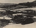
 Hawk Creek basin. Circa 1941. (c8259f19-a58f-428b-a9d3-0494c0d4d888).jpg 5,694 × 3,926; 3.18 MB
-
 Hawk Creek basin. Taken c. 1941. (5cbc4500-fc26-4601-9398-80dcf46f2cfb).jpg 5,694 × 3,926; 4 MB
-
 Hawk Creek basin. Taken June 1943. (8a843b98-7bfd-470e-95b3-10694f5b5b8f).jpg 5,842 × 4,155; 4.27 MB
-
 Hawk Creek inlet. Taken c. 1970. (8150f2c0-0276-4796-82b9-fd8310a2c7b1).jpg 5,744 × 4,564; 4.13 MB
-
 Hawk Creek picnic area. July 21, 1941. (8632591f-a174-4346-ad87-39cc69975780).jpg 5,710 × 4,564; 4.93 MB
-
 Hawk Creek picnic area. Taken June 23, 1943. (2dfd8fdd-b460-48fe-8347-eb00dde4dbe3).jpg 5,678 × 4,074; 4.21 MB
-
 Hawk Creek picnic area. Taken September 20, 1940. (6584f9e6-fe70-41d5-ab15-821ffb6bdeaf).jpg 5,694 × 4,564; 4.98 MB
-
 Hawk Creek. Taken c. 1941. (999da11a-21f9-4f17-97d6-d9200bd76912).jpg 5,694 × 3,926; 3.84 MB
-
-
-
 HFCA 1607 NPS Employees, Women 389.jpg (a4ec44f30c614872b6a6ac4e8cc7b141).jpg 7,771 × 5,174; 3.69 MB
-
 Hunters Ferry beach. Taken May 21, 1941. (1088f897-07e5-40b3-ad19-52e0484c24e7).jpg 5,662 × 4,548; 4.74 MB
-
 Hunters Ferry landing. Taken May 22, 1941. (c1016dab-26c8-4421-937f-e029e79764ab).jpg 5,694 × 4,548; 3.15 MB
-
-

-

-
 James Birnie. c. 1855. (dd9e0b7e-0dcc-408e-bbad-92cb5ba8aff0).jpg 4,674 × 5,962; 1.64 MB
-
 John Work. c. 1855. (e6998aec-397a-4912-932b-723fadeff036).jpg 4,731 × 5,976; 2.19 MB
-

-
 Just below Little Dalles. Taken June 10, 1938. (e0d962fe-50d3-4d4c-a8a5-37257acbd0dd).jpg 5,710 × 4,548; 3.32 MB
-
-

-

-

-

-

-

-

-

-

-

-

-

-
-

-

-
 Lincoln Mill from Water (f479efc6-5a8b-4ec5-90ab-5f4c7c2d642a).jpg 960 × 1,280; 312 KB
-

-
-

-

-

-
 Little Falls Dam site. Taken c. 1920. (b403c68e-890e-4b5a-a23a-e05fd101f0ab).jpg 5,744 × 4,564; 2.75 MB
-
 Little Falls, upper dam site. Taken July 3, 1908. (519efd29-542b-4dad-9c12-3ec44e8e4cbf).jpg 5,710 × 4,515; 3.47 MB
-

-

-
 Long Lake dam site. Taken January 20, 1911. (a6e4366c-57fb-467d-9798-6a3c762626b3).jpg 5,710 × 4,499; 3.41 MB
-
 Looking downstream near Clark. Date unknown. (76db780c-a9b7-4e40-b049-118ddc050c94).jpg 3,244 × 1,858; 569 KB
-

-

-
-
 Marble and China Bend. Taken May 6, 1941. (3ab5fee2-4004-4d38-807f-7961eec2c6f8).jpg 5,710 × 4,597; 3.62 MB
-
 Marcus and Marcus Flats. (98972a36-bdae-4c98-a8f4-fe2a6f3ad257).jpg 5,744 × 4,597; 3.69 MB
-

-
 Marcus Island. Taken July 1942. (3386d32e-3a9c-47b0-ab19-f837aab11cc9).jpg 5,744 × 4,597; 2.54 MB
-
 Marcus Island. Taken July 1942. (a53d88b1-49eb-4628-b80a-e4f46bdc7573).jpg 5,744 × 4,597; 2.78 MB
-
 Meyers Falls (the falls). c. 1920. (74016cd1-85aa-4a69-bc1b-d3d890dfb865).jpg 5,764 × 4,617; 2.99 MB
-

-
 Meyers Mill. 1914. (bba60fb7-7b42-4b2e-bb1b-dd46b898be8f).jpg 5,700 × 3,612; 2.16 MB
-

-

-

-

-

-

-

-
-
 Mule Deer and Mule Barn (9a5e41fe-1dd8-b71b-0b30-3a82c6aa63e2).JPG 3,300 × 2,475; 2.38 MB
-
 Near Hunters. Taken c. 1937. (5682feaf-9a97-4785-b73b-fb7d4f159812).jpg 5,662 × 4,548; 3.7 MB
-
 New Lincoln mill. Taken June 27, 1940. (396579a5-27b4-4aea-ac16-1faf5ec2fdaa).jpg 5,678 × 4,564; 3.25 MB
-
 New Lincoln town. Circa 1945. (c005984b-0240-470f-90b6-eb74a438acac).jpg 5,678 × 4,564; 3.44 MB
-

-
 North Gorge. Taken c. 1938. (f20bb68b-f7c8-43bd-82b2-b1066f31ed24).jpg 5,710 × 4,564; 3.51 MB
-

-

-

-

.jpg)
.jpg)
.jpg)
.jpg)
.jpg)
.jpg)
.jpg)
.jpg)
.jpg)
.jpg)
.jpg)
.jpg)
.jpg)
_and_Iguatz_Staehly_(right),_a_neighbor._ca._1905.%22_(24a9414e-4024-43cf-9f13-82306cb2a1b9).jpg)
.jpg)
.jpg)
.jpg)
.jpg)
.jpg)
.jpg)
.jpg)
.jpg)
.jpg)
.jpg)
.jpg)
.jpg)
.jpg)
.jpg)
.jpg)
.jpg)
.jpg)
.jpg)
.jpg)
.jpg)
.jpg)
.jpg)
.jpg)
._Forms_a_pair_with_(c2f1bc4a-bc01-4ed4-af3e-4e724064a03a).jpg)
_Jennie_Cleghorn%22_Probably_an_albumen_print_(20b9fde9-b440-49b9-a054-9564dbdfa906).jpg)
.jpg)
.jpg)
.jpg)
.jpg)
.jpg)
.jpg)
_at_the_Kettle_River_Gorge._c._1918._Handwritten_caption_reads-_%22gorge_of_the_Kettle_river_mile_from_(52b0bfb8-ca27-44b6-98d3-ee02eec0b153).jpg)
.jpg)
.jpg)
.jpg)
.jpg)
.jpg)
.jpg)
.jpg)
.jpg)
.jpg)
.jpg)
.jpg)
.jpg)
.jpg)
.jpg)
.jpg)
.jpg)
._A_joined_pair_of_images._Taken_June_23,_1923._(e13f6de8-4e93-4de8-bdb5-90de1b95d327).jpg)
.jpg)
.jpg)
.jpg)
_and_Augusta_(%3F)_Williams_at_mourning_ceremony_at_Kettle_Falls,_June_1938._Taken_by_Edward_Kowrach._They_were_(201885e1-ee37-4d0d-b7f8-df0b31898fbd).jpg)
.jpg)
_and_Salmon_Chief_of_Schweillp._Taken_1861._(ff90e054-306c-4b7f-88f1-8321f9821bd5).jpg)
.jpg)
.jpg)
.jpg)
.jpg)
.jpg)
.jpg)
.jpg)
.jpg)
.jpg)
.jpg)
.jpg)
.jpg)
.jpg)
.jpg)
.jpg)
.jpg)
.jpg)
.jpg)
.jpg)
.jpg)
.jpg)
.jpg)
.jpg)
.jpg)
.jpg)
.jpg)
.jpg)
.jpg)
.jpg)
.jpg)
._Taken_January_1935._(35bfcb63-2f12-49fb-b45f-f64219241c57).jpg)
.jpg)
.jpg)
.jpg)
.jpg)
.jpg)
_said_by_a_relative_to_be_on_Hayes_Island._Taken_c._1914._(261cbfbd-97d3-4576-9662-4cce9c1e2b62).jpg)
.jpg)
.jpg)
.jpg)
.jpg)
.jpg)
.jpg)
.jpg)
.jpg)
.jpg)
._Near_Fruitland._Taken_c._1900._(64b1ae2b-fb62-42e2-9570-204112bbb0bf).jpg)
.jpg)
.jpg)
.jpg)
.jpg)
.jpg)
.jpg)
.jpg)
.jpg)
.jpg)
.jpg)
.jpg)
.jpg)
.jpg)
.jpg)
.jpg)
.jpg)
.jpg)
.jpg)
.jpg)
.jpg)
.jpg)
.jpg)
.jpg)
.jpg)
.jpg)
.jpg)
.jpg)
.jpg)
.jpg)
.jpg)
.jpg)
.jpg)
.jpg)
.jpg)
.jpg)
.jpg)
.jpg)
.jpg)
.jpg)
.jpg)
.jpg)
.jpg)
.jpg)
.jpg)
.jpg)
.jpg)
.jpg)
.jpg)
.jpg)
.jpg)
.jpg)
.jpg)
.jpg)
.jpg)
.jpg)
.jpg)
.jpg)
.jpg)
._c._1920._(74016cd1-85aa-4a69-bc1b-d3d890dfb865).jpg)
.jpg)
.jpg)
.jpg)
.jpg)
.jpg)
.jpg)
.jpg)
.jpg)
.jpg)
.jpg)
.JPG)
.jpg)
.jpg)
.jpg)
.jpg)
.jpg)
.jpg)
.jpg)
.jpg)
.jpg)
.jpg)
.jpg)
.jpg)
.jpg)
_from_Kelly_Hill_after_tree_clearance._Site_of_old_Marcus_at_center,_new_Kettle_Falls_bridges_(8e58cf61-c712-485c-8aac-5c85081ea31d).jpg)